Hraunfossar waterfalls – the lava falls of Borgarfjörður
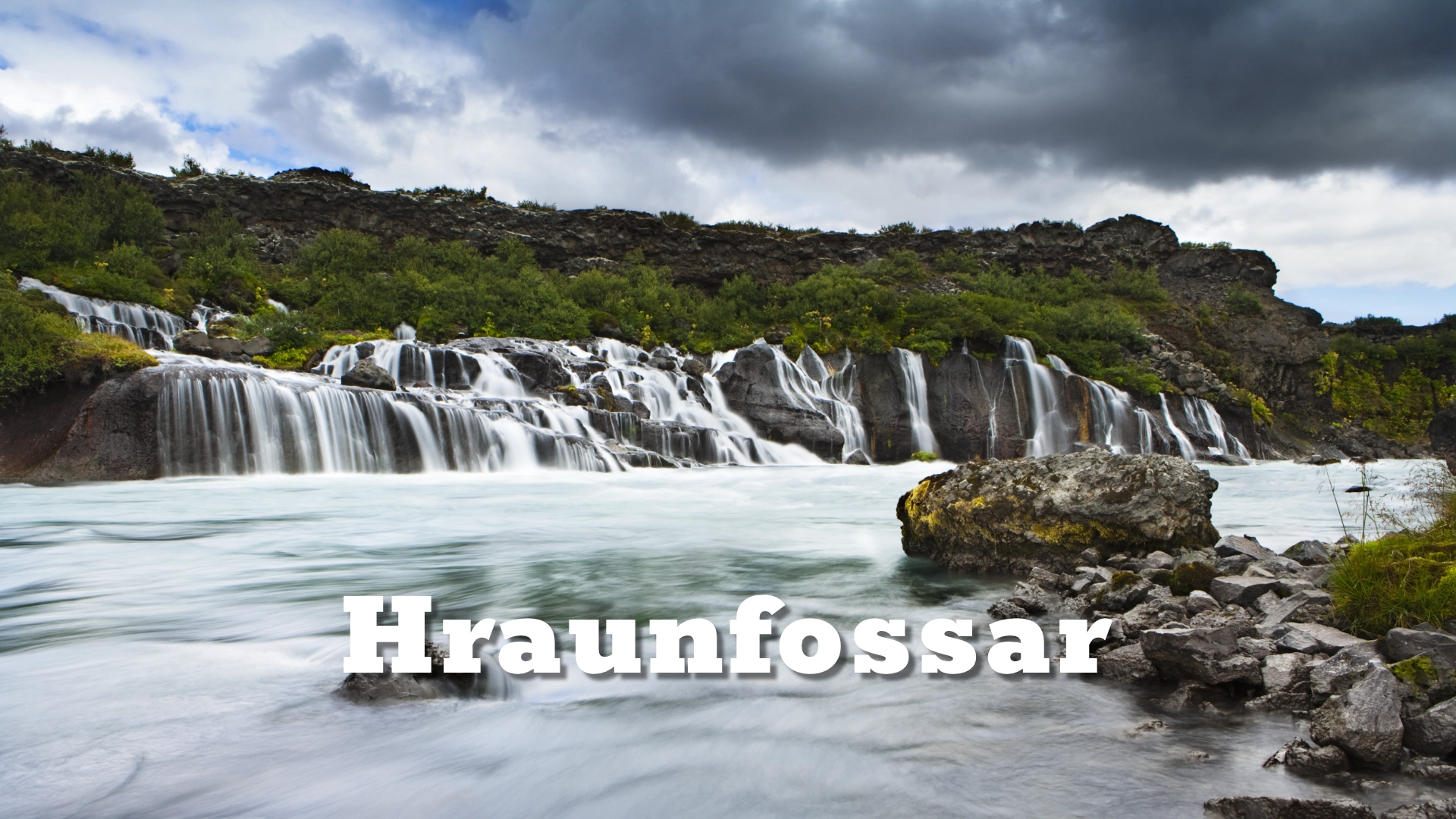
Hraunfossar lies beside Hvítá in Borgarfjörður, a short distance from Húsafell. Rather than descending from a visible river, hundreds of streams appear from beneath the edge of Hallmundarhraun and fall through lava, moss and low vegetation into the glacial river below. The waterfalls extend for approximately 900 metres, but their character is best understood both as a continuous sweep across the riverbank and at close range, where the water can be seen emerging directly beneath the lava. Barnafoss lies a short walk upstream, making the two waterfalls a natural combined visit even though each was formed in a different way.
The location of Hraunfossar waterfalls – the lava falls of Borgarfjörður
Latitude
64.7028
Longitude
-20.9777
Hraunfossar waterfalls – the lava falls of Borgarfjörður
Two water systems meeting
The defining feature of Hraunfossar is the visible meeting of clear groundwater and the glacial Hvítá. Rain and meltwater travel through Hallmundarhraun without forming a surface river. When this water reaches less permeable rock beneath the lava, it is redirected laterally until it emerges along the exposed edge above Hvítá. What appears to be a long row of separate waterfalls is therefore the outlet of a much larger underground water system.
Hvítá has cut its channel below the level of the lava, creating the height from which the spring water falls. The clear streams stand out against the sediment carried by the glacial river, especially when light allows both the colour and movement of the two waters to remain visible. This relationship is more important than the size of any individual cascade. Hraunfossar is a landscape formed by water moving through the lava, the river cutting below it and the two systems finally meeting along the bank.
This is the Hvítá of Borgarfjörður, not the river of the same name that flows past Gullfoss in South Iceland. The two rivers belong to different drainage systems despite sharing one of Iceland’s common river names.
Hallmundarhraun and the hidden course of the water
Hallmundarhraun is an extensive lava field that flowed westwards from volcanic vents near Langjökull. Published research dates the eruption to approximately AD 880–910. The lava travelled for roughly 50 kilometres, passing north of Eiríksjökull and Strútur before reaching the Hvítá valley. Its porous surface and fractured interior now determine how water moves across a large part of the landscape.
Water readily sinks into the young lava instead of collecting in open channels. Beneath it, older and less permeable layers prevent the water from continuing downwards, while the cut made by Hvítá exposes the level at which it can escape. Hraunfossar makes this hidden structure visible. The waterfalls are not water running across Hallmundarhraun, but groundwater completing its journey through and beneath the lava.
The formation belongs to a wider volcanic landscape extending towards Langjökull, but the main viewpoints keep the geological relationship compact and readable. Visitors can see the lava edge, the emerging water and the river below within the same view, then use closer positions to study individual outlets and the different paths taken by the streams.

Hraunfossar and Barnafoss
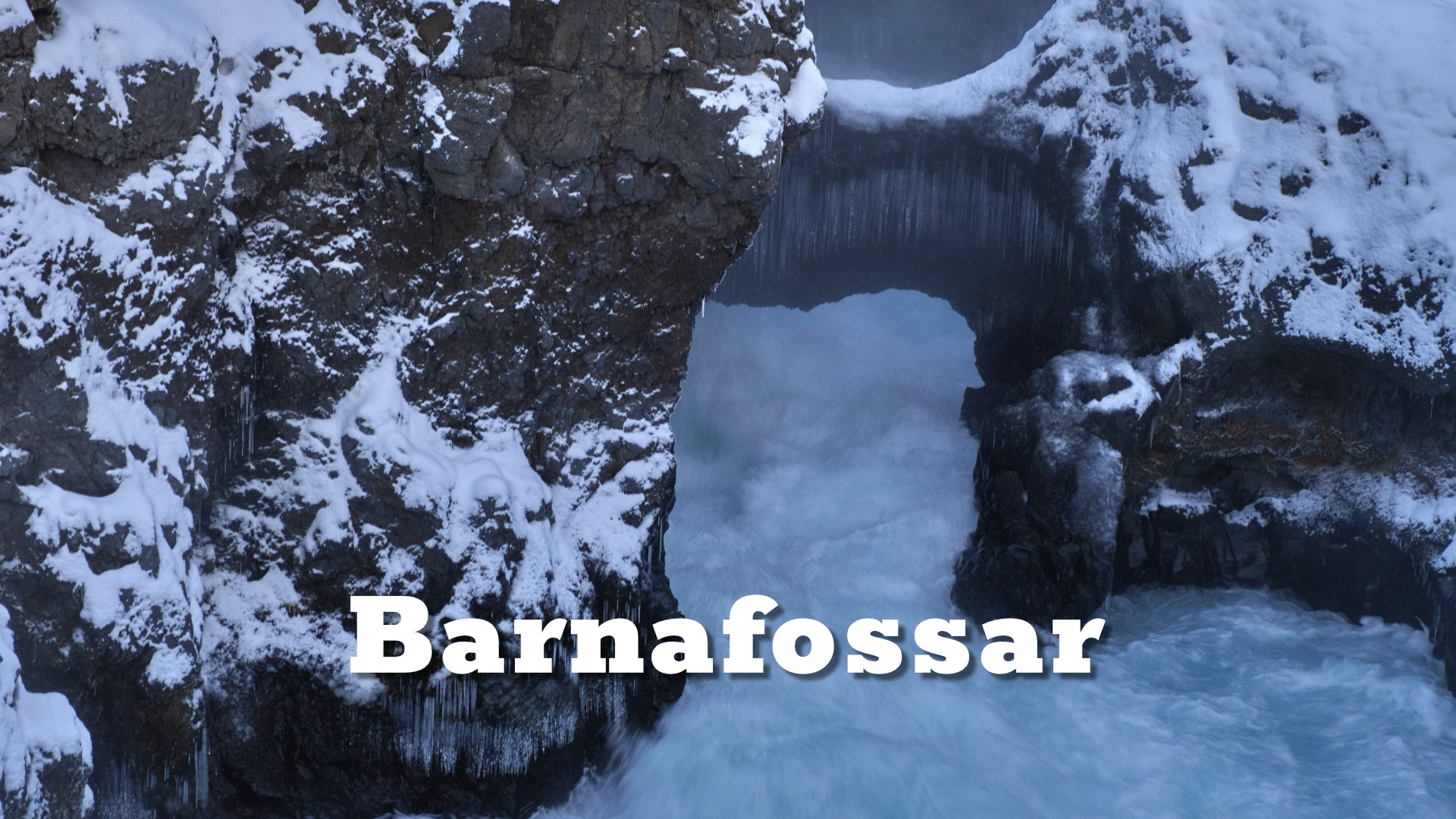
Barnafoss lies a short and straightforward walk upstream from Hraunfossar. There, Hvítá narrows and forces its own glacial water through a confined channel in the lava. At Hraunfossar, clear groundwater enters the river from beneath the lava edge; at Barnafoss, the river itself is the force shaping the rock. Their proximity makes the contrast easy to observe without combining them into a single geological feature.
Almost every visit to Hraunfossar should include both waterfalls. Around one hour is normally sufficient for the principal viewpoints and the walk between them, although photographers may need longer. The full story of Barnafoss, including the natural stone arch that once crossed the river and the folklore behind its name, belongs to its dedicated destination page.
Visiting throughout the year
The principal Hraunfossar viewpoint is close to the parking area and easily accessible. From there, the path continues towards other views and Barnafoss. Parts of the route contain steps or more uneven ground, but the connection between the two waterfalls is clear and uncomplicated under normal conditions. Services are available beside the parking area when the café is operating, although visitors should not depend on particular facilities without checking current arrangements.
Hraunfossar is normally accessible throughout the year. Winter changes the paths more than the approach: snow and ice can make steps, viewing areas and the route towards Barnafoss slippery. The waterfalls themselves remain worthwhile, with ice forming around the outlets while water continues to emerge beneath the lava. Autumn brings the strongest colour as the low vegetation and birch around the falls turn yellow and red, adding another layer between the dark lava and pale water.
Hraunfossar and Barnafoss have been protected together as a natural monument since 1987. Visitors should remain on the established paths and viewing areas, both for safety beside the river and to protect the vegetation growing across the lava.
Reading the full line and its details
No single viewpoint contains the whole character of Hraunfossar. The broader views show how the waterfalls extend along the riverbank and reveal their relationship with Hvítá. Closer compositions isolate the places where water appears beneath the lava, passes through moss and vegetation and divides into narrow falls. Moving between these two scales is the most effective way to understand the destination.
The long formation also rewards selective framing. A telephoto lens can separate groups of falls and compress the layers of spring water, lava and glacial river, while a wider lens gives greater weight to the complete riverbank and surrounding landscape. From above, the almost kilometre-long line becomes easier to read as one formation, but drone use within the protected area requires permission from the nature-conservation authority.
Interesting facts:
- Hraunfossar extends for approximately 900 metres along the bank of Hvítá.
- The waterfalls are formed by groundwater emerging from beneath Hallmundarhraun rather than by a surface river flowing over the lava.
- Published research dates the Hallmundarhraun eruption to approximately AD 880–910.
- Hallmundarhraun travelled roughly 50 kilometres westwards from vents near Langjökull.
- Hraunfossar and Barnafoss have been protected together as a natural monument since 1987.
- The Hvítá at Hraunfossar is a different river from the Hvítá that flows past Gullfoss in South Iceland.
Image Gallery


Photography tips:
- Photograph both scales of Hraunfossar: the complete line of falls along the riverbank and close sections where clear water emerges directly beneath the lava.
- Even light works best for retaining detail in the white water, dark lava and glacial river. Avoid very bright conditions when possible, particularly if you want to use slower shutter speeds.
- A tripod and a neutral-density filter can help lengthen exposures without losing control of highlights in the water. Keep enough texture to show the separate streams rather than turning the entire formation into a uniform white band.
- Use a telephoto lens to isolate groups of waterfalls and compress the layers of moss, lava, falling water and Hvítá.
- Autumn is particularly strong for colour, with yellow and red vegetation separating the pale water from the dark lava. Winter ice can provide structure around the outlets, but paths and viewpoints may be slippery.
- Wider compositions should include Hvítá where possible, because the contrast between the clear spring water and the glacial river is central to the landscape.
- Aerial photography can reveal the full length of Hraunfossar and its relationship with the river, but drone use within the protected area requires prior permission from the nature-conservation authority.
Destinations nearby