Grindavík
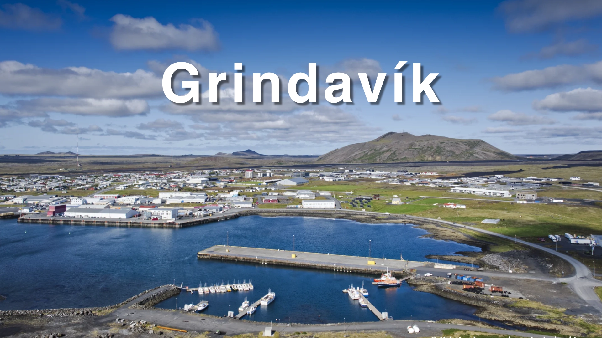
Grindavík must first be understood as a fishing town. The harbour explains why a substantial community developed on this exposed part of the Reykjanes coast, how people earned their living and why rebuilding the town matters. Fishing activity, saltfish production and the relationship between the settlement and the sea remain visible around the harbour and at Hópsnes.
That history did not end when Grindavík was evacuated on 10 November 2023. A magmatic intrusion formed beneath the area, the ground opened across parts of the settlement and nearly 3,800 people left their homes. The fissures, damaged infrastructure and later eruptions transformed the town, but they did not erase the community or reduce Grindavík to a volcanic disaster site.
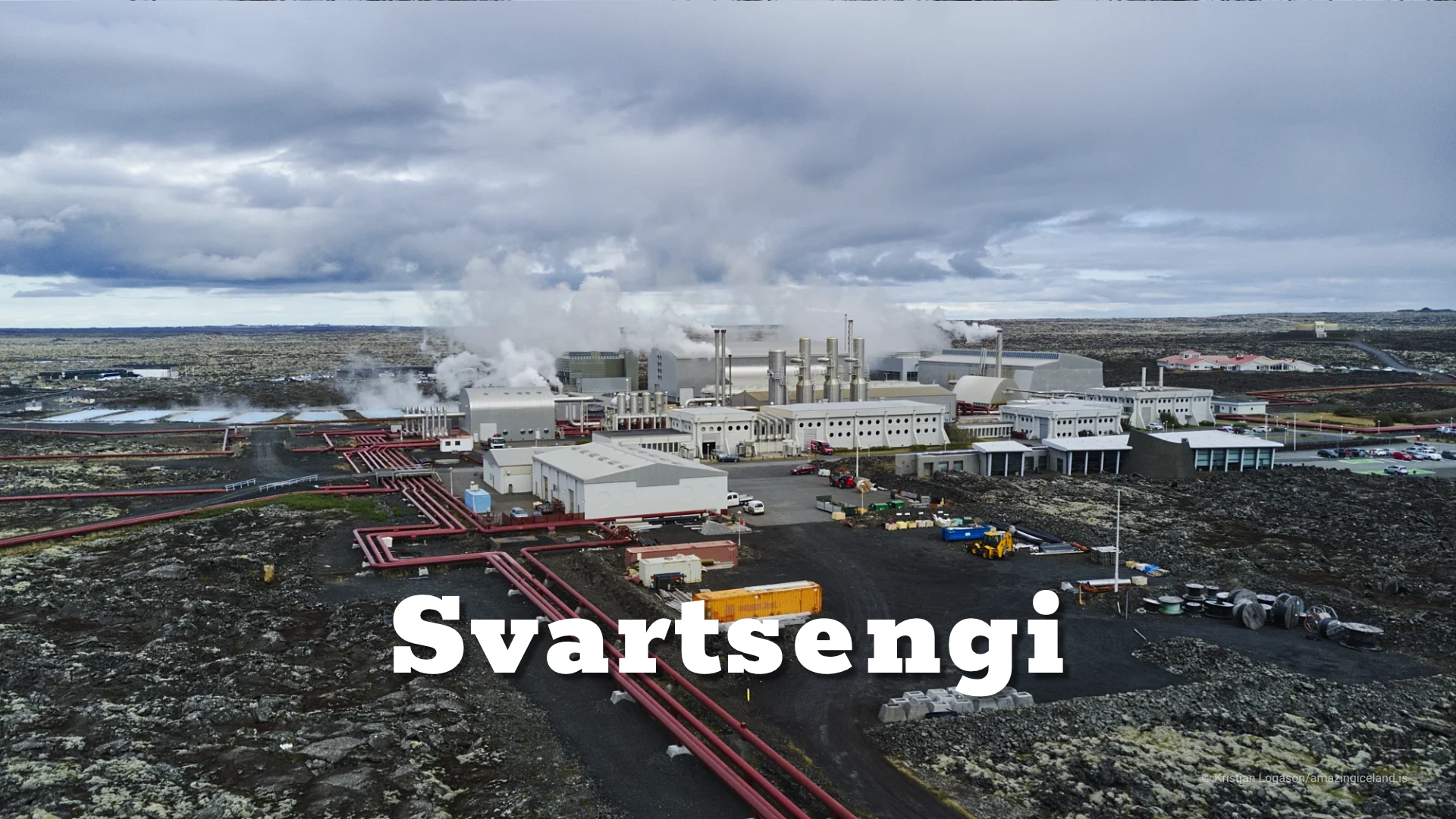
Life in Grindavík has since moved considerably closer to normal. Roads are open, fishing activity continues, services and businesses have returned, and visitors are welcomed. Some eruption-related locations have been prepared for public access, while dangerous fissures and damaged areas are fenced. The situation is nevertheless not final. Magma continues to accumulate beneath Svartsengi, official risk assessments remain in force and the number of residents returning is still changing.
A visit therefore requires two kinds of respect. Grindavík should be approached as a living community rather than a collection of damaged houses, and current safety information must take precedence over anything written in a permanent destination guide.
The location of Grindavík
Latitude
63.8424
Longitude
-22.4338
Grindavík
A town built by fishing
Grindavík stands on the south coast of the Reykjanes Peninsula, where low lava fields meet an exposed Atlantic shoreline. The modern town grew from older settlements associated with Járngerðarstaðir, Þórkötlustaðir and Staður. Of these, Járngerðarstaðahverfi became the centre of the present town, but the older pattern remains visible in names and historic sites around the area.
The coast offered access to rich fishing grounds but few naturally secure landing places. For centuries, crews launched relatively small open boats from the shore and depended on local knowledge of reefs, currents and changing sea conditions. The work was dangerous, and the coastline around Grindavík contains reminders of vessels and crews that did not return safely.
Harbour development changed what was possible. Better access for motorised vessels allowed fishing to expand, and Grindavík developed into one of Iceland’s important fishing ports. The harbour became the town’s economic centre, surrounded by processing facilities, workshops and the services required to keep vessels operating.
Before the evacuation in 2023, close to 3,800 people lived in Grindavík. Only part of that community has returned, and exact figures can give a misleading impression because registered residence and actual daily presence are not the same. What remains clear is that fishing continues to provide both work and continuity while decisions about homes, services and the town’s future are still being made.
The harbour, saltfish and Kvikan
The harbour is the best place to begin understanding Grindavík. This is not a decorative waterfront developed primarily for visitors. It is a working area where fishing vessels land catches and where the organisation of the town still follows the practical requirements of the fishing industry.
Saltfish played an important role in that development. Preserving cod with salt allowed fish to be stored and exported over long distances, connecting Icelandic fishing communities with markets abroad. The work required repeated splitting, salting, stacking and drying, and it shaped employment in Grindavík as well as the buildings and working areas around the harbour.
Kvikan, the town’s cultural house, preserves this history through its saltfish exhibition. The subject is wider than one local industry. Saltfish became one of the foundations of Iceland’s export economy, and Grindavík provides a direct setting in which to understand how fishing, preservation and foreign trade were connected.
The relationship between the museum and the harbour is important. Kvikan explains the processes and history, while the harbour shows that fishing is not confined to the past. Together they prevent Grindavík from being interpreted only through the events that began in 2023.

Hópsnes and the exposed coast
Hópsnes lies south-east of the town, between the harbour lagoon and the open sea. The peninsula and the neighbouring area of Þórkötlustaðanes belong to Grindavík’s older fishing landscape, where settlement, boat access and the dangers of the coast can be understood outside the modern harbour.
A lighthouse stands near the outer coast, surrounded by low lava, grass and views across the Atlantic. Remains connected with shipwrecks can also be found in the area. They are physical evidence of how unforgiving this coast could be before modern navigation, harbour protection and rescue services reduced some of the risks.
Hópsnes is also valuable because it gives distance from the town. From the peninsula, the harbour, settlement and surrounding lava fields can be seen in relation to one another. The view explains why the harbour entrance mattered and how Grindavík occupies a relatively small opening between old lava and the sea.
The drive and walking possibilities around Hópsnes depend on road and ground conditions, but the area normally suits a short extension to a visit to the harbour. It should be approached as a historic coastal landscape rather than simply as a viewpoint.
The raid of 1627
On 20 June 1627, raiders from Salé, in present-day Morocco, reached Grindavík. They came ashore in the Járngerðarstaðir area, seized people and property and left with captives who were later sold into slavery in North Africa.
The event became part of what Icelanders call Tyrkjaránið, commonly translated as the Turkish Raid or Turkish Abductions. The name is misleading when read as a modern description of nationality. The raiders who attacked Iceland came from Salé and Algiers and included people of different origins. The commander associated with the Grindavík raid, Jan Janszoon, was Dutch.
A separate force from Algiers attacked the Eastfjords and the Westman Islands the following month. Across the raids, hundreds of people were taken from Iceland, while others were killed. Only a minority of the captives were eventually ransomed and able to return.
Grindavík was therefore the first Icelandic community attacked during the events of that summer. The raid belongs to the town’s maritime history because the same open sea that provided food and trade also left isolated coastal settlements exposed to people arriving from beyond Iceland.
When the ground opened
On 10 November 2023, Grindavík was evacuated after intense earthquakes and rapid deformation indicated that a large magmatic intrusion was forming beneath the area. Nearly 3,800 residents left the town, many with little certainty about when they could return or what condition their homes would be in.
The most serious damage was caused by movement of the ground rather than by lava. As magma forced its way through the crust, the surface pulled apart and subsided along fissures crossing roads, gardens, utility systems and building foundations. Some breaks were immediately visible, while others extended beneath apparently intact surfaces.
This distinction is essential to understanding Grindavík. Images of flowing lava became the dominant international representation of the disaster, but damaged water, sewer and heating systems made the town uninhabitable before lava reached any houses. Restoring Grindavík therefore required more than waiting for an eruption to end. The ground had to be examined, fissures mapped and fenced, roads repaired and essential infrastructure rebuilt.
The evacuation protected the population, but it also divided the town’s history into a clear before and after. Residents were displaced across Iceland, businesses had to find temporary arrangements and families faced decisions about whether returning would be possible or desirable. Those decisions have not all been made in the same way.
The Sundhnúkur eruptions
The first eruption on the Sundhnúkur crater row began north of Grindavík on 18 December 2023. It was followed by a series of eruptions between Grindavík and Svartsengi, with activity repeatedly beginning along fissures before becoming concentrated around fewer vents.
The eruption that most directly affected the town began on 14 January 2024. A fissure opened south-east of Hagafell, followed by a shorter fissure just north of Grindavík. Lava from the second opening reached the uppermost part of the settlement, and three houses burned.
Three houses represent only a small part of the town’s building stock, but they were complete losses for the families connected with them. The event also demonstrated that the danger was not theoretical. The fissure opened close to the settlement despite earlier efforts to understand where the next eruption might begin.
Nine eruptions occurred on the Sundhnúkur crater row between December 2023 and August 2025. The most recent of those ended on 5 August 2025, but magma accumulation beneath Svartsengi continued during 2026. The absence of an active eruption does not mean the episode has ended, and future intrusions or eruptions remain possible.
Large defensive barriers have been constructed around Grindavík and the infrastructure at Svartsengi. They have redirected lava and changed how future flows may approach the town, but they cannot remove every possible outcome. Their scale shows how much engineering has been required to make continued activity and rebuilding possible.
Return and rebuilding
By 2026, daily life in Grindavík had moved much closer to normal. Roads were open, fishing continued, public facilities and businesses were operating, and the town was again receiving visitors. Preschool activity restarted in August 2026 for the first time since the evacuation, an important step for families considering a return.
That development should not be described as a completed recovery. Many former residents live elsewhere, damaged buildings have been demolished and decisions about property ownership and future housing continue. Some families want to return, while others have concluded that they will not. Both choices are part of the present reality.
The official assessment published at the end of May 2026 still classified the overall danger in Grindavík as considerable and kept the area at the civil-protection uncertainty level. At the same time, the municipality has emphasised that known fissures are fenced, dangerous subsidence has been filled and the fire service maintains continuous monitoring. In practical terms, the town functions close to normally while maintaining a level of preparedness that would be unusual elsewhere.
This balance is likely to keep changing. Grindavík is neither an abandoned town nor a place where geological uncertainty has disappeared. It is a community rebuilding while accepting that monitoring, evacuation planning and changing access conditions may remain part of daily life.
Visiting Grindavík
Two to three hours is enough to visit the harbour, see Kvikan, continue to Hópsnes and understand some of the changes around the town. More time can be useful if the visit includes the wider coast or designated locations connected with the recent eruptions.
Visitors are welcome, and Grindavík has become a popular destination since access reopened. The most useful approach is to begin with the working harbour and the town’s fishing history before looking at the volcanic changes. This order gives the damaged landscape its proper context: the eruptions affected an established community rather than creating a destination on previously empty ground.
Designated eruption-related locations and locally guided visits provide appropriate ways to learn about what happened. Fenced areas, damaged private property and residential streets not identified for visitors should be left alone. A road being open does not make every adjoining piece of land suitable for access.
Conditions can change with renewed seismic activity, gas pollution or an eruption. Before travelling, check information from the Icelandic Meteorological Office, Civil Protection, SafeTravel and Grindavíkurbær. Follow local signs and any instructions concerning road closures, evacuation routes or restricted ground.
Interesting facts:
- Grindavík developed from the older settlements of Járngerðarstaðir, Þórkötlustaðir and Staður.
- The town became one of Iceland’s important fishing ports after improved harbour access allowed larger motorised vessels to operate more reliably.
- Kvikan preserves the history of saltfish production and its importance to the Icelandic economy.
- Raiders from Salé attacked Grindavík on 20 June 1627.
- The name Tyrkjaránið does not accurately describe the raiders’ modern nationalities; the forces came from Salé and Algiers.
- Nearly 3,800 people were evacuated from Grindavík on 10 November 2023.
- Most serious damage to the town came from ground rupture and damaged infrastructure rather than lava.
- Lava reached the northern part of Grindavík on 14 January 2024 and three houses burned.
- Nine eruptions occurred on the Sundhnúkur crater row between December 2023 and August 2025.
- Preschool activity restarted in Grindavík in August 2026 for the first time since the evacuation.
Image Gallery


Photography tips:
- Begin at the harbour. Fishing vessels, working areas and the surrounding town show the economic reason Grindavík exists and provide a stronger visual introduction than the recent damage alone.
- The defensive barriers are best photographed with enough surrounding landscape to show their scale and relationship to the town, lava fields and Svartsengi. Avoid reducing them to abstract earthworks without context.
- Use wider views for the changed landscape around Grindavík, where old lava, new lava, barriers, roads and the settlement can be layered together. A longer lens can compress these elements when photographing from an appropriate public location.
- Hópsnes works well in low winter light, stormy coastal weather and long evening light. The lighthouse, exposed shoreline and remains associated with shipwrecks provide a different account of Grindavík’s relationship with danger and the sea.
- Do not photograph damaged private houses or people dealing with their property. Public infrastructure, designated eruption-related locations and wider landscape views can document what happened without intruding into individual loss.
- Conditions around recent lava and eruption sites can change. Follow current access instructions and do not enter fenced ground for a better viewpoint.
Destinations nearby