Vogar á Vatnsleysuströnd
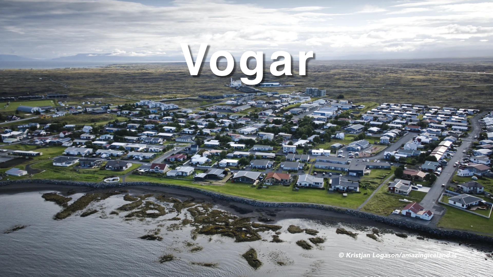
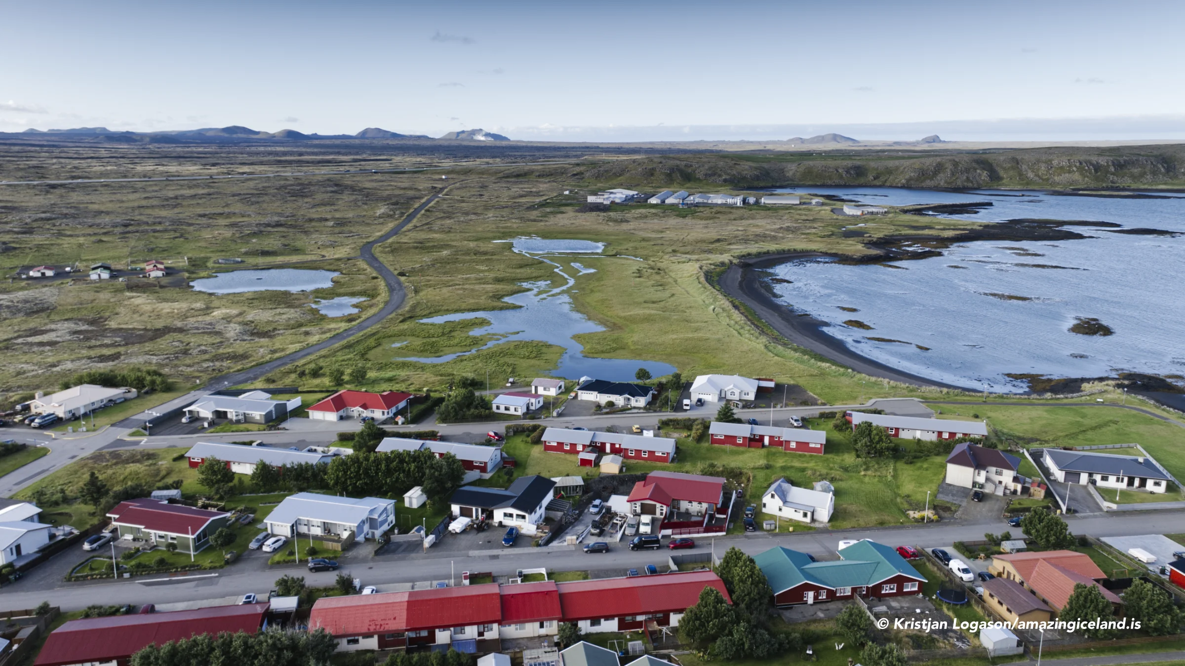
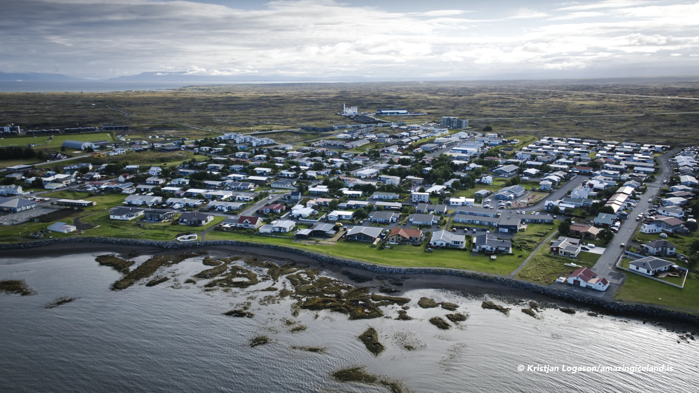
Vogar stands beside Vogavík on the northern coast of the Reykjanes peninsula. Almost everyone arriving in Iceland passes the junction, yet the town and coastline remain out of sight below Reykjanesbraut.
Turning away from the highway reveals a different Reykjanes. The old road follows Vatnsleysuströnd past farms, ponds, lava shores, Kálfatjarnarkirkja and routes leading inland across Strandarheiði. This was once a working landscape of farming, seasonal fishing, boat landings, wells, boundary walls and stone sheepfolds.
The settlement history recorded in *Landnámabók* reaches back to Iceland’s first generations. The municipality traces its boundaries to legislation from 1270, while the modern town developed much later around fishing, harbour construction and road connections.
Vogar works best as the beginning of a coastal detour rather than an isolated town stop. The harbour, Vogatjörn and shoreline can be explored briefly, while the old road through Vatnsleysuströnd reveals the historical landscape hidden from the main highway.
The location of Vogar á Vatnsleysuströnd
Latitude
63.983328
Longitude
-22.387632
Vogar á Vatnsleysuströnd
The town below the highway
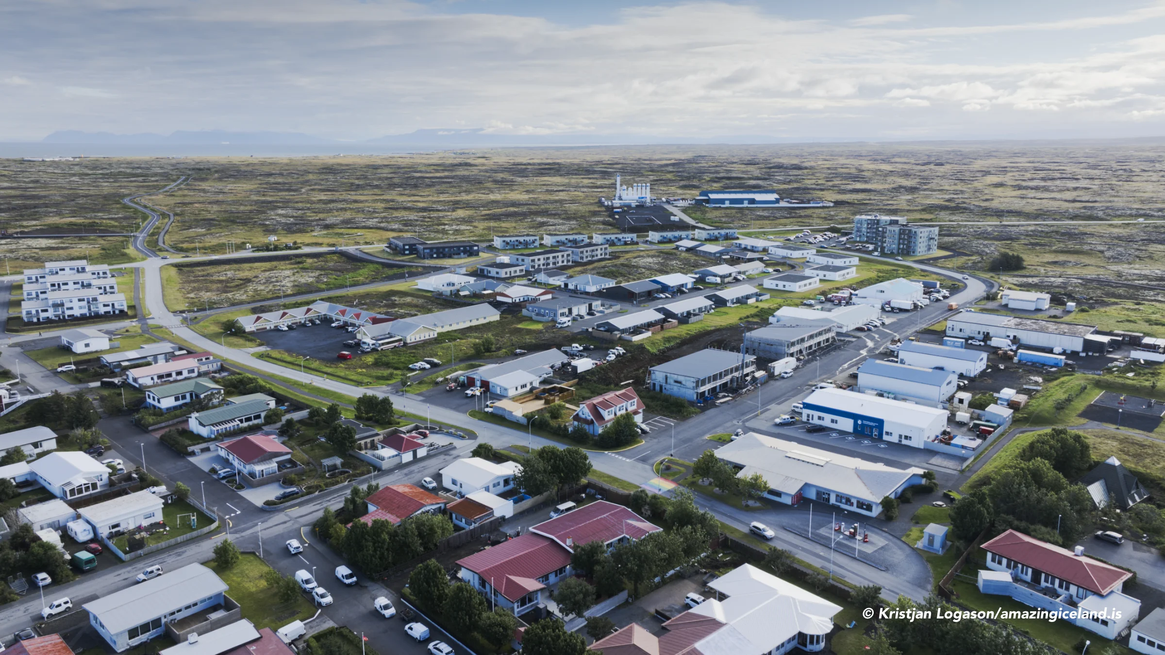
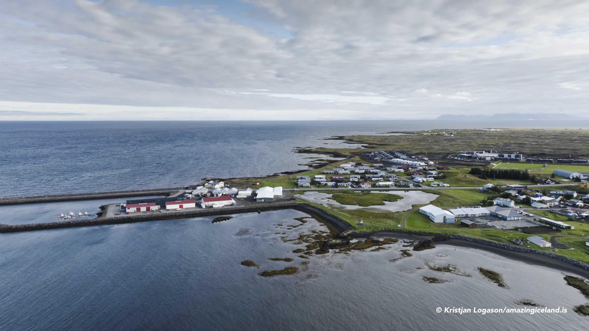
Vogar lies approximately 1.5 kilometres from Reykjanesbraut, on the shore of a small bay called Vogavík. The town belongs to Sveitarfélagið Vogar, which extends along Vatnsleysuströnd and inland across a substantial part of the Reykjanes peninsula.
For centuries, settlement here consisted largely of farms and seasonal fishing stations distributed along the coast. The growth of motorboat fishing and the harbour gradually concentrated more activity at Vogar, creating the present town.
Fishing no longer defines the community as strongly as it once did. Vogar’s position between Reykjanesbær and the capital area has made it increasingly residential, with many inhabitants travelling elsewhere for work. The same location that makes the town practical for residents also makes it easy for visitors to overlook.
The harbour and Vogatjörn provide a natural focus for a walk. The pond, tidal shore and nearby mudflats attract ducks, waders and seabirds, particularly during migration. The coastline also places the town within its proper setting: a small community between lava, shallow water and the broad expanse of Faxaflói.
A cloak for a peninsula
The settlement story of Vatnsleysuströnd begins with Steinunn hin gamla, a kinswoman of Ingólfur Arnarson. According to Landnámabók, she spent her first winter in Iceland with Ingólfur.
He offered to give her Rosmhvalanes outside Hvassahraun. Steinunn gave him a spotted hooded cloak in return and insisted that the transfer should be considered a purchase rather than a gift.
The detail is small but revealing. By exchanging something for the land, Steinunn established that she held it through a transaction rather than through Ingólfur’s generosity.
She later gave her kinsman and foster-son Eyvindur the land between Kvíguvogabjörg and Hvassahraun, corresponding approximately with the modern municipality. Hrolleifur Einarsson of Heiðarbær then sought the property and reportedly gave Eyvindur a choice between selling the land or fighting a duel. Eyvindur instead proposed exchanging farms, and Hrolleifur subsequently settled at Kvíguvogar.
Kvíguvogar eventually became Vogar, while Kvíguvogabjörg became Vogastapi, usually shortened simply to Stapi.
The administrative history is almost as old. Municipal records identify Vatnsleysustrandarhreppur in boundary legislation from 1270, placing it among Iceland’s oldest recorded local-government districts. Njarðvík was incorporated into the district in 1596 and separated again in 1889. Vatnsleysustrandarhreppur retained its historical name until 1 January 2006, when it became Sveitarfélagið Vogar.

Along Vatnsleysuströnd
Vatnsleysuströnd—usually called simply Ströndin by local people—is the inhabited coast between Vogar and Hvassahraun. The old Vatnsleysustrandarvegur follows the shoreline below Reykjanesbraut, providing a quieter and more revealing route through the area.
The landscape contains an unusually dense collection of historical remains. Old farm sites, fishing stations, boat landings, paths, wells, boundary walls and animal enclosures survive along the coast. Many are subtle, unsignposted or located on private land, and they should not be approached as though the entire shoreline were an open archaeological park.
The road itself offers the best introduction. It passes the farms and coastal wetlands while maintaining broad views across Faxaflói. On clear days, Snæfellsjökull can be visible on the far side of the bay.
Vatnsleysuströnd is also used for northern-lights excursions. The coast is close to Reykjavík and Keflavík, but sufficiently removed from their brightest urban lighting to provide useful darkness and an open northern horizon. Conditions still depend on cloud cover, auroral activity and local light, but the shore offers greater space and visibility than many locations within the towns.
Kálfatjarnarkirkja and Staðarborg
Kálfatjarnarkirkja stands prominently on the low coastal land beside the old shore road. A church at Kálfatjörn is documented from around 1200, although the present building is considerably younger.
The current church was consecrated on 11 June 1893. It was the largest rural church in Iceland when built, large enough to accommodate the congregation of a coast that was then more heavily populated than it is today.
Its scale reflects the former importance of Vatnsleysuströnd as both an agricultural district and a centre of seasonal fishing. Today, the white church stands almost alone in the open landscape, with the coast, ponds and distant mountains providing its wider setting.
Inland from Kálfatjörn, on Strandarheiði, stands Staðarborg. This circular sheep shelter was constructed entirely from carefully fitted stone without mortar. Its walls remain approximately the height of a person, forming an almost complete ring in the open heath.
The date of its construction is uncertain. A traditional account credits a farmworker named Guðmundur with building it and says he intended to close the stonework into a roof. According to the story, the farmer stopped him when it appeared the completed structure might become more impressive than the tower of Kálfatjarnarkirkja. The unfinished shelter has remained open to the sky.
Staðarborg was protected as an archaeological monument in 1951. Visitors should not climb on its walls, remove stones or attempt to rearrange the structure. It is not directly beside the main road, so its location and route should be checked before setting out across the heath.
Keilir
Keilir rises inland from Vatnsleysuströnd and is one of the most recognisable mountains on the Reykjanes peninsula. Its unusually regular cone is visible from a large part of the capital area and has become an emblem of Reykjanes and a particular symbol of Vogar.
The mountain reaches 379 metres above sea level. It was formed during a volcanic eruption beneath a glacier, producing the hyaloclastite that makes up much of the cone. A core of harder rock has resisted erosion more successfully than the material around it, helping Keilir retain its distinctive shape.
Although the mountain itself is not exceptionally high, reaching it adds distance and rough terrain to the outing. Access begins from the Strandarheiði junction on Reykjanesbraut and continues towards Höskuldarvellir. The approach road is rough gravel and can be difficult or unsuitable for small cars.
From the recognised starting point, the route first crosses uneven lava before reaching easier ground. The complete walk is approximately seven kilometres and normally takes three to four hours. The final ascent is steeper, but a visible path leads towards the summit.
Walkers should remain on the established path. Vegetation in this exposed volcanic environment grows slowly and can be damaged by repeated traffic. Weather can also change quickly on the open heath, even though the mountain appears close to the road.
From the summit, the view extends across Reykjanes, Faxaflói and the surrounding lava fields. Keilir deserves substantial time and may eventually warrant its own destination page, but it remains inseparable from the landscape and identity of Vogar.
Visiting Vogar and the shore
Vogar is a short detour from Reykjanesbraut. The town itself can be explored during a brief stop, particularly around the harbour, Vogatjörn and the coastal paths.
A more rewarding visit continues along Vatnsleysustrandarvegur. The old shore road passes Kálfatjarnarkirkja and gives access to the coastal landscape that remains hidden from the highway. It is a pleasant alternative drive rather than simply a route between major attractions.
Kálfatjarnarkirkja and the shore can be combined into a short excursion. Staðarborg requires additional walking and route preparation, while Keilir is a separate three-to-four-hour outing.
The shoreline is also worth considering after dark when northern lights are forecast. Its open view across Faxaflói, limited local lighting and easy access from the capital area have made Vatnsleysuströnd a popular aurora-excursion area.
Much of the coast remains farmland or private property. Visitors should use established roads, parking areas and paths, avoid farmyards and home fields, and treat the historical remains as protected parts of a working landscape.
Interesting facts:
- Vogar lies only about 1.5 kilometres from Reykjanesbraut.
- The town takes its name from Vogavík, the bay beside which it developed.
- According to Landnámabók, Steinunn hin gamla exchanged a spotted hooded cloak for Rosmhvalanes because she wanted the land transfer recognised as a purchase.
- The earlier name Kvíguvogar developed into Vogar, while Kvíguvogabjörg became Vogastapi.
- Vatnsleysustrandarhreppur appears in boundary legislation from 1270.
- The municipality retained that name until 1 January 2006, when it became Sveitarfélagið Vogar.
- The present Kálfatjarnarkirkja was consecrated in 1893 and was Iceland’s largest rural church when built.
- Staðarborg is a circular drystone sheep shelter protected as an archaeological monument since 1951.
- Keilir is a 379-metre mountain formed during a subglacial eruption.
- Vatnsleysuströnd provides open views across Faxaflói and is a popular area for northern-lights excursions.
Image Gallery




Photography tips:
- The harbour, Vogatjörn and nearby tidal areas provide the strongest subjects within Vogar itself, particularly when birds and reflections animate the foreground.
- Vatnsleysuströnd is primarily a landscape of light, coastline and distance rather than large landmarks.
- Clear conditions can reveal Snæfellsjökull across Faxaflói. A longer lens can make the distant glacier more significant within the coastal landscape.
- Kálfatjarnarkirkja benefits from a low viewpoint or a wider composition that includes the open shore and sky.
- Early or late directional light reveals the individual stone courses of Staðarborg more effectively than flat daylight.
- Do not climb on Staðarborg or move stones to create a photograph.
- Keilir’s conical form is strongest from a distance. From close to the mountain, much of the shape disappears.
- The coast can work particularly well during winter twilight, when the last colour remains over Faxaflói.
- For northern-lights photography, use the coastline, church or Keilir as structure within the frame rather than photographing the aurora without a landscape.
- Remain on roads and recognised paths. Much of Vatnsleysuströnd is private farmland, while moss-covered lava is fragile and difficult to cross safely.
Destinations nearby