Grábrók
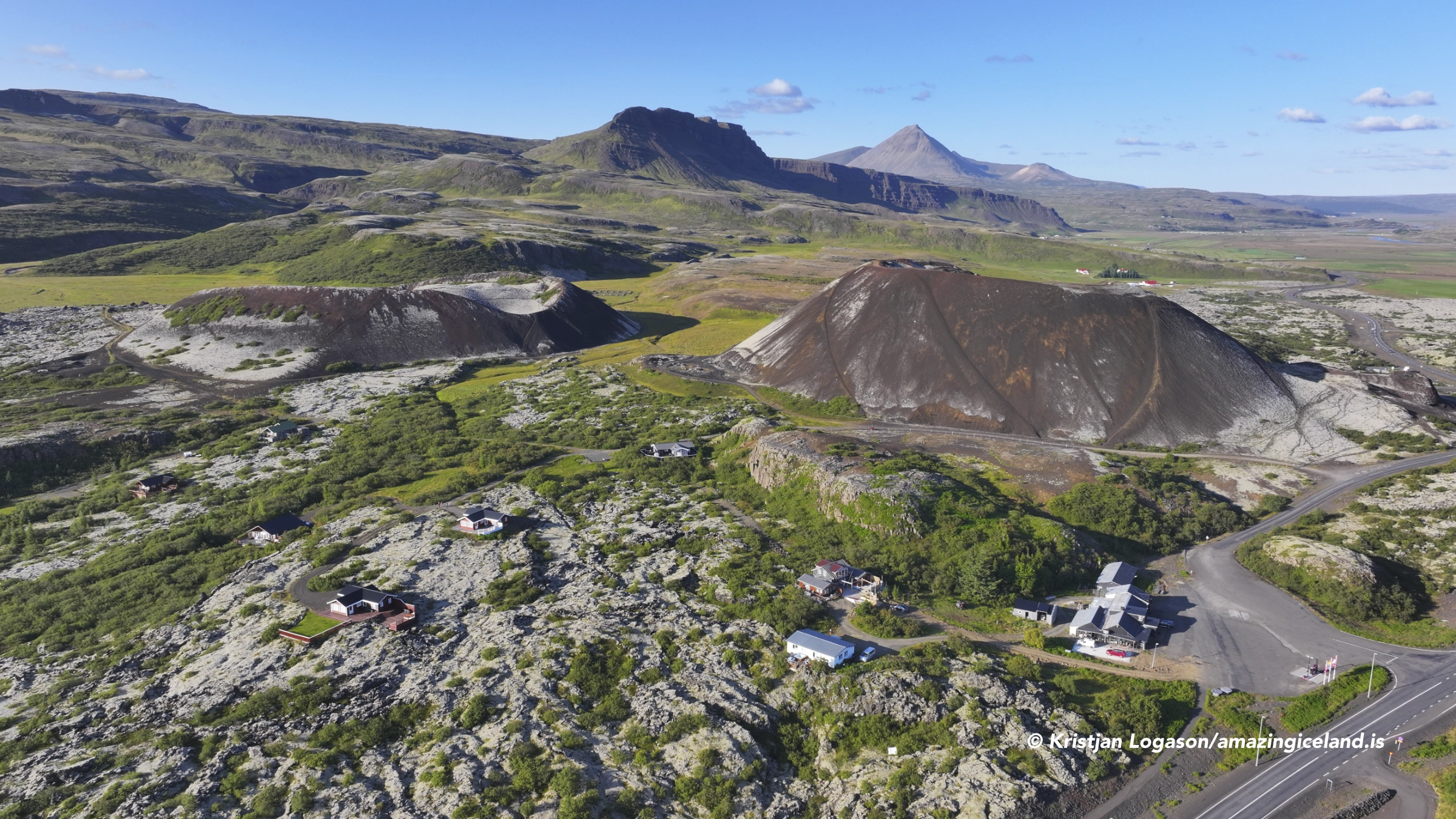
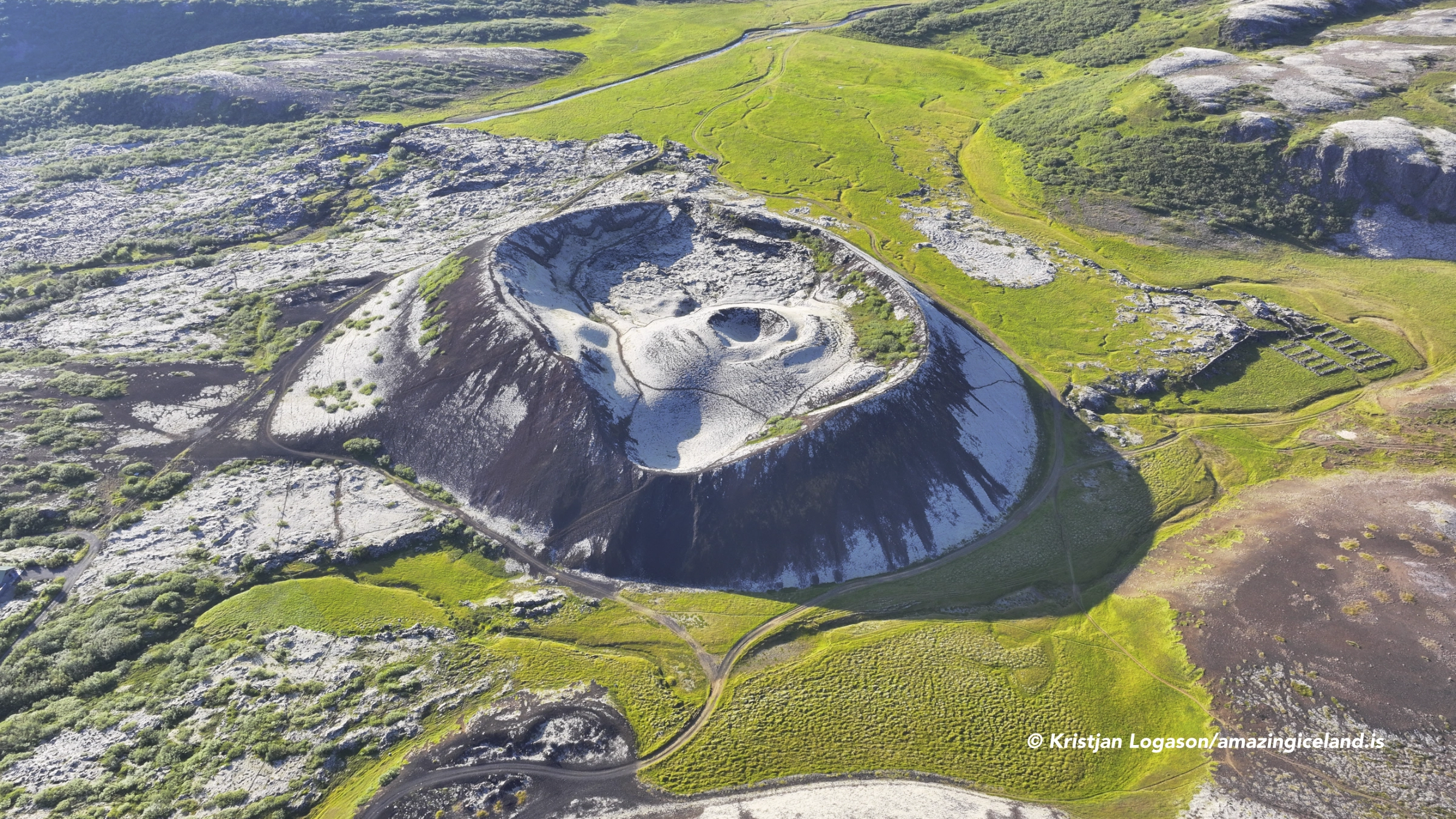
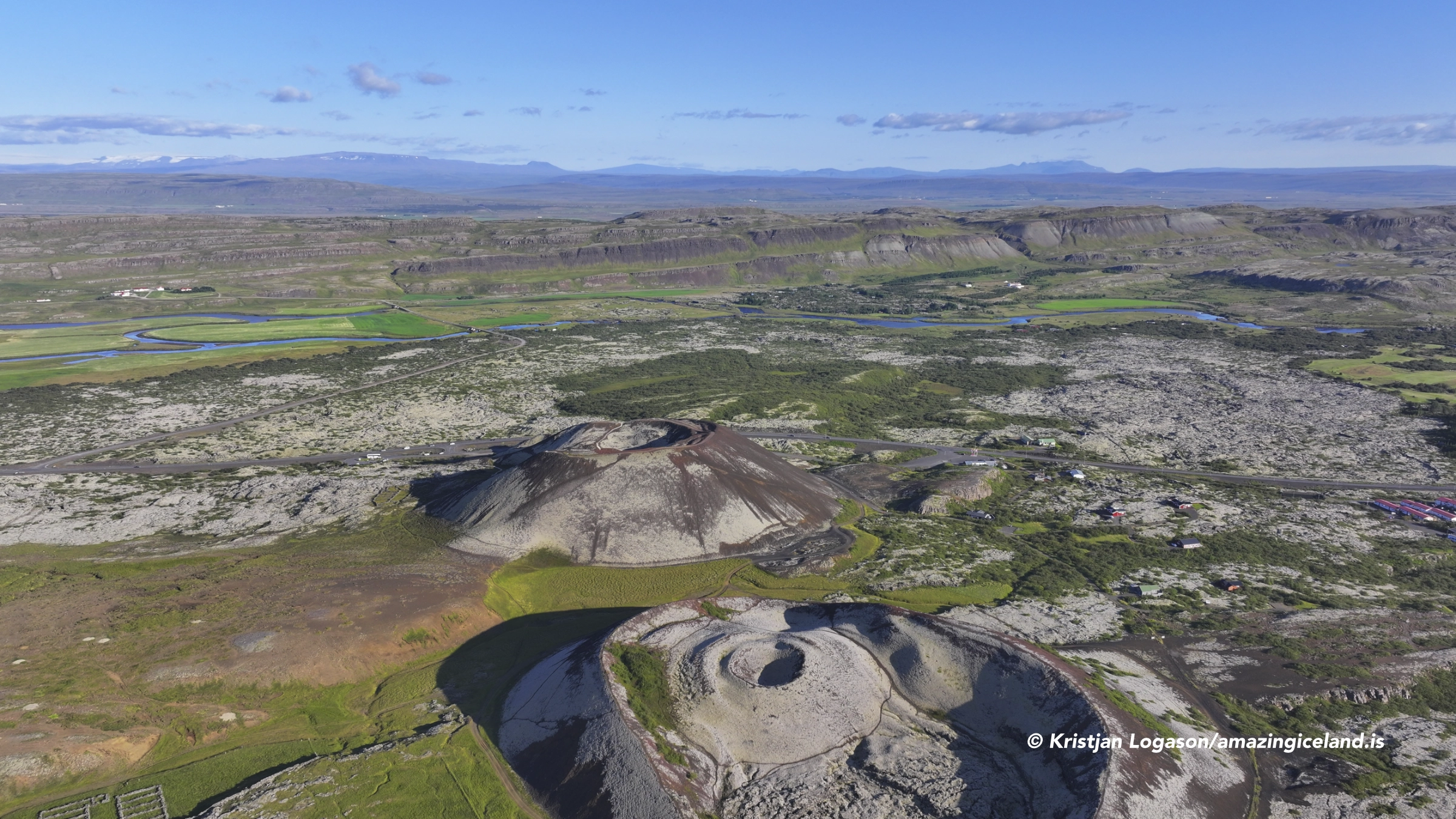
Grábrók rises directly beside Route 1 near Bifröst in Borgarfjörður. It is the largest and best known of the three Grábrókargígar craters, which formed along a short volcanic fissure around 3,000 years ago. The other two are Grábrókarfell and Litla-Grábrók, although the latter was substantially damaged before the area received formal protection.
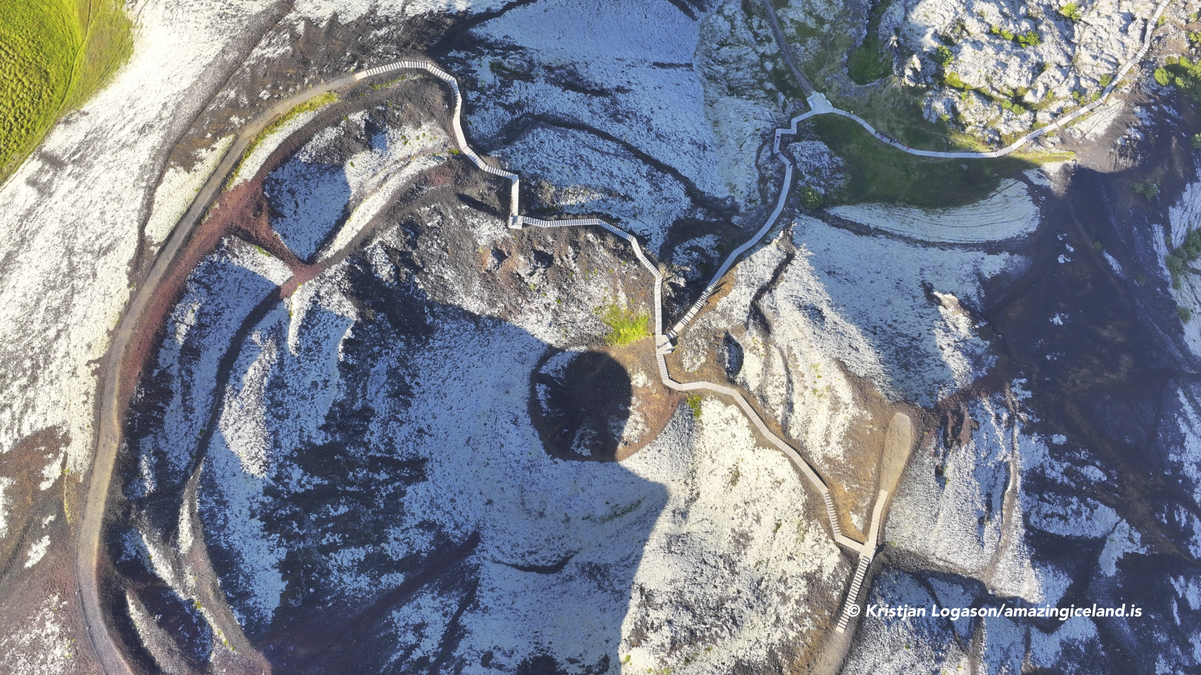
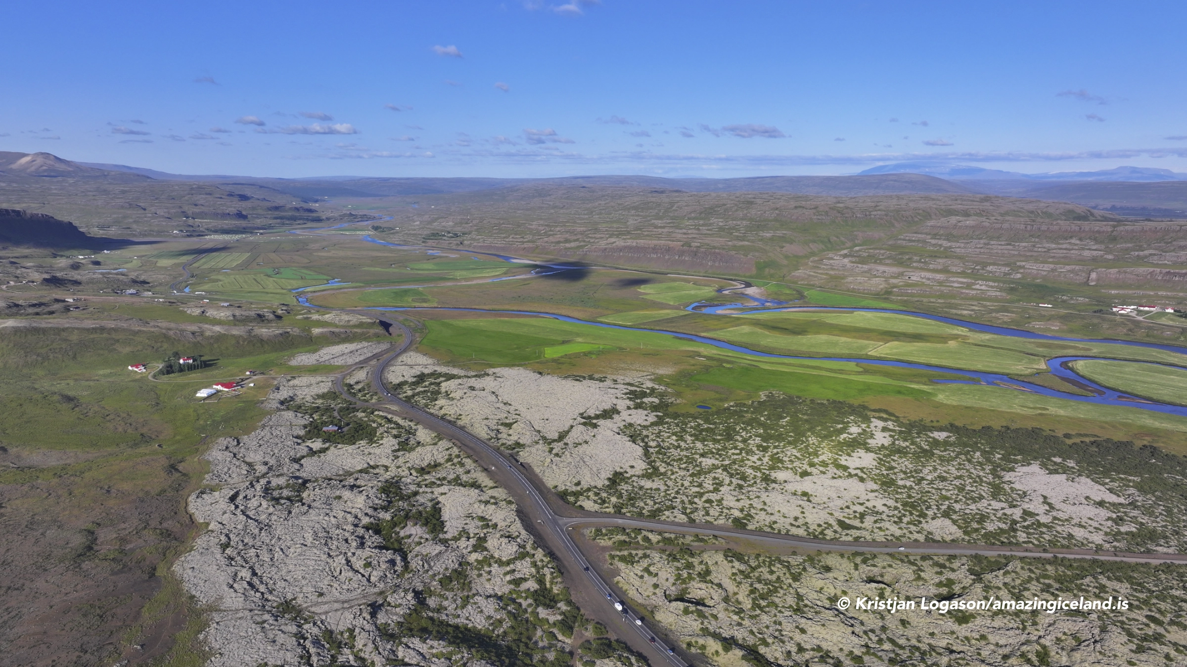
A constructed path with steps leads from the parking area to the rim of Grábrók. The climb is not particularly difficult, and the route continues around the crater, providing views into its interior and across Norðurárdalur. From above, it is possible to follow the direction taken by Grábrókarhraun and understand how the lava changed the valley and formed Hreðavatn.
Grábrók can be visited in an hour, but the walk and changing viewpoints justify more time. Its accessibility makes it an easy stop beside the Ring Road, yet the crater rewards more than a quick climb and photograph from the highest point.
The location of Grábrók
Latitude
64.7716
Longitude
-21.5398
Grábrók
Three craters on a short volcanic fissure
Grábrók, Grábrókarfell and Litla-Grábrók formed during the same fissure eruption. They are part of the Ljósufjöll volcanic system, which extends westwards across Snæfellsnes. Volcanic activity became concentrated at several points along the fissure, building the craters from layers of scoria and other material thrown from the vents.
Grábrók, also known as Stóra-Grábrók when distinguished from the smaller crater, is the largest and most clearly formed of the three. Its steep outer slopes and broad rim are easily recognised from the surrounding valley. Grábrókarfell lies farther west and has a wider, less symmetrical form, while much of Litla-Grábrók was removed or damaged by earlier construction and extraction of volcanic material.
The surviving craters demonstrate that a relatively short fissure can produce several distinct volcanic forms. From a distance, Grábrók appears almost isolated, but the wider view from its rim makes the relationship between the three vents and the surrounding lava field much clearer.
How the lava reshaped Norðurárdalur
The eruption produced Grábrókarhraun, a rough ʻaʻā lava field known in Icelandic as apalhraun, which spread across a substantial part of Norðurárdalur. Over approximately three millennia, moss, heath and other vegetation have softened its surface, but the uneven form of the lava remains visible between the plants.
As the lava entered the valley, it obstructed the existing drainage. It dammed part of Norðurárdalur and formed Hreðavatn, while also affecting the course of Norðurá farther downstream. These relationships can be difficult to understand when driving through the valley because vegetation and later development conceal parts of the lava margin.
The view from Grábrók brings the landscape together. From the rim, visitors can follow the lava away from the craters, see how it occupies the lower ground and examine its relationship with Hreðavatn and the surrounding mountains. The summit is therefore more than a viewpoint; it provides the clearest explanation of what the eruption changed.

Protection and the remains of Litla-Grábrók
Grábrókargígar were first protected as a natural monument in 1962. The protection covers the three craters and the geological formations around them. Visitors must remain on the marked paths, both to protect the loose volcanic material and to prevent further damage to the vegetation growing over it.
Litla-Grábrók shows why this protection became necessary. Considerable parts of the smaller crater were removed or altered when scoria was taken for construction and road building. The damage cannot be reversed, but it gives the surviving craters additional importance as geological structures rather than sources of building material.
Grábrók itself has also experienced heavy visitor pressure. Constructed steps, boardwalks and clearly defined trails concentrate foot traffic on a surface that would otherwise erode quickly. Remaining on the route is therefore not merely general advice; it is part of protecting the crater.
Sheepfolds within the volcanic landscape
The protected area also contains evidence of how the land was used before the craters became visitor destinations. At the edge of Grábrók are the remains of a stone sheepfold used between 1831 and 1872. Another sheepfold beside Grábrókarfell replaced it and remained in use until 1992.
These structures connect the volcanic landscape with the farming history of Norðurárdalur. Long after the eruption, the crater slopes and lava margins became part of the working countryside. Sheep were gathered and sorted within structures built from the same local stone that shaped the surrounding terrain.
The remains are less immediately noticeable than the craters, but they add an important human layer to the site. Grábrókargígar were not isolated geological monuments before their protection; they stood within land that continued to be used by neighbouring farms into the late 20th century.
Climbing Grábrók
The parking area is directly beside Route 1, and the marked path begins close to the base of the crater. There are no visitor facilities at the site. Constructed steps and stairs make the ascent straightforward for most people, although the continuous climb requires some effort.
Once on the rim, the route continues around the crater. The changing position reveals both the depth and structure of the interior, while the outward view opens across Grábrókarhraun, Grábrókarfell, Bifröst, Hreðavatn and the wider valley. Walking the complete rim gives a much better understanding of Grábrók than stopping only at the first high viewpoint.
Allow at least an hour for the ascent, the circuit of the rim and the return to the parking area. Photographers and visitors interested in the wider geology may want longer, particularly when changing light reveals more detail in the crater and lava field.
Grábrók is easily combined with nearby destinations around Bifröst. Hreðavatn and Glanni are directly connected with the same valley landscape, while Paradísarlaut offers a closer experience of the vegetation and water flowing through Grábrókarhraun.
Interesting facts:
- Grábrók is the largest of the three Grábrókargígar craters.
- The other craters are Grábrókarfell and Litla-Grábrók.
- The craters formed along a short fissure belonging to the Ljósufjöll volcanic system.
- Grábrókarhraun is approximately 3,000 years old.
- The lava dammed part of Norðurárdalur and formed Hreðavatn.
- Grábrókargígar were first protected as a natural monument in 1962.
- Litla-Grábrók was substantially damaged by earlier extraction of volcanic material.
- One sheepfold beside Grábrók was used from 1831 to 1872.
- A later sheepfold beside Grábrókarfell remained in use until 1992.
- A constructed path leads to the rim, which can be followed around the crater.
Image Gallery





Photography tips:
- Photographing Grábrók from a distance shows its complete form more clearly than photographs made only from the crater itself. A normal or short telephoto lens can separate the crater from the surrounding lava and valley.
- From the rim, include the crater interior as part of a wider composition rather than filling the entire frame with the dark central hollow. This preserves the relationship between the rim, interior and surrounding landscape.
- Directional light helps define the shape and texture of the crater, but light that is too low can leave much of the interior in unwanted shadow.
- The view over Grábrókarhraun is useful for showing scale and the direction of the lava flow. Look for compositions that connect the crater with the lava field, Hreðavatn or Grábrókarfell.
- A wide-angle lens is useful on the rim, while a normal or short telephoto lens gives greater control over the relationship between individual landscape elements.
- Remain on the marked path and boardwalk. The restriction protects both the loose geological formations and the vegetation, and the established route already provides several useful viewpoints.
Destinations nearby