Barnafoss waterfall
Barnafoss, meaning Children’s Falls, lies beside Hraunfossar in Borgarfjörður in West Iceland. The two waterfalls are reached from the same visitor area and belong to the same river landscape, yet they could hardly behave more differently. At Hraunfossar, groundwater emerges in many clear streams from beneath the lava. At Barnafoss, the Hvítá itself is forced through a confined rocky channel, twisting and foaming between dark walls. The short walk between them turns this geological contrast into the central experience of the visit.
The location of Barnafoss waterfall
Latitude
64.7015
Longitude
-20.9727
Barnafoss waterfall
The river forced into a narrow channel
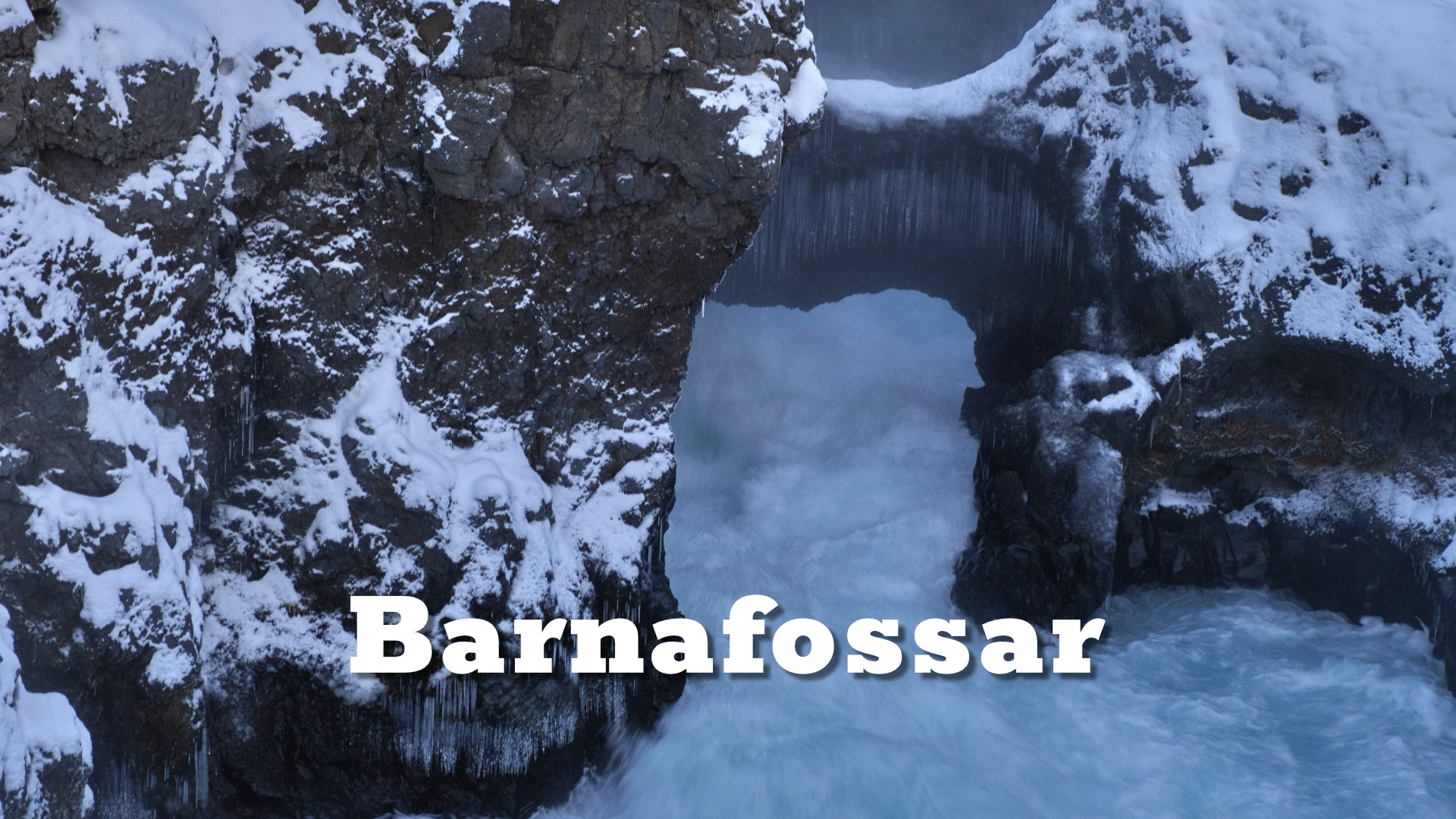
The Hvítá flows from the highlands near Langjökull and carries a substantial volume of water through Borgarfjörður. At Barnafoss, that broad river is compressed by the form of the lava and bedrock into a narrow, irregular channel. The waterfall is therefore not a single open drop. Its character comes from acceleration, turbulence and the way the current disappears between rock walls before breaking back into view.
The confined gorge also determines how Barnafoss is experienced. There is no one broad frontal view equivalent to that of a conventional waterfall. Visitors look down into the channel and follow separate parts of the flow from the paths and modern pedestrian bridge. Water, rock and depth overlap at close range, making the waterfall feel concentrated rather than expansive.
A contrast with Hraunfossar
Barnafoss becomes easier to understand when seen beside Hraunfossar. Both are connected with Hallmundarhraun, the extensive lava field that formed around AD 930, shortly after Iceland’s settlement. The eruption produced approximately 8–9 cubic kilometres of lava, but the two waterfalls reveal very different relationships between lava and water.
At Hraunfossar, water that has travelled through permeable layers beneath the lava emerges along the riverbank in a long series of gentle cascades. Barnafoss is the river itself, confined and driven through a channel eroded into the volcanic landscape. One waterfall is dispersed across the edge of the lava; the other gathers the river’s energy into a small space. Their proximity makes the difference immediately visible without requiring a long walk or a technical explanation.

The children and the vanished stone arch
The name Barnafoss comes from a well-known Icelandic folktale. According to the story, two children from a nearby farm were left at home while their parents attended church on Christmas Day. The children set out to follow them and attempted to cross the river on a natural stone arch above the falls. They fell into the water and were lost.
When their mother learned what had happened, she cursed the arch so that no one else would die while crossing it. The natural arch later disappeared, and no trace of that crossing remains today. This was not the modern pedestrian bridge now used by visitors; the two should not be confused. The story is folklore rather than documented history, but the narrow channel and violent current explain why such a cautionary tale became attached to this particular place.
Visiting Barnafoss
Barnafoss and Hraunfossar share a visitor area beside Route 518. Parking is free, toilets are available, and the walk to Barnafoss is short and easy. About one hour is a realistic amount of time for seeing both waterfalls without rushing, although photographers may want longer to work along the different viewpoints.
The site is accessible throughout the year when Route 518 is open. In winter, the road may remain passable while ice and packed snow make the paths more difficult, so footwear and pace should match the conditions. Fences define the developed viewing areas around the gorge. Drone flights are prohibited according to signs at the site, and photography should therefore be planned from the paths, viewpoints and bridge.
Interesting facts:
-
- Barnafoss means Children’s Falls and takes its name from a folktale about two children lost in the river.
- Barnafoss and Hraunfossar are reached from the same visitor area but are formed by different movements of water through the landscape.
- Hallmundarhraun formed around AD 930 and is estimated to contain approximately 8–9 cubic kilometres of lava.
- The natural stone arch in the folktale has vanished; it was not the modern pedestrian bridge now present at the site.
- Parking is free, toilets are available, and signs prohibit drone flights.
Image Gallery


Photography tips:
-
- Barnafoss is mainly a close, compressed subject. Use the constricted channel, overlapping rock walls and sections of turbulent water rather than searching only for a complete overview.
- A faster shutter speed preserves spray, texture and the force of the current. A longer exposure can also work, but should reveal the direction and structure of the flow rather than smoothing the water into an indistinct surface.
- Overcast light is particularly effective because it controls the contrast inside the gorge and keeps detail in both the water and dark rock.
- Autumn colour in the surrounding vegetation can separate the gorge from the wider landscape, while snow in winter simplifies the scene and makes the dark water more dominant.
- Work from the established paths, viewpoints and bridge. Drone flights are prohibited according to signs at the site.
Destinations nearby