Garður
Garður stands on the northernmost part of the Reykjanes Peninsula, where the low land of Miðnes meets Faxaflói. Fishing shaped the settlement for centuries, supported by productive grounds close to shore and a seasonal workforce considerably larger than the permanent population. The harbour and old landing places still connect the modern town to that history.
The name Garður means a wall or enclosure. In this case it refers to Skagagarður, a substantial medieval structure that crossed the outer peninsula between Útskálar and Kirkjuból. The surviving remains are modest compared with the scale of the original wall, but they reveal that this exposed coastal land was once used for cultivation as well as fishing.
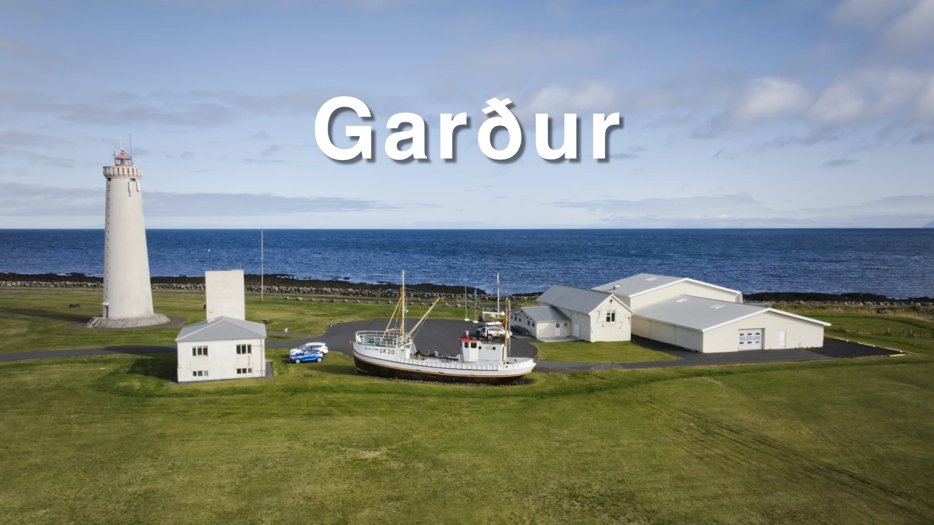
For most visitors, the natural conclusion to the town is Garðskagi. Two lighthouses stand near the point, with the heritage museum between them and an open view across the sea towards Snæfellsjökull, Snæfellsnes, Akrafjall and Esja. Garður therefore works both as a destination in its own right and as a practical base for exploring Reykjanes.
The location of Garður
Latitude
64.0826
Longitude
-22.6924
Garður
A town built around fishing
Garður developed beside some of the most productive fishing grounds in southwest Iceland. For much of its history, boats were launched from natural landing places rather than a sheltered modern harbour, and fishing shaped where people lived and worked along the coast. Garðshöfn, formerly known as Gerðahöfn or Gerðabryggja, remains part of this maritime landscape.
Historical figures illustrate the importance of the seasonal fishery. In 1780, Garður had 120 permanent residents and the wider parish of Útskálar had 288. During the fishing season, 55 local rowing boats operated from the parish, in addition to two visiting boats. These numbers show that this was not simply a small farming community beside the sea. Fishing brought crews from elsewhere in Iceland and temporarily transformed the population and activity of the district.
The character of the town changed as motorboats required better harbours and fishing operations increasingly moved to neighbouring settlements. Garður nevertheless retained its close relationship with the sea. In 2018, the former municipality of Garður merged with Sandgerði to create Suðurnesjabær, but the two towns remain distinct settlements with their own histories and coastal character.
Skagagarður and the origin of the name
Skagagarður once ran for approximately 1.5 kilometres between Útskálar and Kirkjuból. Large field walls continued from both ends, creating a barrier across the outer part of the peninsula. Although it has become flattened and incomplete over time, it remains one of relatively few surviving medieval structures of its kind in Iceland.
Research based on volcanic ash layers indicates that Skagagarður was built during the 10th or 11th century. It consisted mainly of turf with stonework along the top and may originally have reached approximately shoulder height. Its inner side was stepped while the outer face was comparatively smooth, allowing livestock to be driven out while making it difficult for the animals to return.
The wall is believed to have protected fields from grazing sheep. Old field boundaries, place names and surviving cultivation remains indicate that grain was once grown over a considerable area of Garðskagi. This agricultural history can be difficult to imagine in the present open landscape, but Skagagarður shows that the land was organised and managed on a substantial scale during the early centuries of settlement.
Parts of the wall can still be traced, particularly south of Skagabraut. Towards Útskálar, sections were levelled during later cultivation and are much less distinct. This is not a monument that rises dramatically from the ground; understanding what it represents is more important than its present height.

Garðskagi and the two lighthouses
Garðskagi is the main visitor area in Garður. The low headland projects into Faxaflói and provides wide views in almost every direction. On clear evenings, the sun sets towards Snæfellsjökull and light can extend along the Snæfellsnes mountain range, Akrafjall and Esja.
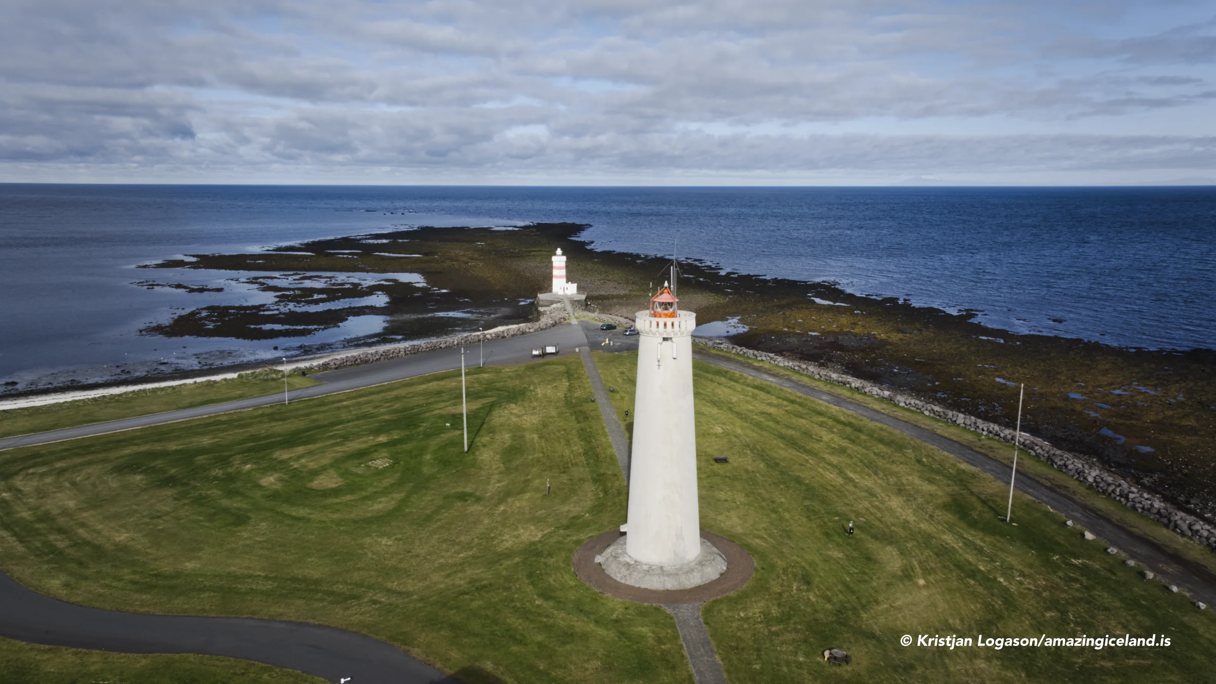
A navigation marker stood at Garðskagatá from 1847, and a lantern was added in 1884. The older lighthouse was constructed in 1897 and remains close to the shoreline. Its small square form belongs to an earlier period of navigation, when the light had to be positioned as close to the point as practical.
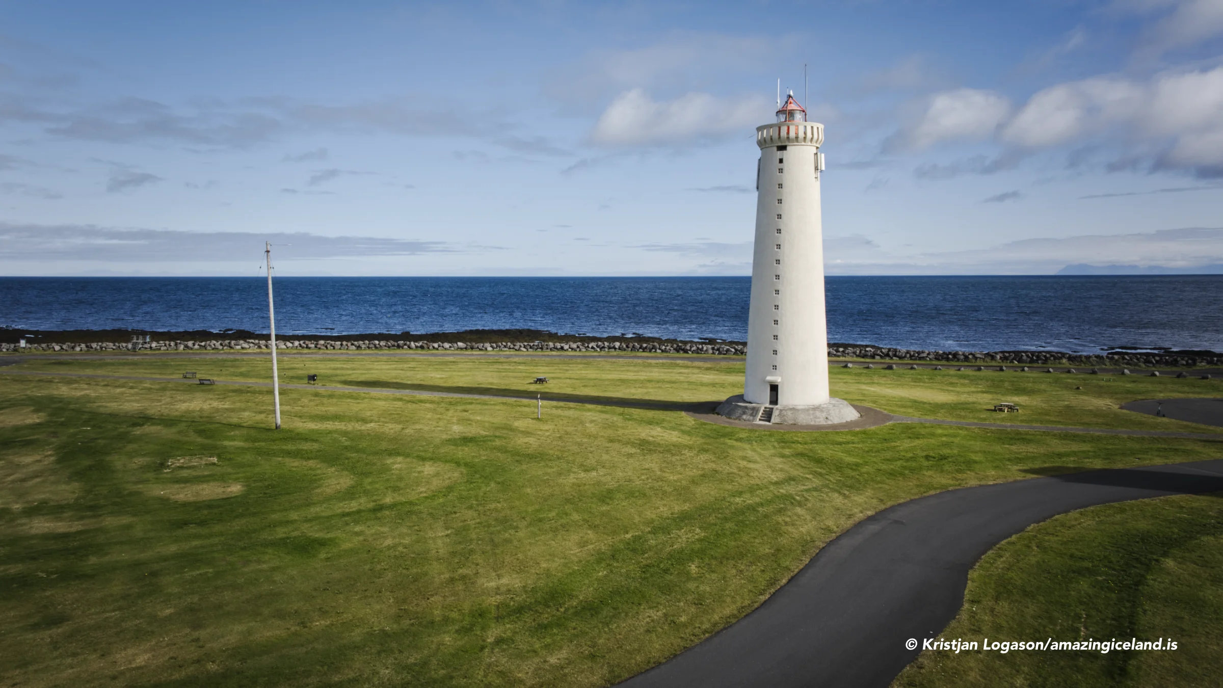
The newer lighthouse was completed and inaugurated in 1944, the year Iceland became a republic. It is consequently often called Lýðveldisvitinn, or the Republic Lighthouse. At 28.6 metres, it is the tallest lighthouse in Iceland and stands farther inland than its predecessor. When access is available through the heritage museum, the balcony provides an elevated view over Garðskagi and the surrounding sea.
The two towers are different in scale and form, but together they have become the most recognisable landmarks of Garður. They also record changes in navigation, construction and the demands placed on structures standing along this exposed coast.
Birds and the coastal environment
Garðskagi is well known among birdwatchers. Its position at the outer edge of the peninsula makes it an important place for observing migrating birds, particularly during spring and autumn. Information panels beside the old lighthouse help visitors identify some of the species seen along the shore.
The importance of the location is reflected in the history of the old lighthouse. From 1962 until 1978, the Icelandic Institute of Natural History used it as a bird observation station. This connected the building directly with scientific monitoring of the migration passing the point.
Seals, dolphins and whales may also be seen offshore, although sightings vary considerably and should never be expected on a short visit. Binoculars make it easier to examine both the shoreline and the wider waters without approaching resting birds or other wildlife.
The landscape itself is low and open rather than dramatic in height. Its strength comes from the relationship between sea, sky, changing light and distant mountains. Clear weather reveals the scale of Faxaflói, while wind, cloud and rougher conditions give the lighthouses a very different setting.
Útskálar and Kirkjuból
Útskálar and Kirkjuból stood at opposite ends of Skagagarður, and both carry important parts of the area’s history. The present Útskálakirkja was built between 1861 and 1863 at the initiative of the parish priest Sigurður B. Sívertsen. It is a timber church standing on a stone foundation, with a tower, porch and choir loft. Sívertsen also founded Gerðaskóli in 1872, now one of the oldest continuously operating primary schools in Iceland.
Kirkjuból is associated with the violent final stage of the Icelandic Reformation. In November 1550, Jón Arason, the last Catholic bishop of Hólar, and his sons Ari and Björn were executed at Skálholt. The following year, men from northern Iceland travelled south and killed Kristján skrifari and several of his men at Kirkjuból in revenge for their part in the executions.
Accounts differ over exactly how Kristján skrifari died, including a tradition that he was burned inside the house. According to another tradition, he had declared that “the earth and the axe” would best keep Jón Arason and his sons. The saying has become closely connected with the story, but it should not be treated as a securely recorded statement.
The killing at Kirkjuból was not an isolated local dispute. It was part of the struggle surrounding the Reformation and the transfer of religious and political power in Iceland. Garður, Skálholt and Hólar preserve different parts of the same national story.
Byggðasafnið at Garðskagi
Byggðasafnið á Garðskaga gives the fishing and domestic history of the area a physical setting. Its exhibitions include household objects, fishing equipment, models of former buildings and a substantial collection of restored engines and machinery. The collection helps explain the transition from rowing boats to mechanised fishing and the changes that followed in coastal communities such as Garður.
Among the preserved vessels is Fram, a clinker-built boat constructed in 1887. The museum also maintains the wooden motorboat Hólmsteinn GK 20 outside the main building. Together with the machinery collection, the boats make the museum more than a general display of household objects; it has a strong maritime and technical character.
The museum is also the access point for visiting the 1944 lighthouse when it is open. Its seasonal schedule should be checked before making a special journey, particularly outside summer. Even when the buildings are closed, the lighthouse area, shoreline and views remain accessible.
Visiting Garður
Garður is reached by paved roads and is only a short drive from Keflavík and Keflavík International Airport. The principal visitor parking is at Garðskagi, close to the museum and the two lighthouses. From there, visitors can walk around the immediate coastline and examine the buildings without undertaking a demanding hike.
Allow two to three hours to combine Garðskagi, the museum, Útskálakirkja, Skagagarður and the harbour area. A shorter visit can concentrate on the lighthouses and coast, while birdwatchers and photographers may remain much longer when conditions are interesting.
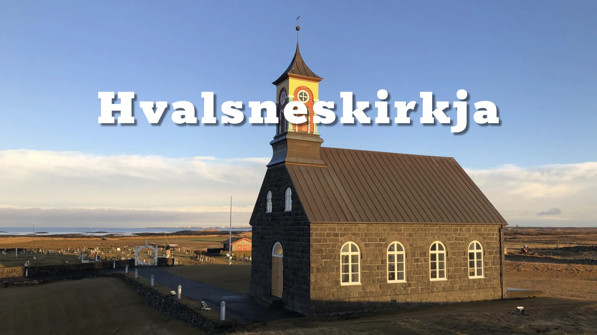
Garður can also work as a base for exploring Reykjanes. It provides access to the western shore towards Sandgerði, Hvalsnes and the outer lighthouse coast while remaining close to the services of Keflavík. Its location is particularly useful for visitors who want to explore the peninsula without treating it merely as the road between Reykjavík and the airport.
Interesting facts:
- Garður takes its name from Skagagarður, a medieval wall that crossed the outer peninsula between Útskálar and Kirkjuból.
- Archaeological evidence indicates that Skagagarður was built during the 10th or 11th century.
- The wall was approximately 1.5 kilometres long and was probably intended to protect cultivated fields from livestock.
- Fifty-five local rowing boats and two visiting boats operated from Útskálar parish during the fishing season of 1780.
- The old lighthouse at Garðskagi was built in 1897.
- The new lighthouse was inaugurated in 1944 and is often called Lýðveldisvitinn.
- At 28.6 metres, the 1944 lighthouse is the tallest lighthouse in Iceland.
- The old lighthouse served as a bird observation station from 1962 to 1978.
- Garður and Sandgerði merged in 2018 to create Suðurnesjabær.
- Kristján skrifari and his men were killed at Kirkjuból in 1551 during the aftermath of the execution of Jón Arason.
Image Gallery





Photography tips:
- The two lighthouses offer different compositions. The smaller 1897 lighthouse works well against the sea and open horizon, while the taller 1944 tower can be used as a strong vertical element within the wider coastal landscape.
- Evening light is particularly important at Garðskagi. From the point, the sun sets towards Snæfellsjökull and can illuminate clouds and distant mountains across Faxaflói.
- Both long and short exposures can work along the shore. The choice should depend on the movement of the sea, the wind and whether the intention is to emphasise texture or simplify the water.
- Garðskagi can be a useful northern-lights location when the sky is clear. Use the lighthouse as a recognisable foreground, but account for artificial light around the buildings and avoid overexposing the white tower.
- A wide-angle lens is useful for combining a lighthouse with the sky, while a normal or short telephoto lens can compress the tower against Snæfellsjökull, distant mountains or changing light across the bay.
- For birds, use a long lens and remain at a distance that does not disturb feeding, resting or nesting activity, particularly during the breeding and migration periods.
Destinations nearby