Hellnar beach cove in Snæfellsnes Iceland
Hellnar sits on the southern side of the Snæfellsnes Peninsula. Today it is a very small settlement, with around **10 permanent residents**, but historically it was one of the more important fishing places on this stretch of coast.
Its main natural feature is **Baðstofa**, a cove beneath the cliff **Valasnös**, reached by a short walk from the village. The cove is known for the colours in its rock, which change with the light, moisture and level of the sea.
Hellnar is also a place where the older human landscape remains unusually visible. The springs Maríulind and Ásgrímsbrunnur, the church, the remains of the old fishing settlement and the coastal route to Arnarstapi all belong to a much longer history than the size of the present village suggests.
The location of Hellnar beach cove in Snæfellsnes Iceland
Latitude
64.7521
Longitude
-23.6446
Hellnar beach cove in Snæfellsnes Iceland
From fishing settlement to small village
Hellnar was once a considerably larger community than it is today. Historical records indicate that around 200 people lived here in the early seventeenth century, and the 1703 census recorded a population just below that figure.
Fishing was central to the settlement. Hellnar belonged to the same coastal economy as neighbouring Arnarstapi, but the two places developed differently as trade and administration became increasingly concentrated elsewhere.
During the period of the Danish trading monopoly, Arnarstapi became the main administrative and trading centre for this part of Snæfellsnes. Over time, Hellnar lost population while larger settlements such as Ólafsvík and Grundarfjörður became more important.
The contrast is striking today. Hellnar feels quiet and small, yet the landscape still carries the structure of a place that once supported a much larger working community along this coast.
Baðstofa beneath Valasnös
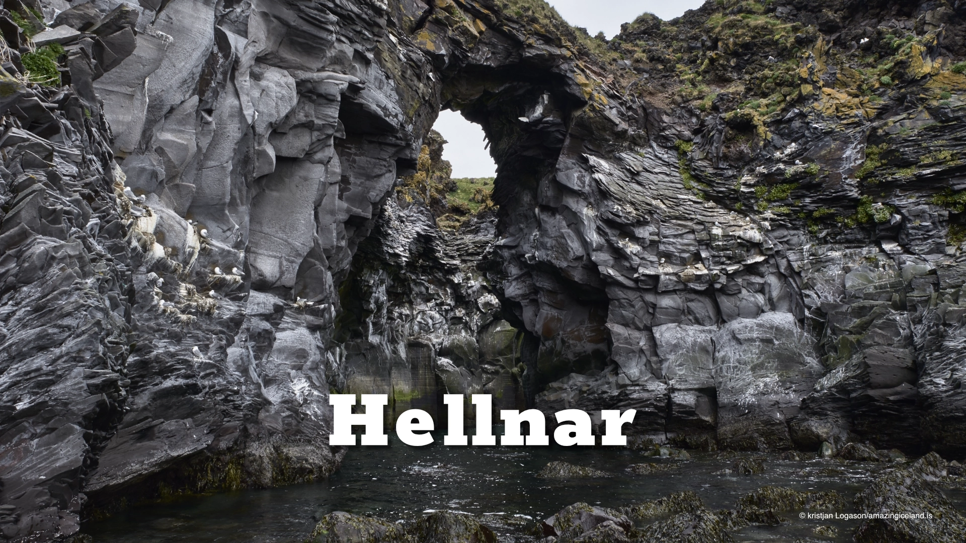
The cove Baðstofa lies below the cliff Valasnös and is reached by a short walk down from Hellnar. The rock inside and around the cove contains a surprising range of colours and textures that change noticeably with light and sea conditions.
Traditionally, Baðstofa is considered at its best early in the morning, in sunshine and around high tide, when the colours in the rock become especially strong. Wet surfaces deepen the tones, while lower-angle light can reveal details that are much flatter under midday conditions.
The tide changes the appearance of the cove, but visitors are not cut off there by rising water. Fresh water also emerges from beneath the lava close to the shore, adding another element to a place already shaped by the meeting of rock, sea and groundwater.
Baðstofa is therefore not simply a small coastal cave or inlet. Its character comes from the constant changes in light, moisture and water level.

Maríulind and Ásgrímsbrunnur
Two named springs are associated with Hellnar, preserving a much older relationship between the settlement and fresh water emerging along the coast.
One is Maríulind, also known historically as Gvendarbrunnur. Tradition connects the spring with Guðmundur Arason the Good, one of Iceland’s best-known medieval bishops, while later tradition also tells of an appearance of the Virgin Mary at the site.
Those associations belong to religious tradition rather than documented medieval history, but they have remained strong enough that Maríulind is still known as a pilgrimage destination.
The second spring is Ásgrímsbrunnur, named after the priest Ásgrímur, who lived from 1758 to 1829. He is said to have carved the well into the rock at a place where water had not previously flowed visibly.
These are small features, but they say something important about Hellnar. In a coastal settlement where reliable fresh water mattered, a spring could become both a practical resource and a place of memory.
The trail to Arnarstapi
A coastal path connects Hellnar with Arnarstapi. The route is about 2.5 kilometres one way and normally takes around 45–60 minutes, depending on pace and conditions.
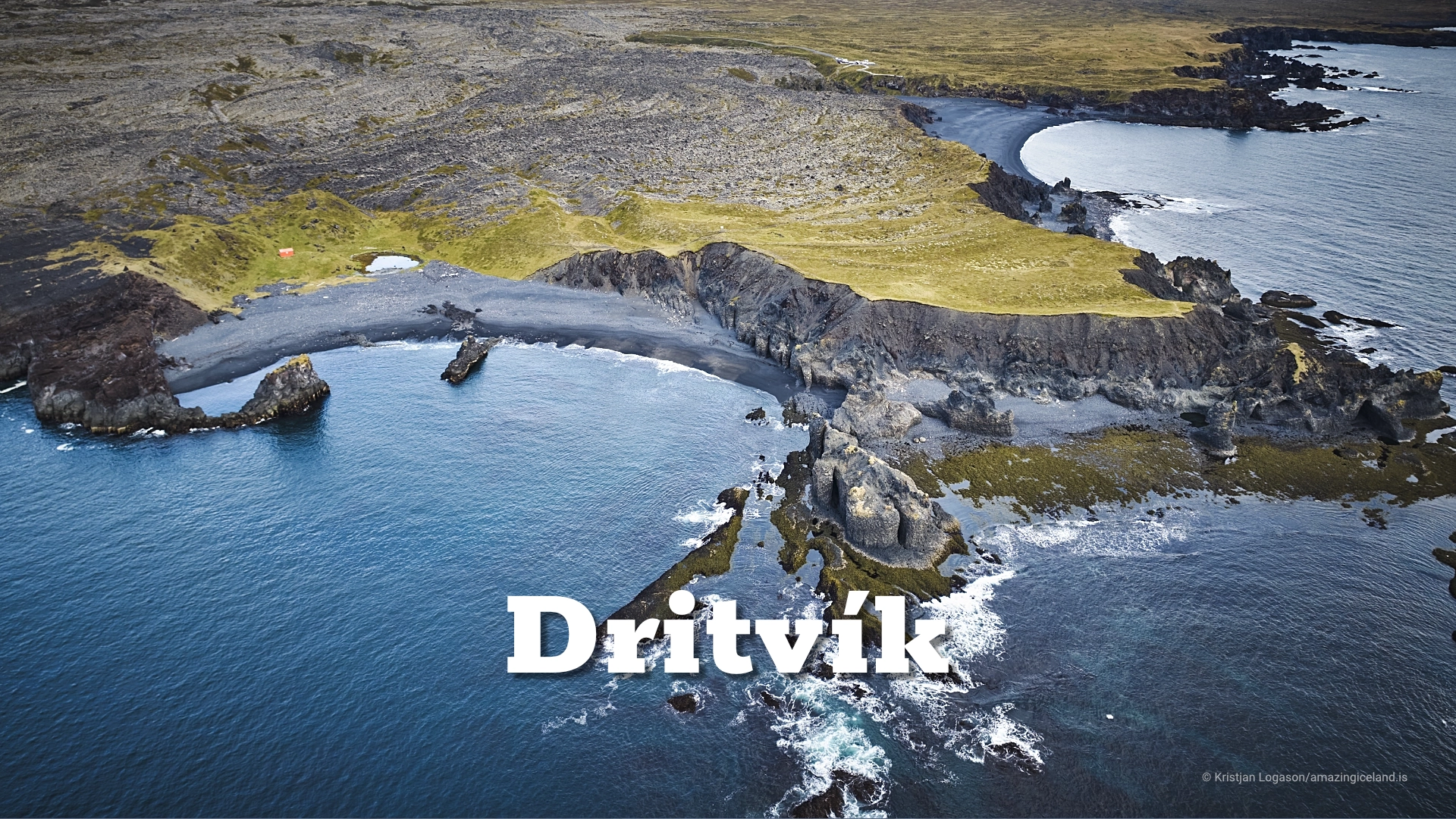
The trail can be walked in either direction and crosses Hellnahraun, following the cliffs and shoreline between the two settlements. This part of the coast has been protected as a nature reserve since 1979.
In normal conditions the route is not difficult, but it crosses uneven lava and remains exposed to wind and weather. The path also passes through a landscape that preserves much of the old working coast between the two villages.
That is what makes the walk more than a scenic connection. Hellnar and Arnarstapi were once part of the same coastal economy, and the trail still ties the two places together physically as well as historically.
Hellnar church
The church stands on higher ground above the village and is one of the most recognisable buildings in Hellnar. The present structure was consecrated in 1945, replacing an earlier church on the site.
Its simple form suits the scale of the settlement, while its elevated position gives it a much stronger presence in the surrounding landscape than the size of the building might suggest.
In summer, the church belongs visually to the green slopes and open coast. In winter, particularly with snow on the ground and Snæfellsjökull visible beyond, it becomes a completely different subject.
The church adds another layer to Hellnar’s long continuity as a settlement. Like the springs and old fishing history, it belongs to a place that has changed greatly in population without losing its connection to the landscape around it.
Interesting facts:
- Hellnar once had around 200 inhabitants and was one of the larger fishing settlements on this part of Snæfellsnes.
- Today the village has around 10 permanent residents.
- Baðstofa lies beneath the cliff Valasnös.
- The colours in Baðstofa change with both light and sea level.
- The cove is traditionally considered especially beautiful early in the morning around high tide.
- Maríulind is also known historically as Gvendarbrunnur.
- Ásgrímsbrunnur is named after the priest Ásgrímur, 1758–1829.
- The Hellnar–Arnarstapi coastal path is about 2.5 km long.
- The coast between the two villages has been protected since 1979.
- The present Hellnar church was consecrated in 1945.
Image Gallery


Photography tips:
- For the strongest colour, early morning sunlight around high tide is traditionally considered the best combination.
- Wet rock, moss, seaweed and smaller formations can produce stronger details than trying to fit the entire cove into one frame.
- Changing weather often suits Hellnar because short breaks of light can make the wet rock respond very strongly.
- Use the coastal trail towards Arnarstapi for wider compositions that combine cliff, shoreline and lava.
- The church is a separate subject, especially in winter when snow simplifies the foreground and Snæfellsjökull may be visible beyond the settlement.
- Longer focal lengths can help isolate details in Baðstofa or compress the relationship between the church and mountain, while wider lenses are better for showing the coast.
- Avoid treating the village only as a collection of landmarks. The strongest images often come from showing how the settlement, cliff and sea belong to the same small landscape.
Destinations nearby