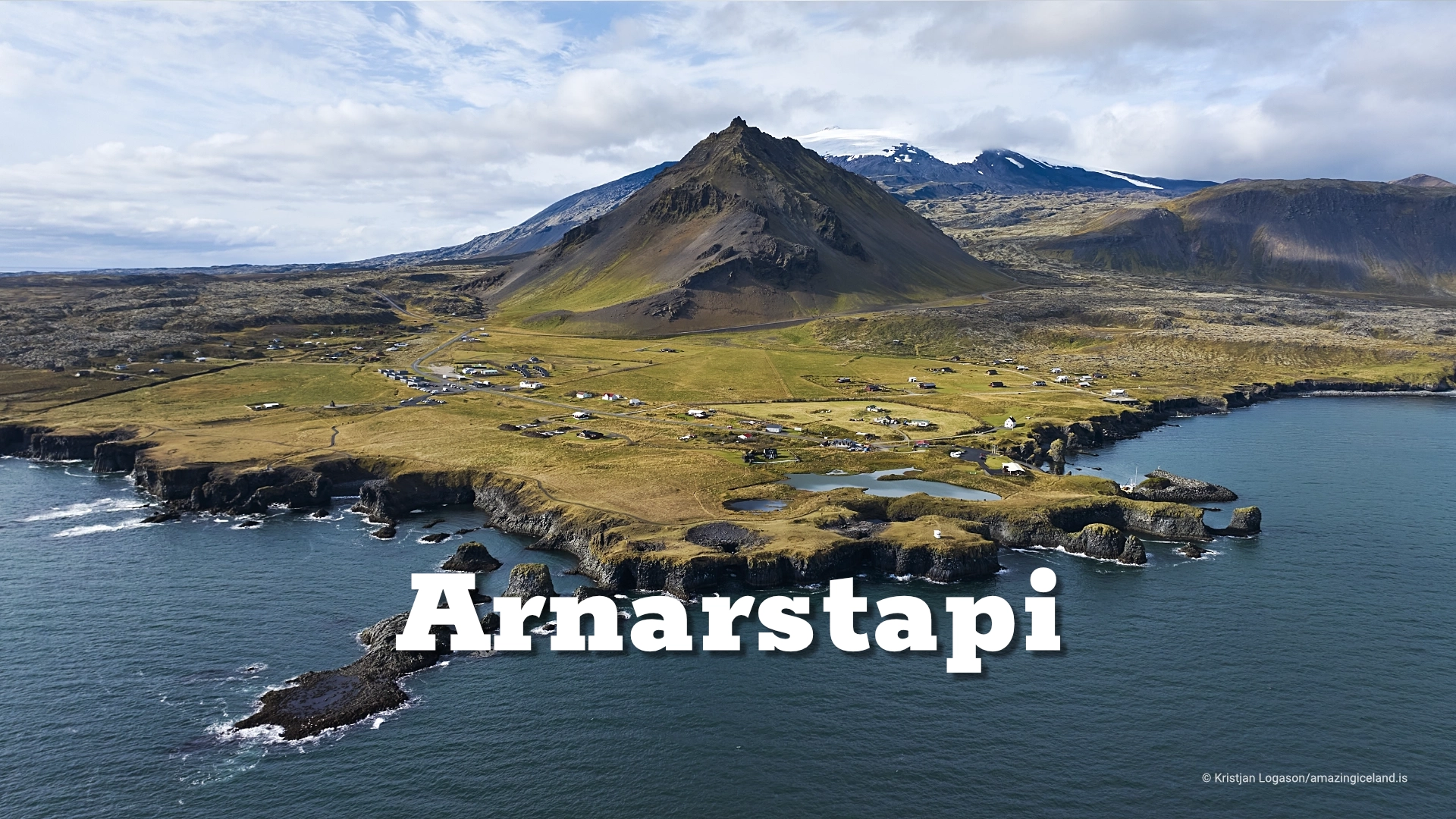
Arnarstapi is a fishing hamlet at the foot of the low Mt. Stapafell on the southern side of the Snaefellsnes peninsula.

At the foot of **Mt. Stapafell**, Arnarstapi sits on the southern side of the Snæfellsnes Peninsula, facing a coast of basalt cliffs, sea arches, ravines and old landing places. The village was once an important trading and fishing settlement, built around access to a coastline where a good landing place could determine whether a community prospered.

Today Arnarstapi is smaller, but the relationship with the sea remains visible. Fishing boats still use the harbour in summer, while the cliffs, birdlife and coastal paths have become the main reason most visitors stop.

The village itself lies outside Snæfellsjökull National Park, but the coastal strip between Arnarstapi and Hellnar has been protected since **1979**. That protected coast is one of the strongest parts of the destination, because it connects the modern village with the older working landscape of southern Snæfellsnes.

The location of The village of Arnarstapi in Snæfellsnes peninsula

Latitude
64.7702
Longitude
-23.6211

The village of Arnarstapi in Snæfellsnes peninsula

Stapi, the harbour and the old trading place

Arnarstapi is often shortened simply to Stapi. Its position on an exposed coast made the quality of its landing place especially important, and the site known as Stöð was historically considered one of the best landing places on the outer Snæfellsnes Peninsula.

That advantage helped the settlement develop around fishing, trade and access to the sea. Arnarstapi later became an important trading place and at one time supported a larger population than it does today.

The harbour is still small, but it remains part of the village rather than a historic relic. Fishing boats continue to use it in summer, and the relationship between Arnarstapi and the sea can still be read in the harbour walls, old landing places and the way the settlement sits against the coast.

The village therefore makes more sense when approached from the harbour outward. Arnarstapi was not created because the location was picturesque. It grew because this particular stretch of coast offered practical access to the sea.

Gatklettur and the coast

The coastline around Arnarstapi is one of the main reasons to spend time here rather than simply drive through. Basalt cliffs have been cut by the sea into arches, caves, narrow openings and vertical faces, creating a compact but varied coastal landscape.

The best-known formation is Gatklettur, the sea arch just off the coast. A path and fencing guide visitors along the cliff edge, with viewpoints towards the arch and other formations shaped by the same marine erosion.

There are also openings and cavities along the coast where strong southerly seas can force spray high into the air. Their behaviour depends entirely on swell, wind and water level, so they are not always active.

The coast should therefore be treated as something that changes from visit to visit. Calm conditions reveal the shape and structure of the basalt, while rougher weather makes the relationship between the rock and the sea much more obvious.

Birds and Arctic terns

The cliffs between Arnarstapi and Hellnar support considerable seabird life from spring into autumn. Kittiwakes, fulmars and razorbills are among the species associated with the coast, using the steep cliffs and ledges as nesting and resting places.

Arnarstapi itself is also known for its Arctic tern colony. The terns nest on the ground and can defend their nesting areas aggressively when people approach too closely.

Outside the nesting ground they are generally not a problem. Keeping to established paths is therefore important both for the birds and for visitors who would rather avoid becoming the centre of attention for an entire colony.

The terns are a major part of Arnarstapi in summer. Their calls, rapid flight and constant movement can fill the village, creating a very different atmosphere from the quieter months outside the breeding season.

The coastal walk to Hellnar

One of the best ways to experience Arnarstapi is to walk the protected coast towards Hellnar. The marked route is about 2.5 kilometres and usually takes around one hour, although walking time naturally varies.

The route can be walked from either end and crosses Hellnahraun, a lava field around 4,000 years old. Along the way, the path follows the coastline past bird cliffs, lava formations and places connected with the older fishing landscape.

This is what makes the walk more interesting than a simple trail between two villages. The route passes through a section of coast where natural formations and working history still overlap.

Old fishermen’s landing places sit within the same landscape as sea cliffs and lava. The walk therefore gives a much clearer sense of how people once used this coastline than either Arnarstapi or Hellnar can provide alone.

Bárður Snæfellsás

Near the coast stands the sculpture of Bárður Snæfellsás, one of the central figures in the folklore and saga landscape of western Snæfellsnes. The sculpture was made by Ragnar Kjartansson, the Icelandic sculptor born in 1923 and grandfather of the contemporary artist of the same name.

Bárður is associated with Arnarstapi, Snæfellsjökull, Sönghellir, Rauðfeldargjá and several other places across the peninsula. His story is therefore not tied to one location, and there is little value in forcing all of the traditions surrounding him into Arnarstapi alone.

That is also what makes the figure interesting. Bárður exists across the landscape, with different parts of his story attached to different places.

Arnarstapi is one of the locations named in Bárðar saga Snæfellsáss, which is why the sculpture belongs here rather than functioning simply as a modern decoration. It connects the village with a much broader narrative spread across Snæfellsnes.

Stapafell and the village

Stapafell rises directly above Arnarstapi and gives the village much of its visual character. From several viewpoints, houses and harbour sit beneath the mountain, with Snæfellsjökull farther inland.

That relationship between settlement and mountain is one of the strongest features of Arnarstapi. The village feels contained between Stapafell and the sea, with very little separation between harbour, cliffs, birds and the surrounding volcanic landscape.

Arnarstapi also has a campground and the normal services expected at one of the better-known stops on Snæfellsnes. Those facilities are useful, but they are not the reason the village works as a destination.

The combination of harbour, mountain, coastline, birdlife and the walk towards Hellnar is what gives Arnarstapi its character. It is a small village, but there is considerably more to understand here than the usual quick stop at Gatklettur.

Interesting facts:

  • Arnarstapi is often simply called Stapi.
  • The old landing place known as Stöð was considered one of the best on the outer Snæfellsnes Peninsula.
  • The protected coastal strip between Arnarstapi and Hellnar dates from 1979.
  • Gatklettur is the best-known sea arch on the Arnarstapi coast.
  • The coastal walk to Hellnar is about 2.5 km and usually takes around one hour.
  • Hellnahraun between the villages is around 4,000 years old.
  • Arnarstapi has an Arctic tern colony in summer.
  • The sculpture of Bárður Snæfellsás is by sculptor Ragnar Kjartansson (1923–1988).
  • Arnarstapi lies outside Snæfellsjökull National Park.

Image Gallery

Photography tips:

  • Use Gatklettur as a starting point rather than the only subject. The surrounding cliffs, openings and interaction between rock and water often produce stronger compositions than isolating the arch alone.
  • For wider views of the village, use Stapafell as the background. The mountain gives scale to the houses and harbour and explains the physical setting of Arnarstapi better than a tight village photograph.
  • The harbour works particularly well in lower light, when boats, buildings and harbour walls separate more clearly from the surrounding slopes.
  • Along the coastal path, look for compositions that combine basalt, sea and bird cliffs rather than treating each element separately.
  • For Arctic terns, use a long lens and remain on the established path. This protects the nesting area and also gives better control over flight direction and background than following individual birds across the colony.
  • The strongest bird photographs are often made by watching repeated flight paths rather than chasing movement. Terns frequently use the same approaches to and from the nesting area.
  • Overcast weather can work very well along the coast because it holds detail in dark basalt while preventing the sea and sky from becoming excessively bright.
  • Rougher seas can make the coastal openings and spray much more dramatic, but keep well back from cliff edges and avoid moving closer simply because the water is more active.

Destinations nearby

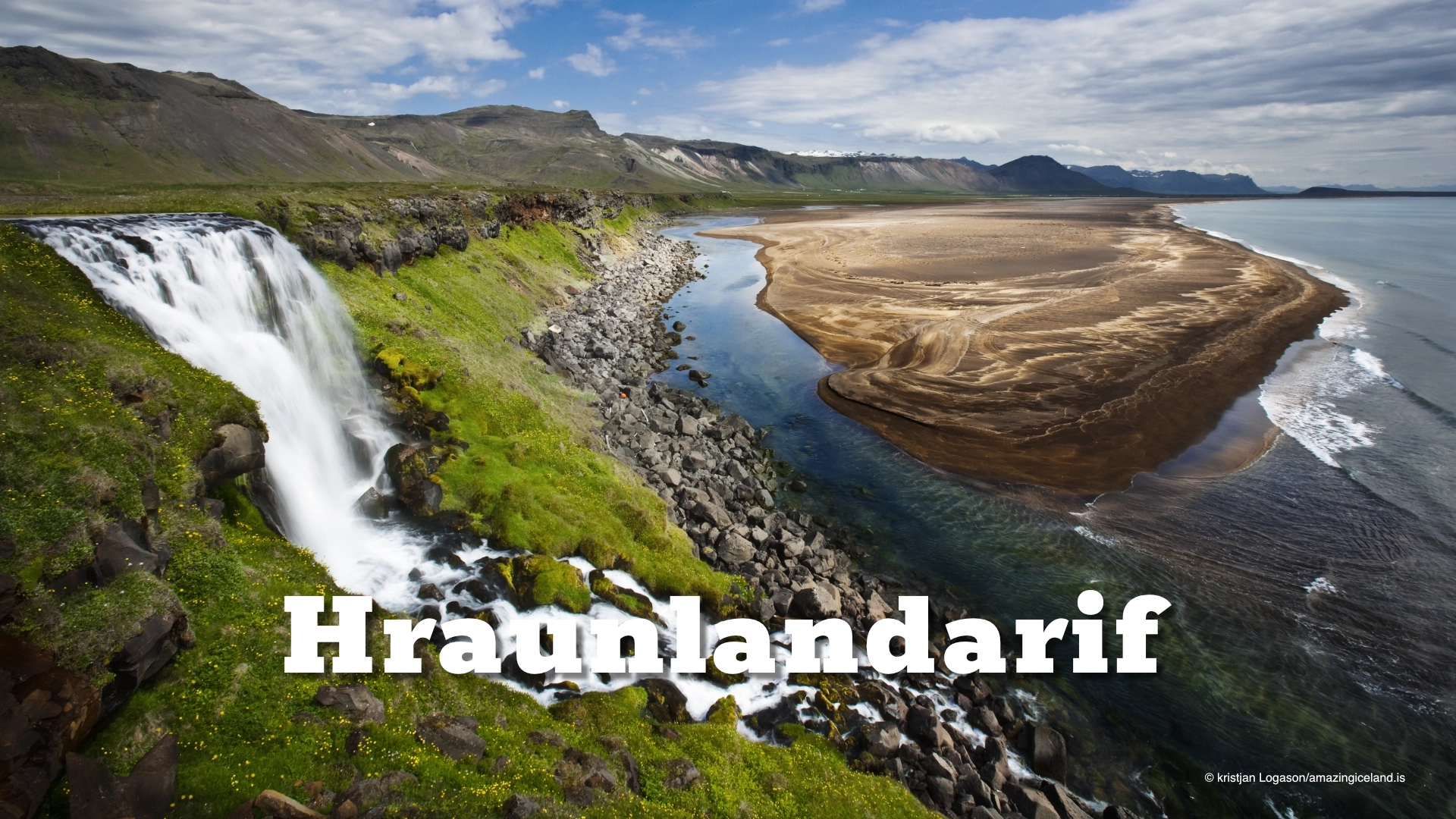
Hraunlandarif is a golden beach located on the Snæfellsnes Peninsula in West Iceland. It is one of the few golden sand beaches in Iceland
Hellnar cove in snæfellsnes
Berserkjahraun is truly a marvel to behold. The 4,000-year-old lava field, located on the Snæfellsnes Peninsula in Iceland, is simply breathtaking.
The most famous of these Svörtuloft locales is a magnificent 4-kilometer-long strip of jet-black sea cliffs located in the westernmost reaches of Snæfellsnes
Sönghellir cave