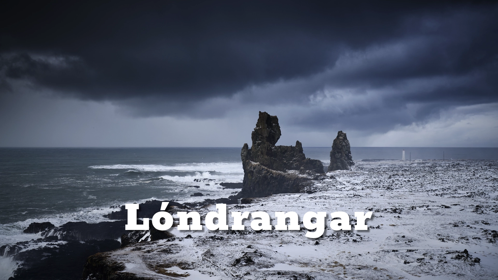
Lóndrangar stand on the south coast of the Snæfellsnes Peninsula inside **Snæfellsjökull National Park**. The two towers rise **75 metres** and **61 metres** above the sea and are among the most distinctive volcanic formations on this part of the peninsula.
They are not isolated rocks that formed independently. Lóndrangar are the resistant remains of an old volcanic crater, left standing after softer surrounding material was gradually removed by erosion.
Nearby **Svalþúfa** is thought to form part of the surviving rim of the same crater. Seen together, the stacks and the headland make much more geological sense than they do when treated as separate features.
The location of Londrangar volcanic plugs in Snæfellsnes peninsula
Latitude
64.7324
Longitude
-23.7840
Londrangar volcanic plugs in Snæfellsnes peninsula
The remains of an old crater
Lóndrangar are best described as crater plugs. They represent the harder volcanic material that remained inside an old crater after softer surrounding material was gradually worn away.
Basalt intrusions and dykes run through the surviving rock, which helps explain why older descriptions sometimes referred to Lóndrangar as dykes rather than plugs. The two descriptions are not really competing explanations.
The stacks are the resistant volcanic core of a much larger structure that has mostly disappeared. Marine erosion then continued to cut back the surrounding coast and isolate the harder rock.
Today, the taller stack reaches about 75 metres, while the lower one reaches about 61 metres. No established individual names for the two towers are known.
Understanding them as remnants of a larger crater changes the way the landscape reads. Lóndrangar are not simply two spectacular sea stacks; they are the surviving interior of a volcanic structure that has otherwise been almost completely dismantled.
Iceland’s oldest recorded rock climb
The first recorded rock climb in Iceland took place at Lóndrangar in 1735, when Ásgrímur Bergþórsson, a farmer from the area, climbed the higher 75-metre stack.
No detailed description of his route survives, but the ascent appears to have been made without anything resembling modern climbing equipment. That makes the climb more than a local curiosity and places it at the beginning of the documented history of climbing in Iceland.
Almost two centuries later, in 1938, the lower 61-metre stack was first recorded as climbed.
There is also an older oral tradition connected with the formations. According to the story, a condemned man escaped capture by climbing one of the stacks to a place where those pursuing him could not follow. He survived and later managed to escape Iceland aboard a foreign ship.
That story belongs to oral tradition rather than the documented history of Ásgrímur’s 1735 ascent, and the two are best kept separate. Together, however, they show that Lóndrangar have long been understood as more than a distant landscape feature.

Drangsvogur and the old fishing station
Lóndrangar was not always simply a landmark. East of the higher stack lies Drangsvogur, where there was once a seasonal fishing station.
Tradition records as many as 12 boats operating from the site when the station was at its busiest. Fishing huts, drying walls and working areas once occupied the coast around the landing place, and some remains of this activity can still be seen along the walking route.
This history changes the way the coast should be read. What now feels exposed and largely empty was once a working landscape where people launched boats into the Atlantic and processed their catch on shore.
The setting makes that history especially striking. The same cliffs, stacks and rough sea that now attract visitors were part of the daily working environment of fishermen using Drangsvogur.
Seeing Lóndrangar from Svalþúfa
The best overall view of Lóndrangar is from Svalþúfa. From the clifftop, the two stacks stand clearly against the sea, while Malarrif and its lighthouse can be seen beyond them from many angles.
The higher viewpoint also makes it easier to understand the relationship between the stacks and the surrounding coast. Instead of seeing Lóndrangar only as isolated towers, you can read them as part of the much larger volcanic structure that includes Svalþúfa.
The viewpoint is on an open cliff edge with no fence, so there is no reason to approach the edge closely for a better view.
A marked coastal route connects Svalþúfa, Lóndrangar and Malarrif. The full route is roughly 2.5–3 kilometres depending on the exact path used and normally takes around an hour to an hour and a half.
Parts of the route near the coast cross rough ground and beach stones. For many visitors, however, the Svalþúfa viewpoint alone gives the clearest and most complete understanding of the formation.
Seabirds and the cliffs
Lóndrangar and the neighbouring cliffs are important nesting places for seabirds. Fulmars nest on the stacks, while puffins, guillemots and kittiwakes are also found along this section of the coast.
The birdlife belongs to the wider Svalþúfa and Þúfubjarg cliff environment rather than being unique to the towers themselves. During the breeding season, movement between the sea, cliff ledges and stacks becomes a major part of the landscape.
That makes Lóndrangar more than a geological formation during spring and summer. The stacks become part of a living coastal habitat, with birds using the same resistant rock that survived the destruction of the original crater.
The combination of geology and wildlife is one of the strengths of the site, especially when viewed from Svalþúfa where both can be seen within the same wider coastal scene.
Interesting facts:
- Lóndrangar rise about 75 metres and 61 metres above the sea.
- They are the resistant remains of an old volcanic crater.
- Nearby Svalþúfa is thought to be part of the same crater rim.
- Ásgrímur Bergþórsson climbed the higher stack in 1735, the oldest recorded rock climb in Iceland.
- The lower stack was first recorded as climbed in 1938.
- Oral tradition tells of a condemned man who escaped capture by climbing one of the stacks.
- Drangsvogur beside Lóndrangar once supported a seasonal fishing station.
- Tradition records as many as 12 fishing boats operating there.
- The stacks and surrounding cliffs are important seabird nesting sites.
- Lóndrangar lie inside Snæfellsjökull National Park.
Photography tips:
- The strongest overall view of Lóndrangar is usually from Svalþúfa, where the two stacks can be placed within the broader coastal landscape.
- One classic composition includes the stacks with Malarrif lighthouse farther along the coast.
- From other positions, Snæfellsjökull can appear behind the formation, creating a strong relationship between glacier, volcanic stacks and coast.
- Longer focal lengths are useful for compressing the relationship between Lóndrangar, Malarrif and Snæfellsjökull.
- Wider lenses work better when the aim is to show Svalþúfa, the coastline and the stacks as parts of the same volcanic structure.
- Clear conditions reveal the relationship between the different landmarks, while low cloud or mist can simplify the scene and make the towers more dominant.
- Seabirds can add scale and movement during the breeding season, especially when using a longer lens from the established viewpoint.
- Because Svalþúfa is an open clifftop with no fence, there is no photographic reason to work close to the edge.