Skeiðarársandur in south east Iceland
Skeiðarársandur stretches between the southern edge of Vatnajökull and the Atlantic coast, forming a broad landscape of braided rivers, gravel, silt and black sand. Route 1 crosses the plain between Lómagnúpur and Skaftafell, but the scale is difficult to understand from a moving vehicle. What appears at first to be an empty surface is the accumulated work of glaciers, rivers, volcanic eruptions and repeated floods over thousands of years.
The crossing also holds two very different stories of change. The twisted bridge girders near Skaftafell recall the jökulhlaup of 1996, when floodwater, sediment and blocks of ice destroyed sections of the Ring Road and damaged its bridges. Farther west, birch has been spreading naturally across land that was long considered almost barren. Skeiðarársandur is therefore not simply a space between destinations. It is a landscape where destruction and recovery can be read side by side.
The location of Skeiðarársandur in south east Iceland
Latitude
63.9609
Longitude
-17.1819
Skeiðarársandur in south east Iceland
A plain built by glaciers and rivers
Skeiðarársandur is a glacial outwash plain, formed as rivers carried rock, gravel, sand and fine sediment away from Vatnajökull and deposited it across the lowland. Near the glacier the material is generally coarser, while finer sand and silt extend towards the coast. The accumulated sediments are in places more than one hundred metres thick and record approximately ten thousand years of glacial erosion, river transport and flooding.
Ordinary meltwater continually contributes to this process, but the largest changes have been caused by jökulhlaup: sudden glacial outburst floods released from beneath Vatnajökull. Water from Grímsvötn has historically travelled beneath Skeiðarárjökull before emerging onto the sandur. During the largest floods, water has spread across much of the plain, shifting enormous quantities of sediment and altering river channels in a matter of hours.
This is why the surface is not uniform. Gravel ridges, abandoned channels, active braided rivers and patches of finer sediment belong to different phases of deposition and erosion. From ground level these features can seem disconnected. Seen across the full width of the landscape, they reveal a plain that is still being constructed.
The road that completed the Ring Road
For centuries the rivers of Skeiðarársandur formed a major barrier to travel through southeast Iceland. Their channels divided and moved, while the danger of jökulhlaup made permanent crossings difficult. The opening of the bridge across Skeiðará in 1974 completed the continuous road around Iceland and gave the crossing a national importance extending far beyond the region.
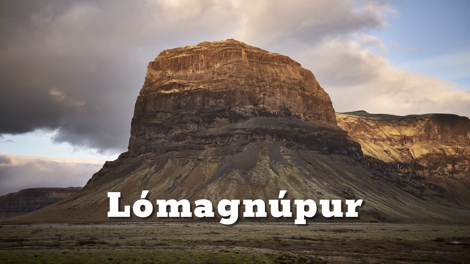
Today Route 1 allows the sandur to be crossed easily, but that ease can conceal the character of the landscape. Three stops help make the journey more understandable. At the western side, a stopping place near Lómagnúpur introduces the breadth of the plain and the relationship between mountain, glacier and outwash. The picnic-table stop near the centre provides a quieter view across the open sandur. At the eastern side, close to Skaftafell, twisted bridge girders form a memorial to the destruction caused by the 1996 jökulhlaup.
The crossing itself is the destination. Allowing an additional 20–30 minutes for the three stops gives enough time to look beyond the road and recognise changes in surface, vegetation and river channels. Lómagnúpur has its own destination page, but here the mountain serves another role: it marks the western boundary and provides a powerful measure of the sandur’s scale.

The jökulhlaup of 1996
On 30 September 1996, an eruption began at Gjálp beneath the ice of Vatnajökull. The eruption continued into October and melted a vast quantity of ice. Instead of escaping immediately onto the lowland, much of the meltwater drained beneath the glacier into Grímsvötn, where it accumulated under the ice.
The expected jökulhlaup began on 5 November. Water forced its way from Grímsvötn beneath Skeiðarárjökull and emerged onto Skeiðarársandur, carrying sediment and large blocks of ice. Sections of Route 1 were torn away, the bridge across Gígjukvísl was destroyed and the long bridge across Skeiðará was severely damaged. The road had been closed before the flood reached the sandur, and no lives were lost.
The twisted steel displayed beside Route 1 gives the event a physical scale that photographs and measurements cannot provide on their own. It shows what happened when infrastructure designed to cross a powerful glacial landscape met a flood far beyond ordinary river conditions. The monument should not be understood as a relic of a remote geological past. The eruption was monitored with modern instruments, the road was part of the national transport system, and the destruction occurred within living memory.
Rivers that refuse to remain fixed
The 1996 flood was exceptional, but movement is normal on Skeiðarársandur. Glacial rivers carry heavy sediment loads and flow across ground made from their own deposits. Channels divide, merge, fill with sediment and find new routes. A bridge can therefore lose its river even without being destroyed.
This happened to Skeiðará. In 2009 the river changed course and began flowing into Gígjukvísl. The long Skeiðará bridge, once the defining engineering work of the Ring Road crossing, no longer served its original purpose and was subsequently dismantled. The altered drainage is an important part of the sandur’s story because it demonstrates that the plain is governed by continuing processes rather than a fixed arrangement of named rivers and permanent channels.
For visitors, abandoned channels and apparently dry stretches should not be mistaken for meaningless empty ground. They are evidence of earlier river courses and possible future change. The view from the road is a moment within a much longer sequence of movement.
Birch returning without planting
Against this history of flood and erosion, a new woodland has been establishing itself naturally on Skeiðarársandur. A genetic study published in 2023 documented mountain birch across more than 35 square kilometres of the plain. The research indicates that most of the founding trees originated from Bæjarstaðarskógur, with seeds carried over a considerable distance onto the sandur.
By the time of field studies conducted from 2018 to 2020, the founding population had begun producing its own seed, allowing the woodland to expand from within. Research on the sandur has found that birch seeds are especially likely to accumulate on vegetated surfaces and germinate among low-growing plants. Thin moss can provide particularly favourable conditions. This means that the spread of woodland depends not only on visible trees but also on small variations in a surface that might appear almost bare.
The development is remarkable because it has not been produced by conventional tree planting. Nature is gradually healing and transforming the sandur through seed dispersal, shelter, moss development and successful germination. The emerging woodland does not erase the glacial landscape; it adds a new phase to it. A plain created by ice and flood is becoming a place where native woodland can establish itself again.
A living surface that looks empty
The apparent emptiness of Skeiðarársandur makes responsible access especially important. From inside a vehicle, a patch of sand or gravel may look firm, barren and harmless to cross. At close range it may contain thin moss, low plants, accumulated birch seeds or seedlings only a few centimetres high. Tyres can crush that early growth, disturb the surface in which seeds collect and create tracks that encourage others to follow.
Off-road driving is prohibited in Iceland, including across sandy areas that appear to have no vegetation. Damage does not become acceptable because plants are difficult to see. Tyre marks can remain for years, channel water and accelerate erosion; recovery can be exceptionally slow where the growing season is short. On Skeiðarársandur the issue is particularly clear because the least visible stages of natural recovery are among the most vulnerable.
Visitors should remain on Route 1 and use the established stopping places. The western stop near Lómagnúpur, the central picnic-table stop and the bridge monument provide different views without driving onto the sandur. Protecting the surface requires no special intervention. It begins by recognising that land which looks empty may already be alive.
Reading the landscape during the crossing
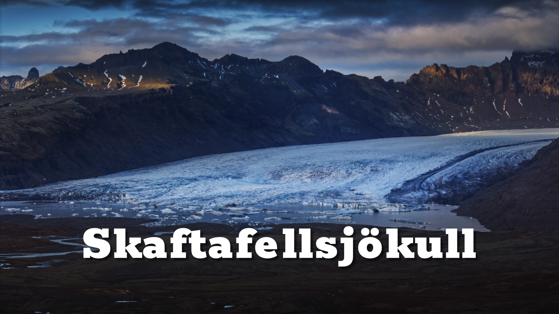
Skeiðarársandur changes with weather, light and viewing direction. In clear conditions, Vatnajökull and its outlet glaciers establish the source of the rivers and sediment. Low cloud can remove that upper scale and concentrate attention on the plain itself, while side light reveals shallow channels and gravel ridges that disappear under flat midday light. The experience is strongest when the three stops are treated as parts of one crossing rather than unrelated roadside pauses.
At Lómagnúpur, look east across the plain and notice how quickly the mountain gives way to open ground. At the central stop, examine the surface more closely and look for the transition from apparently barren sand to moss, low vegetation and young birch. At the bridge monument, the relationship between natural processes and human infrastructure becomes immediate. Together, the stops explain Skeiðarársandur as a connected landscape shaped by water, altered by catastrophe and now changing again through natural regeneration.
Interesting facts:
- Skeiðarársandur covers roughly one thousand square kilometres and is among the world’s largest active glacial outwash plains.
- Its sediments have accumulated through ordinary glacial river flow and repeated jökulhlaup over approximately ten thousand years.
- The opening of the Skeiðará bridge in 1974 completed Iceland’s continuous Ring Road.
- The 1996 jökulhlaup followed the Gjálp eruption beneath Vatnajökull and destroyed or damaged major sections of Route 1 and its bridges.
- Skeiðará changed course into Gígjukvísl in 2009, leaving its former long bridge without its original river crossing.
- A 2023 genetic study documented naturally established mountain birch across more than 35 square kilometres of the sandur.
Image Gallery


Photography tips:
- Use the stop near Lómagnúpur to show the mountain as the western wall of the sandur and to give the open plain a strong sense of scale.
- At the central picnic-table stop, compare broad landscape photographs with close studies of moss, young birch and the textures that are easily missed from the road.
- Low side light is useful for revealing shallow river channels, gravel ridges and variations in the otherwise flat-looking surface.
- A telephoto lens can compress braided channels, the glacier margin and distant mountains into a clearer relationship; a wide lens is useful when the foreground contains meaningful texture or vegetation.
- At the bridge monument, use the twisted steel as a foreground element while retaining enough of the surrounding sandur to explain what caused the damage.
- Overcast conditions can work well for the emerging woodland and surface details, while broken light helps separate individual sections of the immense plain.
- Photograph only from established stopping areas and on foot. Never drive onto the sand for a viewpoint, even where the surface appears completely bare.
Destinations nearby