Sigöldufoss waterfall in Tungna river
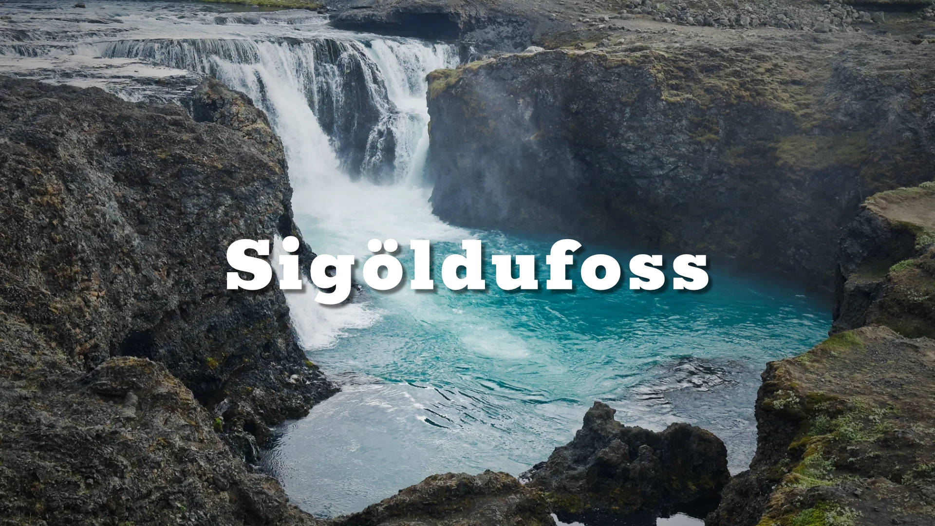
Sigöldufoss is a broad waterfall on the river Tungnaá, located directly beside the highland road F208 in the central highlands of Iceland. Closely associated with the Sigölduvirkjun hydropower area, the waterfall represents a meeting point between natural river dynamics and engineered flow control, while still retaining strong visual and geological presence.
The location of Sigöldufoss waterfall in Tungna river
Latitude
64.1704
Longitude
-19.1319
Sigöldufoss waterfall in Tungna river
A natural waterfall in an altered river
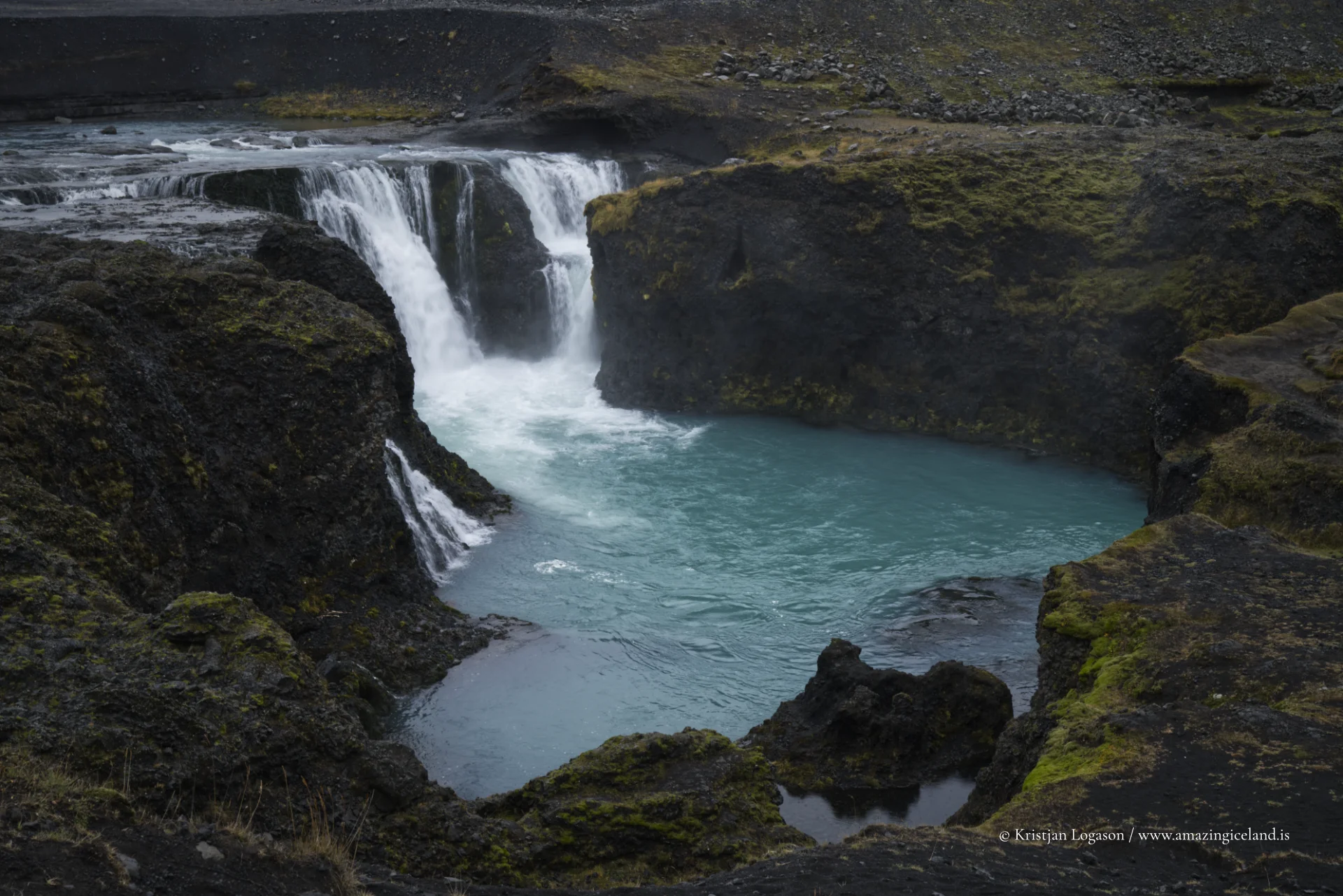
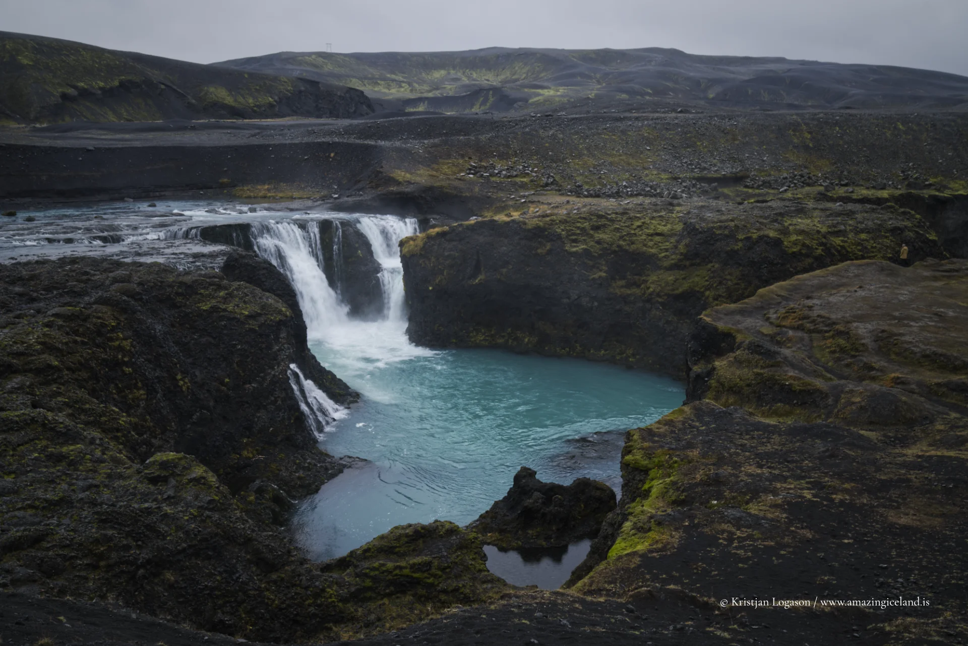
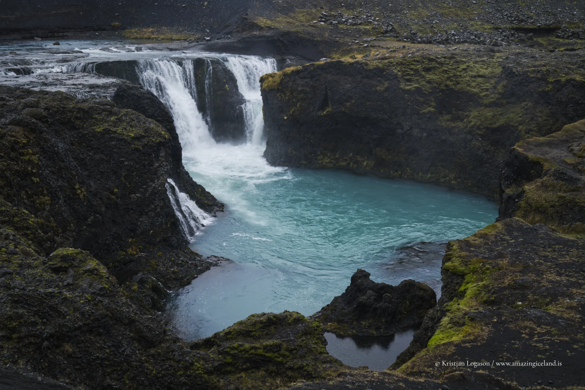
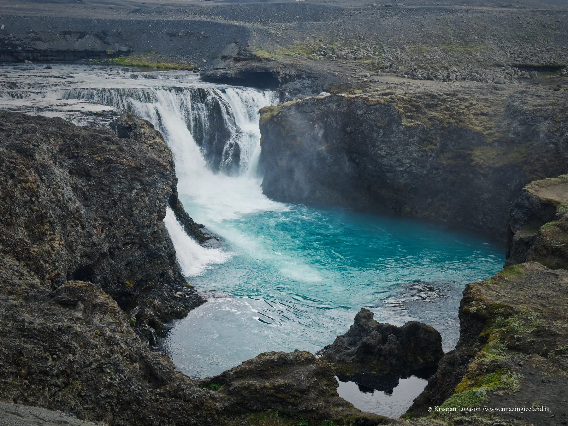
Sigöldufoss falls approximately 10 metres across a broad ledge of natural rock. The visible width changes with the amount of water entering the old channel. At lower flow, the water divides into separate cascades and much of the riverbed is exposed. When more water is released, those channels begin to join and the waterfall becomes wider and more forceful.
The ledge itself is not a spillway or an artificial drop. It is the original waterfall in the Tungnaá. What changed was the route taken by the river. This distinction matters because the modern appearance of Sigöldufoss cannot be understood by looking at the rock formation alone: the waterfall is natural, while its present discharge is largely the result of water management upstream.
The surrounding terrain is open and sparsely vegetated. Dark rock and sediment frame the lighter water, while roads, bridges and power infrastructure remain visible parts of the setting. They are not distractions from the destination’s story. They are the reason the waterfall looks as it does today.
When the Tungnaá was diverted
Sigölduvirkjun was constructed during the 1970s and entered operation in 1977. The Tungnaá was dammed upstream to create the reservoir commonly called Sigöldulón, also known as Krókslón. Most of the river was then directed away from its former channel through an intake canal and pressure shafts to the power station.
Before this development, the sediment-rich glacial river continued through its natural bed and crossed Sigöldufoss. After diversion, most of that water reached the lower river by an engineered route instead. The old channel, the natural waterfall and the downstream meeting point remained, but their hydrology changed fundamentally.
This is more than ordinary regulation of a river whose full flow still passes over a waterfall. Most of the Tungnaá no longer reaches Sigöldufoss under normal operating conditions. The falls survive as a landform in the former main channel, carrying the water that remains there and any additional controlled release sent through the old riverbed.

Why the water often appears clearer today
The Tungnaá is a glacial river and historically carried fine suspended sediment. Present-day photographs of Sigöldufoss, however, often show water that appears clear or blue-green rather than grey-brown. The apparent contradiction is a consequence of the diversion.
Much of the sediment-bearing river now travels through the reservoir and power system instead of crossing the falls. Sediment also settles while water is held in the reservoir. Clearer spring water enters the former channel, contributing to the flow seen at Sigöldufoss. The result is commonly less water, less suspended sediment and more visible bedrock than at the original waterfall.
The flow should not be described simply as pure spring water. Water can also be released into the channel as part of the managed system, and both its volume and appearance may vary. Sigöldufoss can therefore look different between visits without the rock formation itself having changed.
When the old waterfall returned in 2009
The transformation became particularly clear in 2009, when Sigölduvirkjun was stopped for maintenance. Approximately 200 cubic metres of water per second were released into the old riverbed, and Sigöldufoss returned close to its former force for several weeks.
Contemporary reporting noted that the waterfall had been seen at comparable power only twice since the station began operating. For a short period, the separate modern cascades became part of a much broader and more forceful fall. The event offered a rare demonstration of what had been removed from the old channel—not the waterfall itself, but most of the river that once crossed it.
No high-flow and low-flow pair is currently attached to this page. If historic or future high-discharge photographs are added, they should be dated and captioned clearly. Flow is not a minor seasonal detail at Sigöldufoss; it changes the visual character of the destination and records the operation of the wider water system.
Sigöldufoss and Sigöldugljúfur are different places
Sigöldufoss is often confused with Sigöldugljúfur because the two destinations share the Sigölda name and lie within the same altered river system. They are nevertheless separate places.
Sigöldugljúfur is the former Tungnaá canyon below the dam, now known for clear springs and numerous small cascades entering through its walls. Sigöldufoss lies farther downstream in the old main channel. It is the broad natural waterfall immediately above the bridges and Hrauneyjalón.
The two pages should be read together. Sigöldugljúfur shows what became of a section of river canyon after the Tungnaá was diverted. Sigöldufoss shows what became of the original main-channel waterfall. Neither name is an alternative for the other.
Reaching Sigöldufoss from F208
The turn towards Sigöldufoss lies between the two bridges on F208 below Sigölduvirkjun. A short drive leads to the stopping area, and from there the walk to the waterfall is very short. This is not a highland hike, and no long approach is required.
Although the road is known locally as F208, the bridges and Sigöldufoss can be reached without a four-wheel-drive vehicle in suitable conditions. That does not make access independent of weather. The developed road serving the hydropower area often remains accessible beyond the normal summer season of the southern F208, but snow, ice, storms, drifting and temporary closures still determine whether the journey is sensible on a particular day. Current road and weather information should always be checked.
The route farther into the Highlands may have different vehicle requirements and seasonal restrictions. Reaching Sigöldufoss should not be taken as evidence that the continuation towards Landmannalaugar or the southern section of F208 is open or suitable for the same vehicle.
There are no visitor services at the waterfall itself. Visitors travelling outside summer should be prepared for rapidly changing weather and should not assume that a maintained power-station road will provide ordinary winter driving conditions.
Higher and lower viewpoints
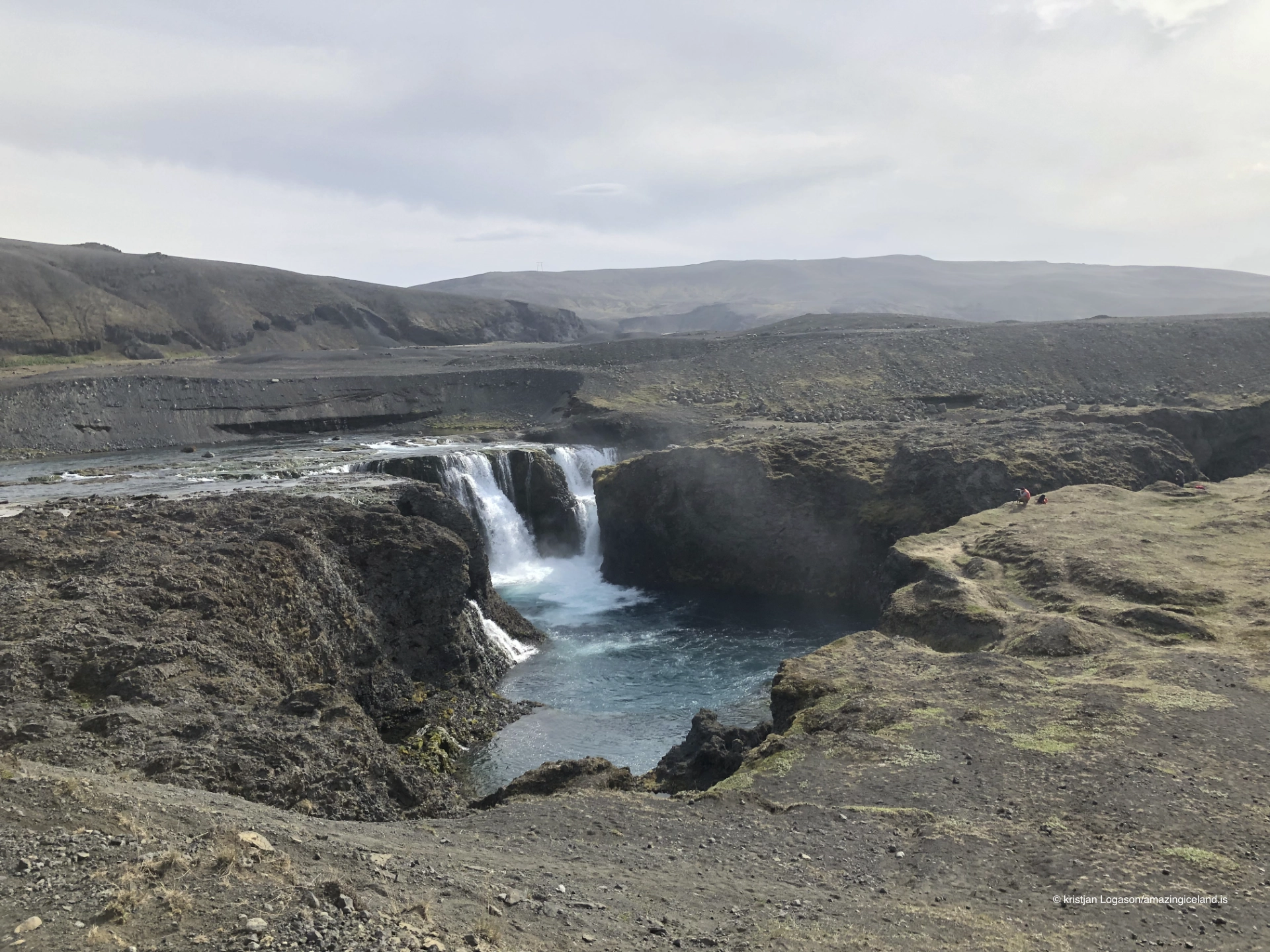
Sigöldufoss can be viewed from both a higher position and a lower point nearer the falls. The higher viewpoint gives a clearer overview of the broad ledge, the separated cascades and the old channel. The lower position brings the viewer closer to the water and changes the relationship between the individual falls and the pool below.
The viewing area is open and unfenced. Its apparent simplicity should not encourage careless movement near the edge. The riverbank is steep in places, and wet, icy or loose ground can make the approach less secure. Remain on durable ground, keep well back wherever footing is uncertain and do not descend an unmarked bank to obtain a lower angle.
The power station is visible from the waterfall area. Visitors can also read the two channels in the surrounding landscape: the reduced flow continuing through the old Tungnaá bed and the much larger power-station outflow returning by its engineered course. Below the bridges, the waters meet before entering Hrauneyjalón.
This visible division is the key to understanding Sigöldufoss. The site is not a natural waterfall with an unrelated power station in the background. It is one river following two routes—one across its former waterfall and the other through the machinery built to use its energy.
Interesting facts:
Interesting facts
- Natural formation: Sigöldufoss is a natural bedrock waterfall, not an engineered spillway.
- Height: The waterfall drops approximately 10 metres; its active width varies with discharge.
- Diverted river: Most of the Tungnaá now bypasses the falls through Sigölduvirkjun.
- Clearer modern flow: Reduced glacial sediment and water entering the old channel help explain the clear or blue-green appearance often seen today.
- Full force in 2009: A maintenance shutdown sent approximately 200 cubic metres per second through the former riverbed, temporarily restoring much of the waterfall’s earlier power.
- Two waterways: The old river channel and power-station outflow can be seen meeting below the bridges.
- Separate destination: Sigöldufoss is not the same place as Sigöldugljúfur.
Image Gallery
Photography tips:
-
- Use the higher viewpoint to show the full ledge, exposed riverbed and segmented form of the modern waterfall.
- Move to the established lower position for a closer relationship between the cascades and the pool, but do not descend unmarked steep ground.
- Include the power station, bridges or divided waterways when they help explain how the Tungnaá has been altered.
- A moderate telephoto can separate individual cascades from the dark rock; a wider frame can show how little of the former channel is now occupied by water.
- Moderate shutter speeds retain structure in the individual falls. Very long exposures can merge the separate streams and conceal the form created by lower discharge.
- A polarising filter can reduce glare and reveal the pool, but retaining some reflection helps the water keep its natural surface character.
- Process the blue-green water conservatively. Its colour can be striking without exaggerated saturation.
- Overcast light balances white water against dark rock. Broken sunlight can isolate one section of the falls, though the contrast may become difficult to control.
- Use a person or one of the bridges sparingly when scale is needed.
- The unfenced bank is part of the working environment. No photograph requires standing close to an uncertain edge.
Destinations nearby