Laugahraun lava field in Landmannalaugar
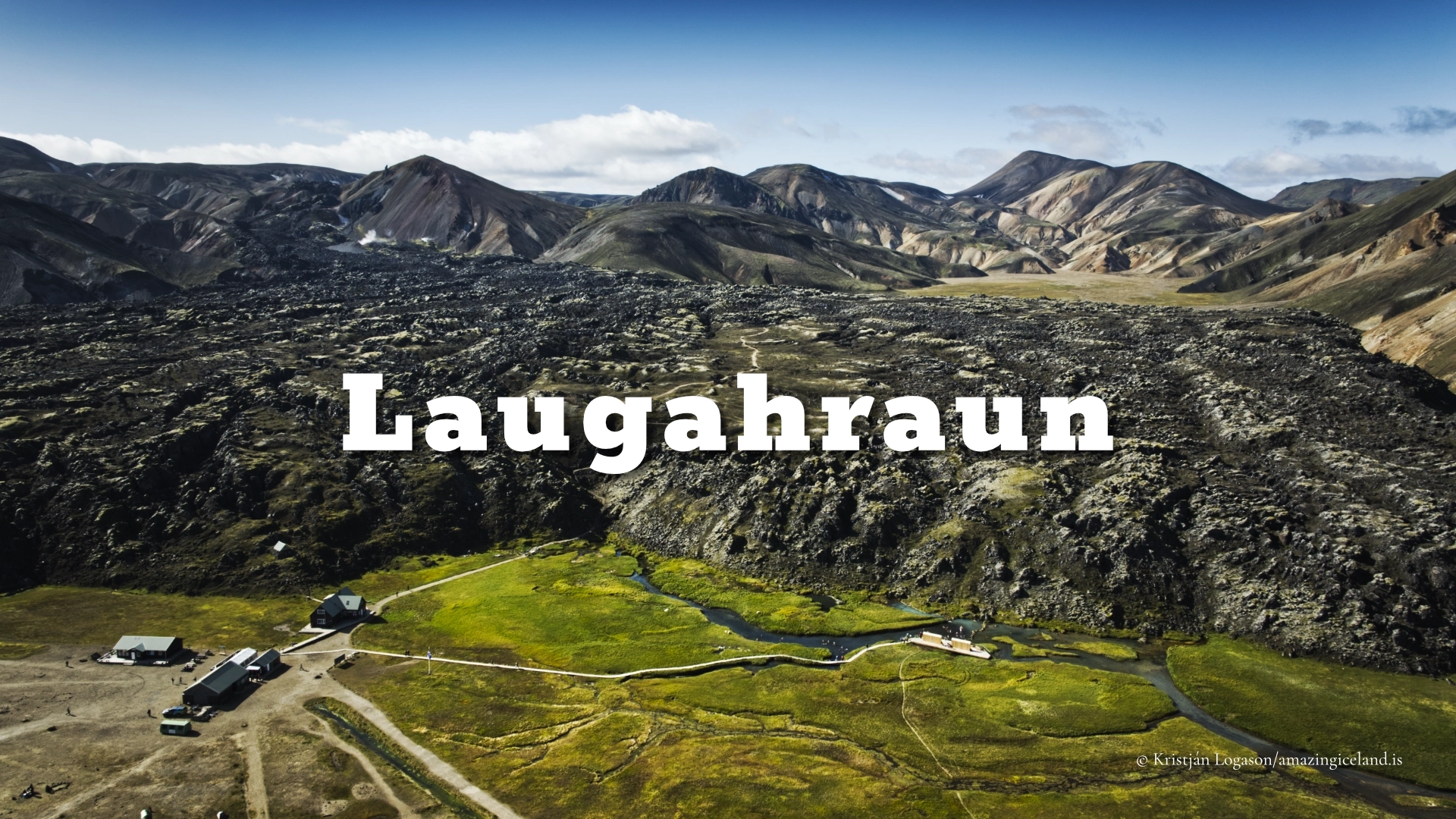
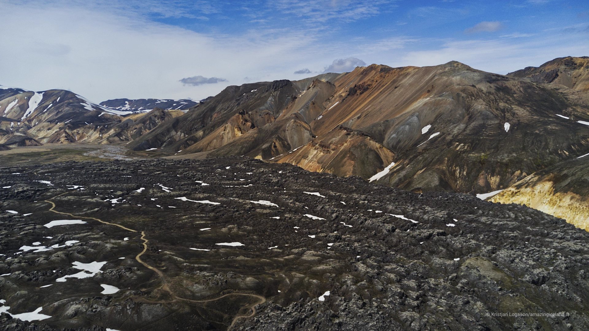
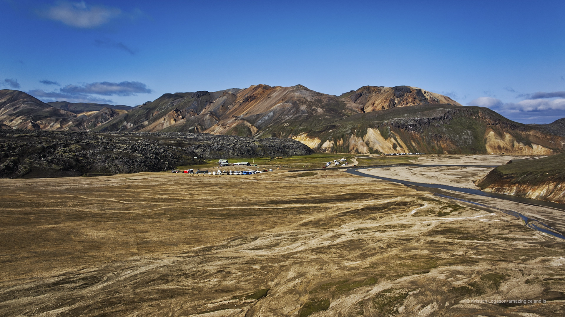
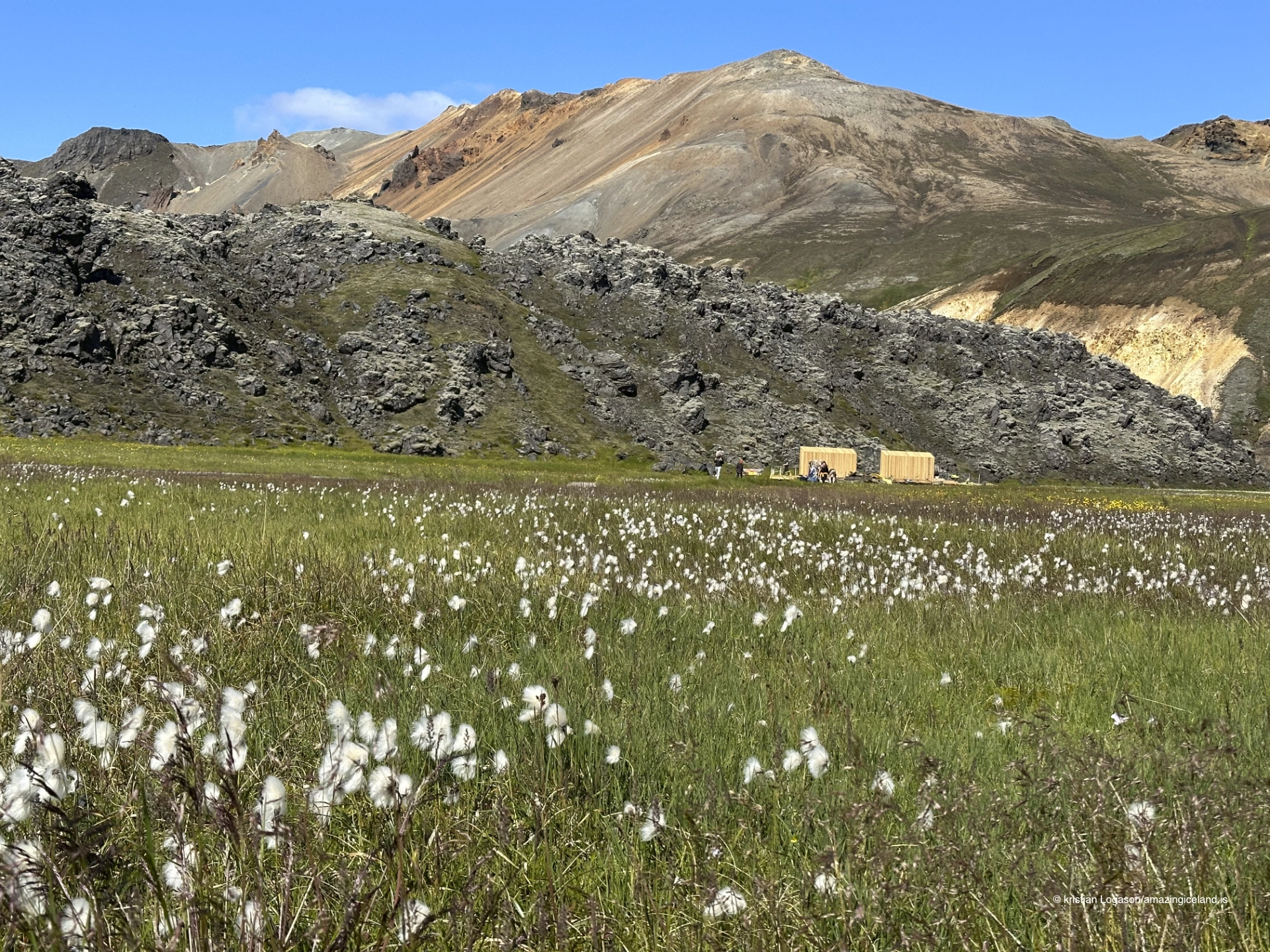
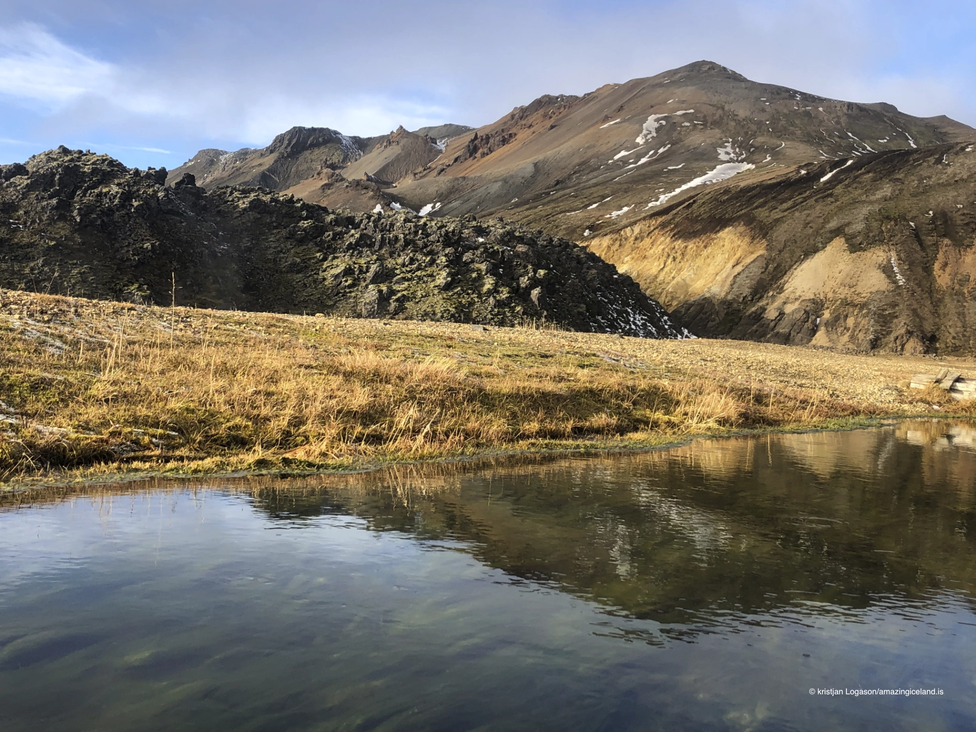
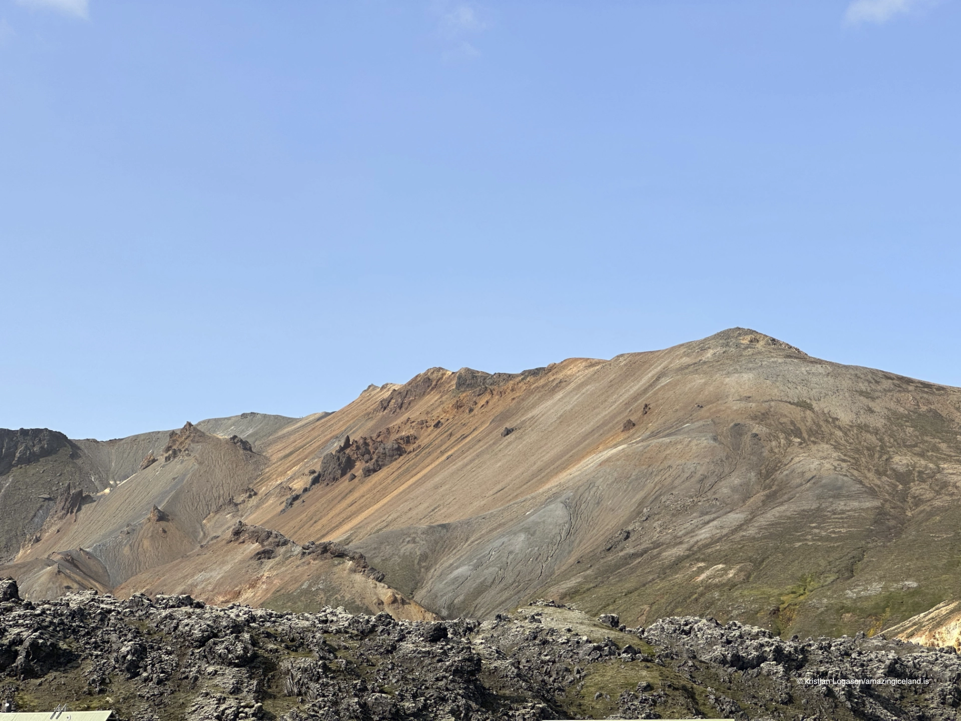
Laugahraun forms the dark edge of the Landmannalaugar basin. From a distance, the lava appears almost black against mountains carrying red, yellow, green and grey mineral colours. At close range, its surface divides into fractured blocks, glassy reflections, ridges and irregular openings.
The contrast is easy to misread. Laugahraun is not basalt lying among rhyolite mountains. The lava itself is rhyolitic and belongs to the Torfajökull volcanic system. What visitors see is young, dark and glass-rich rhyolite beside older rhyolitic terrain that has been changed by geothermal fluids, oxidation, erosion and time.
The marked Laugahringur route provides the clearest introduction. It begins by taking walkers through part of the lava before continuing around it through the wider Laugahraun and Grænagil landscape. The complete loop normally takes approximately two to two and a half hours.
The location of Laugahraun lava field in Landmannalaugar
Latitude
63.9907
Longitude
-19.0614
Laugahraun lava field in Landmannalaugar
Young rhyolite among older rhyolite mountains
Rhyolite is a silica-rich volcanic rock produced by evolved magma. Because rhyolitic magma is usually much more viscous than basaltic magma, it does not necessarily spread into broad, fluid sheets. At Laugahraun, the lava accumulated as a thick, uneven flow with broken surfaces and steep, blocky forms.
Its dark appearance does not make it basalt. Fresh rhyolitic lava can contain abundant volcanic glass, including obsidian, and can look almost black where the glass is dense. Reflections from glassy surfaces appear among duller fractured blocks throughout the field.
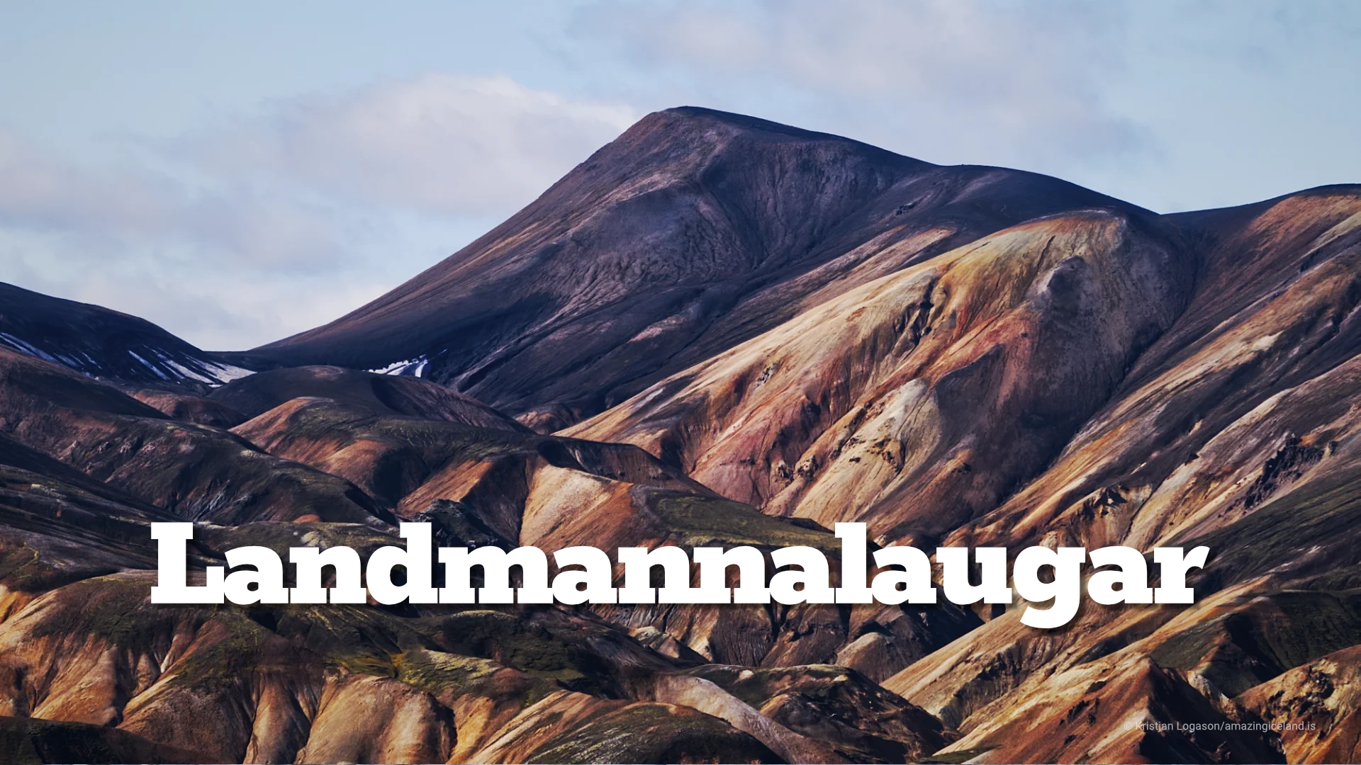
The older mountains surrounding Landmannalaugar are also largely rhyolitic, but their present appearance records a much longer history. Heat and geothermal water altered their original minerals. Iron compounds oxidised, clays formed, and erosion exposed folded slopes in many colours. Laugahraun has not undergone the same degree of alteration and erosion, so the two expressions of rhyolite look radically different.
This is what makes the lava geologically valuable to the visitor. Within one basin, it is possible to compare a relatively young rhyolitic flow with an older rhyolitic landscape that has been chemically and physically transformed.
The connected eruptive episode of 1477
Laugahraun formed during the major regional eruptive episode of 1477. Basaltic fissure activity occurred in the Veiðivötn volcanic system farther north, while related disturbance and magma movement affected the neighbouring Torfajökull system. Rhyolitic magma erupted at Torfajökull and produced Laugahraun.
The distinction matters. Laugahraun belongs to the same connected regional episode as the Veiðivötn eruption, but it is not basalt that flowed south from the Veiðivötn fissures. It is a rhyolitic product of Torfajökull’s own magma system.
More than five centuries of frost, snow, wind and water have acted upon the field, but its volcanic structure remains clear. Soil is limited, vegetation is sparse across many surfaces, and broken flow forms still dominate. The lava therefore feels young not because it retains heat, but because erosion and plant growth have not yet concealed its construction.

Obsidian and the anatomy of a thick lava flow
Obsidian forms when silica-rich lava cools rapidly enough for volcanic glass to develop instead of an entirely crystalline rock. At Laugahraun, glassy pieces occur throughout the fractured lava. Some catch the light immediately; others appear dark and ordinary until viewed from a different angle.
Visitors should look without collecting. Obsidian, loose fragments and the larger lava formations all belong to the protected landscape. Removing one small piece may seem harmless, but a heavily visited place cannot withstand thousands of people making the same decision.
There is no single formation that explains Laugahraun. Its character lies in the abundance of detail: shattered blocks, flow ridges, cavities, glassy faces and surfaces gradually being occupied by moss and other highland vegetation. Walking slowly and looking closely reveals more than searching for one named feature.
The rough appearance can also make the lava seem more difficult to walk than it is. The established route uses natural openings and a worn line through part of the field. Under ordinary summer conditions, the Laugahringur loop is not technically difficult, although firm footwear is sensible and wet rock, remaining snow or poor visibility can change the experience.
Walking Laugahringur through Laugahraun and Grænagil
Laugahringur is a roughly five-kilometre circuit beginning at the main Landmannalaugar visitor area. Walkers first enter and pass through part of Laugahraun on the established path. The route then continues around the lava through the wider landscape towards Grænagil before returning to the basin.
This sequence is more accurate than saying that the route either crosses the entire lava field or remains wholly outside it. It begins within the lava, uses an established passage through its broken surface and then follows the surrounding terrain as a loop.
Approximately two to two and a half hours should be allowed for the complete circuit. The route is among the easier introductions to Landmannalaugar, but time depends on conditions and on how often walkers stop. Laugahraun rewards close observation, while Grænagil and the neighbouring slopes open the walk into a broader study of altered rhyolite and geothermal terrain.
Several longer routes share portions of this path. Walkers may continue towards Brennisteinsalda or join the Laugavegur rather than completing Laugahringur. Signs and current local information should guide the choice; a general description cannot account for temporary closures, snow or weather.
The lava margin and Landmannalaugar’s hot water
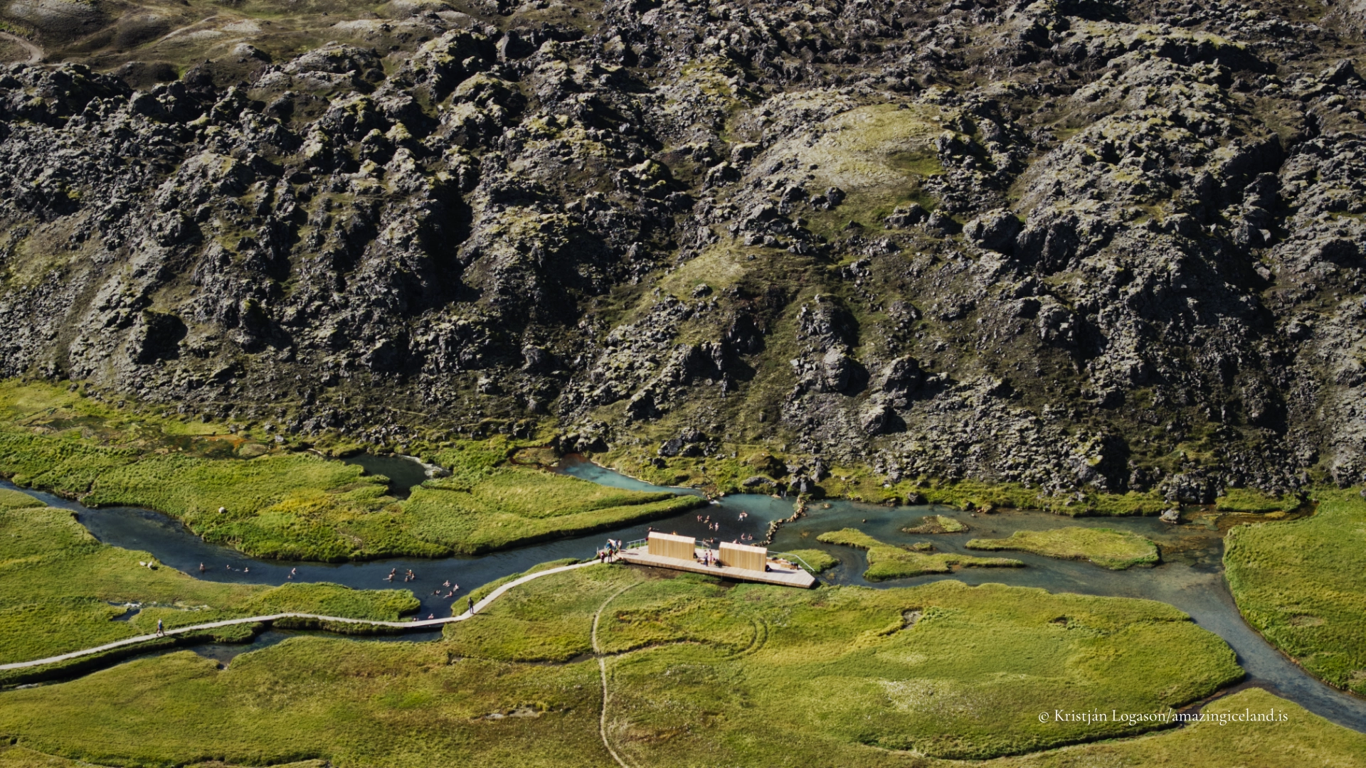
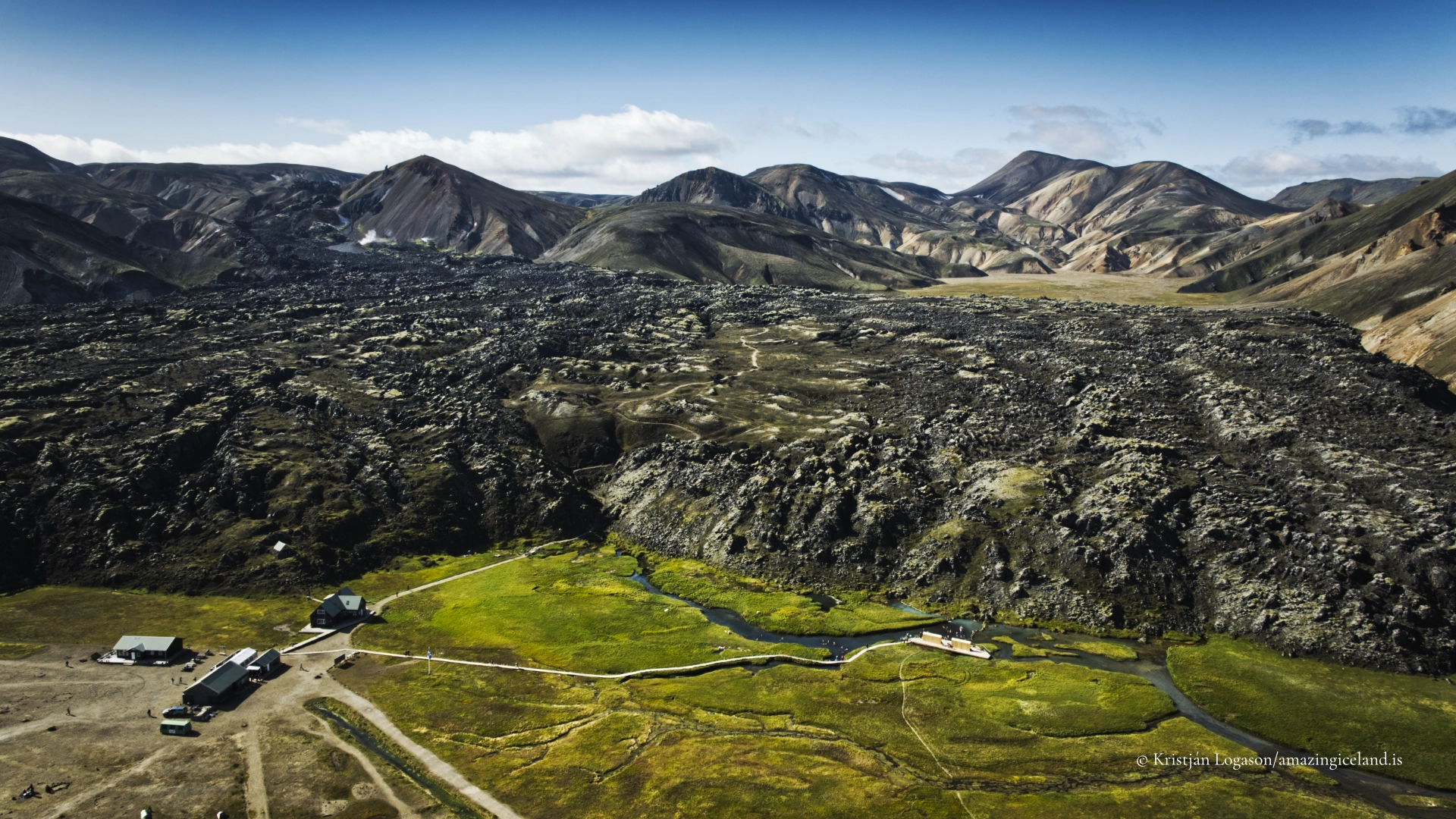
Laugahraun does more than provide a visual boundary. Its fractured mass affects the movement of water through the basin. At its margin beside the main visitor area, warm geothermal water and colder surface water meet to create Landmannalaugar’s recognised natural bathing pool.
The pool is part of the larger Landmannalaugar story and is covered fully on that destination’s master page. Here, its importance is structural: the bathing place is not randomly positioned beside a photogenic lava field. Its location is connected to the lava margin and to the different routes through which water reaches the surface.
Other geothermal streams, altered ground and vents in the surrounding landscape are not alternative bathing places. Visitors should use only the recognised pool and established access beside the main area.
Leaving the lava unchanged
Laugahraun lies within Fjallabak Nature Reserve. Visitors should stay on the established route, avoid making new tracks and leave obsidian and other geological material where it lies. Moss and sparse highland vegetation recover slowly, while footsteps away from the path can encourage others to follow and turn one mark into a permanent route.
The guidance is not to avoid the lava altogether. The marked path intentionally enters it. The distinction is between following that route and climbing across untracked surfaces simply to explore, shorten the walk or obtain a photograph.
Drone use within Fjallabak is permit-controlled during the main summer period, including from 15 June to 15 September. General aviation rules and any further site restrictions also apply. Flights should never disturb walkers, wildlife or people around the bathing pool, hut and campground. Current requirements must be checked before flying.
Interesting facts:
-
- Laugahraun is rhyolitic, despite its dark colour and basalt-like appearance from a distance.
- The lava contains obsidian formed from rapidly cooled, silica-rich magma.
- Laugahraun formed within the Torfajökull volcanic system during the connected regional eruptive episode of 1477.
- The surrounding coloured mountains are also largely rhyolitic, but have been altered and eroded over a much longer period.
- Laugahringur is a roughly five-kilometre loop taking approximately two to two and a half hours.
- The route begins through part of Laugahraun and then continues around it through the Grænagil landscape.
- Landmannalaugar’s natural bathing pool lies against the lava margin, where warm and cold water meet.
Image Gallery
Photography tips:
-
- Use side light across the blocky surface to reveal fractures, ridges and relief.
- Look for small reflections from obsidian, but never move or collect pieces to improve a composition.
- Contrast the dark young lava with Brennisteinsalda and the older altered mountains.
- Elevated viewpoints on Bláhnúkur and Brennisteinsalda reveal the shape of Laugahraun within the wider basin.
- Keep people small in the frame when the purpose is to show the scale of the lava and surrounding mountains.
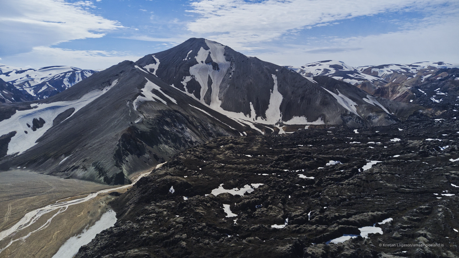
- Remaining snow can separate dark lava blocks and simplify complex surfaces.
- Protect highlights reflecting from obsidian without forcing detail into every shadow.
- Use restraint with saturation in the coloured mountains; their geological variety does not need exaggeration.
- Stay on the established route rather than stepping onto fragile or untracked ground for a cleaner foreground.
- Drone photography must follow the current protected-area permit requirements and aviation rules.
Destinations nearby