Krafla power station
Krafla Power Station was not simply built near an active volcano.
Construction began in 1975, the same year the Krafla volcanic system entered a nine-year period of repeated rifting, magma intrusions and eruptions. The ground opened, lava crossed the landscape, boreholes changed and the geothermal reservoir behaved in ways the engineers had not anticipated.
The power station therefore became part of the volcanic history it had been designed to exploit.
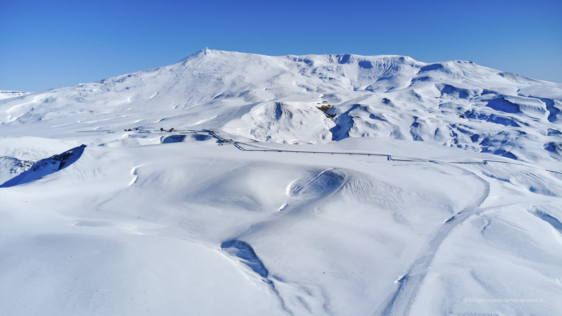
Krafla is much larger than the mountain, crater or power station carrying its name. It is a central volcano with a caldera approximately eight by ten kilometres across and a fissure swarm extending for roughly 100 kilometres through northeast Iceland.
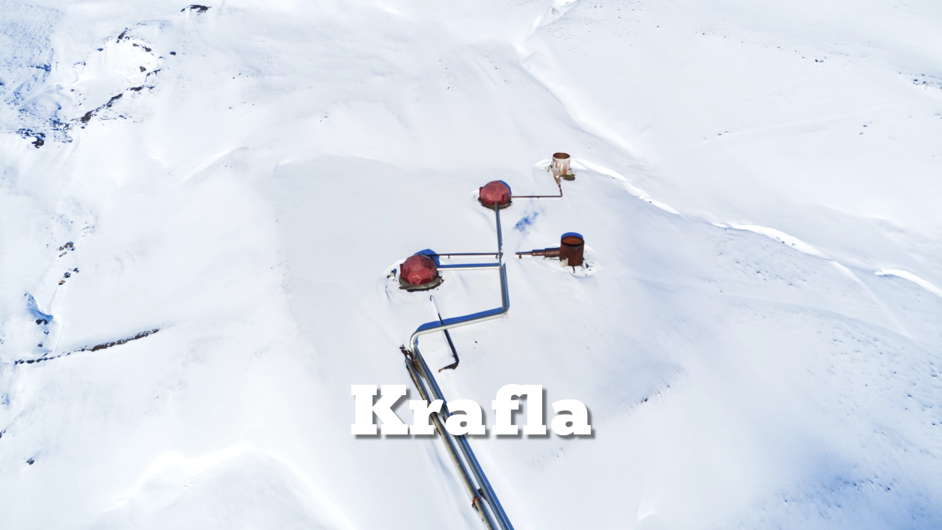
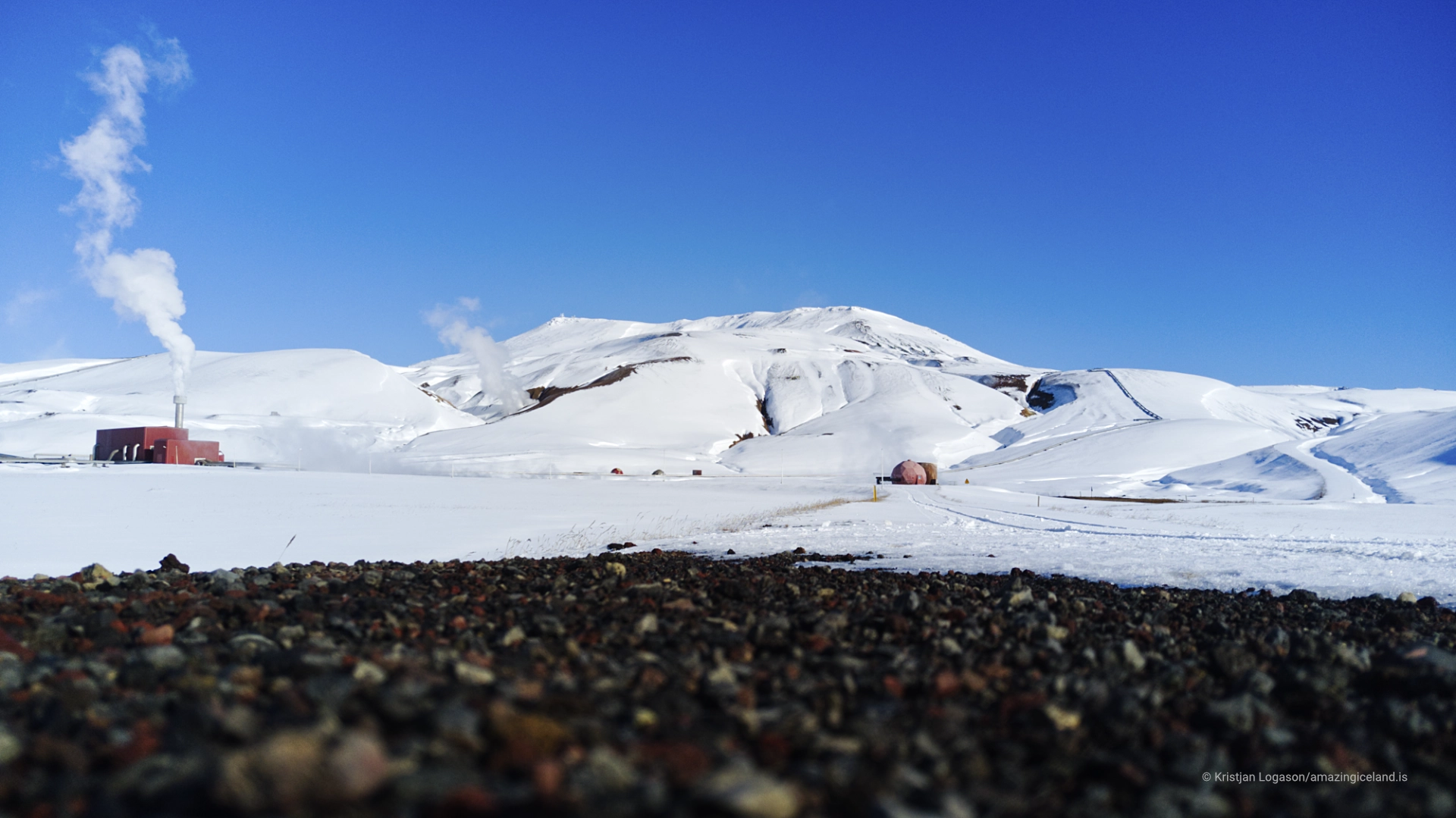
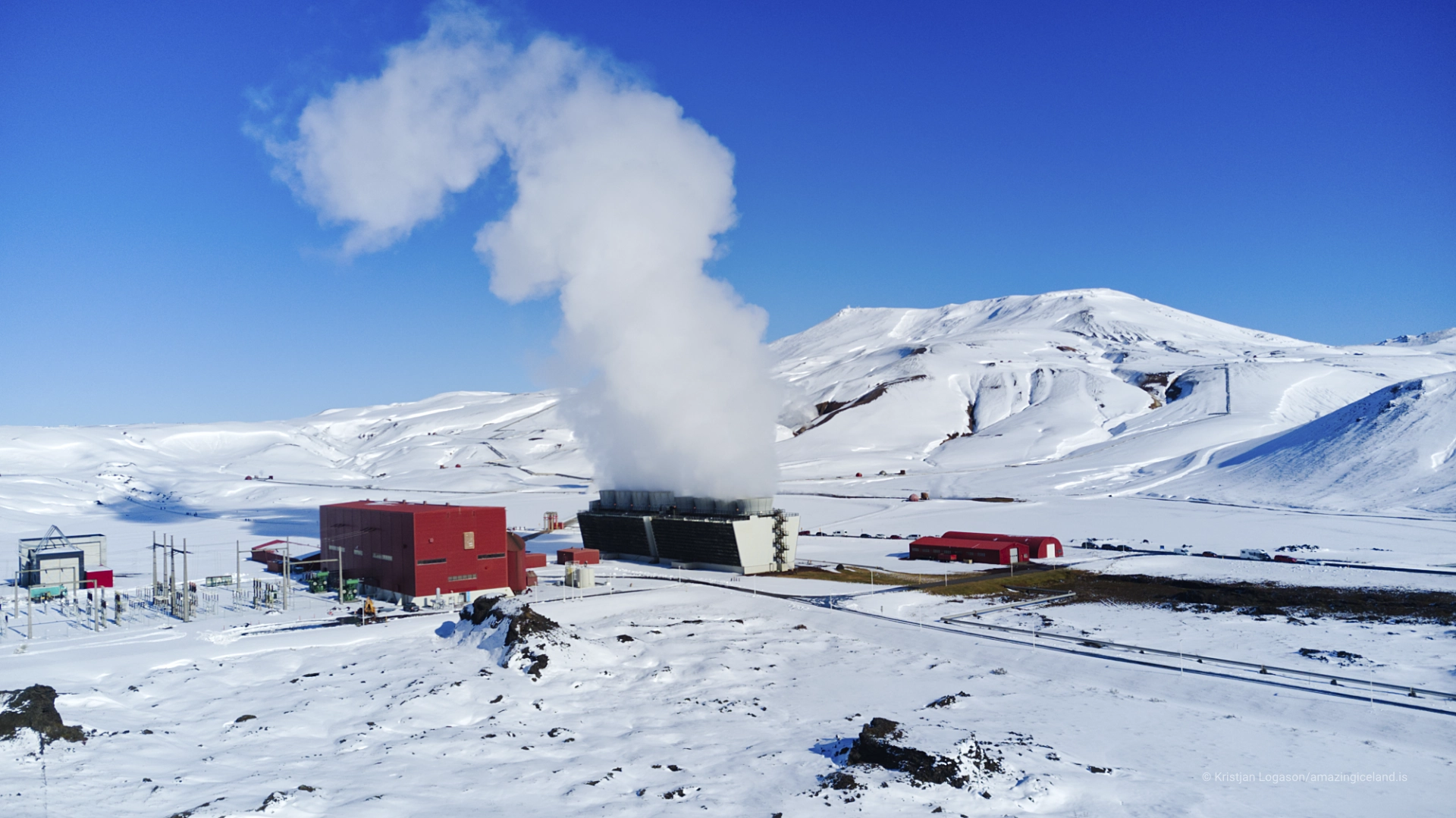
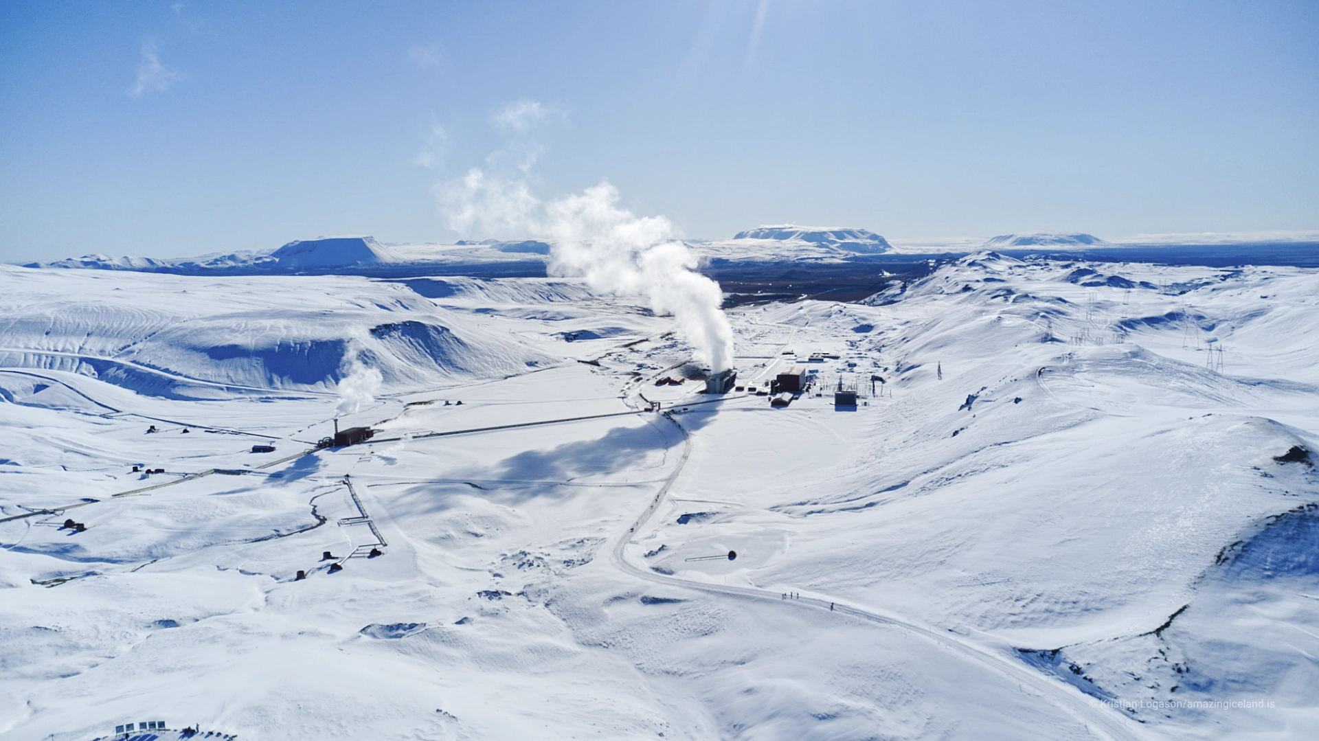
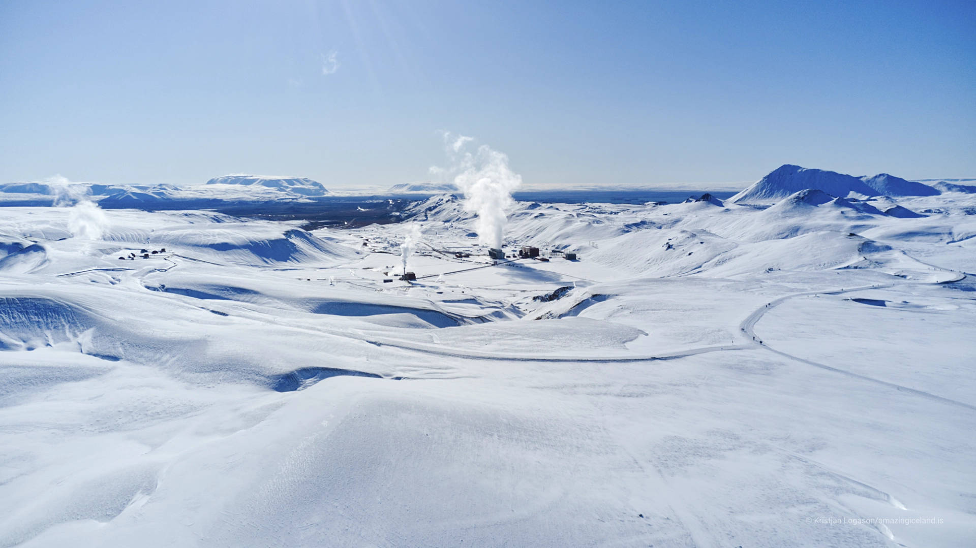
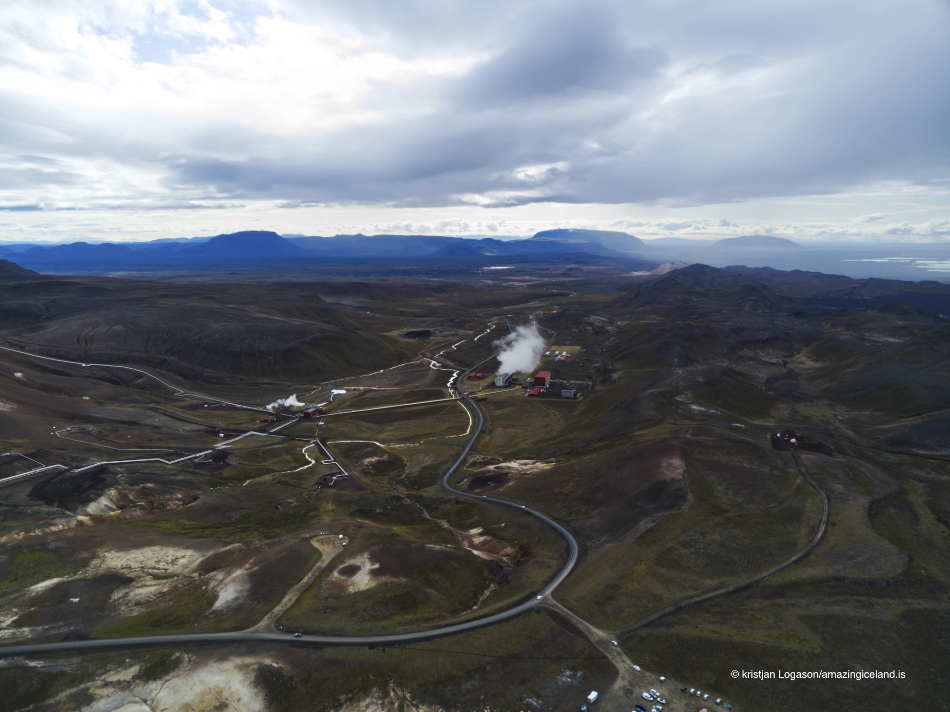
Road 863 enters this volcanic system and passes the power station before continuing towards Víti and Leirhnjúkur. Pipes cross the slopes, steam rises between industrial buildings, and geothermal wellheads stand among lava fields created during the Krafla Fires of 1975–1984.
To an ordinary visitor, much of this infrastructure is difficult to interpret. It can appear to be a collection of unexplained pipes, buildings and steam placed within a volcanic landscape. The real story is far more interesting.
Krafla is a place where plate movement, magma, groundwater, geothermal engineering and electricity production meet. The power station survived because its engineers gradually learned to work with a volcanic system that was changing beneath them.
The location of Krafla power station
Latitude
65.7112
Longitude
-16.7736
Krafla power station
A Volcanic System, Not a Single Mountain
The name Krafla is often used as though it describes one clearly defined volcano.
In reality, the Krafla volcanic system includes a central volcano, a large caldera, geothermal areas and a long fissure swarm extending north and south. Magma can accumulate beneath the central part of the system before moving sideways underground through dykes and opening fissures far from the centre.
The caldera is not immediately obvious to most visitors. It does not resemble a single steep-walled crater. Roads, mountains, geothermal fields and lava formations occupy the broad depression, making its overall scale difficult to perceive from ground level.
The fissure swarm is easier to recognise where faults, cracks and rows of volcanic vents cross the landscape. These structures follow the active rift zone where the North American and Eurasian tectonic plates are gradually moving apart.
That movement is not expressed as a smooth and continuous separation. The crust can stretch slowly for long periods while magma accumulates beneath the volcanic system. When the pressure becomes too great, magma may force its way sideways through the crust. The resulting dyke intrusion can produce earthquakes, widen the rift and sometimes reach the surface as an eruption.
During the Krafla Fires, this process occurred repeatedly.
The power station had been built to use heat from the volcanic system. It then found itself operating during one of the clearest modern demonstrations of how that system actually works.
The Mývatn Fires and the Krafla Fires
The events of 1975–1984 were not the first prolonged volcanic crisis at Krafla.
A similar episode, known as the Mývatn Fires, began in 1724 and continued until 1729. It opened with an explosive eruption that formed Víti, the crater now reached by following Road 863 beyond the power station.
The crisis developed through repeated earthquakes, rifting, magma movements and eruptions. Lava flowed through parts of the Mývatn region and reached the settlement at Reykjahlíð.
The name Mývatnseldar—the Mývatn Fires—does not describe one continuous eruption. It refers to a sequence of volcanic events occurring across several years. This earlier episode showed that Krafla could awaken through repeated bursts of activity rather than one isolated eruption.
By the twentieth century, however, the system had been quiet for generations. Geothermal exploration could proceed with modern drilling and engineering, while the events of the eighteenth century appeared to belong safely to the past.
Construction of Krafla Power Station began in 1975. In December of that year, the volcanic system entered a new rifting episode.
The Krafla Fires lasted from December 1975 until September 1984. Like the Mývatn Fires, they were not nine years of continuous eruption. The crisis consisted of approximately 20 separate rifting and dyke-intrusion events. Nine of those events produced volcanic eruptions.
Magma accumulated beneath the Krafla caldera and then forced its way sideways into the fissure swarm. Some intrusions remained underground. Others opened eruptive fissures and sent lava across the surface. The individual eruptions varied greatly in size and duration. Between them came periods of renewed inflation as magma again accumulated beneath the central volcano.
This repeated cycle allowed scientists to observe the volcanic system almost as though it were breathing: pressure building beneath Krafla, magma moving into the rift, the crust widening and the central area subsiding before inflation began again.

Watching the Rift Move
The Krafla Fires became the first plate-boundary rifting episode studied closely using modern seismic and geodetic instruments.
Earthquakes revealed where the crust was breaking. Measurements of the ground recorded inflation, subsidence and horizontal movement. Together, these observations allowed scientists to follow magma as it moved beneath the surface.
The episode transformed scientific understanding of how Iceland’s rift zones behave. It showed that spreading between the tectonic plates may occur through concentrated episodes in which repeated dyke intrusions accommodate decades or centuries of accumulated movement.
An eruption is only the visible part of that process. Considerable rifting can occur underground without magma ever reaching the surface.
The repeated intrusions and eruptions on the Reykjanes Peninsula since 2021 have made this pattern familiar to a new generation of Icelanders. Magma accumulates, earthquakes increase, dykes propagate through the crust, the ground opens and eruptions may follow. A single volcanic crisis can contain many intrusions and eruptions separated by quieter intervals.
The individual volcanic systems and risks are different, and Krafla should not be treated as a direct model for every event on Reykjanes. The scientific connection is nevertheless important.
The measurements made at Krafla helped establish how repeated dyke intrusions, ground deformation and fissure eruptions can redistribute plate movement across an active rift. That understanding became part of the scientific foundation used to interpret later volcanic unrest elsewhere in Iceland.
The young lava around Leirhnjúkur is the most accessible visible result of the Krafla Fires. Dark flows, fissures and volcanic vents record the eruptions, while steam can sometimes be seen rising through parts of the fractured ground.
That warmth should not be understood simply as lava remaining hot since 1984. It belongs to Krafla’s continuing geothermal activity beneath and within the young volcanic terrain.
Building During a Volcanic Crisis
Construction of Krafla Power Station was already under way when the Krafla Fires began. The timing could hardly have been more difficult.
A geothermal station depends upon a detailed understanding of heat, pressure, water and permeability beneath the ground. The rifting episode altered those conditions while the project was being developed.
Earthquakes affected the construction area. Magma movements changed the geothermal reservoir. Some boreholes became damaged or unusable, while corrosive volcanic gases created further technical problems.
The station had been designed around expectations formed before the volcanic crisis. Engineers were forced to respond to a system behaving in ways that were scientifically important but operationally disastrous.
Electricity generation began on 21 February 1978. At first, the station supplied only seven megawatts to the grid, far below its intended capacity. The geothermal resource was powerful, but extracting and controlling it reliably during volcanic unrest proved much harder than simply drilling into hot ground.
The troubled beginning is essential to understanding Krafla. The station is sometimes presented as a straightforward example of Iceland using renewable geothermal energy. That description hides the decades of experimentation, failure and adaptation required to make it work.
Landsvirkjun took over operation of the power station in 1986, after the Krafla Fires had ended. Further drilling, research and technical improvements gradually increased production.
The second turbine was finally brought into service in 1999. Krafla then reached its present installed electrical capacity of 60 megawatts, more than two decades after construction had begun.
The delay was not merely a story of an unsuccessful industrial project eventually being completed. It was a period in which engineering had to catch up with the volcanic system.
Turning Geothermal Heat into Electricity
Krafla uses heat stored beneath the volcanic landscape to generate electricity.
Wells are drilled into the geothermal reservoir, where water has been heated under high pressure by the surrounding rock. When the geothermal fluid rises towards the surface and the pressure falls, part of the water turns to steam.
The mixture is carried through large pipelines to separator equipment. There, steam is separated from the remaining geothermal water. The steam travels towards the turbine building, where it turns turbines connected to electrical generators. After passing through the turbines, the steam is cooled and condensed.
Some of the separated geothermal water is returned underground through reinjection wells. Reinjection at Krafla began in 2002. Returning fluid to the reservoir helps manage pressure and reduces the amount of geothermal water discharged at the surface. It also demonstrates that geothermal energy requires active management.
Geothermal heat is renewable on geological timescales, but an individual reservoir is not an unlimited supply that can be exploited without consequence. Production, pressure, temperature and reinjection must be monitored if the field is to remain useful.
Krafla has an annual generation capacity of approximately 465 gigawatt-hours.
Those figures may be difficult to connect with what visitors see from Road 863. The pipes, wellheads and steam are the visible parts of a much larger underground system.
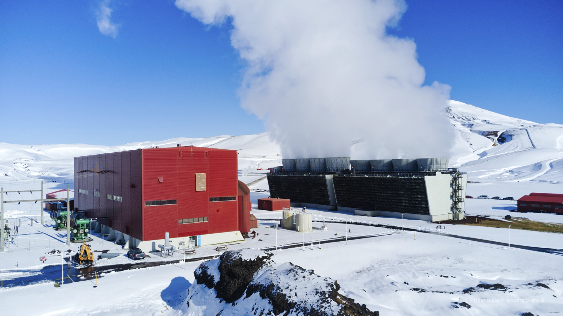
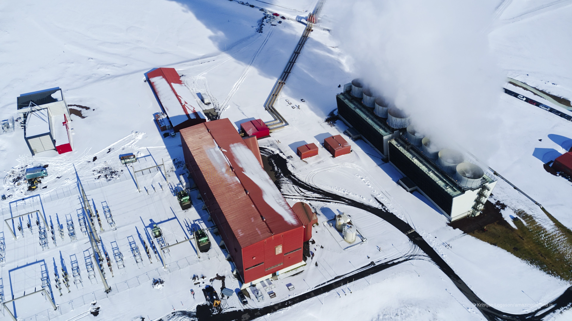
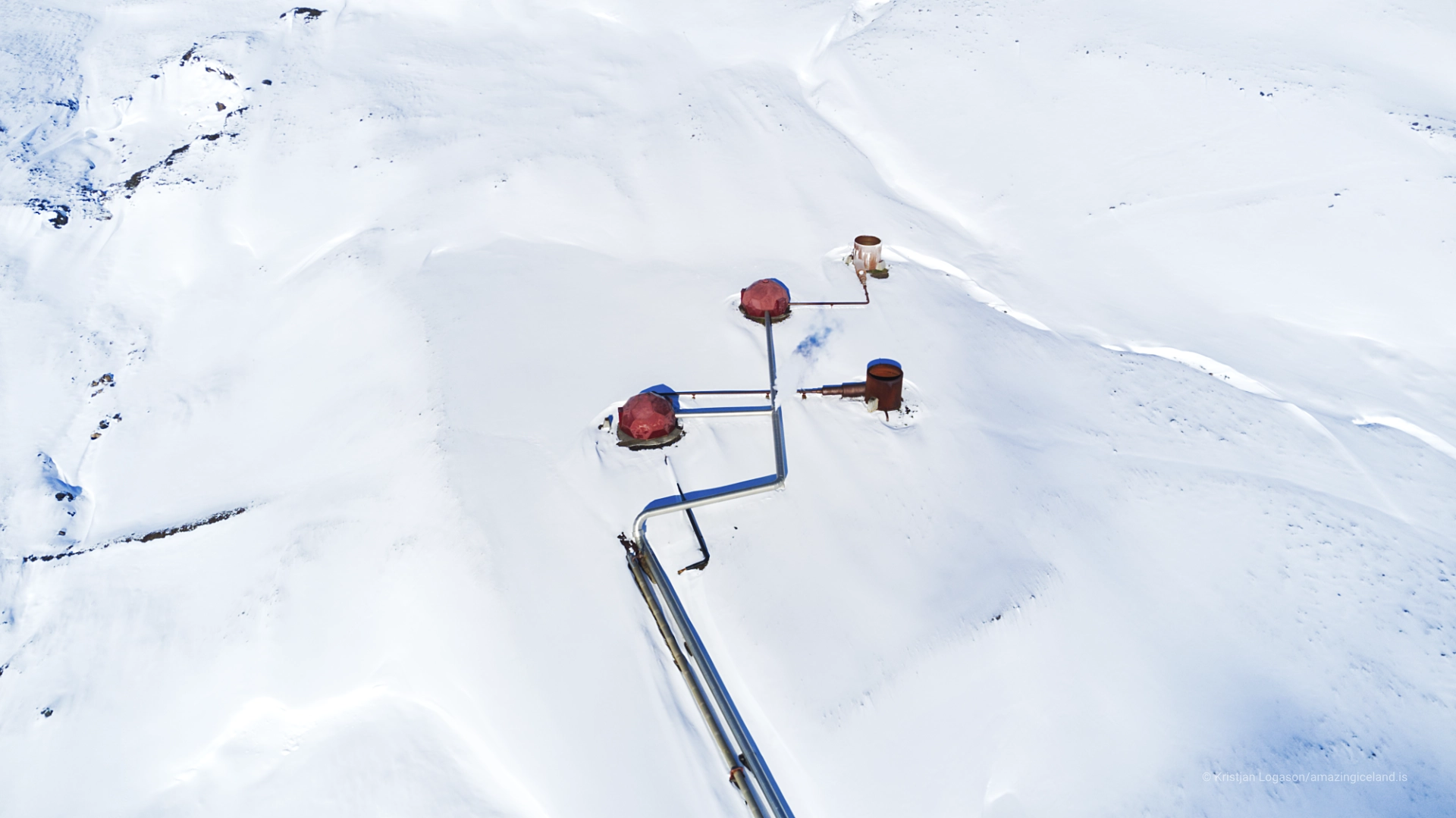
Large pipelines carry geothermal fluid and steam across the production field. Wellheads connect individual boreholes to that network. Separator stations divide steam from hot water, while the turbine building contains the machinery that converts geothermal energy into electricity.
Visible steam does not necessarily indicate an emergency or uncontrolled release. Steam plumes are a normal part of operating and managing a geothermal field, although their appearance changes constantly with temperature, humidity and wind.
Once the function of the infrastructure is understood, the landscape becomes easier to read. The station is no longer simply a building surrounded by pipes. It is the surface expression of a reservoir extending deep beneath Krafla.
Drilling into Magma
In 2009, a scientific drilling project at Krafla produced one of the most remarkable accidents in the history of geothermal exploration.
The Iceland Deep Drilling Project intended to drill the IDDP-1 well to a depth of approximately 4.5 kilometres. The objective was to reach extremely hot geothermal fluid under conditions where water behaves differently from ordinary steam and liquid.
Instead, the drill unexpectedly encountered rhyolitic magma at a depth of only about 2.1 kilometres. The magma was estimated to be approximately 900°C.
Drilling into magma was not the original goal, and the encounter could easily have ended with the well being abandoned. Researchers instead completed and tested the upper part of the borehole.
During a ten-month test, the well produced more than 100 megawatts of thermal power.
That number is sometimes compared with the 60-megawatt electrical capacity of the entire Krafla station. The comparison reveals the extraordinary concentration of heat near magma, but thermal and electrical power are not equivalent. Only part of the heat recovered from a well can be converted into electricity.
Even with that qualification, IDDP-1 demonstrated the potential energy available close to a magma body. More importantly, the well provided rare direct evidence of where magma lay beneath an active geothermal field. It turned an unexpected drilling problem into a scientific opportunity.
The encounter now forms part of the foundation for the Krafla Magma Testbed, an international project seeking to establish direct, controlled access to magma in its natural setting.
Scientists hope that purpose-built boreholes near magma could allow instruments to observe temperature, pressure, chemistry and rock behaviour at the boundary between solid crust and molten material. If successful, the project would create the world’s first long-term magma observatory of its kind.
Krafla may therefore contribute to another change in volcanology. During the Krafla Fires, scientists followed a rifting episode from the surface using modern instruments. The Magma Testbed aims to move part of that observation underground, towards the magma itself.
Visiting Krafla
Road 863 leaves the main road east of Lake Mývatn and enters the Krafla area. It is paved past the power station and continues towards Víti. Visitors travelling to Víti and Leirhnjúkur pass directly through the industrial landscape.
Krafla Power Station is worth observing in its own right, but it is a working industrial site rather than an attraction open for unrestricted exploration.
There is no clearly designated public viewpoint or separate parking area intended simply for photographing the complete station. Visitors should not stop where they obstruct Road 863, operational entrances, service roads or access for station employees.
A small exhibition has operated at the power station, although many visitors would barely recognise it as a conventional visitor centre. It is closed during construction work in 2026.
Anyone travelling specifically to see the exhibition should check current information with Landsvirkjun. The station should not be approached on the assumption that public plant tours or indoor access will be available.
Even without entering a building, much of the geothermal system can be seen from the public road. Pipes cross the terrain, steam rises from the production field, and wellheads and industrial buildings occupy the volcanic slopes. Understanding their functions makes the drive considerably more meaningful.
Visitors should remain within public areas and respect signs, barriers and operational restrictions. Geothermal infrastructure may contain high-pressure steam and extremely hot water. A road or track entering the production field should not be assumed to provide public access simply because it is physically open.
Road 863 can close in winter. Snow, visibility, road conditions and maintenance determine whether the area can be reached safely, so winter access should be checked rather than assumed.
Víti and Leirhnjúkur are connected to the Krafla story but deserve to be explored as separate destinations. Víti belongs to the opening of the Mývatn Fires in 1724. Leirhnjúkur provides the clearest walking access to the fissures and lava of the Krafla Fires. The power station explains how people attempted to use the heat beneath the same restless landscape.
Together, the three places show different periods and different consequences of activity within one volcanic system.
The Roadside Geothermal Shower
One of Krafla’s most photographed details is considerably less monumental than either the volcano or the power station.
Beside Road 863, hot water emerges through what appears to be an outdoor shower.
The sight is unexpected: an ordinary shower fixture standing in an exposed volcanic landscape, surrounded by pipes, steam and industrial infrastructure.
It introduces an element of humour into a place otherwise defined by serious engineering and powerful geological processes. It also makes geothermal heat immediately understandable. The underground resource that operates turbines and generates electricity can also appear at the surface as hot running water.
The shower should not be treated as an official bathing facility. Conditions, water temperature and access may change, and its roadside position requires care. Visitors should not block the road, enter operational areas or assume that every geothermal outlet is safe to touch.
Photographically, the shower works because of its absurd familiarity. The object belongs in a bathroom, yet it stands beneath an open sky inside one of Iceland’s most active volcanic systems.
It is a minor feature, but a memorable one.
Interesting facts:
-
- Krafla is a central volcano with a caldera approximately eight by ten kilometres across.
- Its fissure swarm extends for roughly 100 kilometres through northeast Iceland.
- The Mývatn Fires lasted from 1724 until 1729 and began with the explosive eruption that formed Víti.
- Construction of Krafla Power Station began in 1975.
- The Krafla Fires began in December of the same year and continued until September 1984.
- The Krafla Fires consisted of approximately 20 rifting and dyke-intrusion events rather than one continuous eruption.
- Nine of those events produced volcanic eruptions.
- Krafla was the first plate-boundary rifting episode followed closely using modern seismic and geodetic instruments.
- Electricity generation at Krafla Power Station began on 21 February 1978.
- The station initially supplied only seven megawatts to the grid.
- Landsvirkjun took over operation in 1986.
- The second turbine entered service in 1999, bringing the station to its present 60-megawatt capacity.
- The station has an annual generation capacity of approximately 465 gigawatt-hours.
- Reinjection of separated geothermal water began at Krafla in 2002.
- In 2009, the IDDP-1 borehole unexpectedly encountered rhyolitic magma at approximately 2.1 kilometres below the surface.
- The magma was estimated to have a temperature of approximately 900°C.
- During testing, the well produced more than 100 megawatts of thermal power.
- The Krafla Magma Testbed aims to establish direct scientific access to magma in its natural setting.
- Steam can sometimes be seen rising through the young lava around Leirhnjúkur because geothermal activity continues beneath the fractured ground.
- Road 863 is paved past the power station towards Víti but can close during winter.
Image Gallery
Photography tips:
- Krafla is visually interesting throughout the year. Its strongest subject is not untouched wilderness. It is the geometry of industrial infrastructure operating within an active volcanic system. Pipelines form long curves and straight lines across the terrain. Roads divide lava fields and geothermal ground. Buildings provide scale, while steam repeatedly hides and reveals parts of the station. Wider compositions can show how the infrastructure occupies the volcanic terrain. Pipelines crossing dark ground or snow make the relationship between engineering and geology immediately visible. A moderate or longer focal length can isolate sections of the system and organise what otherwise appears chaotic. Pipes, wellheads, steam outlets and buildings can be compressed into layered geometric compositions. Steam is never entirely predictable. Its visibility depends upon air temperature, humidity, wind and operating conditions within the geothermal field. Cold weather can produce dense white plumes, while warmer or drier conditions may make the same release appear much less dramatic. Wind determines whether steam rises vertically, stretches across the landscape or briefly conceals the station. Fast shutter speeds can freeze the detailed structure of the vapour. Longer exposures allow it to become softer and may simplify a scene crowded with industrial detail. Care is required with exposure: white steam can lose all texture if highlights are allowed to burn out, particularly against dark lava or shadowed buildings. Winter creates particularly graphic conditions. Snow simplifies the ground and separates pipes, roads and steam from their surroundings. Dark infrastructure becomes more prominent, while low light can reveal subtle contours in the volcanic landscape. Summer describes a different relationship. The contrast between industrial structures, black lava, brown geothermal ground and green vegetation demonstrates that Krafla is neither entirely barren nor static. Overcast light may suit the station better than conventional dramatic sunlight. It reduces harsh reflections from pale pipes and allows steam, metal and ground textures to remain visible within the same exposure. Strong side light can make pipelines and buildings more sculptural, but deep shadows may turn already complicated infrastructure into an unreadable mass. The power station cannot easily be photographed as one complete and orderly subject from a designated viewpoint. There is no public observation platform created for that purpose. Photographers must work only from safe and permitted positions without stopping on the road, blocking operational access or entering the production field. This limitation can improve the photographs. Instead of attempting a conventional record image of the entire facility, attention can shift towards the details that explain how the system works: a pipeline disappearing across the terrain, steam moving around a wellhead, the turbine building framed through infrastructure or a road continuing towards the volcanic landscape beyond. The roadside shower offers a completely different visual possibility. A relatively simple composition often works best. Including too much surrounding infrastructure can hide the strangeness of a familiar household object standing alone in a volcanic environment. People may provide scale or humour, but the roadside position must be treated seriously. Leirhnjúkur expands the photographic story beyond the station. The dark young lava, fissures and occasional geothermal steam show the volcanic activity that complicated the power project. Víti provides the deeper historical layer: its crater marks the beginning of the Mývatn Fires, while the station and the lava around Leirhnjúkur belong to events more than two centuries later. Aerial views can reveal relationships that are difficult to organise from the ground: the layout of the station, lines of pipelines, roads, geothermal fields, lava flows and the broad form of the Krafla landscape. Current restrictions applying to drones around infrastructure, protected areas and other visitors must be checked before flying. From above, there is a temptation to turn the power station into a purely abstract arrangement of lines and circles. Geometry is important, but the strongest aerial images retain enough surrounding terrain to explain why those structures are there. Krafla should not look like an industrial complex placed on an interchangeable piece of land. The volcanic setting is the reason the station exists, the source of its energy and the cause of its greatest difficulties.
Destinations nearby