Kleifarvatn lake on Reykjanes peninsula
Kleifarvatn is the largest lake on the Reykjanes Peninsula and one of the most distinctive landscapes in the area. It lies in a tectonic depression beside Sveifluháls, surrounded by steep móberg ridges and an almost treeless volcanic landscape.
The lake covers roughly **9 square kilometres** and reaches a depth of about **97 metres**. There is no obvious river flowing into or out of it, and much of its water movement takes place underground through fractures and permeable volcanic rock.
That underground connection is one of the reasons Kleifarvatn is so closely tied to the tectonic activity of Reykjanes. Changes in the surrounding fault system can alter how water moves beneath the landscape, and the dramatic fall in the lake level after earthquakes in 2000 showed just how direct that relationship can be.
The location of Kleifarvatn lake on Reykjanes peninsula
Latitude
63.9314
Longitude
-21.9839
Kleifarvatn lake on Reykjanes peninsula
A lake in an active landscape
Kleifarvatn sits within the active volcanic and tectonic zone of the Reykjanes Peninsula. The ridges around the lake were formed largely by eruptions beneath glaciers during the Ice Age, when magma interacted with meltwater and ice to create volcanic rocks such as pillow lava, hyaloclastite and tuff.
These formations are visible in outcrops around the lake and along Road 42. Together, they create a landscape very different from many of Iceland’s better-known lake districts.
There are almost no trees, little development and few soft transitions between water and land. Dark beaches, exposed volcanic rock and steep ridges meet the lake directly, giving Kleifarvatn a stark character even in calm weather.
Weathering has also shaped unusual formations along parts of the shoreline, where wind, frost and water have gradually sculpted the softer volcanic material into irregular shapes.
The lake covers approximately 9.1 square kilometres and has a maximum depth of about 97 metres. Rather than having a conventional visible outlet, much of its water moves through the fractured volcanic bedrock beneath and around the lake.
The earthquakes of 2000
That underground connection became particularly obvious in June 2000, when two major earthquakes struck southwest Iceland.
Fissures are believed to have opened in or beneath the lake bed, and afterwards the water level at Kleifarvatn began to fall significantly. A substantial part of the lake’s volume was lost, exposing areas of shoreline that had previously been underwater and noticeably changing the appearance of the lake.
The event demonstrated how directly Kleifarvatn is connected to the fractured geology beneath Reykjanes. Its water level is not controlled only by rainfall, evaporation and visible streams, but also by the underground pathways through which water moves.
The level later recovered to some degree, but the 2000 event remains one of the clearest recent examples on Reykjanes of tectonic activity altering the landscape without an eruption taking place.

Around Kleifarvatn
Road 42 follows the western side of Kleifarvatn and gives repeated views across the water towards Sveifluháls. There are several places where it is possible to stop and approach the shoreline, but the lake is better understood as a landscape to explore gradually than as a destination with one single viewpoint.
The black beaches, exposed rock formations and changing shape of the surrounding ridges make different sections of the shoreline feel surprisingly different from one another.
Close to the southern end of the lake lies Seltún, within the Krísuvík geothermal area. The geothermal field is a separate destination in its own right, but its proximity helps explain why Kleifarvatn sits within such an active geological environment.
The combination of the lake, Sveifluháls and Seltún makes this one of the most varied short stretches of landscape on the Reykjanes Peninsula, moving quickly from still water and dark shoreline into geothermal ground and steep volcanic ridges.
Fish in Kleifarvatn
Both Arctic char and brown trout are found in Kleifarvatn. Arctic char fry from Hlíðarvatn in Selvogur were released into the lake during the 1960s and established successfully.
The lake has since become known among anglers for both char and trout. The fishery is another example of how a seemingly isolated volcanic lake has developed a longer human use beyond simply being part of the landscape.
Fishing regulations and permit arrangements can change, so anyone planning to fish should check current local rules before visiting rather than relying on older information.
A monster beneath the lake
Kleifarvatn also has its own lake-monster tradition. According to local folklore, an enormous dark creature is said to live in the lake, described in some versions as a huge black worm or serpent-like animal and in others as something large enough to be compared with a medium-sized whale.
The story belongs to folklore rather than natural history, but the setting gives it an understandable home. Dark water, steep surrounding ridges and the lack of settlement create exactly the kind of landscape where stories of hidden creatures can take hold.
The lake also entered modern Icelandic fiction through Arnaldur Indriðason’s crime novel Kleifarvatn. Its premise draws directly on the real changes to the lake after the 2000 earthquakes, when falling water levels exposed areas that had previously been submerged.
That connection between a real geological event and a fictional crime gives the novel an unusually close relationship with the landscape that inspired it.
Interesting facts:
- Kleifarvatn is the largest lake on the Reykjanes Peninsula.
- It covers about 9.1 square kilometres and is approximately 97 metres deep.
- The lake has no obvious surface outlet; much of its water moves through fractured volcanic rock underground.
- Its water level dropped dramatically after earthquakes in June 2000.
- Arctic char from Hlíðarvatn were introduced in the 1960s.
- Both Arctic char and brown trout are found in the lake.
- Local folklore tells of a huge black worm or serpent-like creature living in Kleifarvatn.
- The lake inspired Arnaldur Indriðason’s crime novel Kleifarvatn.
Image Gallery


Photography tips:
- Kleifarvatn works particularly well in early spring and late autumn, when sunrise and sunset occur at more useful angles around the lake and low light brings out the structure of the surrounding ridges.
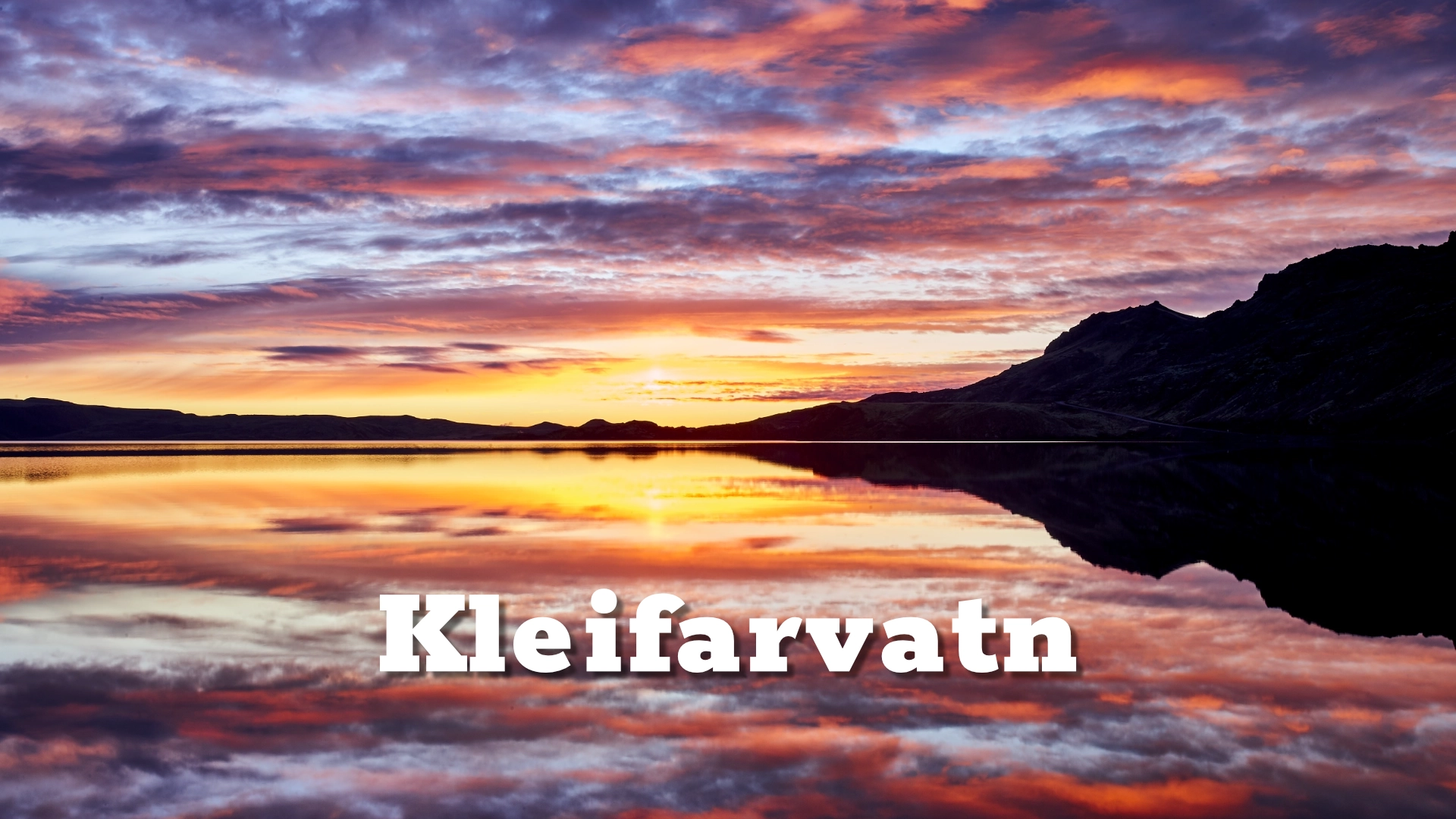
- In calm weather, look for reflections across the lake, especially when colour develops in the sky around sunrise or sunset.
- Do not limit the photography to wide lake views. The weathered rock formations along the shoreline make strong subjects at a smaller scale and help show the geology more clearly.
- Road 42 provides several elevated viewpoints where the relationship between the lake, shoreline and surrounding móberg ridges becomes easier to read.
- Low-angle light generally works better than flat midday conditions because side light reveals the texture of Sveifluháls and the bare volcanic ground.
- Broken cloud and changing weather can give the lake a much darker and more dramatic character than clear blue skies.
- Longer focal lengths can compress the layers of ridges beyond the lake, while wider lenses work better from the shoreline where foreground rock or black beach can be included.
- If the surface is rough, use the movement of the water rather than waiting for reflections. Wind can make the lake feel completely different and often suits the exposed character of the place.
Destinations nearby