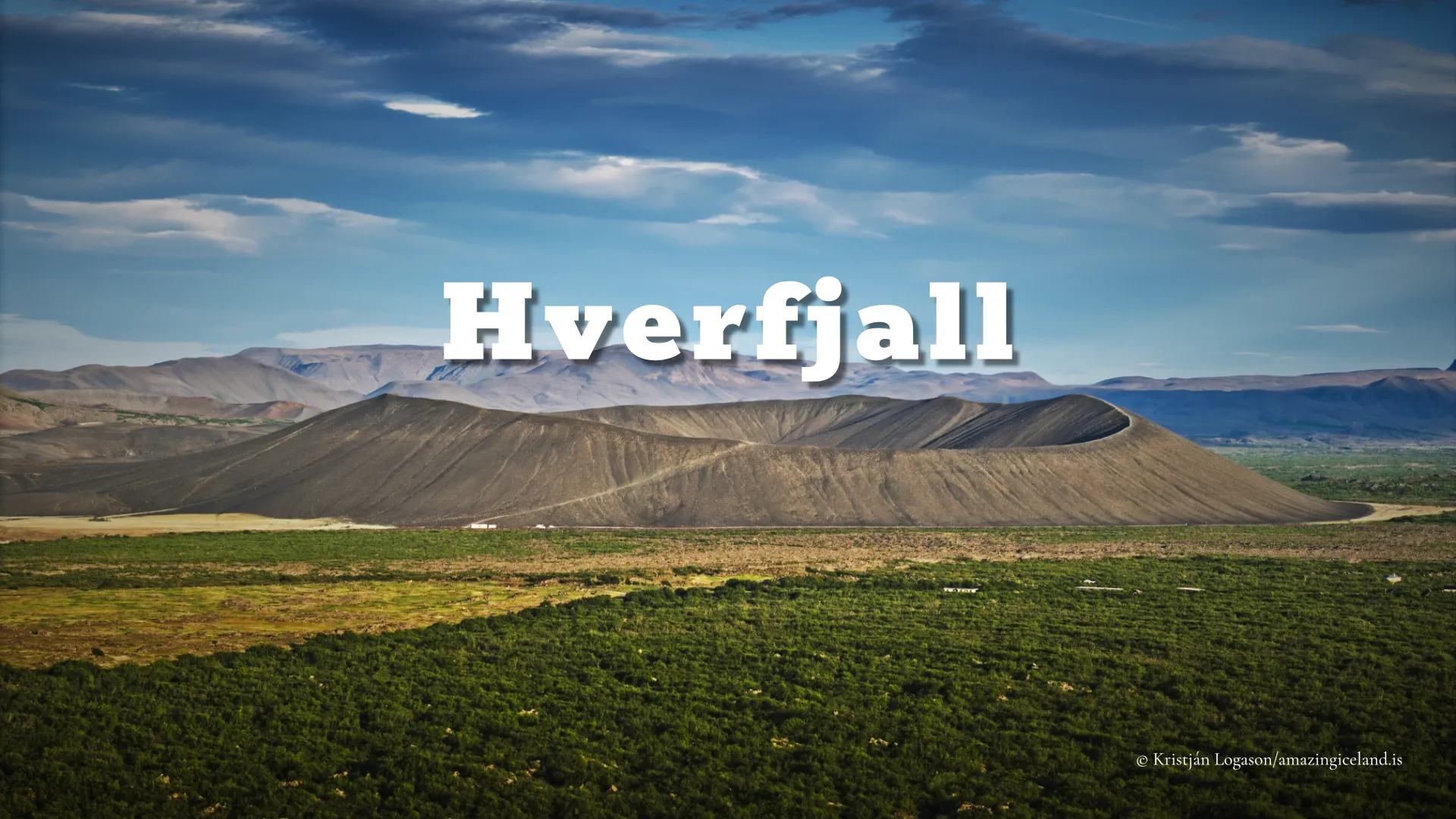
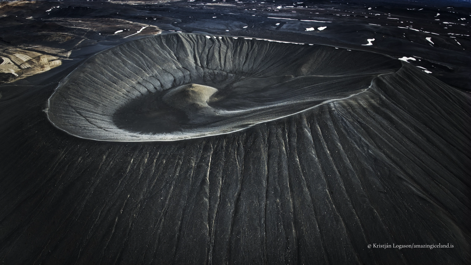
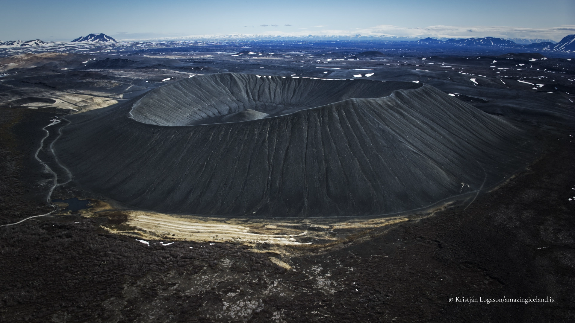
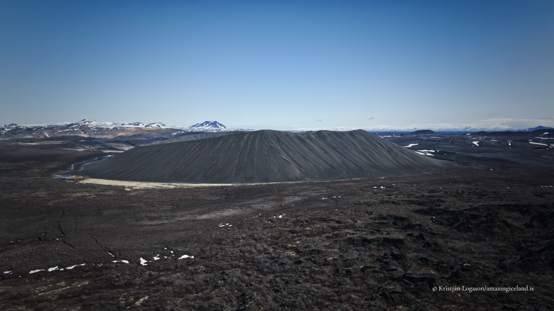
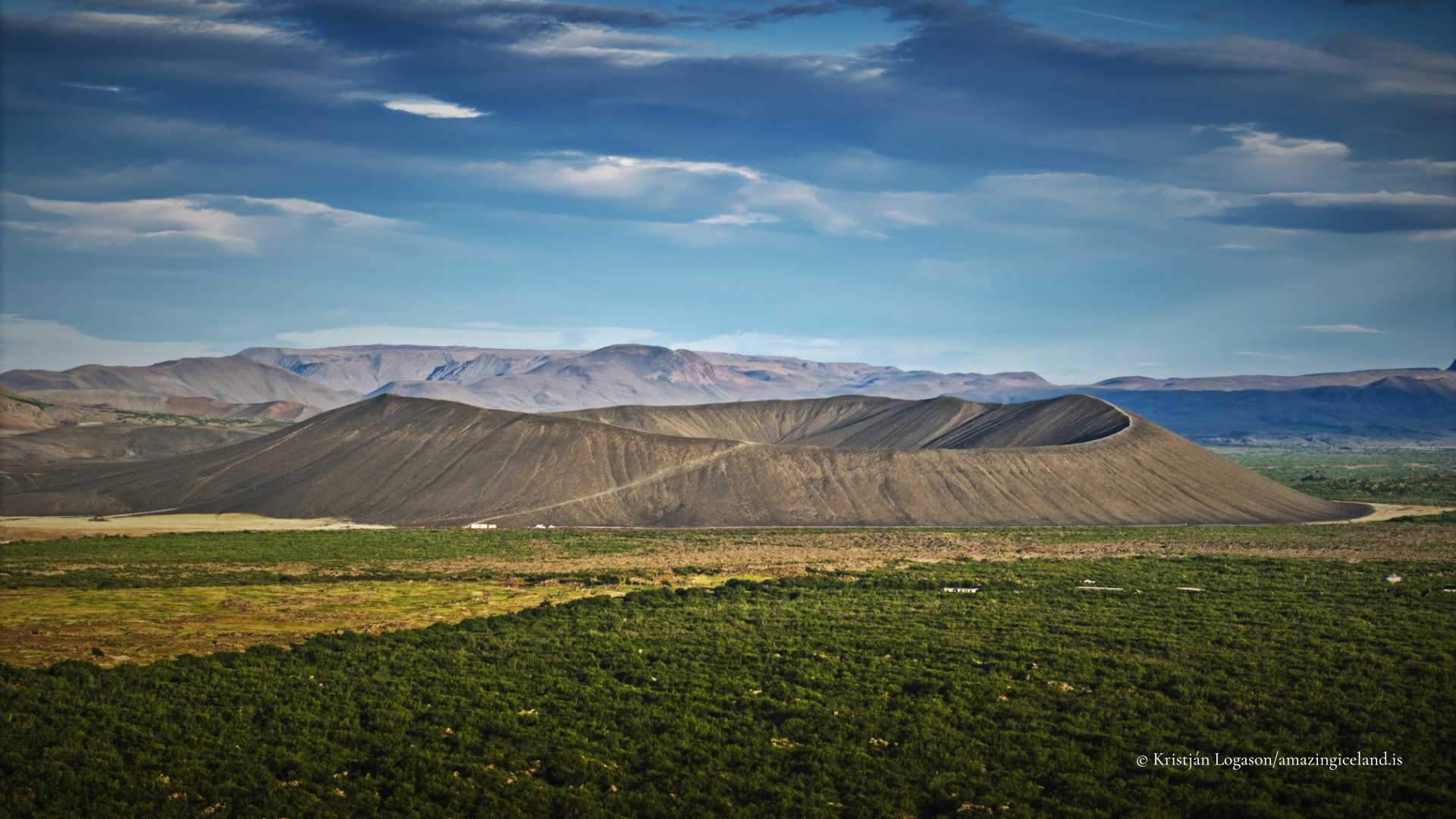
Located on the eastern edge of Lake Mývatn, Hverfjall is one of the largest and most intact explosion craters in Iceland. Its symmetrical form and stark material contrast sharply with the surrounding lava fields and wetlands, making it both visually dominant and scientifically instructive. Hverfjall is not a composite volcano built over time—it is the frozen outline of a single, short-lived but powerful event.
The location of Hverfjall crater
Latitude
65.6058
Longitude
-16.8753
Hverfjall crater
Formation and volcanic context
Hverfjall formed approximately 2,500 years ago during an explosive eruption associated with the volcanic activity that also shaped much of the Lake Mývatn region. The eruption was phreatomagmatic, meaning it occurred when rising magma interacted violently with groundwater or surface water. This interaction caused rapid fragmentation of magma into fine ash and lapilli, producing an eruption dominated by explosive force rather than lava flow.
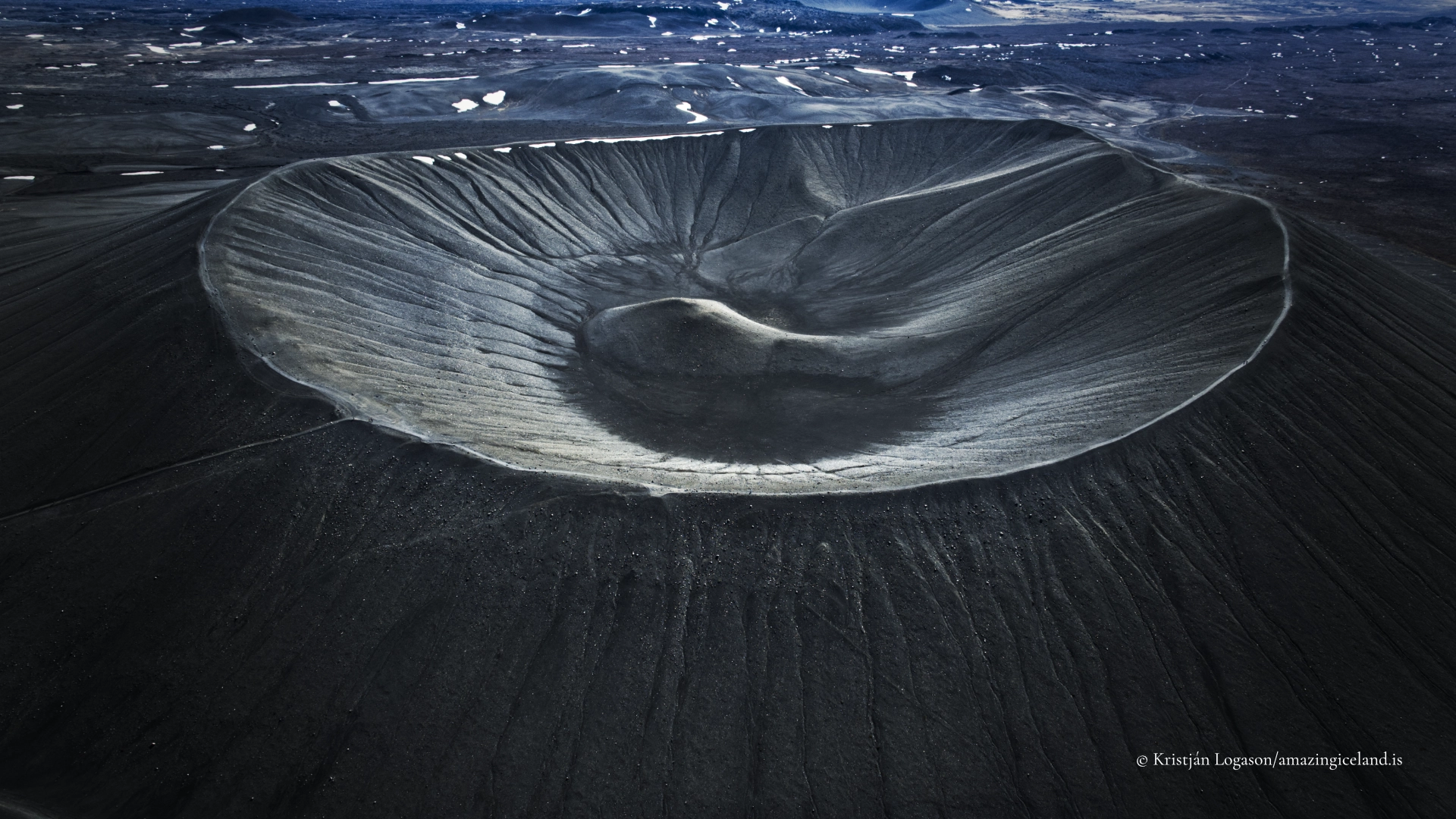
The material ejected during the eruption fell back to the ground around the vent, accumulating as a steep-sided tephra cone. Because the eruption was short-lived and highly energetic, the resulting structure is unusually symmetrical, with slopes approaching the natural angle of repose for loose volcanic material. The crater measures roughly one kilometre in diameter and rises about 140 metres above the surrounding terrain.
What makes Hverfjall academically valuable is its preservation state. Tephra cones are inherently fragile, easily modified by erosion and vegetation over time. Hverfjall’s youth, combined with the relatively dry local climate and limited surface runoff, has allowed it to retain sharp edges and a clearly defined rim. This clarity makes it an exemplary field site for understanding explosive volcanic processes in basaltic systems.
Hverfjall is genetically linked to the broader volcanic episode that created Lake Mývatn and nearby lava formations, but it represents a different eruptive mechanism. Where lava flows built platforms and voids, Hverfjall documents a moment when magma–water interaction dominated, converting molten rock into airborne fragments almost instantaneously.
Morphology, materials, and erosion
The cone is composed primarily of unconsolidated basaltic tephra—ash, scoria, and lapilli—rather than solid rock. This material composition explains both the cone’s steepness and its vulnerability. Slopes are easily disturbed, and even foot traffic can trigger small-scale slumping and erosion.
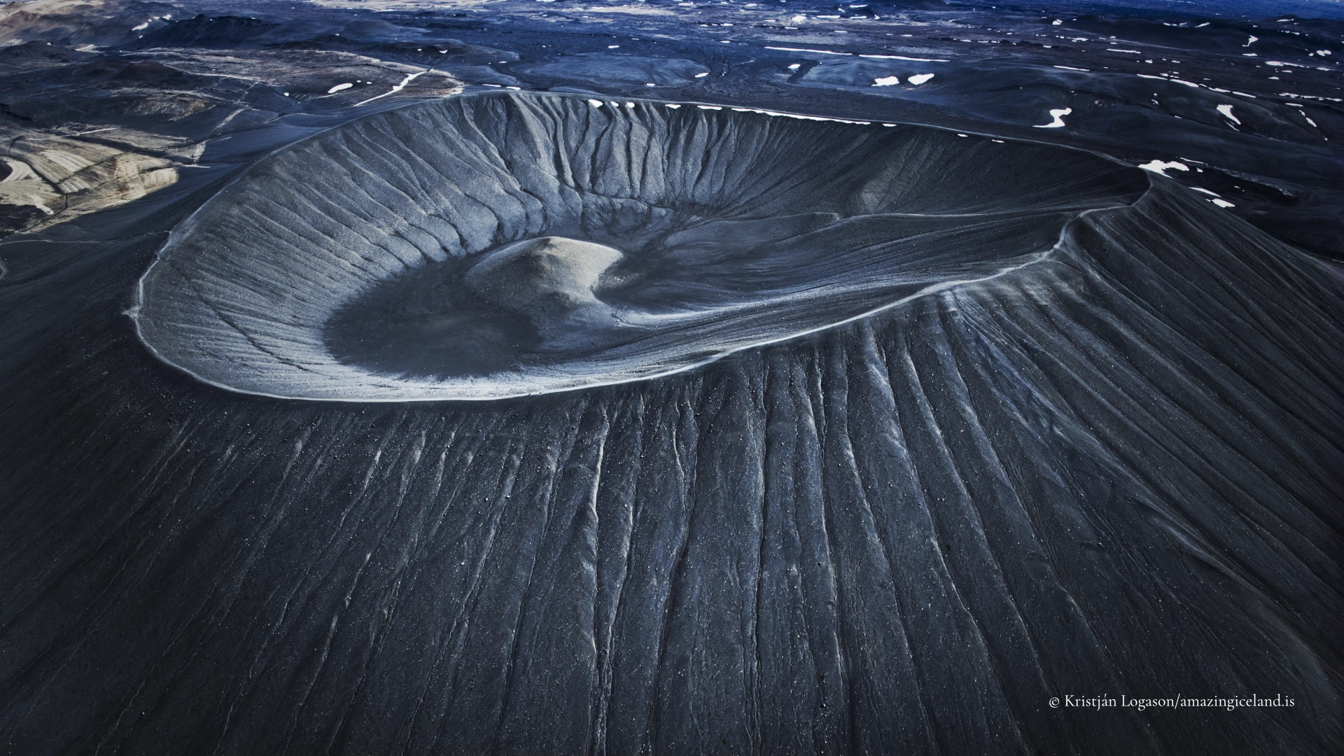
The crater interior is broad and shallow relative to the cone’s height, reflecting the outward-directed nature of the eruption. Unlike stratovolcano craters, which often narrow sharply, Hverfjall’s crater floor spreads gently, emphasizing that the eruption excavated space rather than built structure upward.
Erosion at Hverfjall is subtle but continuous. Wind redistributes fine ash, freeze–thaw cycles loosen surface layers, and occasional heavy rain events carve narrow gullies down the slopes. However, the absence of persistent streams or vegetation roots has limited deep incision, preserving the cone’s overall geometry.
From a geomorphological perspective, Hverfjall serves as a reference model for monogenetic volcanic landforms—volcanoes formed in a single eruptive episode and never reactivated. Its simplicity is not a lack of complexity but a distilled expression of process.
Experiencing Hverfjall—scale, ascent, and restraint
Hverfjall is accessible via a short walk from nearby parking areas east of Lake Mývatn. A marked trail leads to the crater rim, ascending steadily over loose tephra. The climb is not technically difficult, but it is physically demanding due to unstable footing and exposure to wind.
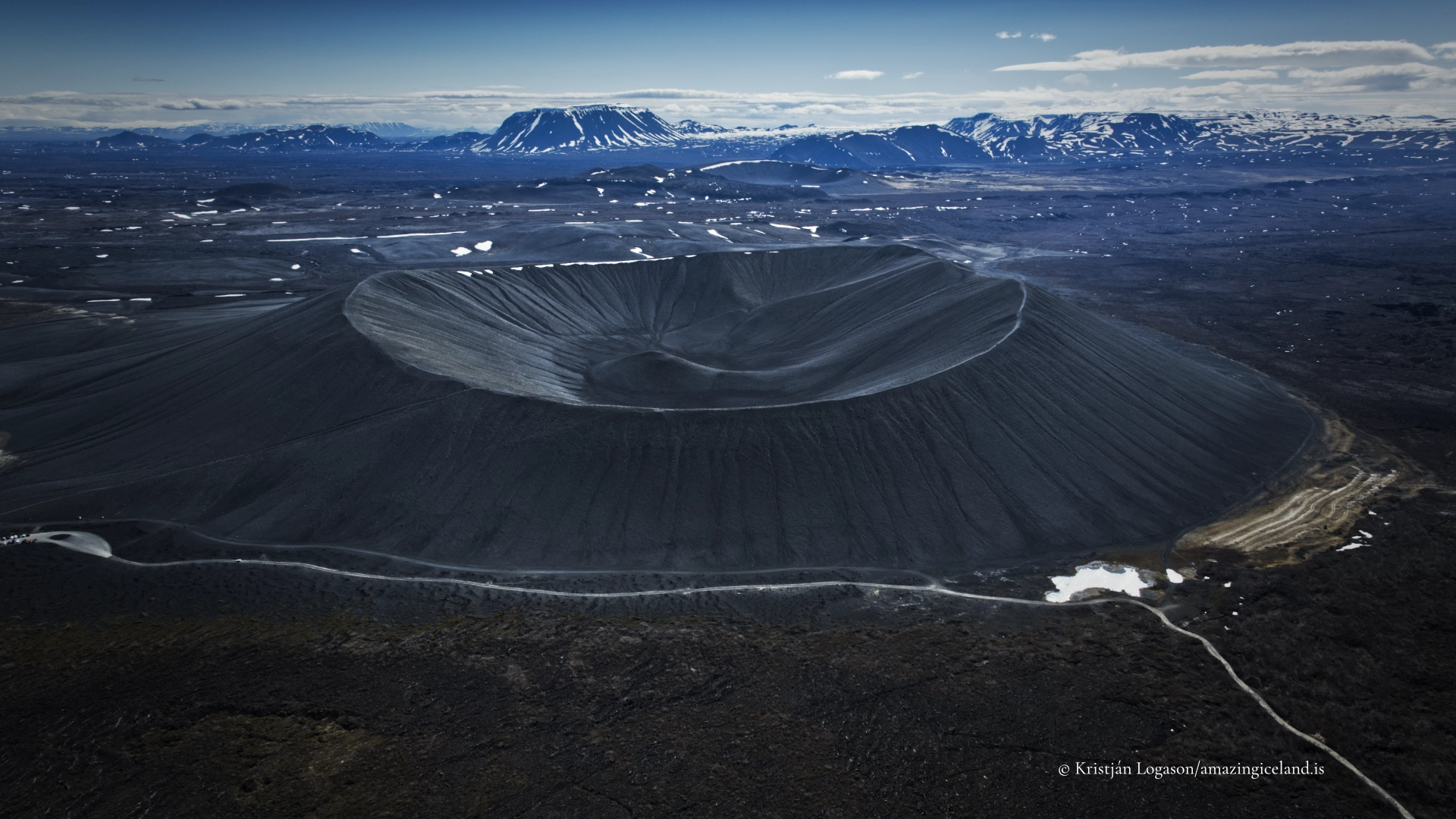
Reaching the rim is the defining moment of the visit. From above, the crater’s scale becomes legible, while outward views extend across Lake Mývatn, Dimmuborgir, and the surrounding volcanic plain. The contrast between the cone’s barren slopes and the biologically rich lake basin below reinforces the diversity produced by closely spaced volcanic processes.
Movement along the rim should be deliberate and restrained. The edge is sharp, the material loose, and sudden gusts are common. Descending into the crater is strongly discouraged, both for safety reasons and to protect the integrity of the landform.
Seasonality significantly affects the experience. In summer, the ash surface absorbs heat and reflects light strongly, creating harsh conditions during midday. In winter, snow can obscure the rim and soften visual cues, increasing risk. In all seasons, weather awareness is essential; Hverfjall offers little shelter.
Hverfjall within the Mývatn volcanic system
Hverfjall’s significance is amplified by its proximity to other volcanic features around Lake Mývatn. Within a short radius, visitors encounter pseudocraters, lava fields, geothermal areas, and collapsed lava structures such as Dimmuborgir. Hverfjall stands apart by representing pure explosive construction, unmediated by lava flow or prolonged activity.
This juxtaposition is academically instructive. It demonstrates how variations in water availability, eruption rate, and magma ascent can produce radically different landforms from chemically similar magma. Hverfjall is not an outlier but a necessary component of the Mývatn volcanic narrative.
Culturally, Hverfjall has long been a visual anchor in the region—an unmistakable landmark visible from multiple directions. Its starkness has resisted folkloric embellishment more than sites like Dimmuborgir, reinforcing its identity as a place of exposure rather than enclosure.
Interpretation and long-term preservation
Hverfjall’s greatest strength—its loose, unconsolidated structure—is also its greatest vulnerability. Foot traffic, trail widening, and off-path movement accelerate erosion that would otherwise occur over centuries. Management strategies emphasize minimal intervention, relying on designated trails and visitor education rather than heavy infrastructure.
For visitors, this places responsibility at the centre of the experience. Hverfjall is not a backdrop but a finite geological record. Preserving its form requires accepting limits on access and resisting the impulse to treat the crater as a playground or photographic prop.
Interpreted correctly, Hverfjall offers something rare: a direct encounter with volcanic mechanics at full scale, unfiltered by later modification. It is a reminder that even Iceland’s most dramatic landforms can be ephemeral on geological timescales, surviving only as long as they are allowed to.
Interesting facts:
- Hverfjall is approximately 2,500 years old, making it younger than many surrounding lava fields.
- The crater is about 1 km in diameter and 140 m high.
- It is a monogenetic volcano, formed in a single eruptive episode.
- The cone is composed entirely of loose tephra, not solid lava.
- Hverfjall is one of the largest tephra cones in Iceland.
Image Gallery

The Locomotive Elite
What do Donald Trump and Iceland’s Locomotive Elite have in common?
Far more than you think.
In The Locomotive Elite, you’ll uncover how a tiny clique in Iceland captured extensive control—of banks, courts, media, and even the central bank.
For decades they ruled, first democratically, then through corruption and in the end through crime, enriching themselves and their cronies while dismantling oversight.
The result?
One of the most spectacular financial collapses in modern history.
Photography tips:
- Shoot from the rim: scale and geometry are best conveyed from above.
- Use people sparingly: small figures emphasize crater size effectively.
- Midday light is harsh: early morning or late evening offers better texture.
- Avoid trampling slopes: footprints scar the surface and degrade compositions.
- Wind matters: protect gear and anticipate rapid weather shifts.
Good cameras for Iceland
Sony A7R V

Sony A7s lll

Canon R6

Nikon Z6 lll

Destinations nearby


Good to have in Iceland


