Hrafnabjargafoss waterfall by highland road F26
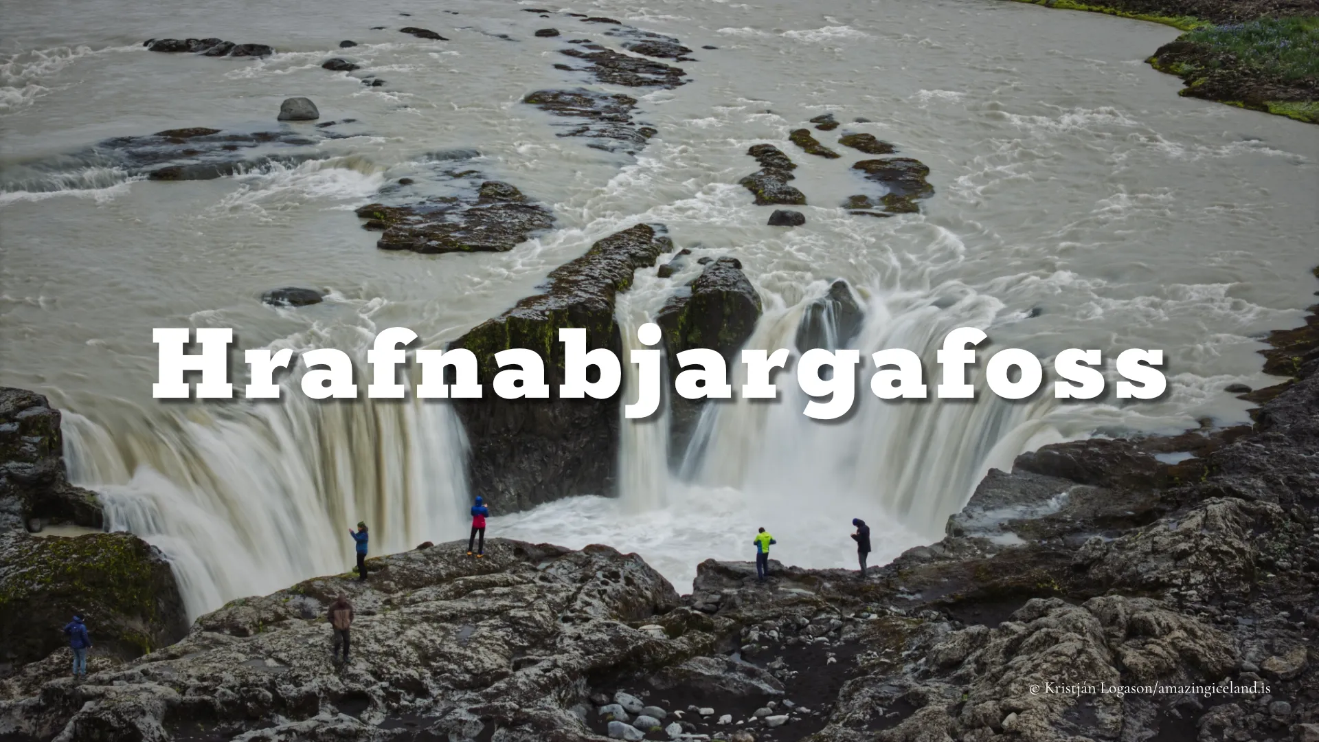
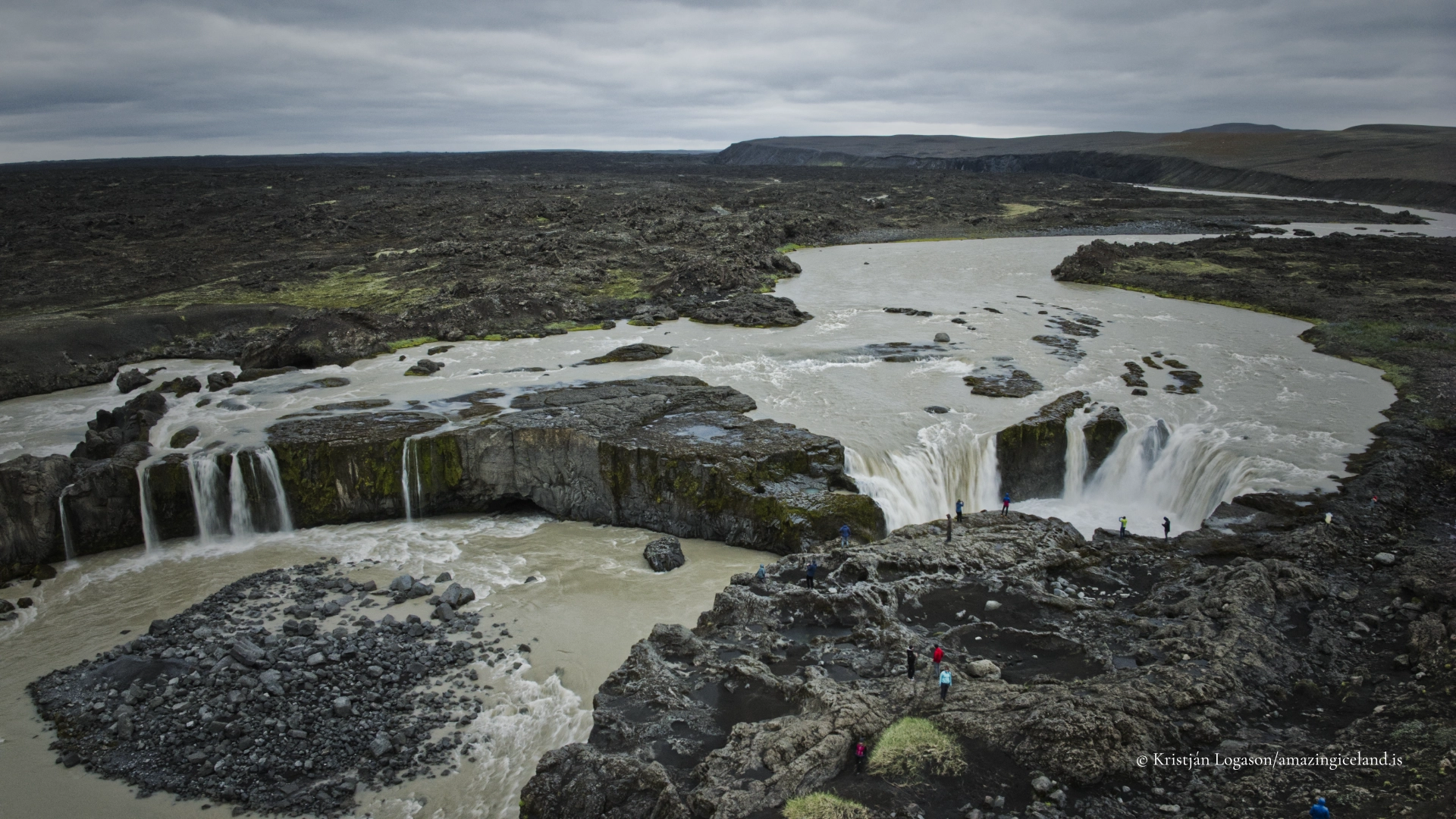
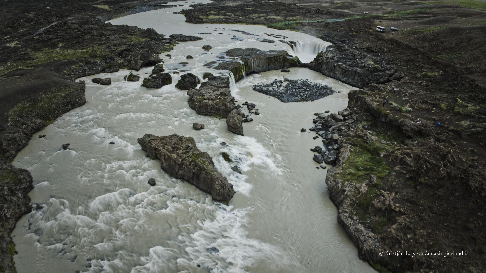
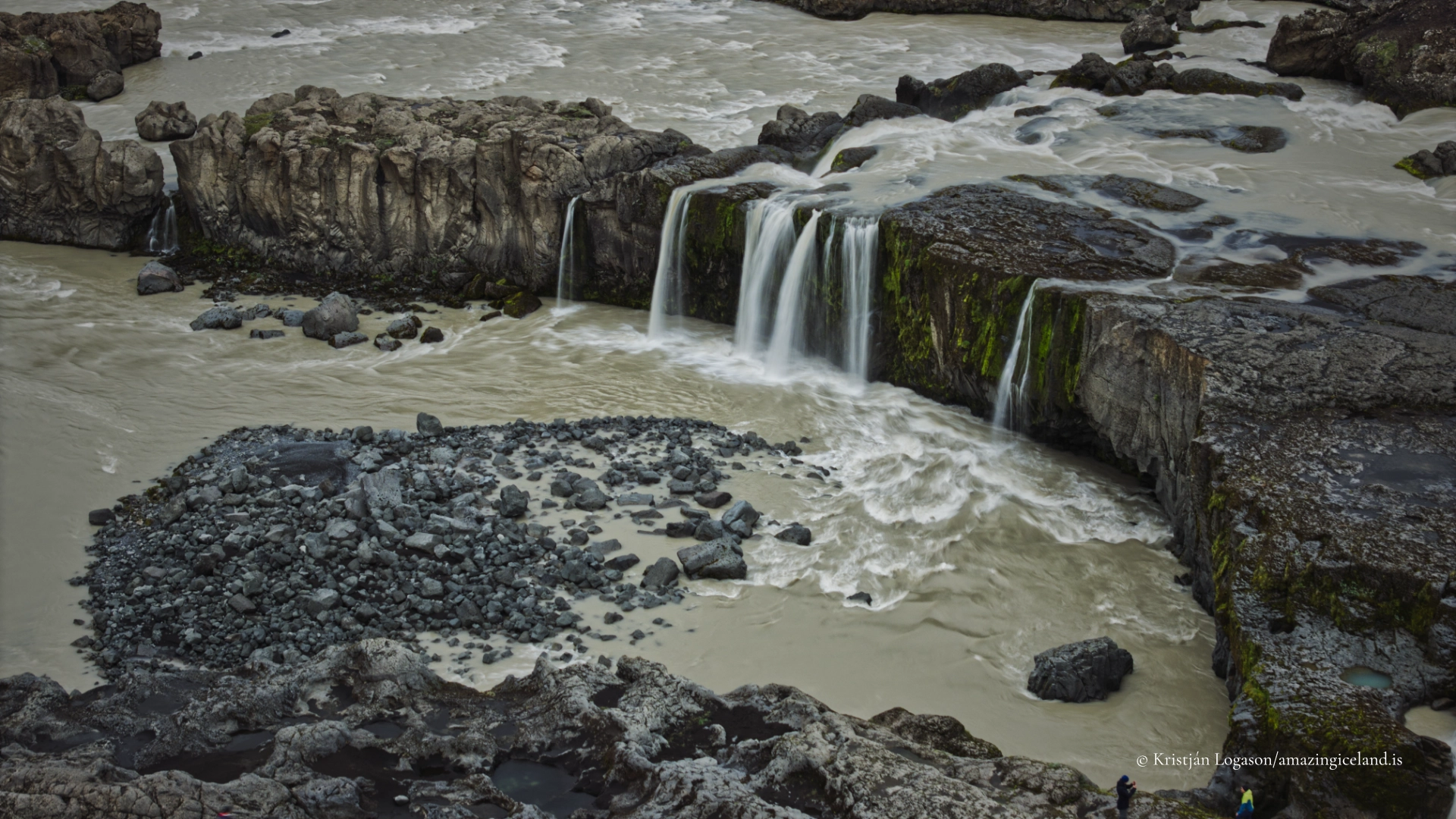
Hrafnabjargafoss does not depend on one high, vertical drop. Its character comes from the way Skjálfandafljót spreads across an irregular basalt threshold, separates into several channels and descends in a curved series of short falls. Water moves around rocks and a central island-like formation, creating a waterfall that is broad, fragmented and continually changing with the river’s flow.
The waterfall lies upstream from Aldeyjarfoss on the same river. Ingvararfoss is situated between them, although it is considerably less prominent and may pass unnoticed during an ordinary visit. Hrafnabjargafoss and Aldeyjarfoss can easily be considered together, but they are not repetitions of the same geological form. Aldeyjarfoss is immediately recognised by its concentrated drop and columnar-basalt amphitheatre. Hrafnabjargafoss reveals itself more gradually through the shape and direction of its separate channels.
Reaching the waterfall requires continuing south beyond Aldeyjarfoss along F26 and then following a rough final track to a small stopping place. There are no signs, paths, barriers or facilities beside the river. The site remains an open highland landscape in which visitors must choose their footing and keep their own distance from fast water and unprotected edges.
The location of Hrafnabjargafoss waterfall by highland road F26
Latitude
65.3519
Longitude
-17.3708
Hrafnabjargafoss waterfall by highland road F26
A broad waterfall divided into many channels
Skjálfandafljót approaches Hrafnabjargafoss as a substantial highland river. At the waterfall, it is not compressed into one narrow chute. Instead, the flow divides across an uneven rock platform and follows several routes through the basalt.
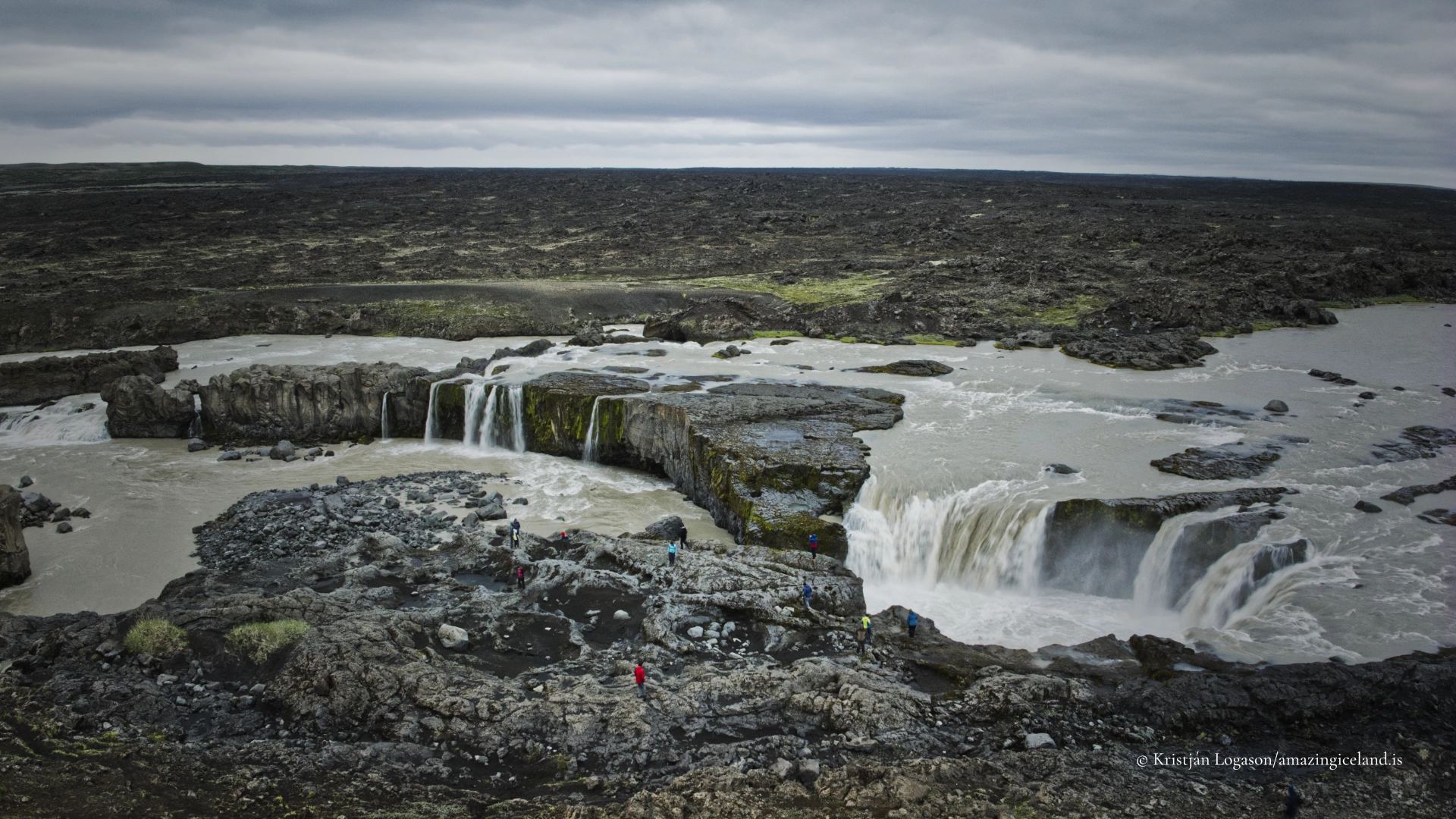
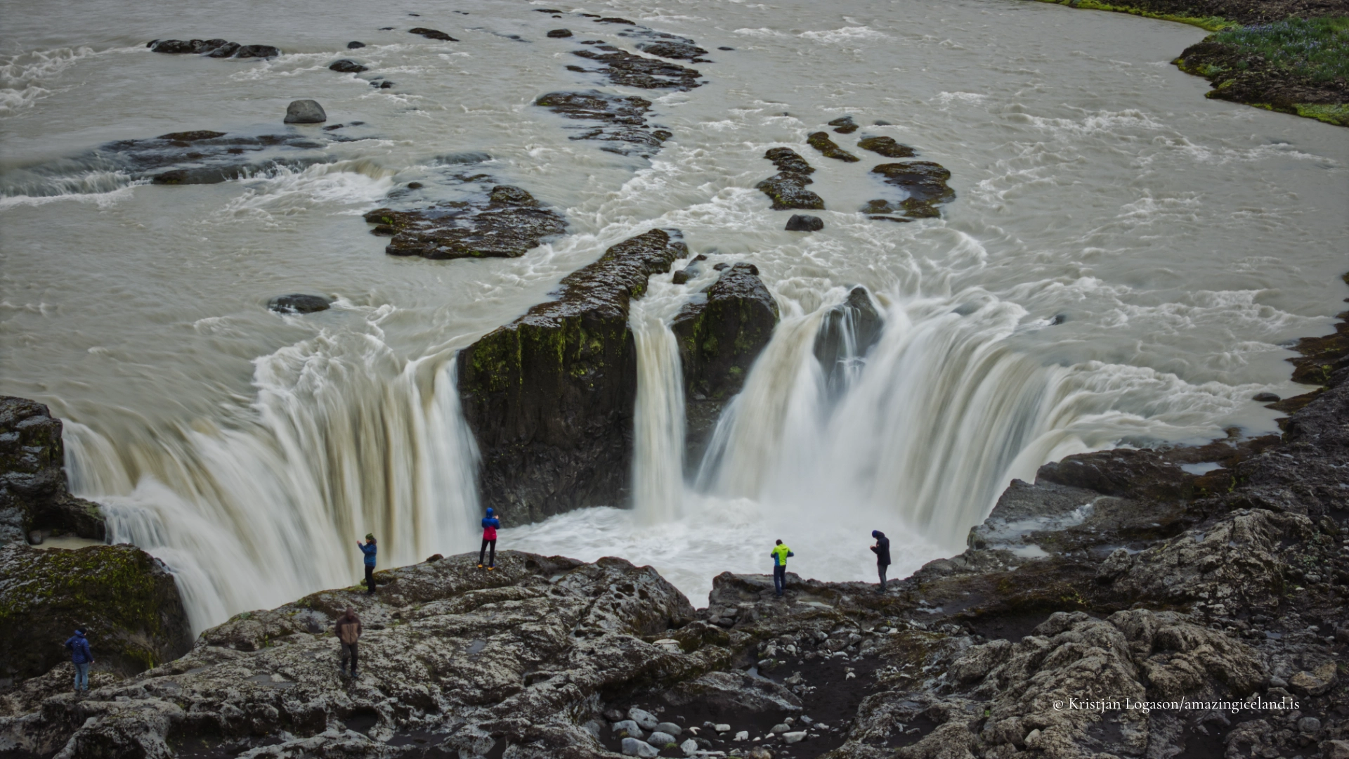
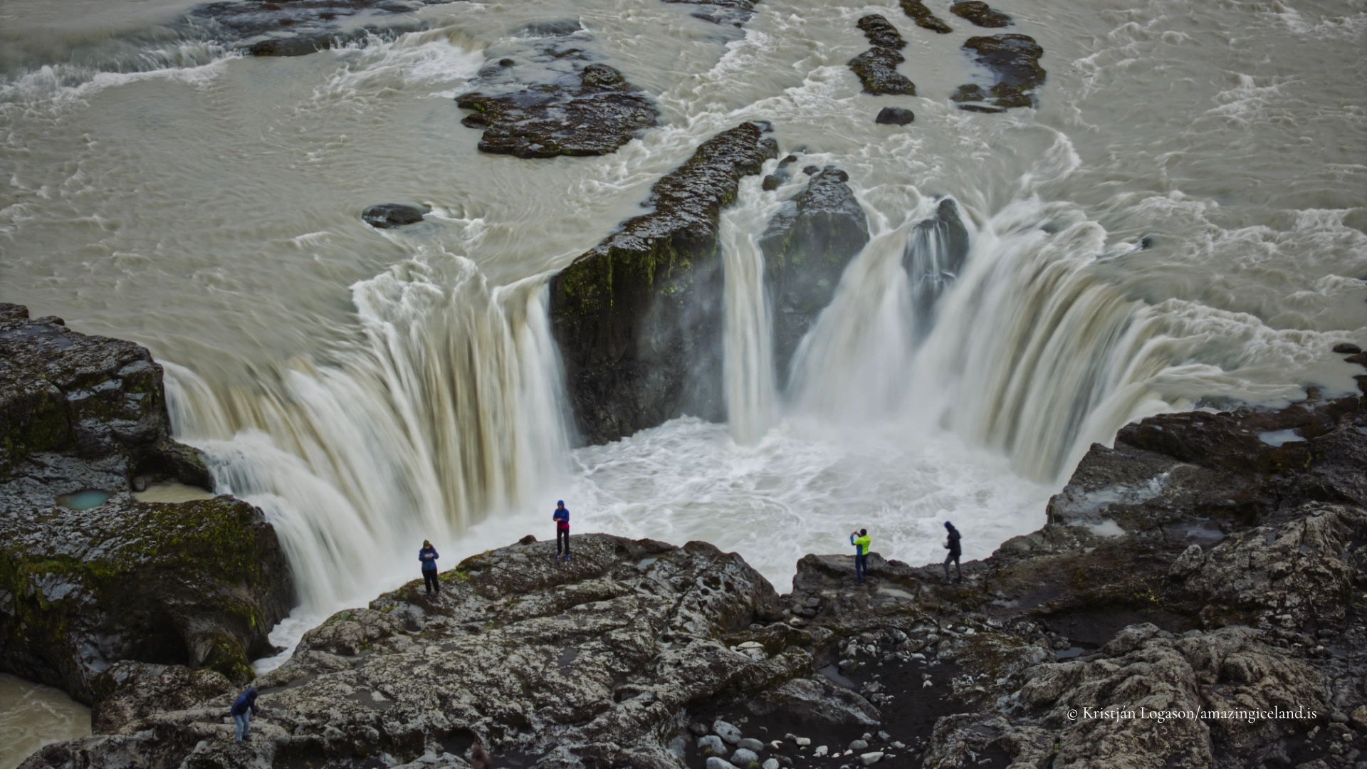
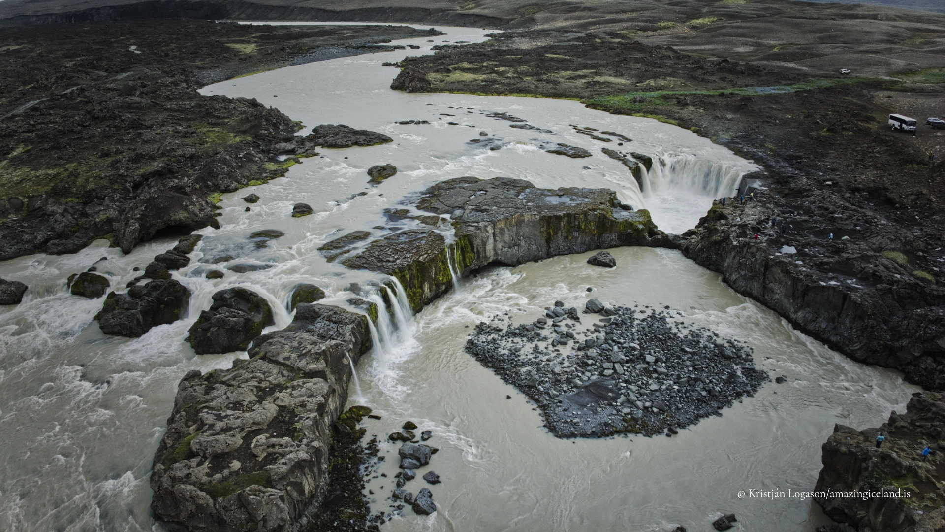
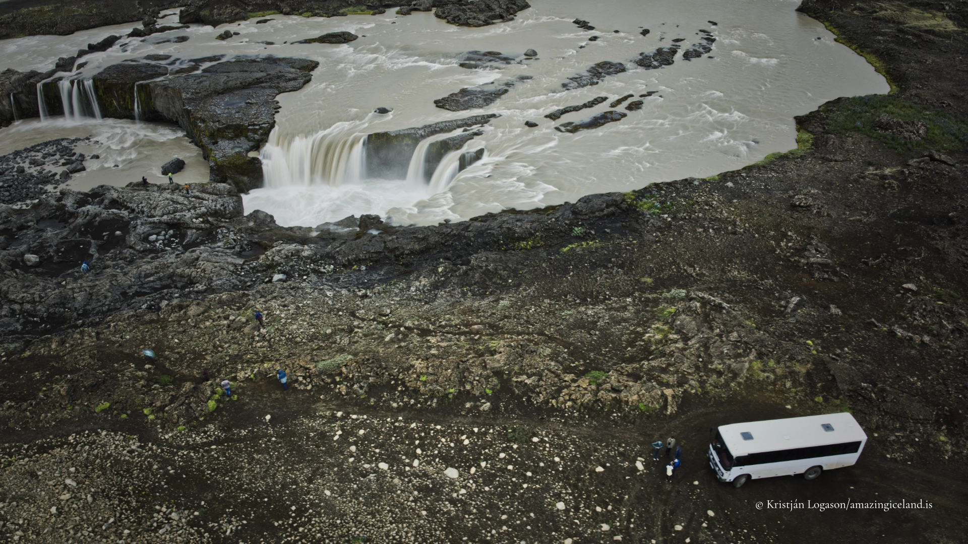
The principal channels descend in separate drops divided by exposed rocks. A central island-like formation interrupts the flow, while parts of the waterfall follow a curved or horseshoe-shaped line. The channels then reunite below the falls as Skjálfandafljót continues north towards Ingvararfoss and Aldeyjarfoss.
This divided structure gives the waterfall a different appearance according to water volume. Individual rock formations and smaller channels may be clear when the river is lower. With greater discharge, separate streams become more forceful and parts of the waterfall may appear to merge. The site should therefore be understood as a waterfall complex rather than reduced to one measured drop.
Figures of approximately five metres are sometimes repeated for its height, but the principal drops may be higher and there is no sufficiently reliable measurement to justify publishing one exact number. Height alone would in any case describe Hrafnabjargafoss poorly. Its most distinctive quality is the width and complexity of the river’s descent.
From normal ground level, visitors see portions of this structure at oblique angles. The river’s complete curve, the relationship between its channels and the central formation become much easier to understand from above. A rock opening or arch is also present within the formation, but it is mainly apparent in aerial views and should not be expected as an obvious feature from the ordinary viewing side.
Rock, water and the form of Hrafnabjargafoss
The basalt at Hrafnabjargafoss determines where the river can flow, but the visible scene is the result of many separate interactions rather than one simple process. Water follows lower sections and weaknesses in the rock, divides around more resistant formations and falls where the riverbed changes level.
It is tempting to explain every channel as evidence of one precise stage of erosion or to compare the waterfall’s supposed hydraulic efficiency with Aldeyjarfoss. The landscape does not require that kind of unsupported theory. What matters is clearly visible: an irregular basalt surface has produced several flow paths, and the river continues to work across all of them.
The amount and colour of the water also change. Skjálfandafljót carries water from the Highlands, and its discharge responds to precipitation, snowmelt and glacial melt. Dark basalt, pale turbulent water and the muted vegetation around the river create a strong visual contrast even under overcast skies. In brighter light, reflections and glare may conceal some of the flow’s structure while revealing colour in the surrounding ground.
The waterfall is active across a wide horizontal space. Sound comes from several directions, and no single viewpoint resolves the whole formation. Moving carefully across the open ground changes which channels overlap and which remain separate. This is part of the experience: Hrafnabjargafoss is understood by looking along it, across it and into individual sections rather than searching for one definitive frontal view.

Upstream from Aldeyjarfoss
Skjálfandafljót flows north through this part of the Highlands. Hrafnabjargafoss is therefore upstream from Aldeyjarfoss, not downstream. Ingvararfoss lies between them on the same river, although it does not have the immediate scale or clearly established visitor stop of the other two waterfalls.
The short geographical separation makes Hrafnabjargafoss and Aldeyjarfoss natural companions on one journey. Their visual differences are especially useful when they are seen on the same day. At Aldeyjarfoss, the river makes a concentrated descent into a clearly defined amphitheatre bordered by columnar basalt. At Hrafnabjargafoss, the river spreads and divides across a broader threshold.
Neither waterfall should be treated merely as an additional viewpoint for the other. Aldeyjarfoss creates a powerful single composition from familiar ground viewpoints. Hrafnabjargafoss asks the visitor to read a more complicated arrangement of channels, rocks and shorter drops. Its wider form is less immediately legible, but that complexity is precisely what distinguishes it.
The name Hrafnabjargafoss comes from Hrafnabjörg, meaning “raven cliffs.” The place-name establishes the connection, but it is unnecessary to turn that into an undocumented claim about a particular history of ravens nesting at the waterfall.
Reaching Hrafnabjargafoss from F26
The northern approach follows Road 842 south through Bárðardalur. Beyond the settled valley, the route becomes F26 before reaching the upper waterfalls. Hrafnabjargafoss lies farther south along F26 than Aldeyjarfoss, and the journey does not normally require a river crossing when approached from Bárðardalur.
A rough final track leaves F26 and can be driven to the stopping place near the river. A high-clearance four-wheel-drive vehicle is recommended for this section. Conditions on an unpaved highland track can change through erosion, wet ground and traffic, so the fact that the track was passable on an earlier visit is not a guarantee for another vehicle or another day.
The stopping area has room for approximately five or six vehicles. The remaining walk is very short, but there is no marked route from the vehicles to the river. Visitors move across open ground and must avoid creating additional vehicle tracks or parking on undisturbed vegetation.
F26 is a highland road whose status changes with snow, thaw, water and road damage. Fixed opening months are therefore misleading. Drivers should check current road and weather conditions before leaving Bárðardalur and be prepared to turn back if the final track is unsuitable.
There are no fuel stations, toilets, food services or other facilities at Hrafnabjargafoss. Visitors should arrive prepared for a remote stop and leave nothing behind.
Viewpoints beside an unprotected river
There are no established paths, viewing platforms, barriers or warning signs at Hrafnabjargafoss. The absence of constructed infrastructure preserves the open character of the site, but it also leaves every visitor responsible for judging the terrain.
The normal viewing side provides several angles across and along the river. The opposite bank is not a practical extension of the visit, and the river should never be treated as something to cross in search of another composition. Fast water, spray, irregular basalt and unprotected drops all require attention.
Visitors can move around on the open ground, but there is no reason to approach the edge closely. Wet rock can be slippery, loose surfaces can shift, and concentrating through a camera makes it easy to lose awareness of footing. This is particularly important when stepping backwards, changing lenses or positioning a tripod.
Because there is no prescribed route, people should use already disturbed ground where possible and avoid trampling unnecessary lines through vegetation. Children and dogs require close control beside the river. Hrafnabjargafoss is not dangerous because it lacks a barrier; it is an unmodified river landscape whose conditions must be read directly.
Interesting facts:
-
- Hrafnabjargafoss lies upstream from Aldeyjarfoss on Skjálfandafljót.
- Ingvararfoss is situated between Hrafnabjargafoss and Aldeyjarfoss, although it is far less conspicuous.
- The waterfall is a broad complex of separate channels and short drops rather than one single vertical fall.
- A central island-like rock formation divides the river before the channels gather again downstream.
- A rock opening or arch is part of the formation, but it is seen most clearly from the air.
- Hrafnabjargafoss takes its name from Hrafnabjörg, or “raven cliffs.”
- The final stopping area accommodates approximately five or six vehicles and has no signs, paths, barriers or facilities.
Image Gallery

Photography tips:
-
- Begin with a wide view that shows the complete segmented waterfall. The relationship between the channels is more important here than isolating one dramatic drop.
- Aerial views are especially informative because they reveal the curved line of the falls, the central formation, the divided channels and the rock arch. Drone use must follow current aviation and local land-use rules.
- From the ground, work with oblique views along the river. Changing position can separate channels that overlap from a more frontal angle.
- Use a faster shutter speed when the different directions and textures of the flow are important. Frozen spray and broken water help explain how the river moves through the rocks.
- Slower exposures can simplify the scene, but excessive smoothing may erase the structure that makes Hrafnabjargafoss distinctive.
- Overcast light helps retain detail in both pale water and dark basalt. Low directional light can reveal the shape of the rocks and the relief between neighbouring channels.
- A polarising filter can reduce glare and strengthen visibility into wet surfaces, but removing every reflection can also make the river appear lifeless.
- A person or vehicle can establish scale when placed on safe, stable ground. No photograph requires anyone to stand near the edge.
- Keep tripod legs well away from loose ground and remain aware of the river while looking through the camera or at a screen.
Destinations nearby