Hljóðaklettar – Inside the Remains of Ancient Volcanoes
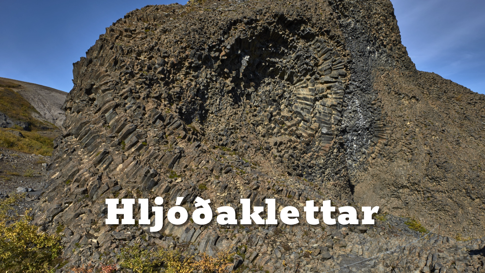
Hljóðaklettar is a collection of extraordinary basalt formations in Vesturdalur, within the northern part of Vatnajökull National Park. Columns bend, twist and spread in different directions. Some form walls and arches, while others surround dark hollows and cave-like spaces.
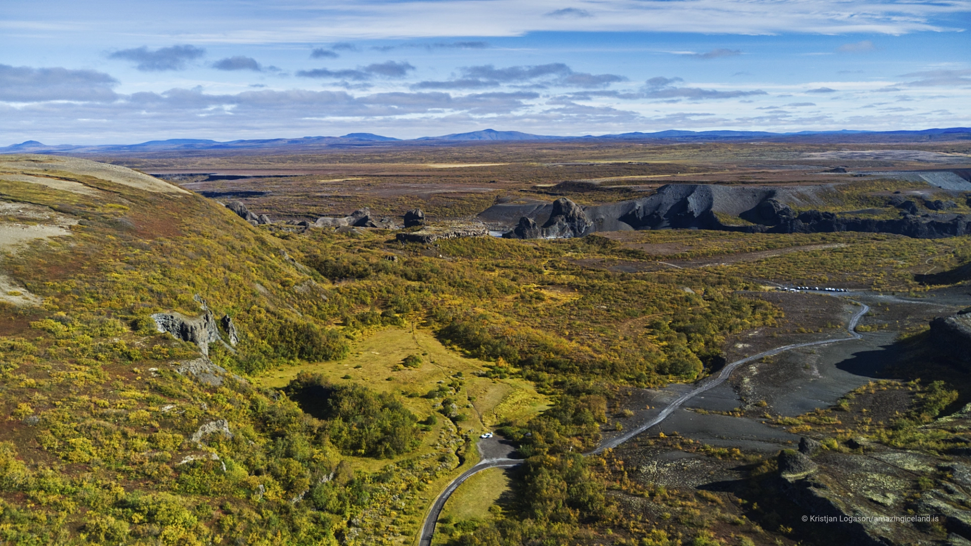
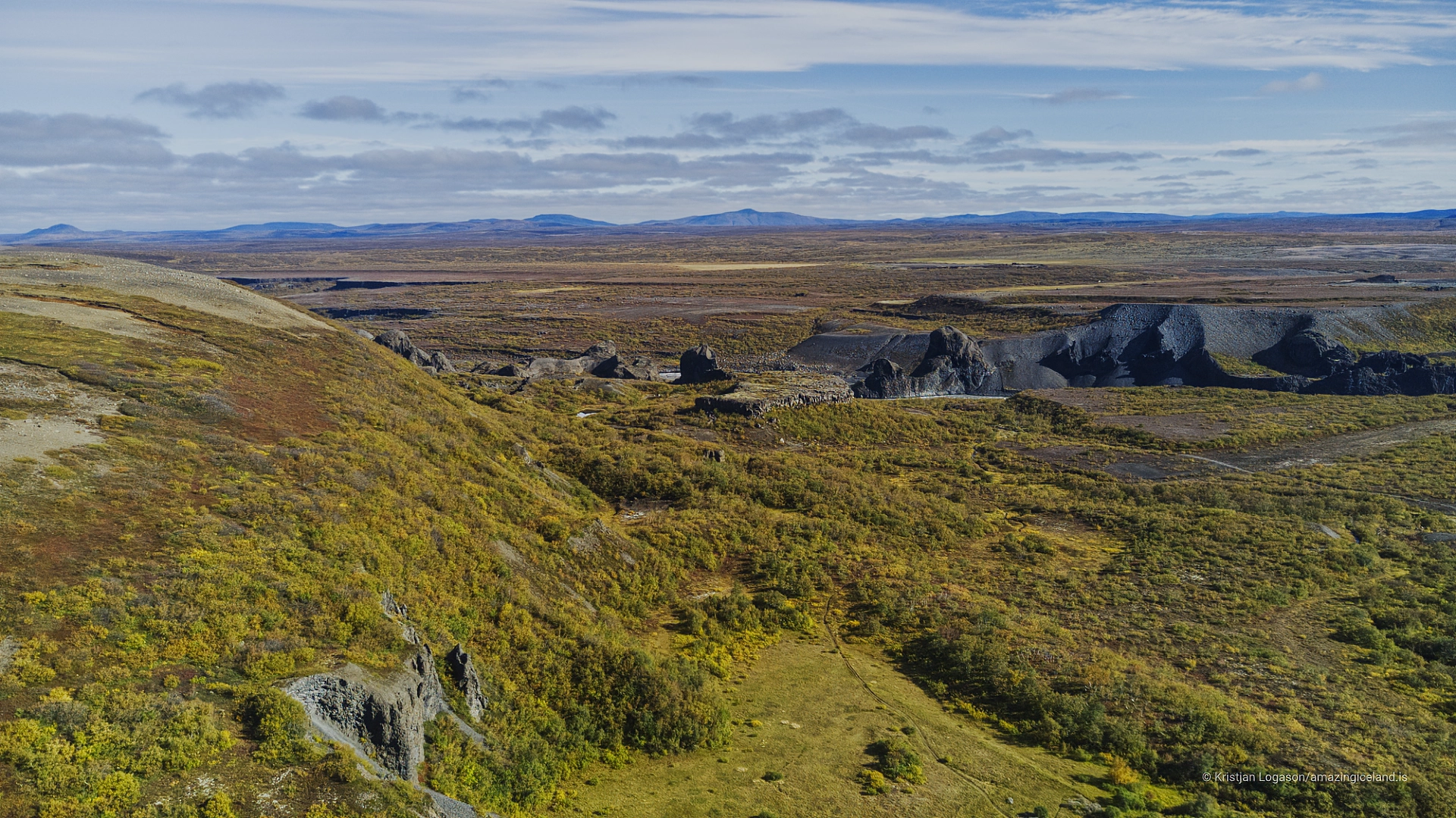
These are not simply unusually shaped cliffs beside Jökulsá á Fjöllum. Hljóðaklettar preserves the resistant internal structures of ancient volcanic craters. The river gradually removed much of the softer material that once surrounded them, exposing the complex basalt architecture within.
The Icelandic name means approximately the Sound Rocks. Voices, footsteps, wind and the distant river are reflected between irregular walls, hollows and openings. The effect changes as visitors move, and sound can seem to arrive from an unexpected direction.
A short route reaches the first formations, but visitors capable of managing rough and rocky ground should walk the complete three-kilometre Hljóðaklettar loop. Almost every turn reveals a different arrangement of columns, colours and volcanic forms.
The location of Hljóðaklettar – Inside the Remains of Ancient Volcanoes
Latitude
65.9489
Longitude
-16.5146
Hljóðaklettar – Inside the Remains of Ancient Volcanoes
The Exposed Interiors of Ancient Craters
Hljóðaklettar belongs to the Jökulsárgljúfur canyon system formed and repeatedly transformed by Jökulsá á Fjöllum.
The river begins beneath Vatnajökull and flows north across a highly active volcanic landscape. Over time, erosion and immense glacial floods cut deeply into the terrain, removed loose volcanic deposits and revealed older structures that would otherwise have remained buried.
At Hljóðaklettar, that erosion exposed the solid interiors of ancient volcanic craters.
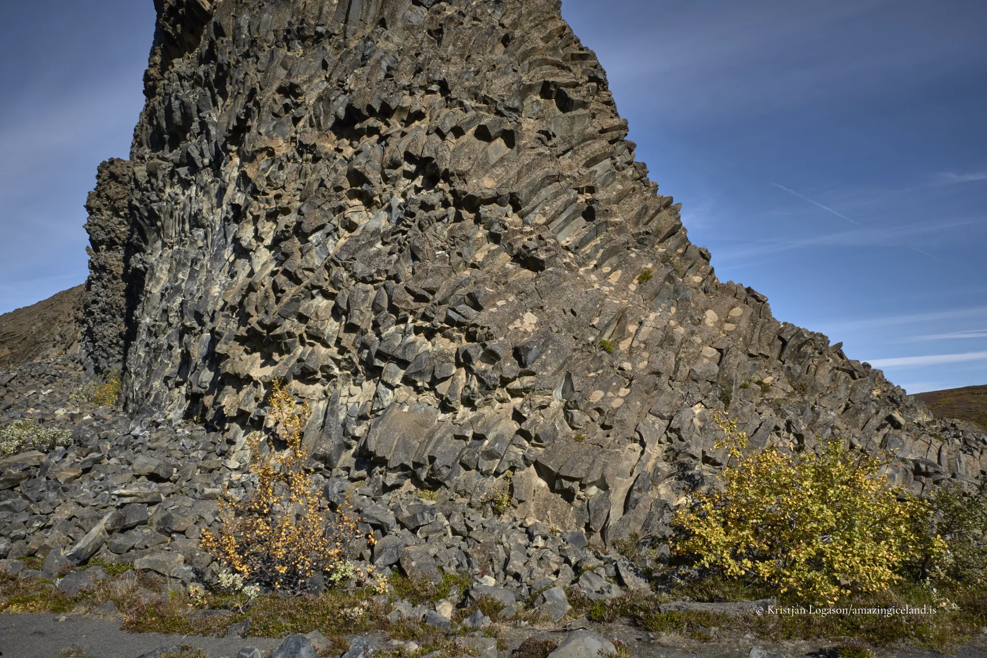
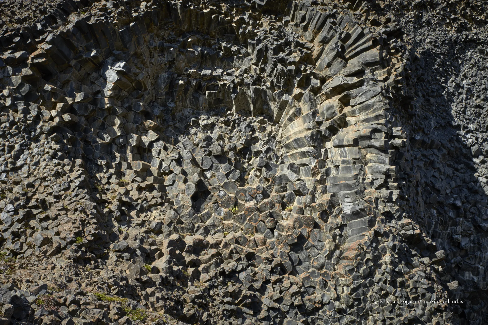
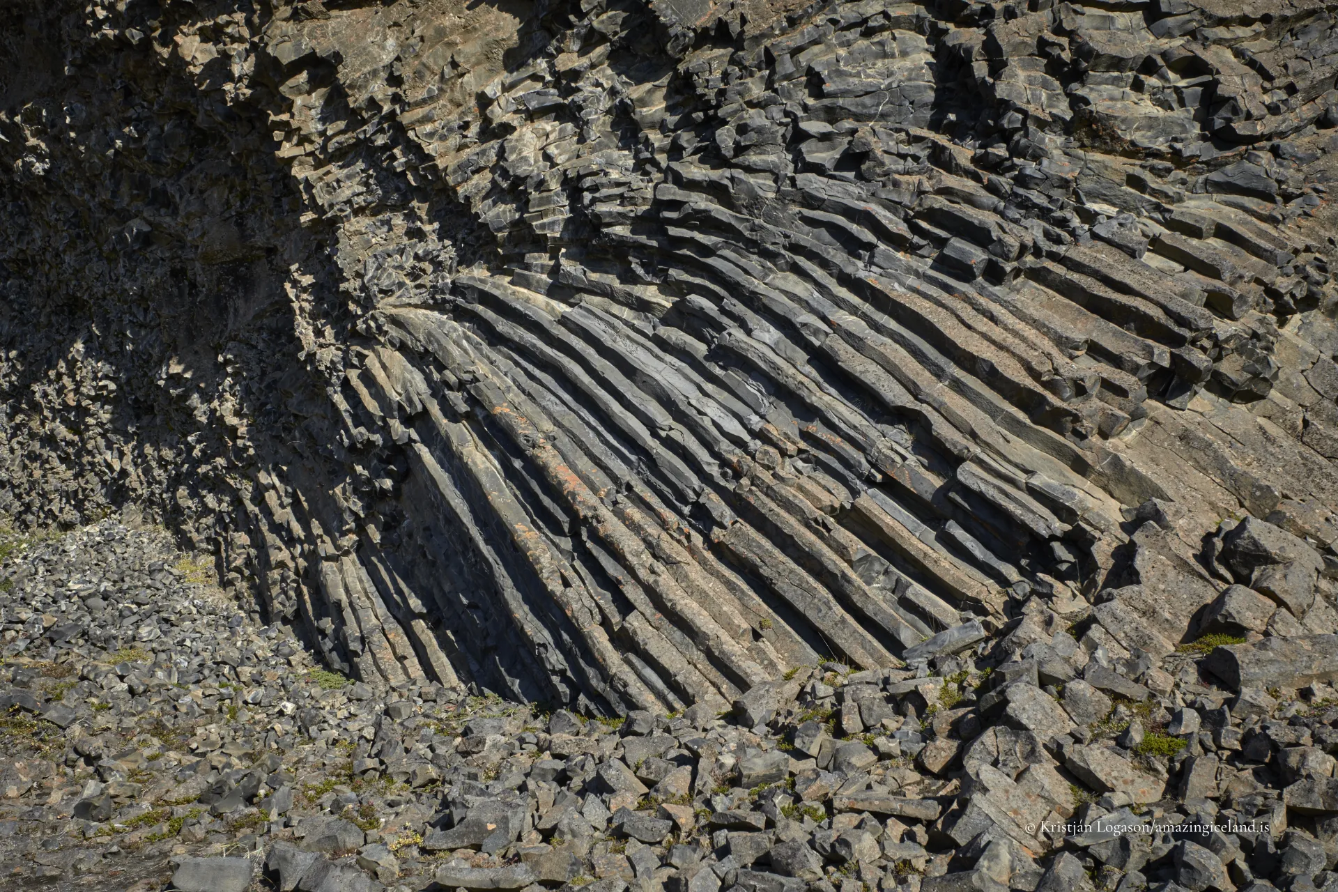
When molten material cooled within and around the craters, contraction divided it into columns. Basalt columns form in relation to the surfaces from which the material loses heat. Because the cooling surfaces inside these volcanic structures were irregular, the columns did not all develop vertically.
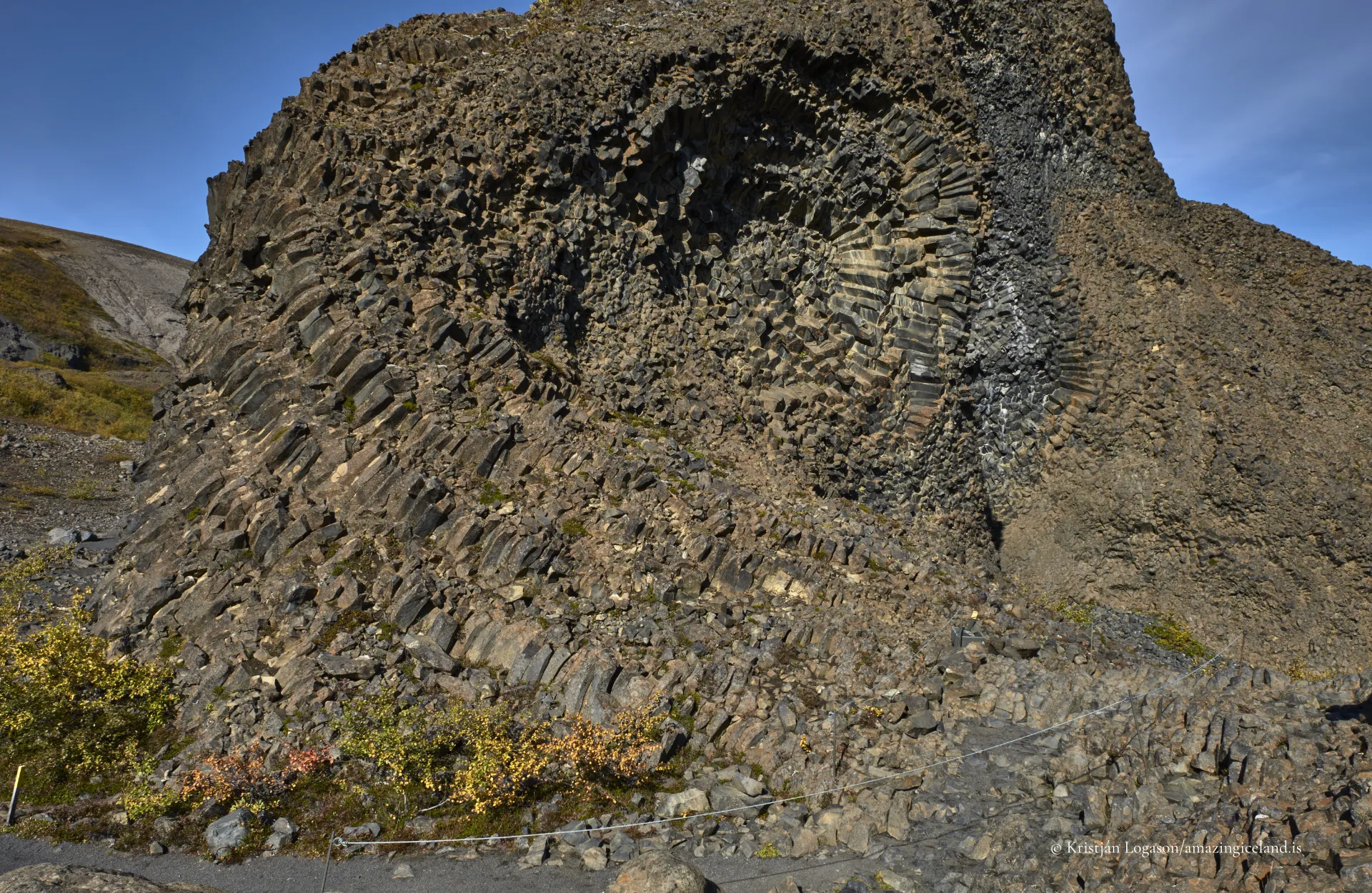
This helps explain the remarkable geometry visible today. Columns radiate away from former cooling surfaces, turn through the rock and meet other arrangements. What now appears as a cliff, wall or hollow may represent only one surviving part of a much larger volcanic structure.
The softer material that once gave the formations more recognisable crater shapes has largely disappeared. What remains is their resistant internal framework. Visitors are not walking among complete volcanoes, but through fragments exposed after the surrounding material was stripped away.
Columns, Colour and Sound
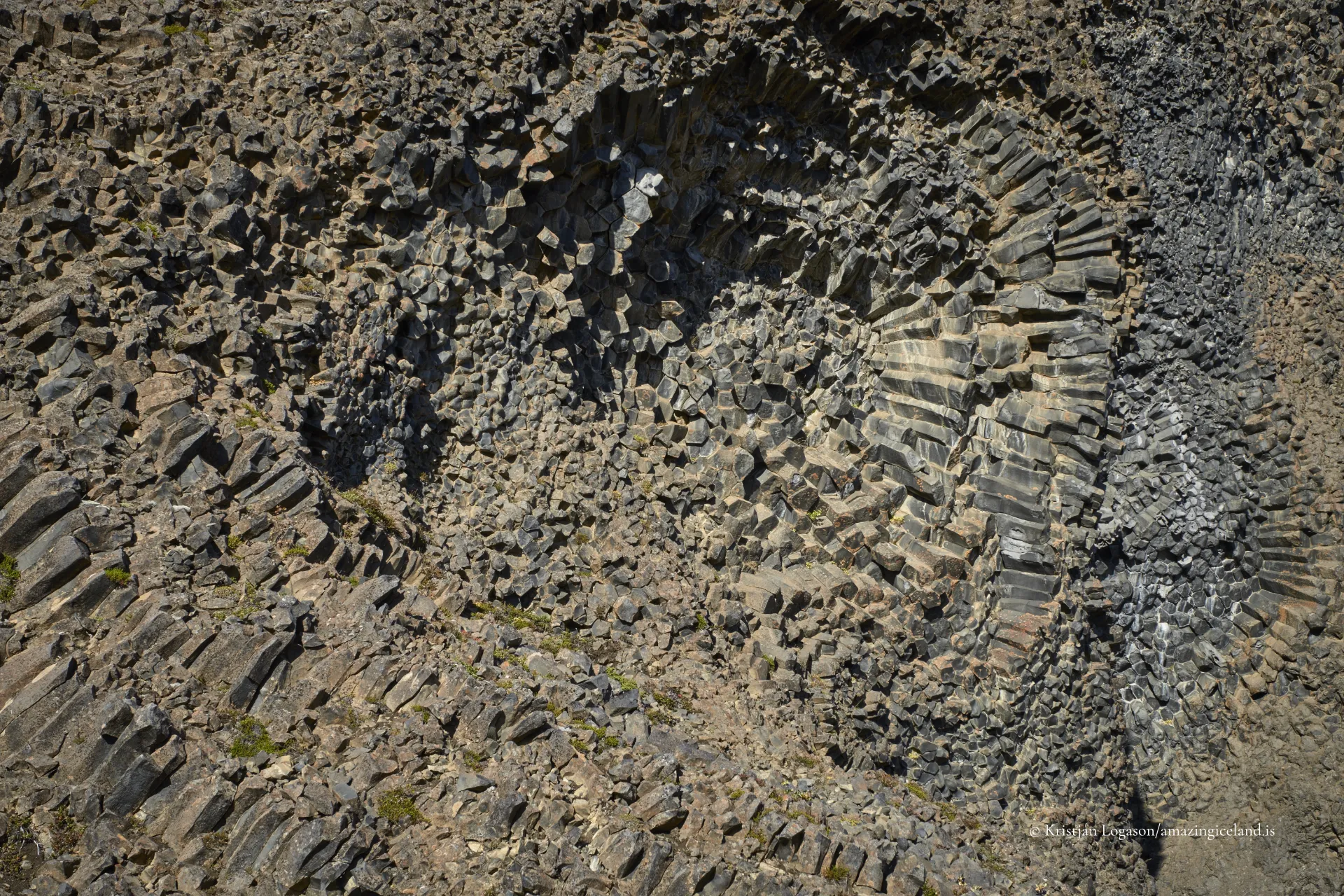
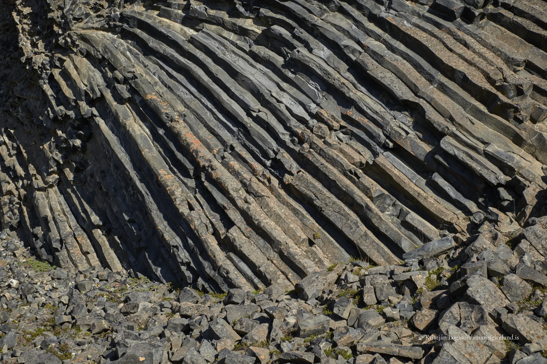
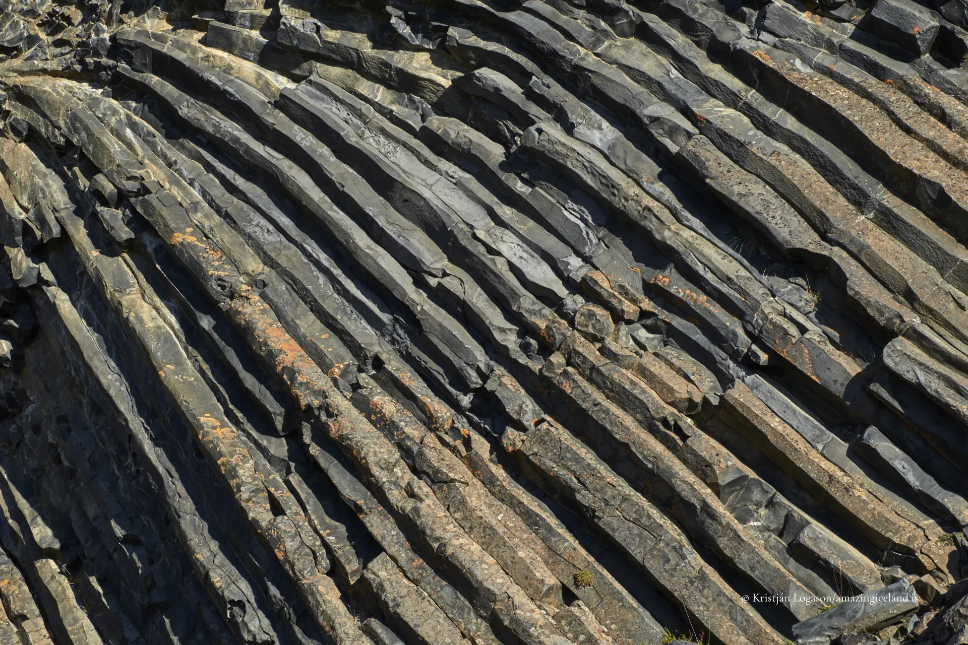
Basalt columns define Hljóðaklettar, but they do not repeat a single pattern. Some rise almost vertically. Others lie across the rock face, curve around cavities or spread outwards from a central point. Broken ends form tightly fitted polygons, while the sides of the columns draw long parallel lines across the cliffs.
Several patterns can occupy the same formation. Columns that appear orderly when examined closely become part of a much more complicated structure from farther away.
Colour adds another layer. The basalt ranges from dark grey and black to warmer brown and reddish tones. Mosses, grasses and low vegetation introduce green and yellow, while pale lichen softens some older surfaces.
The Icelandic word hljóð means sound, while klettar means cliffs or rocks. The name describes a real quality of the formations, although it should not be turned into a promise of one dramatic echo at a particular place.
Sound changes as visitors move between the irregular cliffs, caves and hollows. A voice may return from a rock wall, footsteps may sound closer than expected, and wind can pass through openings without an immediately obvious source. The sound of Jökulsá á Fjöllum may be a distant continuous presence in one place and partly concealed by rock in another.
The effect depends on position, weather, the river and how many people are present. Visitors do not need to shout to test the name. Ordinary voices and footsteps are enough, particularly when the formations are quiet.

Tröllið and the Complete Hljóðaklettar Loop
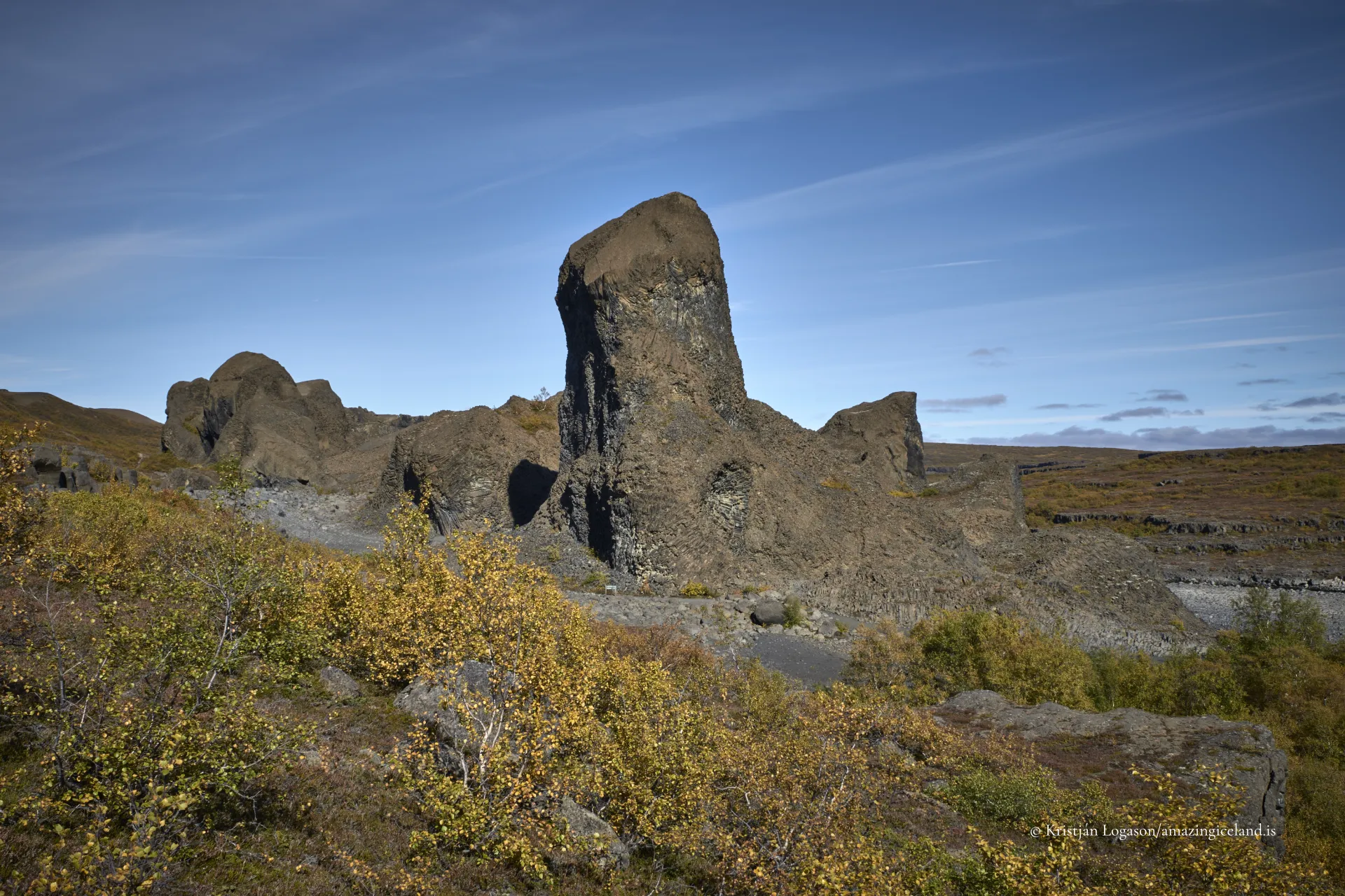
The shortest official walk leads from the Hljóðaklettar parking area to Tröllið and back. It is approximately 1.2 kilometres and usually takes around 30 minutes, depending on how long visitors spend examining the formations.
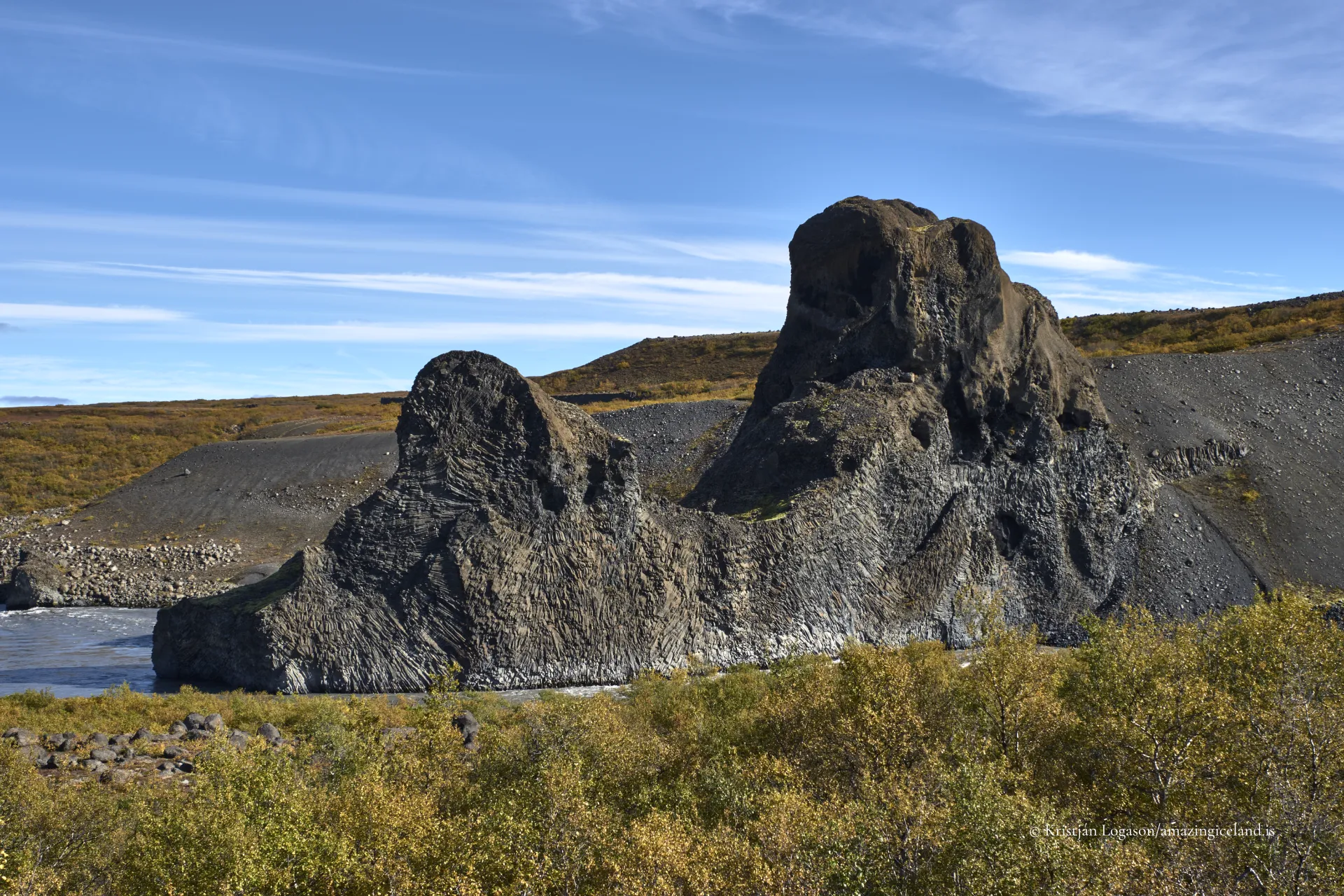
Tröllið—the Troll—is the first individually named formation reached from the parking area. Its columns immediately demonstrate that Hljóðaklettar is unlike a conventional basalt cliff.
The short route provides a useful introduction for visitors with limited time or those who do not wish to undertake the rougher complete circuit. It does not, however, show the full range of Hljóðaklettar.
The principal Hljóðaklettar loop is approximately three kilometres long and normally takes between one and one and a half hours. Photographers and visitors who stop frequently should allow considerably longer.
The official route is rated challenging, but it is not a technical climb. Its difficulty comes mainly from rough, rocky and uneven ground, changes in elevation and the need to watch each step through complicated terrain. Good footwear and reasonable balance are important, and wet conditions make soil and rock more slippery.
The complete loop is strongly recommended for those capable of walking it. Beyond Tröllið, the formations continue to change. The circuit reveals Hljóðaklettar as a connected volcanic landscape rather than a single unusual cliff near a parking area.
Kirkjan, Skuggaklettur, Rauðhólar and the Named Formations
Kirkjan—the Church—is among the best-known places on the main loop. It is a large cave-like opening with a high, pointed interior resembling a vaulted church. Curving basalt columns rise and turn around the hollow as though the structure had been deliberately assembled.
The comparison is architectural rather than religious. Kirkjan is one of the clearest places to see how the direction of the columns responds to the shape of a formation. Daylight entering from outside creates strong contrast: the entrance and sky may be bright while much of the interior remains dark.
The return section of the loop passes Skuggaklettur, or Shadow Rock, with hollows and caves in the basalt. The names are not always prominently displayed on signs, and visitors can understand Hljóðaklettar without identifying every formation. Tröllið, Kirkjan and Skuggaklettur nevertheless show how people have recognised figures, forms and character within the geology.
The longer Rauðhólar loop is approximately five kilometres and normally takes between one and a half and two hours. It adds the red and brown colours of oxidised volcanic material, higher ground and wider views across Vesturdalur to the detailed formations at Hljóðaklettar.
Karl and Kerling—the Old Man and Old Woman—are two named rock pillars closer to Jökulsá á Fjöllum elsewhere in Vesturdalur. They are reached on a separate walk and should not be mistaken for features on the main Hljóðaklettar circuit. A traditional explanation identifies them as trolls caught by daylight and turned to stone.
The Longer Hike from Ásbyrgi
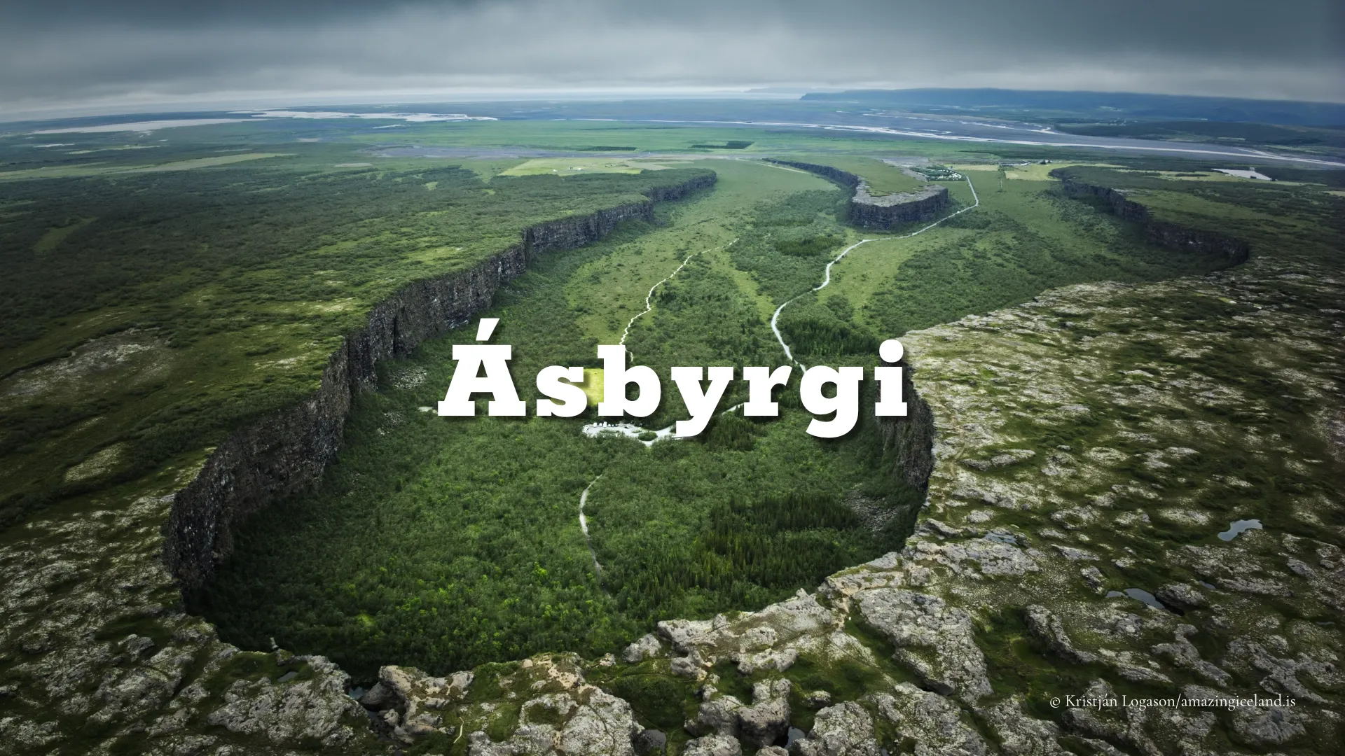
Hljóðaklettar can also be reached as part of a longer hike through Jökulsárgljúfur from Ásbyrgi. This route caused confusion in the former version of this page: Hljóðaklettar is not a short walk from Ásbyrgi.
The hike from Ásbyrgi is a much longer, one-way section connecting separate parts of the national park. It is entirely different from the three-kilometre loop beginning at the Hljóðaklettar parking area.
Walking from Ásbyrgi gives a deeper understanding of Jökulsárgljúfur by connecting the horseshoe-shaped canyon, the changing river landscape and Hljóðaklettar on foot. It also requires substantially more planning than driving into Vesturdalur.
Hikers must consider the full distance, weather, food and water, seasonal trail conditions and transport from the far end. It should not be presented as a casual extension of a visit to Ásbyrgi or attempted on the assumption that it returns to the starting point.
Visitors arriving by car instead drive south from the Ásbyrgi area on Route 862 and take the branch into Vesturdalur. Hljóðaklettar lies approximately 15 kilometres from Ásbyrgi by road.
Summer Access and Facilities in Vesturdalur
The road from Route 862 into Vesturdalur and towards the principal parking area is now paved. The drive is straightforward during the normal summer season, but access remains strongly seasonal.
Route 862 through this area is generally closed or effectively unavailable during winter, while the branch descending into Vesturdalur is completely closed. A paved surface does not make it a year-round road.
Opening dates cannot be assumed from the calendar. Snow, thawing ground and current road conditions determine when the route becomes usable. Visitors travelling early or late in the season should check official road information and Vatnajökull National Park notices before setting out.
The walks begin at the eastern parking area in Vesturdalur. There are no toilets at the Hljóðaklettar trailhead itself. Facilities are available at the nearby Vesturdalur campground, which is only a short distance from the parking area.
Weather can change quickly. Rain deepens the colour of the formations but makes rock and soil slippery, while wind becomes more noticeable on exposed and higher sections. Visitors should carry rain protection and an additional layer even on a short walk. Frequent stops, especially for photography, can make the route take much longer than the official walking time.
Staying on the Paths
Visitors are asked to remain on marked paths throughout Hljóðaklettar. Small signs reinforce this instruction around vulnerable areas.
The basalt formations may look solid, but the surrounding vegetation, loose volcanic material and thin soils are easily damaged. Informal shortcuts widen quickly and encourage other visitors to follow. Rauðhólar is particularly vulnerable, and closed areas must be respected.
Remaining on the path also reduces the risk of falls. It is easy to become absorbed by the direction of the columns while overlooking loose stones, sudden changes in height or rough ground beneath one’s feet.
Visitors should not climb onto formations to obtain a viewpoint, enter closed areas, scratch the rock or remove pieces of basalt. A photograph does not justify stepping beyond the trail or placing equipment on fragile ground.
The formations have survived the removal of the volcanic material that once surrounded them, repeated glacial floods and centuries of weathering. That geological endurance does not mean every surface can withstand concentrated modern foot traffic.
A Landscape That Resists a Single View
There is no one viewpoint from which Hljóðaklettar becomes fully understandable. Its character emerges gradually as visitors walk between formations and see the columns from changing directions.
Light can reorganise the same scene within minutes. Direct sun separates column edges with hard shadows. Overcast conditions reveal subtler variations in rock, vegetation and colour. Inside Kirkjan and other hollows, daylight may illuminate one surface while the surrounding structure remains almost black.
The abundance of visual information is part of the experience. Curves intersect, cliffs overlap and dark rock breaks against vegetation and bright sky. The eye moves through these relationships and assembles them over time; a single photograph has to select one fixed arrangement.
That difficulty is appropriate to the place. Hljóðaklettar is not one symmetrical basalt wall, but the surviving internal architecture of ancient volcanoes, fragmented and exposed by a powerful glacial river.
Visitors do not need to resolve the entire landscape at once. Walking slowly, looking from several positions and allowing the separate structures to emerge is the best way to understand what erosion has revealed.
Interesting facts:
-
- Hljóðaklettar preserves the resistant internal structures of ancient volcanic craters whose softer surrounding material was removed by Jökulsá á Fjöllum.
- Irregular cooling surfaces caused basalt columns to form in many directions rather than only vertically.
- The name can be understood as the Sound Rocks, referring to the way sound reflects between irregular walls, caves and hollows.
- Tröllið is the first named formation reached from the parking area.
- Kirkjan is a high, cave-like formation whose curved columns and pointed interior resemble a vaulted church.
- Skuggaklettur is encountered on the return part of the main loop.
- The short walk to Tröllið and back is approximately 1.2 kilometres.
- The recommended Hljóðaklettar circuit is a three-kilometre loop over rough and rocky ground.
- The longer five-kilometre Rauðhólar loop adds oxidised colours, higher ground and broader views of Vesturdalur.
- Karl and Kerling are named pillars on a separate walk elsewhere in Vesturdalur, not on the main Hljóðaklettar loop.
- Hljóðaklettar can form part of a longer one-way hike from Ásbyrgi, but it is not a short walk from the canyon.
- The paved road into Vesturdalur remains seasonal, and the descending branch is closed in winter.
Image Gallery
Photography tips:
-
- Expect Hljóðaklettar to be difficult to photograph. The challenge is not finding a subject but organising overlapping columns, cliffs, vegetation, colour and bright sky into a coherent frame.
- Identify one relationship before making a wide image: a curve around an opening, a path between formations, or the contrast between red volcanic material and dark basalt. Wide views become confused easily.
- Look for tighter compositions where column ends form polygons or one set of columns changes direction. Details can explain the geology more clearly than an entire cliff.
- Remember scale. Abstract studies can make a large formation resemble a small rock surface. A person can establish size, but should be placed deliberately and photographed with permission when recognisable.
- In Kirkjan, protect useful detail around the bright entrance without trying to reveal every shadow. Darkness describes the depth and shape of the formation.
- Overcast light reduces contrast and reveals colour and structure. Low, direct side light can emphasise texture, but broken midday light often makes complicated scenes harder to organise.
- Rain darkens basalt and strengthens brown, red and green tones. Wet surfaces may reflect light strongly, so use a polarising filter selectively rather than automatically.
- Change position by a few steps before changing equipment. A small movement can separate overlapping columns, remove bright sky or reveal a curve hidden from the previous angle.
- A tripod may be useful in low light only where it can remain entirely on durable ground without blocking the path. Other visitors and trail protection take priority.
- Do not climb or leave the marked path for a photograph. The strongest viewpoint is not worth damaging fragile ground or encouraging others to follow.
Destinations nearby