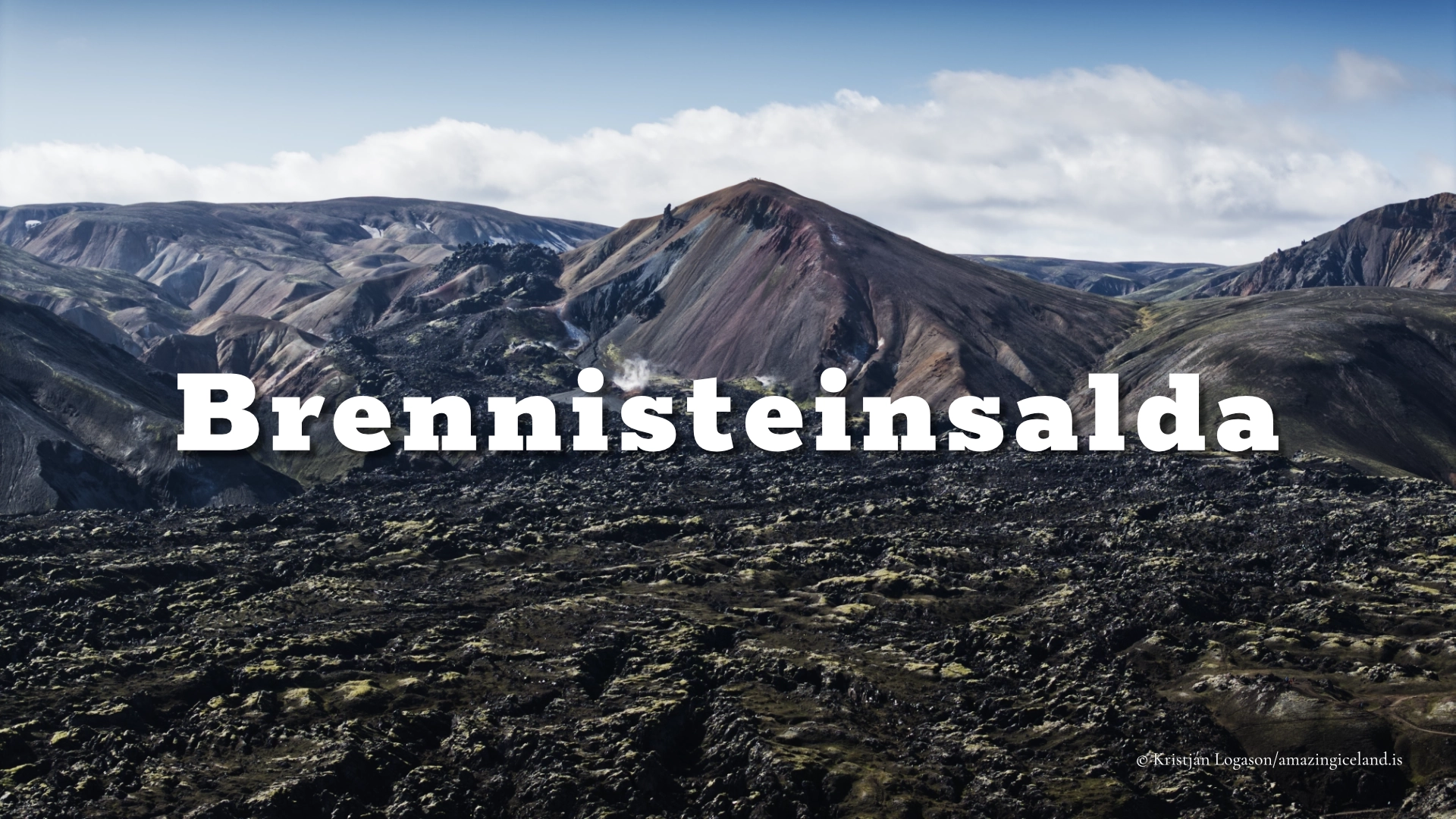
Brennisteinsalda in Landmannalaugar Nature Reserve
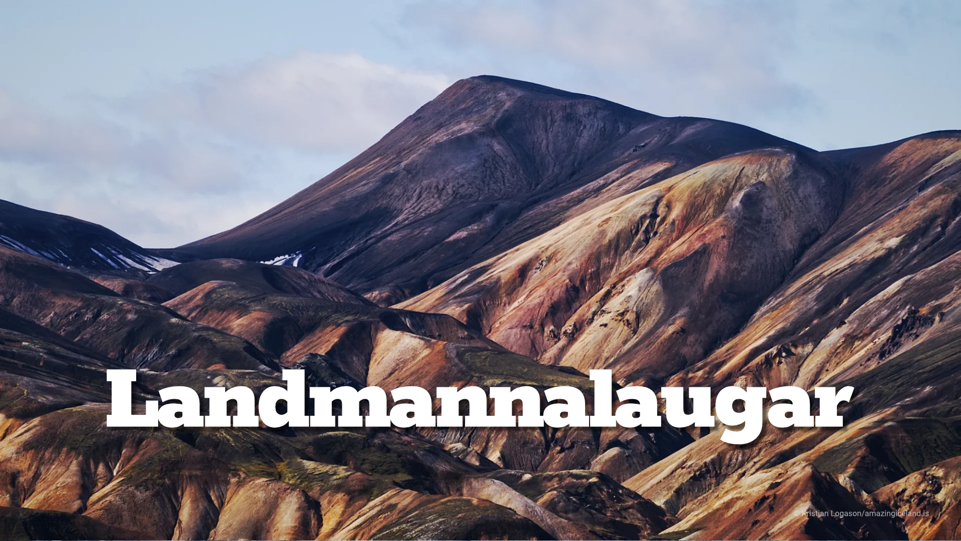
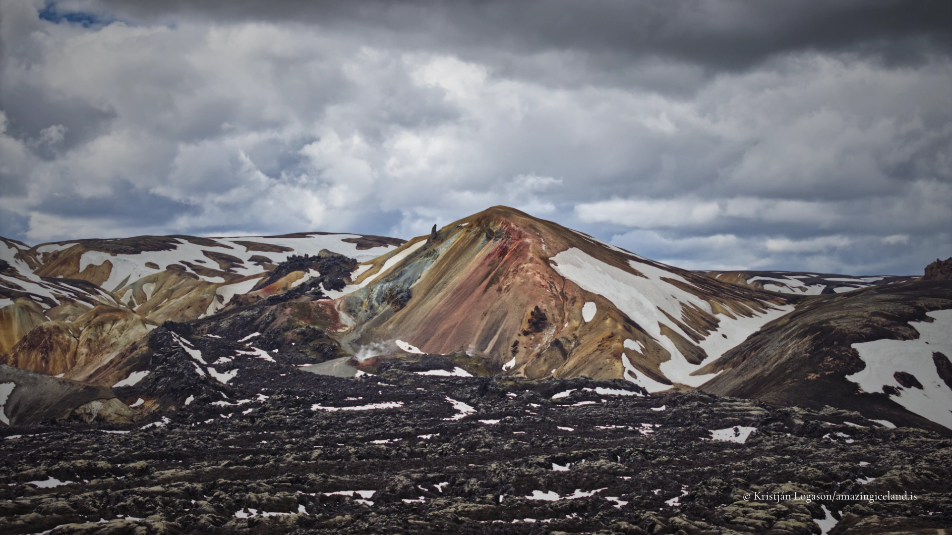
Brennisteinsalda is often called Iceland’s most colourful mountain, but colour alone does not explain it. Its slopes are a visible record of rhyolitic volcanism, geothermal heat, mineral alteration, erosion and plant life. Reds and yellows meet pale grey, green and almost black surfaces, while steam rises from the ground below. The colours change again with rain, cloud and sunlight, so the mountain rarely appears exactly as photographs have promised.
The climb begins in Landmannalaugar and follows part of the traditional Laugavegur trail before a marked path branches towards the summit. At approximately 855 metres, Brennisteinsalda is not among Iceland’s highest mountains, but its position provides an exceptional view across Laugahraun, Vondugil and the surrounding rhyolite peaks. The ascent is best understood as part of a loop rather than a single climb up and down: a walk through several different expressions of the Torfajökull volcanic system.
The location of Brennisteinsalda in Landmannalaugar Nature Reserve
Latitude
64.0456
Longitude
-19.2589
Brennisteinsalda in Landmannalaugar Nature Reserve
A rhyolite mountain in the Torfajökull system
Brennisteinsalda belongs to the Torfajökull volcanic system, which contains Iceland’s largest area of exposed rhyolite. Most of Iceland is basaltic, formed from relatively fluid, dark lava. Rhyolitic magma contains more silica and behaves differently. It is more viscous and can produce explosive eruptions, ash, pumice and lava with a much lighter and more varied appearance.
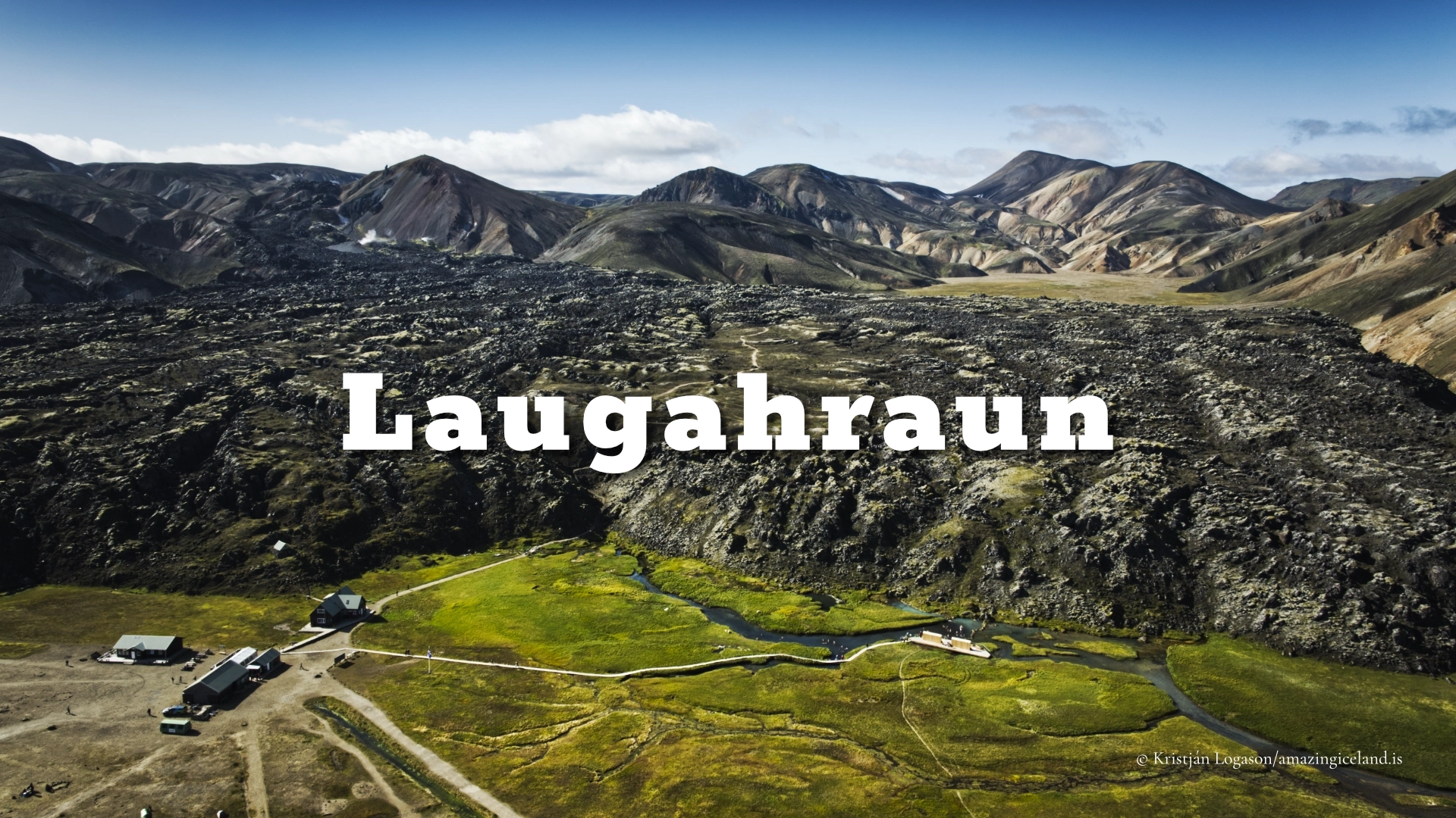
The mountain itself is older than the black Laugahraun lava beside it. This distinction matters because the landscape places volcanic products of very different ages almost against one another. Brennisteinsalda is part of the older rhyolitic terrain, while Laugahraun formed during the 1477 Veiðivötn–Torfajökull volcanic episode.
That episode involved connected activity in the Bárðarbunga and Torfajökull systems. The rhyolitic eruption that produced Laugahraun belongs to Torfajökull, but the lava should not automatically be described as having erupted from Brennisteinsalda itself. The mountain and lava field stand together visually without being the same geological feature.
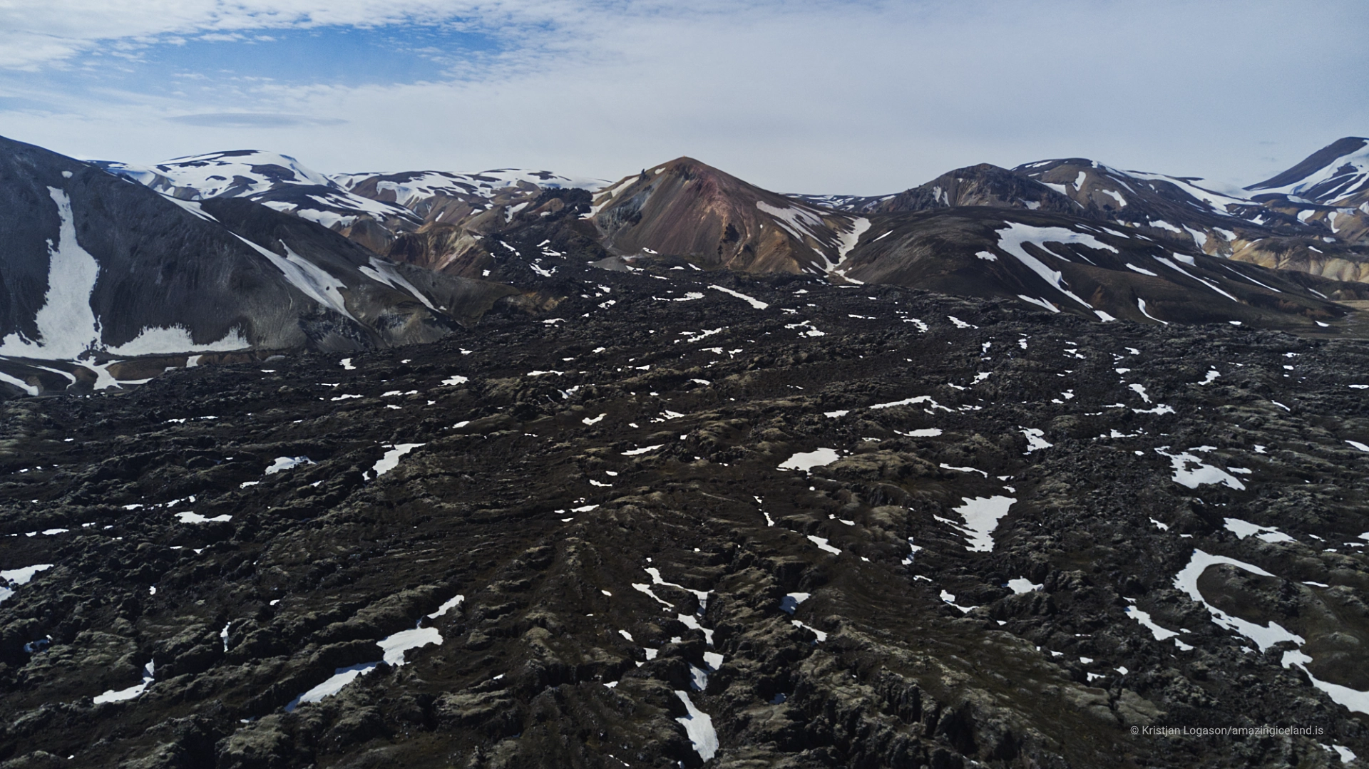
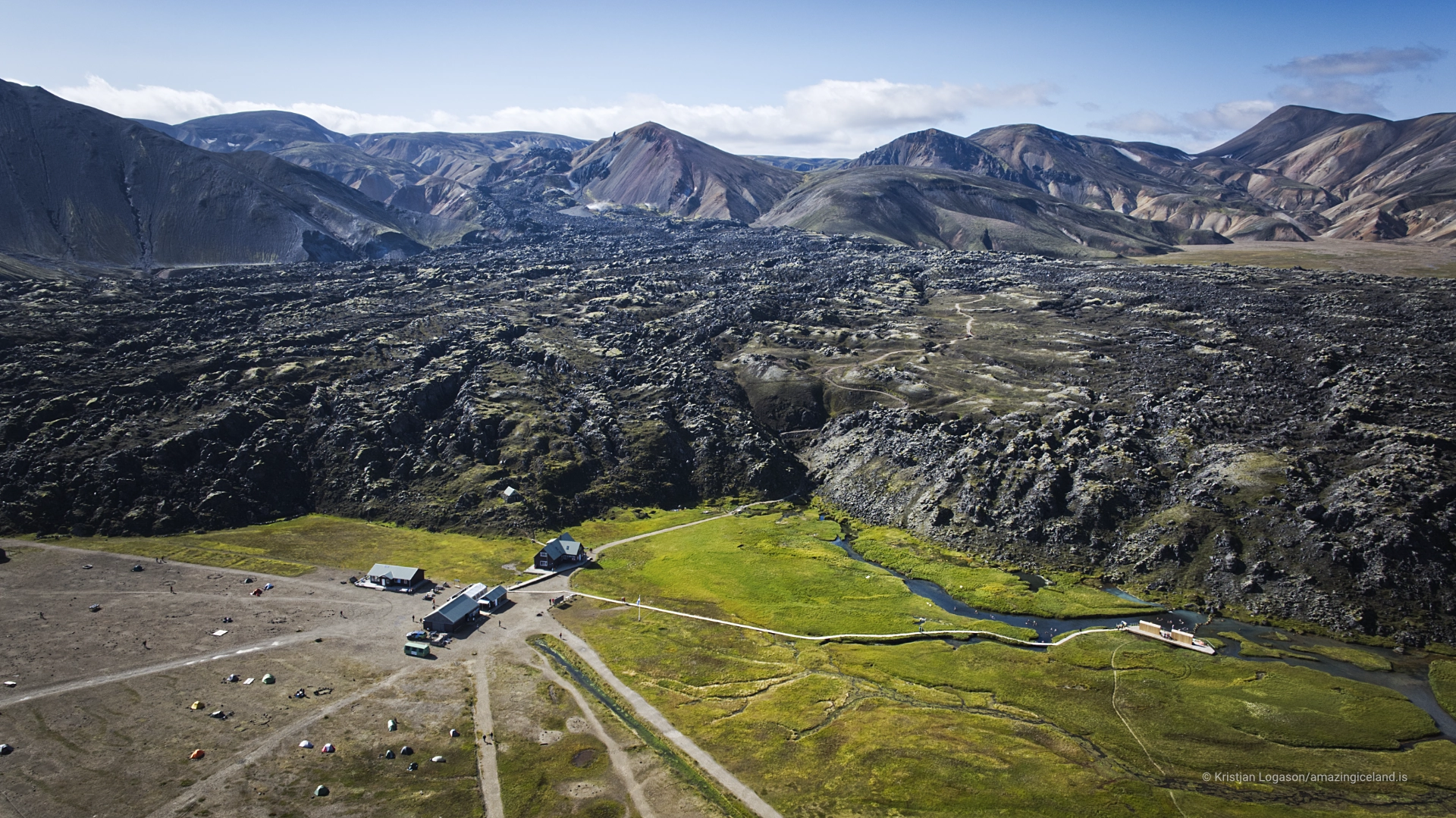
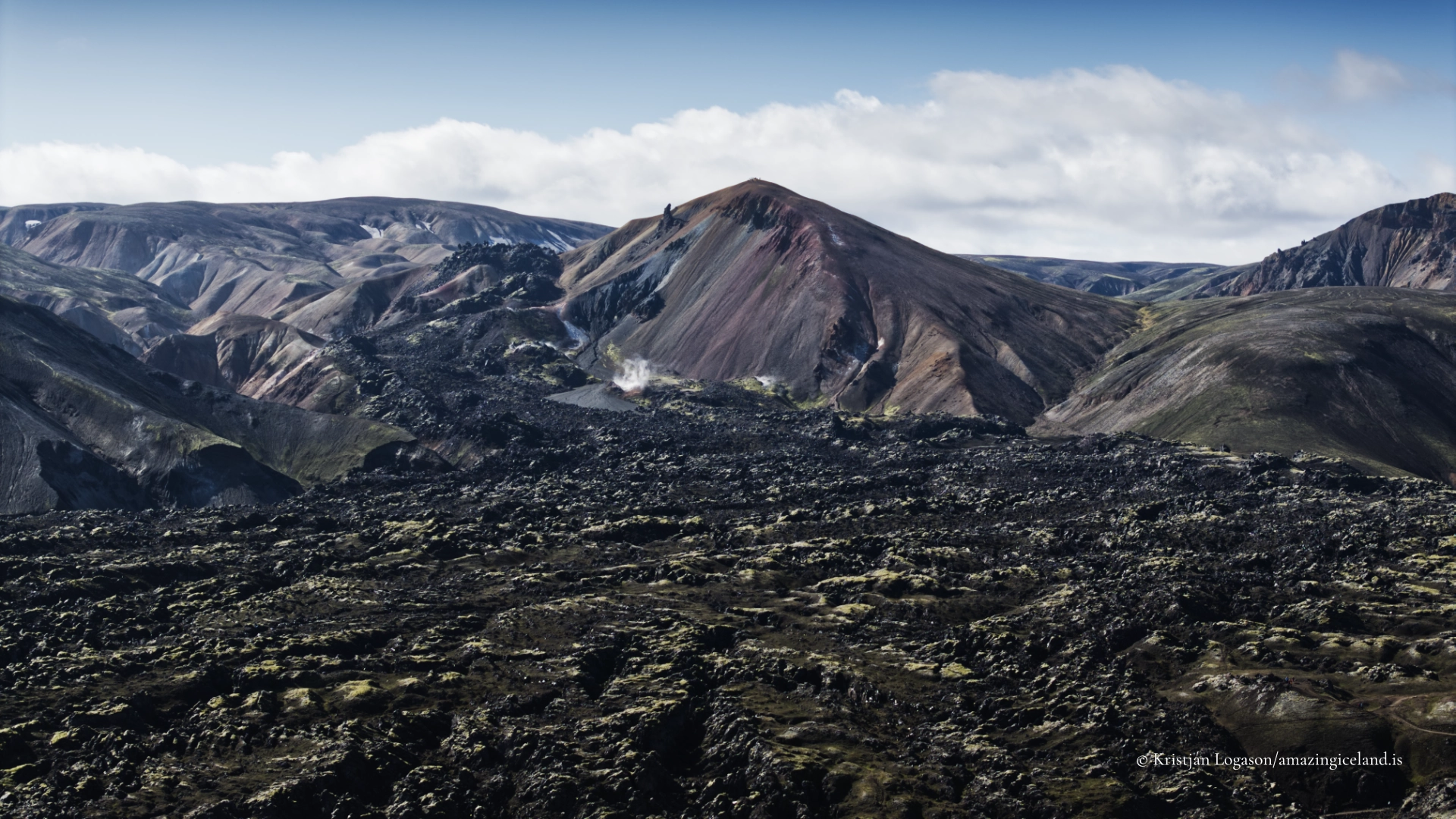
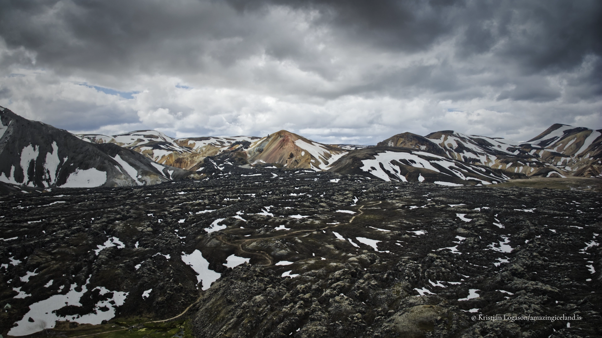
This contrast is particularly clear from higher ground. The coloured, deeply eroded slopes of Brennisteinsalda rise beside the younger and darker lava, allowing visitors to see that “volcanic landscape” does not describe a single kind of rock, eruption or moment in time.
Why Brennisteinsalda changes colour
The name draws attention to sulphur, but sulphur alone does not create the mountain’s full palette. Brennisteinsalda’s appearance comes from several processes working together: the natural colour of rhyolite, oxidation of iron, minerals formed as geothermal fluids alter the rock, sulphur deposited near vents, darker ash and exposed rock, and vegetation growing where conditions allow.
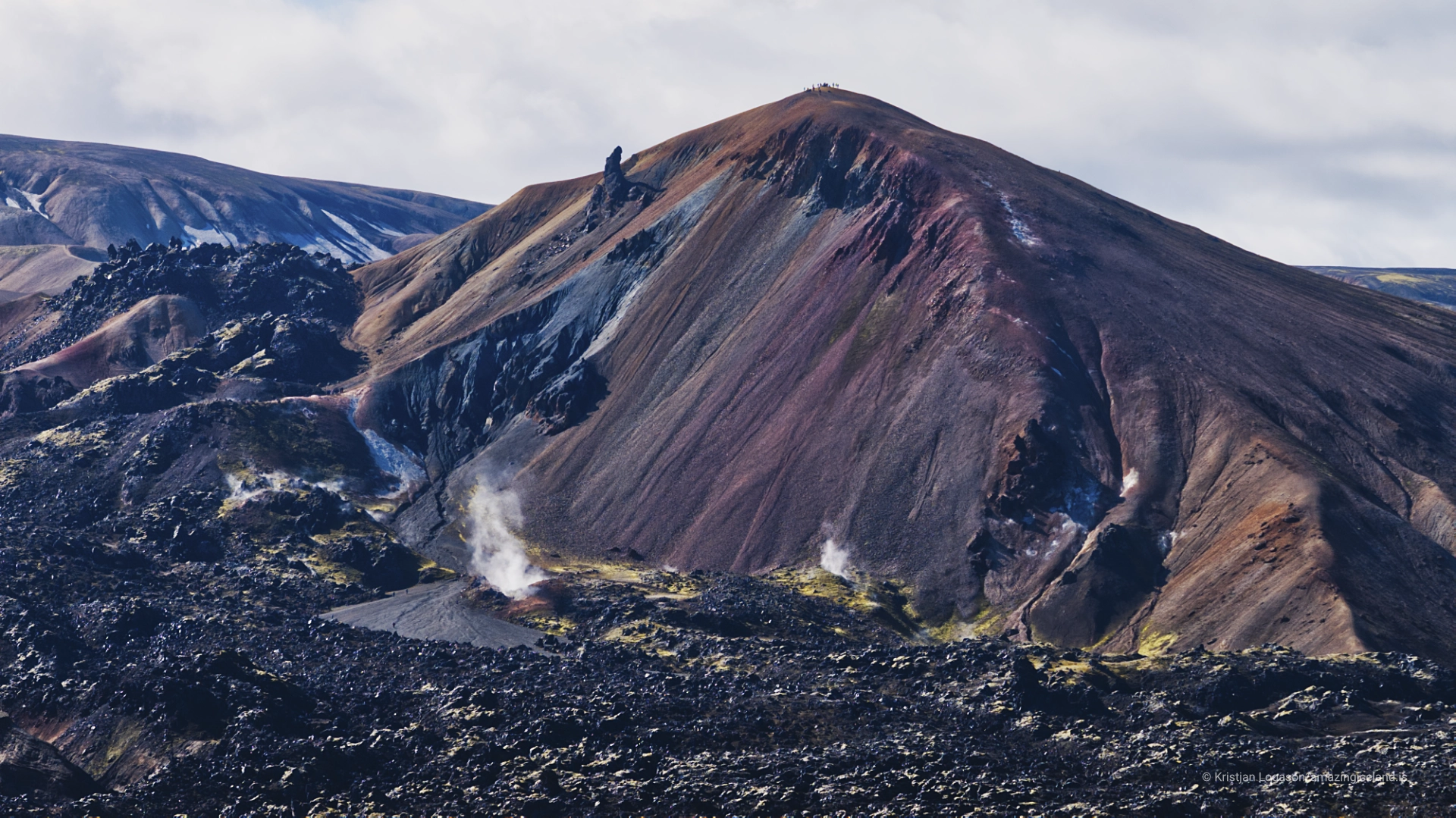
Hot, mineral-rich water moves through cracks below the surface and reacts with the surrounding rock. Over time, this hydrothermal alteration changes both its minerals and its strength. Iron-bearing material can oxidise into red, orange and brown tones. Clay minerals and altered rhyolite contribute paler grey, white and yellow surfaces, while sulphur may form brighter deposits close to geothermal openings. Not every coloured band can be assigned to one mineral simply by looking at it, and the mountain is more complicated than a collection of sulphur stains.
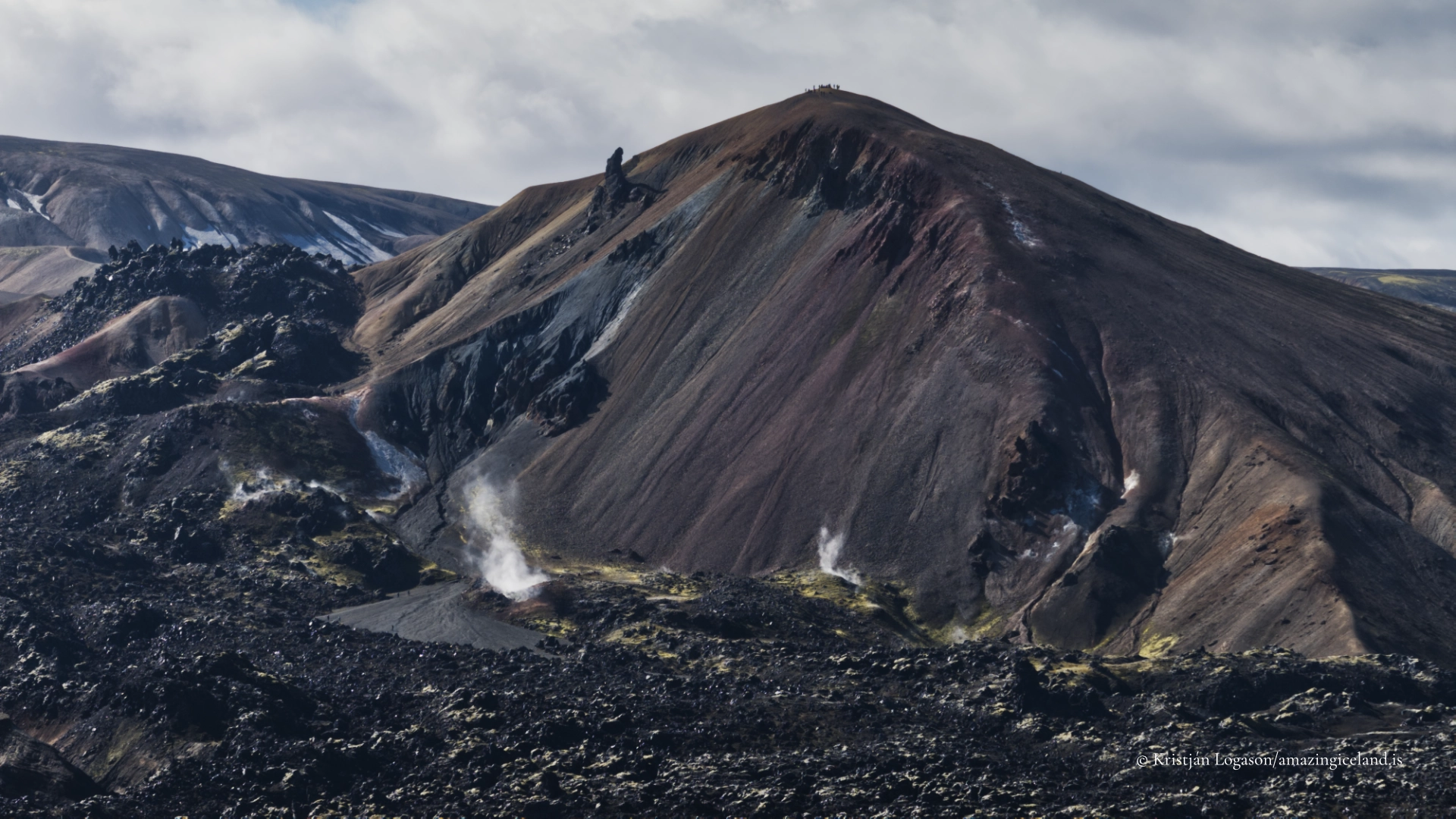
Fumaroles, warm ground and steaming areas occur around Brennisteinsalda, particularly below and around the mountain. The marked summit route does not normally cross dangerously thin geothermal crust, so there is no reason to invent that hazard. Visitors should nevertheless remain on the marked paths, both to protect the vulnerable surface and because loose, altered ground erodes easily.
Weather changes the colour almost as much as viewpoint. Rain can darken the slopes and separate the reds, greens and yellows. Diffuse light can reveal subtle transitions that disappear in harsh sunlight, while low sun strengthens relief and makes erosion channels more prominent. Brennisteinsalda therefore has no single correct colour. Its appearance belongs partly to the rock and partly to the conditions in which it is seen.

Climbing Brennisteinsalda from Landmannalaugar
The recognised approach begins in Landmannalaugar by following the Laugavegur trail towards Laugahraun. Higher in the passage between the lava and Brennisteinsalda, a marked path branches towards the summit. The final ascent is steep and loose in places, but it is generally straightforward for hikers accustomed to mountain trails in good conditions.
The summit is approximately 855 metres above sea level. Exact distance, ascent and walking time depend on the route chosen. Some descriptions measure only the summit climb, while others include a longer circuit through Vondugil or around Laugahraun. This is why published figures differ and why one precise number can be more misleading than useful.
Returning by the same route is possible, but completing a loop gives a better understanding of the landscape. It replaces a repeated ascent and descent with a journey through changing views, surfaces and geological relationships. Several loop variations are used, and visitors should select one that matches current trail information, weather, available daylight and their own experience.
Conditions can change quickly. Loose rhyolitic material becomes less secure when wet, cloud can remove both the view and visual reference points, and strong wind may make exposed slopes uncomfortable or unsafe. Suitable footwear, warm and waterproof clothing, and an assessment of the weather remain more important than a fixed estimate of how long the walk ought to take.
Access roads, parking, river conditions and services are covered more fully on the main Landmannalaugar page. Brennisteinsalda is part of that wider destination, and reaching the trailhead should be planned separately from choosing the summit route.
The view from Brennisteinsalda
The summit brings much of the Landmannalaugar landscape into a single relationship. Laugahraun lies dark beneath the mountain, while the coloured gullies of Vondugil open beyond it. Bláhnúkur rises as a much darker and more sharply defined neighbour, and Suðurnámur forms part of the wider ring of rhyolite mountains. The view also reaches into Jökulgil, where water, erosion and landslides have cut deeply into the volcanic terrain.
This is not merely a panorama from one mountain across several others. From above, the boundaries between rock types and landforms become legible. Young lava appears beside older altered mountains; geothermal steam rises through eroded slopes; rivers and paths occupy the lower spaces between them. The summit helps explain Landmannalaugar as a connected volcanic landscape rather than a collection of separate viewpoints.
The loop continues that process of discovery after the summit. Brennisteinsalda changes shape and colour as the angle of view shifts, while the relationship between mountain, lava and gullies becomes clearer from the ground than it can from any one overlook.
Brennisteinsalda or Bláhnúkur
Visitors with time for only one summit often choose between Brennisteinsalda and Bláhnúkur. The useful distinction is not that one is always shorter or easier. Route choice, surface conditions and weather can change the comparison.
Brennisteinsalda offers closer contact with the coloured rhyolite and geothermal landscape. Its slopes reward attention to mineral patterns, erosion and gradual changes in colour. Bláhnúkur provides a more immediate sense of height above Landmannalaugar and a commanding view from a dark, sharply formed summit.
Colour, view, available time and comfort on steep or loose ground are therefore better criteria than a universal ranking of difficulty. If conditions and time allow, the two mountains complement one another: each explains the other by contrast.
Interesting facts:
-
- Brennisteinsalda rises to approximately 855 metres above sea level.
- It belongs to the rhyolite-rich Torfajökull volcanic system within Fjallabak Nature Reserve.
- Its colours result from rhyolite, iron oxidation, geothermal mineral alteration, sulphur deposits, darker rock and vegetation—not sulphur alone.
- The nearby Laugahraun lava formed during the 1477 Veiðivötn–Torfajökull volcanic episode and is much younger than the mountain beside it.
- The marked summit path branches from the Laugavegur route above Landmannalaugar.
- A loop is recommended because it reveals more of Vondugil, Laugahraun and the surrounding volcanic landscape than returning by exactly the same route.
Image Gallery
Photography tips:
- Brennisteinsalda is best photographed as both a mountain and a surface. Wide compositions can place its coloured slopes against dark Laugahraun, making the difference between the older rhyolitic terrain and younger lava immediately visible. Bláhnúkur provides one of the strongest elevated views towards Brennisteinsalda, while positions along the trail offer closer relationships between the mountain, steam and eroded ground.
- Colour depends heavily on weather. Direct sun can strengthen reds and yellows, but it may also flatten subtle transitions or create severe contrast. Overcast light often separates the tones more evenly, while rain deepens the surface colour. Low directional light reveals ridges, folds and erosion channels that disappear near midday.
- Closer studies of mineral patterns, cracks and transitions between coloured surfaces can become almost abstract. A longer lens helps isolate those details without leaving the marked path. People on the trail can provide scale, but they should be photographed where they naturally and safely belong rather than directed onto vulnerable ground.
- Restraint in editing is important. Brennisteinsalda already possesses an unusual palette, and excessive saturation quickly makes a real geological landscape appear artificial. Neutral reference points such as snow, steam or grey cloud can help keep colour decisions believable.
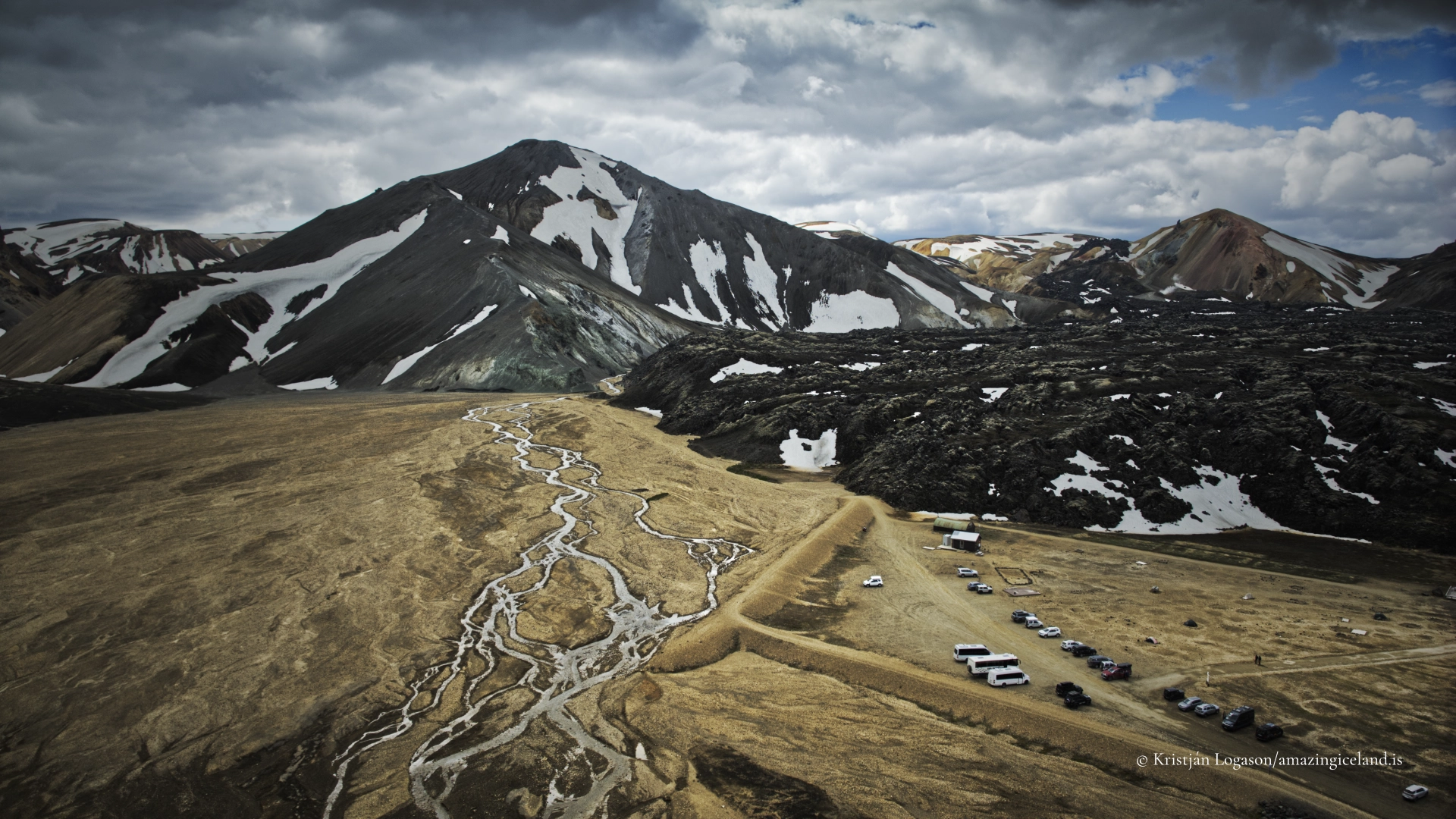
- Aerial views can reveal the relationship between Brennisteinsalda, Laugahraun, Vondugil and Bláhnúkur particularly well. Drone use within the protected area requires permission from the Nature Conservation Agency from 15 June to 15 September. Outside that period, current aviation regulations and the reserve’s general protection rules still apply. Flights must not disturb hikers, wildlife or the experience of the landscape.
Destinations nearby