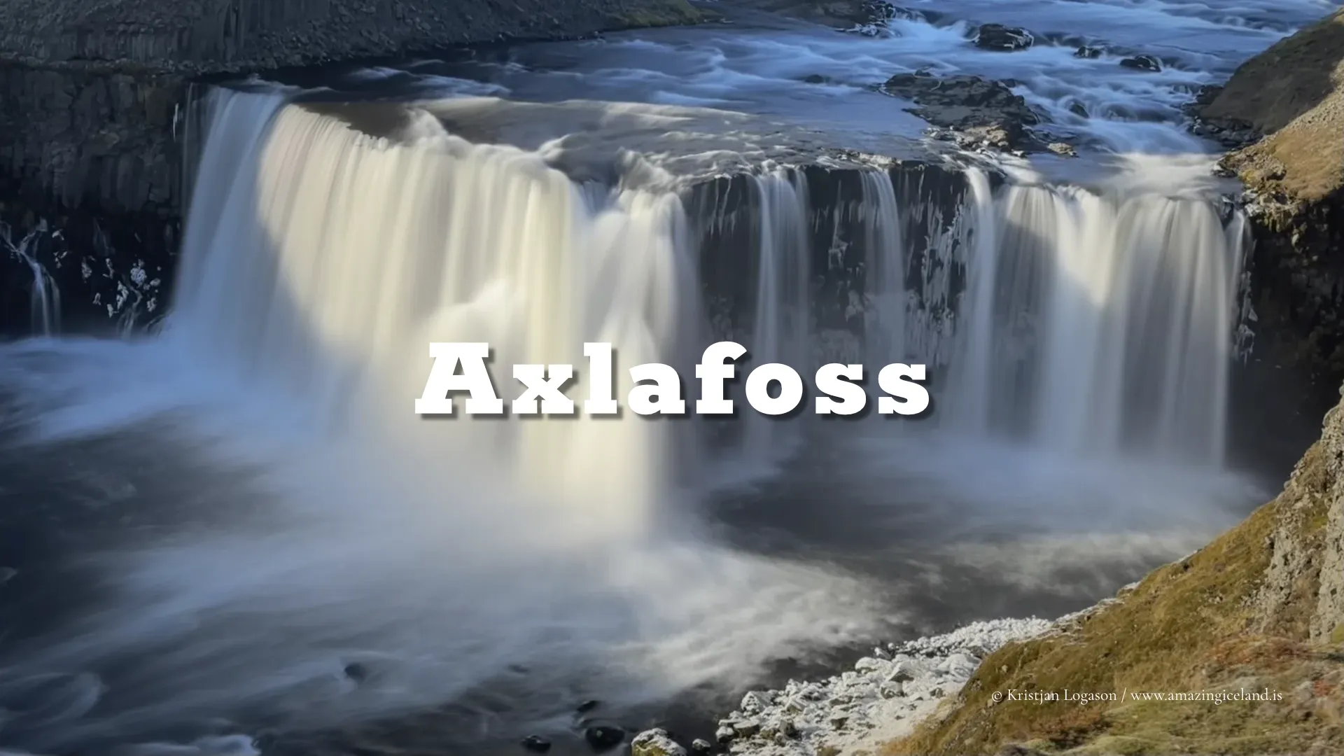
Located along the F210 highland road, Axlafoss is a small but distinct waterfall encountered in transit rather than at journey’s end. Framed by volcanic slopes and sparse highland vegetation, Axlafoss illustrates how water behaves in marginal environments—brief, direct, and closely tied to seasonal conditions.
The location of Axlafoss waterfall by highland road F210
Latitude
63.8619
Longitude
-18.3867
Axlafoss waterfall by highland road F210
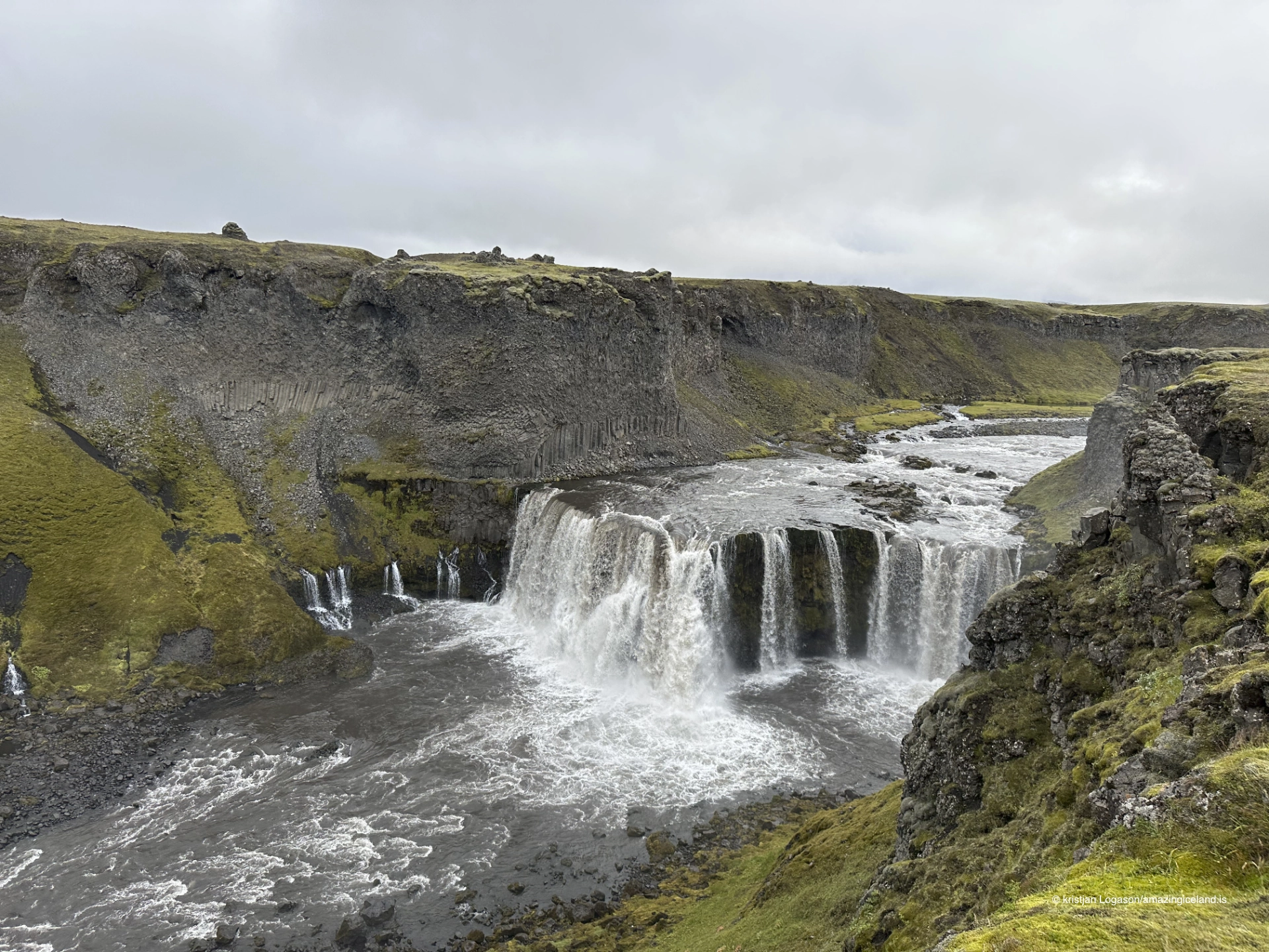
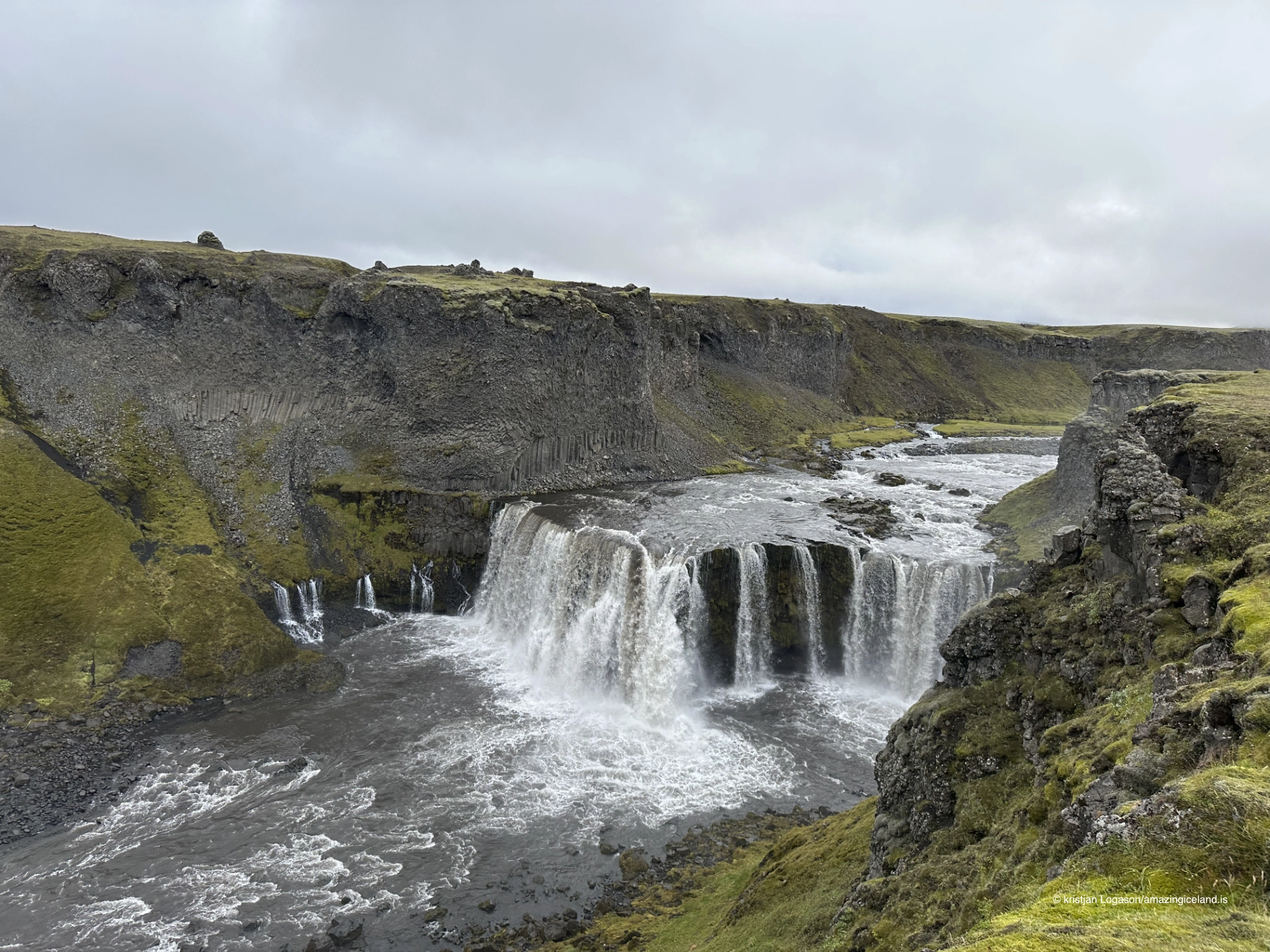
Axlafoss lies in the southern Highlands of Iceland, close to the interior routes that connect the Fjallabak region with the glacial landscapes south of Mýrdalsjökull. Unlike Iceland’s major waterfalls, which are fed by large rivers or persistent glacial outlets, Axlafoss is primarily supplied by surface runoff and localized meltwater. Its flow responds directly to precipitation, temperature, and snowmelt, making it a useful indicator of short-term hydrological conditions in the highlands.
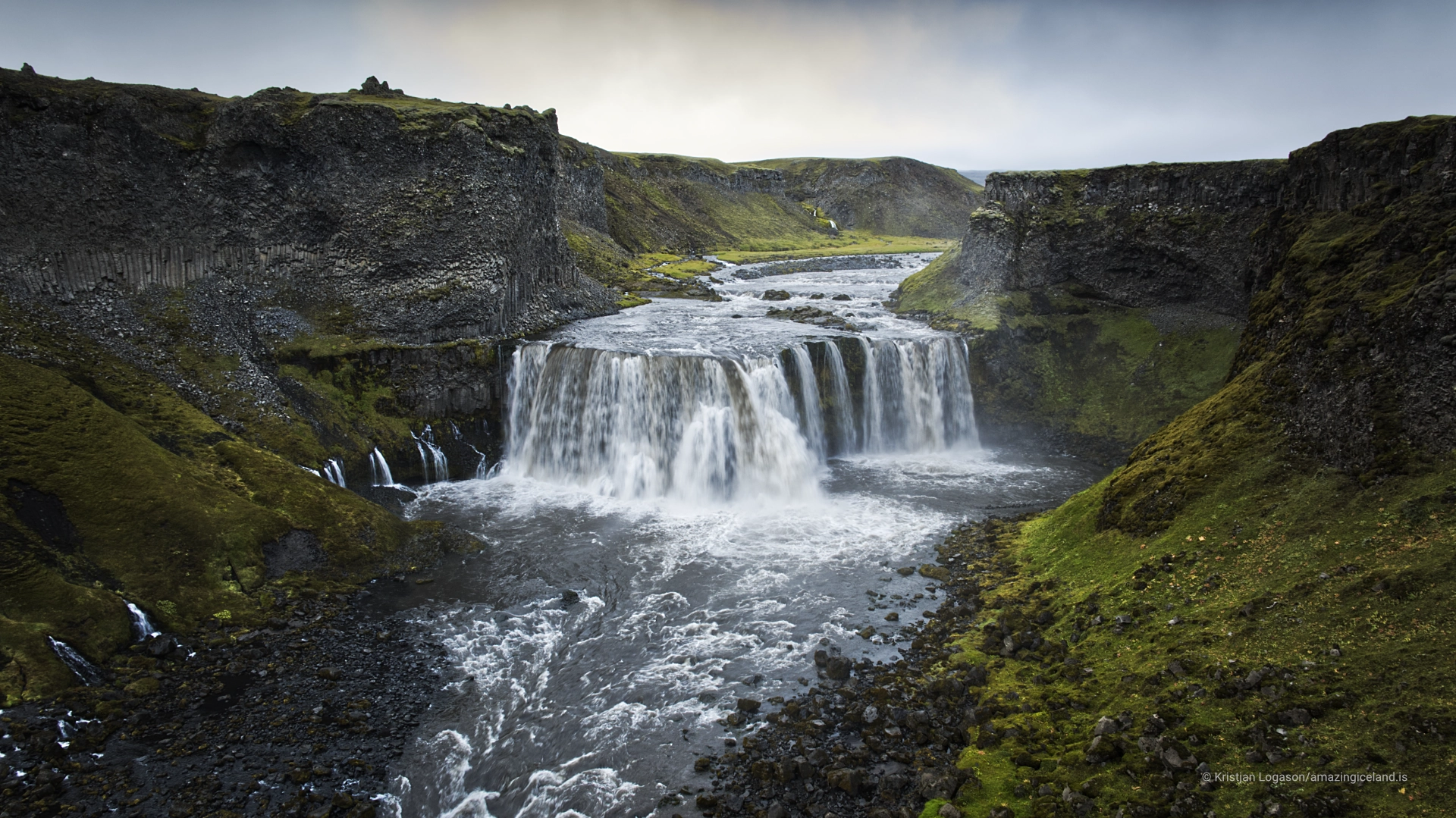
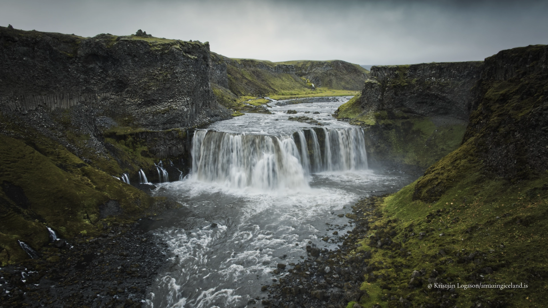
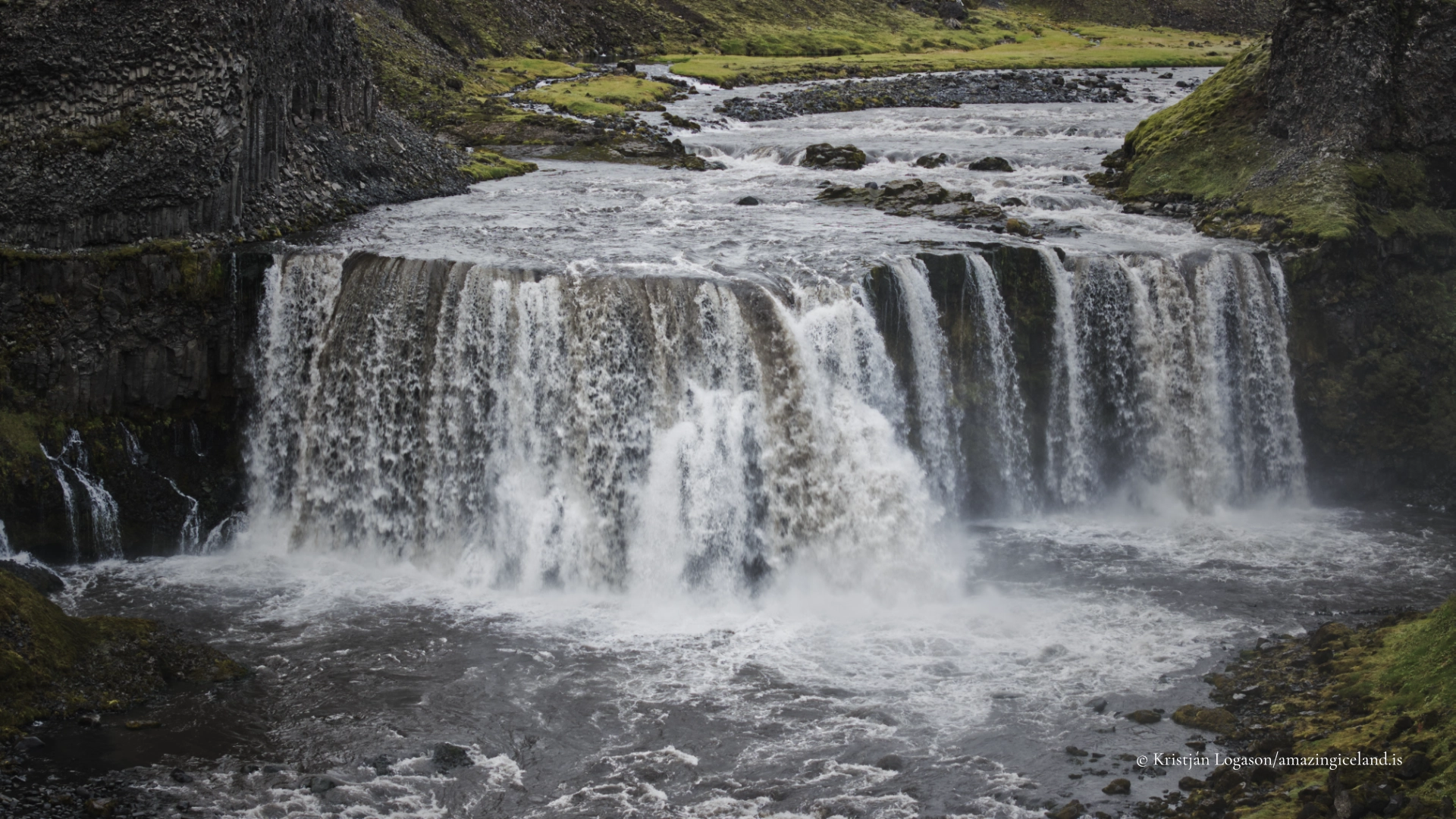
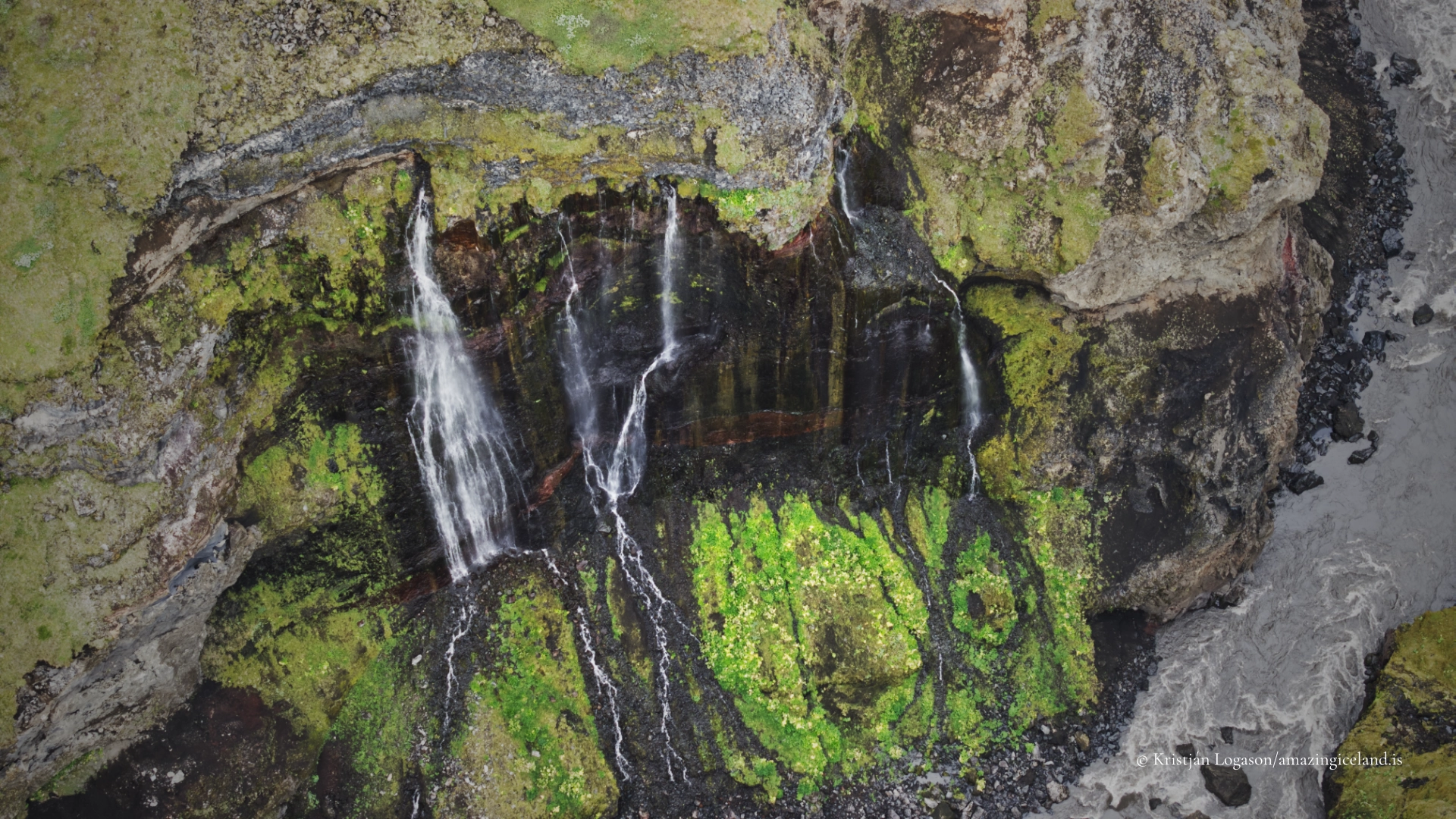
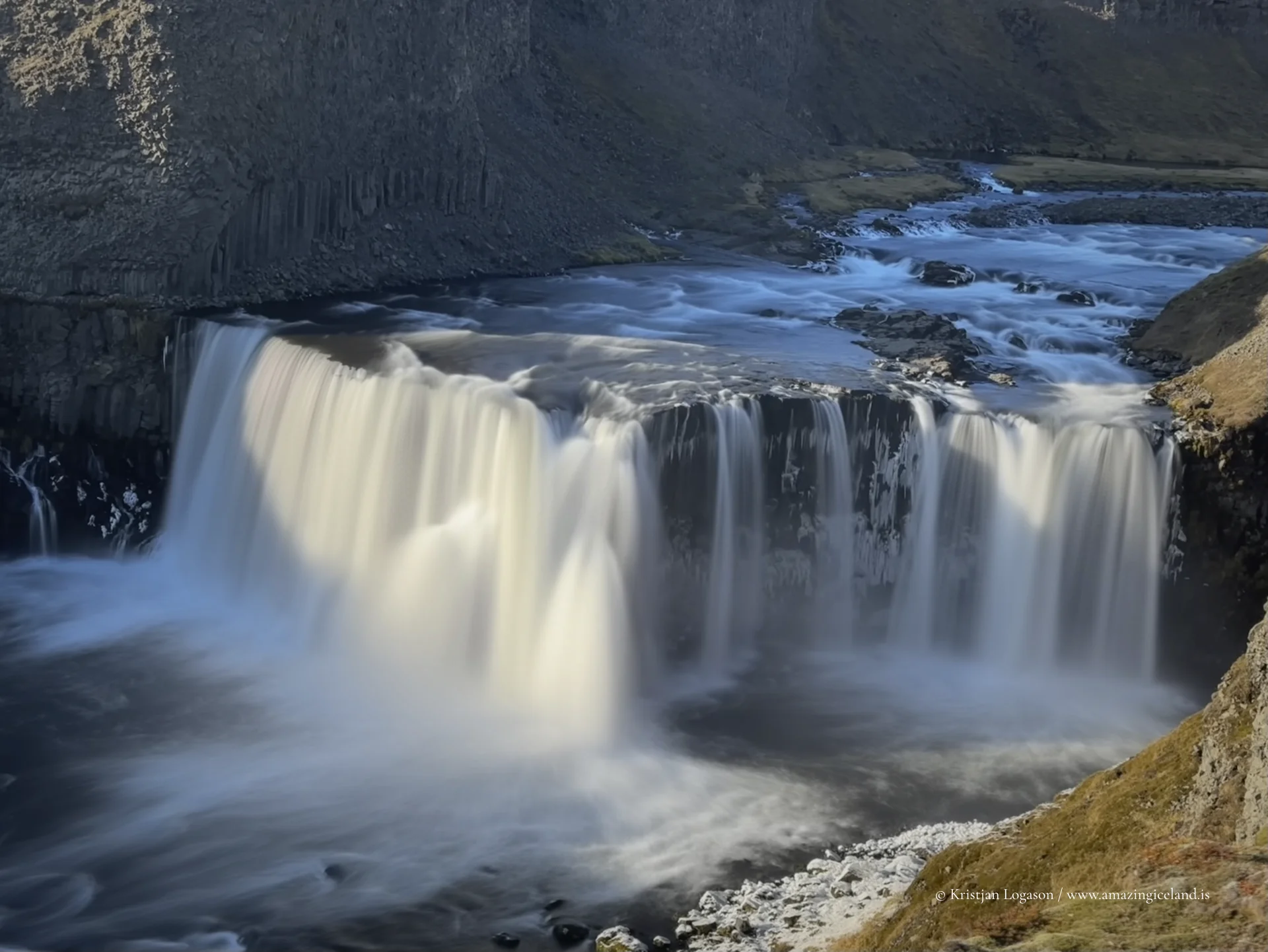
The waterfall descends over exposed volcanic bedrock, forming a narrow but coherent drop that is visually legible even at modest water volumes. The surrounding rock is predominantly basalt, fractured and layered, offering a clear surface over which water spreads briefly before rejoining the surrounding drainage system. There is no deep canyon here; instead, the fall is integrated into the slope itself, reinforcing the sense that Axlafoss is part of a working landscape rather than a singular landmark.
This integration is central to understanding the site. In the highlands, water rarely dominates for long. It appears, moves, and disappears, leaving behind subtle erosion marks rather than monumental voids. Axlafoss fits this pattern precisely—its form shaped by repetition rather than accumulation.
The presence of F210 beside Axlafoss is significant. Fjallabaksleið syðri is one of Iceland’s more challenging highland routes, requiring high-clearance four-wheel-drive vehicles and favorable conditions. River crossings, loose gravel, and weather exposure limit access to the summer months, and even then, travel demands experience and restraint.
Axlafoss is typically encountered as part of this transit, not as a destination with dedicated infrastructure. There are no constructed viewpoints or facilities, and stopping requires careful consideration of road conditions and safety. This absence of development preserves the waterfall’s character and aligns with contemporary highland management principles that prioritize minimal intervention.
From an interpretive perspective, the waterfall’s proximity to the road creates an unusual dynamic. The landscape remains dominant, yet the observer is not removed from it. Vehicles, tracks, and human presence exist openly alongside natural processes, reinforcing the idea that highland travel is participatory rather than observational.
Geologically, the area surrounding Axlafoss reflects the broader volcanic framework of southern Iceland’s interior. Lava flows, ash deposits, and erosion surfaces overlap without being fully obscured by vegetation. This exposure allows for direct reading of landform relationships—how water selects paths, how slopes dictate velocity, and how rock structure influences spread and drop.
The waterfall’s modest height encourages close observation rather than distant viewing. Details matter: the way water fans across rock during higher flow, the way channels narrow as volume decreases, and the mineral staining that marks repeated wetting and drying cycles. These details are often lost at larger waterfalls but are central here.
Seasonal change is pronounced. In early summer, meltwater can give Axlafoss a brief sense of volume and momentum. By late summer, the flow may diminish significantly, sometimes breaking into segmented rivulets. In colder conditions, ice may partially form along the edges, revealing the rock structure beneath with greater clarity.
Axlafoss benefits from its placement within a wider highland narrative. Nearby features such as Mælifell and the black sand plains of the Mýrdalsjökull outwash create a stark visual context in which even small water features become meaningful. The contrast between water and terrain is not decorative; it is explanatory.
This context supports an academic reading of the landscape as a system rather than a collection of highlights. Axlafoss is one node within that system—a point where elevation, runoff, and rock intersect briefly before continuing downstream. Understanding it requires accepting that not all waterfalls are endpoints; some are simply transitions.
From a conservation standpoint, the site reinforces the need for restraint. Fragile soils, slow-growing moss, and unstable surfaces characterize the area. Even short stops should be approached with care, remaining on durable ground and avoiding unnecessary disturbance.
Ultimately, Axlafoss is defined by proportion. Its scale is appropriate to its environment, and its presence feels earned rather than exaggerated. In a region where extremes are common—large glaciers, vast sandur plains, dramatic volcanic cones—Axlafoss offers balance.
For broader destination framework, this waterfall serves as a reminder that Iceland’s Highlands are not composed solely of headline features. They are built from small, precise interactions repeated across space and time. Axlafoss does not compete with larger waterfalls; it complements them by demonstrating how water operates when resources are limited and conditions are uncompromising.
Seen this way, Axlafoss is not incidental. It is representative.
Interesting facts:
- Axlafoss is located along the F210 (Fjallabaksleið syðri) highland road.
- The waterfall is runoff-fed, with flow varying significantly by season and weather.
- It descends over exposed basalt bedrock, typical of Iceland’s volcanic interior.
- There is no developed infrastructure at the site.
- Access is generally limited to summer months due to road conditions.
Image Gallery

The Locomotive Elite
What do Donald Trump and Iceland’s Locomotive Elite have in common?
Far more than you think.
In The Locomotive Elite, you’ll uncover how a tiny clique in Iceland captured extensive control—of banks, courts, media, and even the central bank.
For decades they ruled, first democratically, then through corruption and in the end through crime, enriching themselves and their cronies while dismantling oversight.
The result?
One of the most spectacular financial collapses in modern history.
Photography tips:
- Embrace restraint: Use the surrounding terrain to contextualize the waterfall rather than isolating it.
- Seasonal honesty: Higher flow in early summer, structural clarity later—let conditions guide approach.
- Mid-range lenses: Avoid ultra-wide exaggeration; scale is part of the story.
- Foreground discipline: Moss and fragile soils are easily damaged—compose from durable surfaces.
- Narrative sequences: Pair Axlafoss with road, vehicle, or surrounding slopes to communicate transit and scale.
Good cameras for Iceland
Sony A7R V

Sony A7s lll

Canon R6

Nikon Z6 lll

Destinations nearby


Good to have in Iceland


