Ásbyrgi canyon
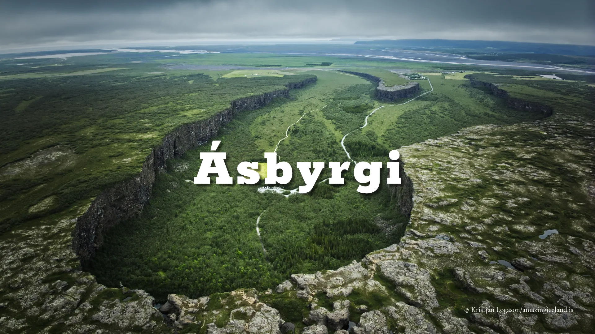
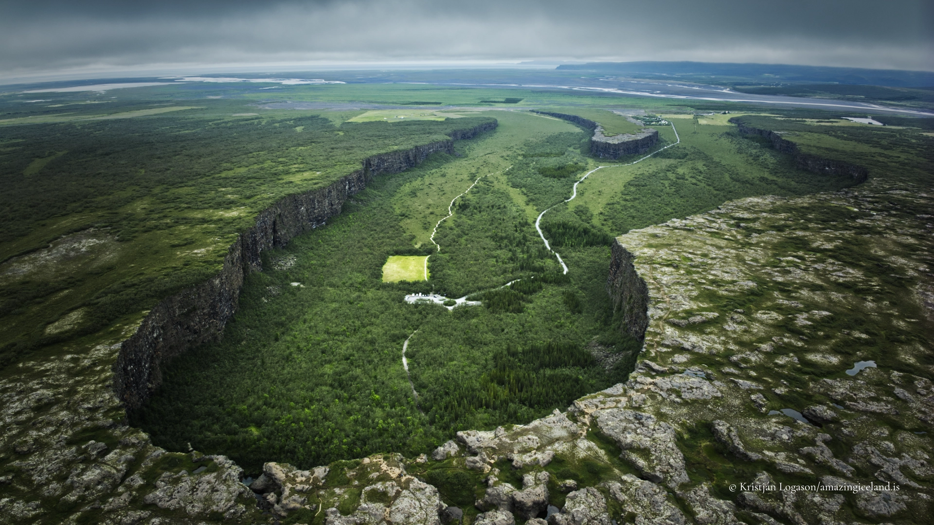
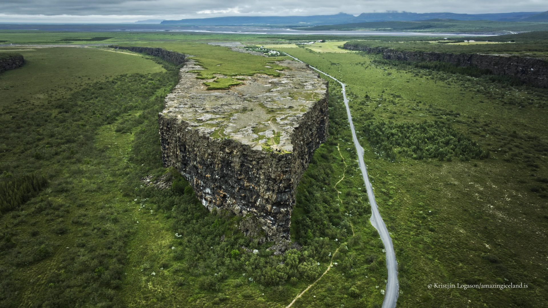
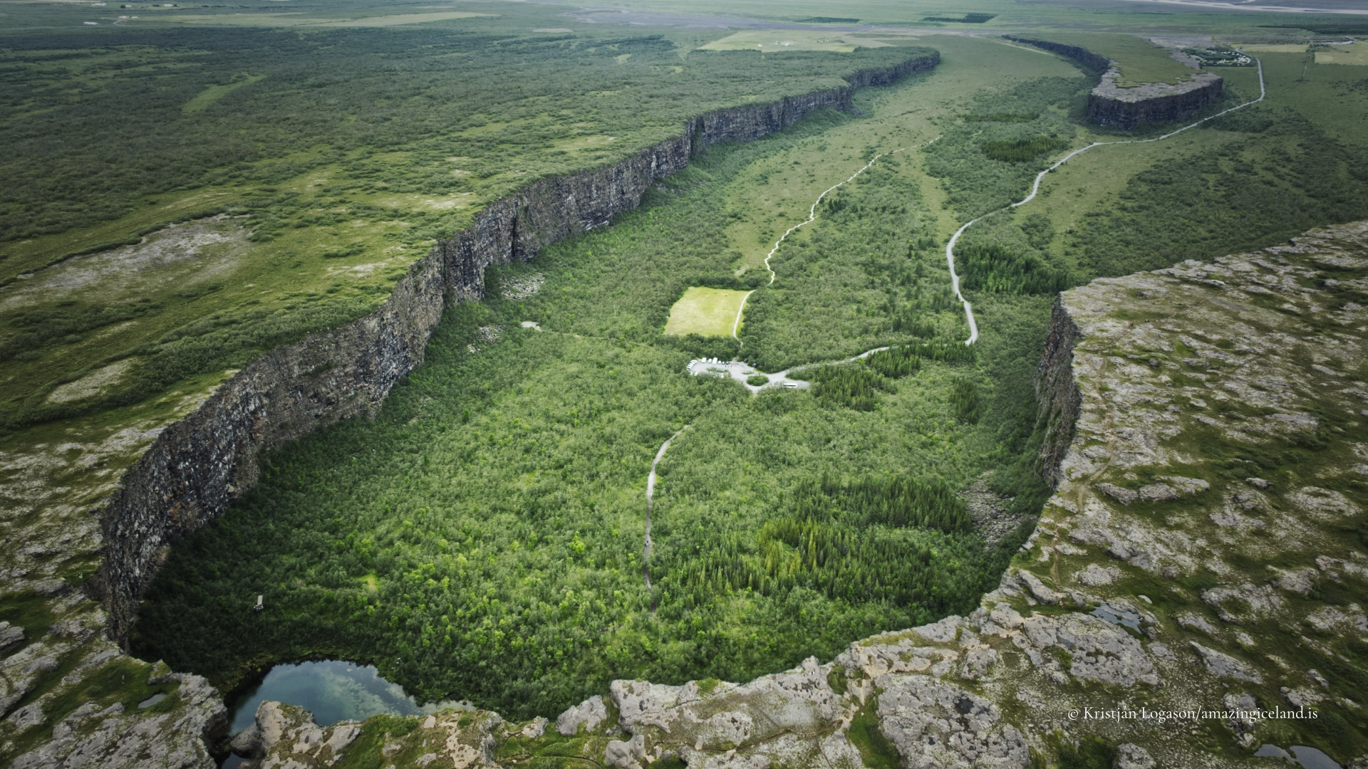
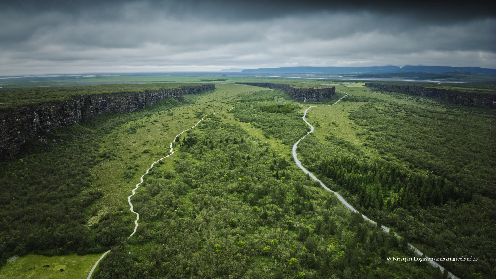
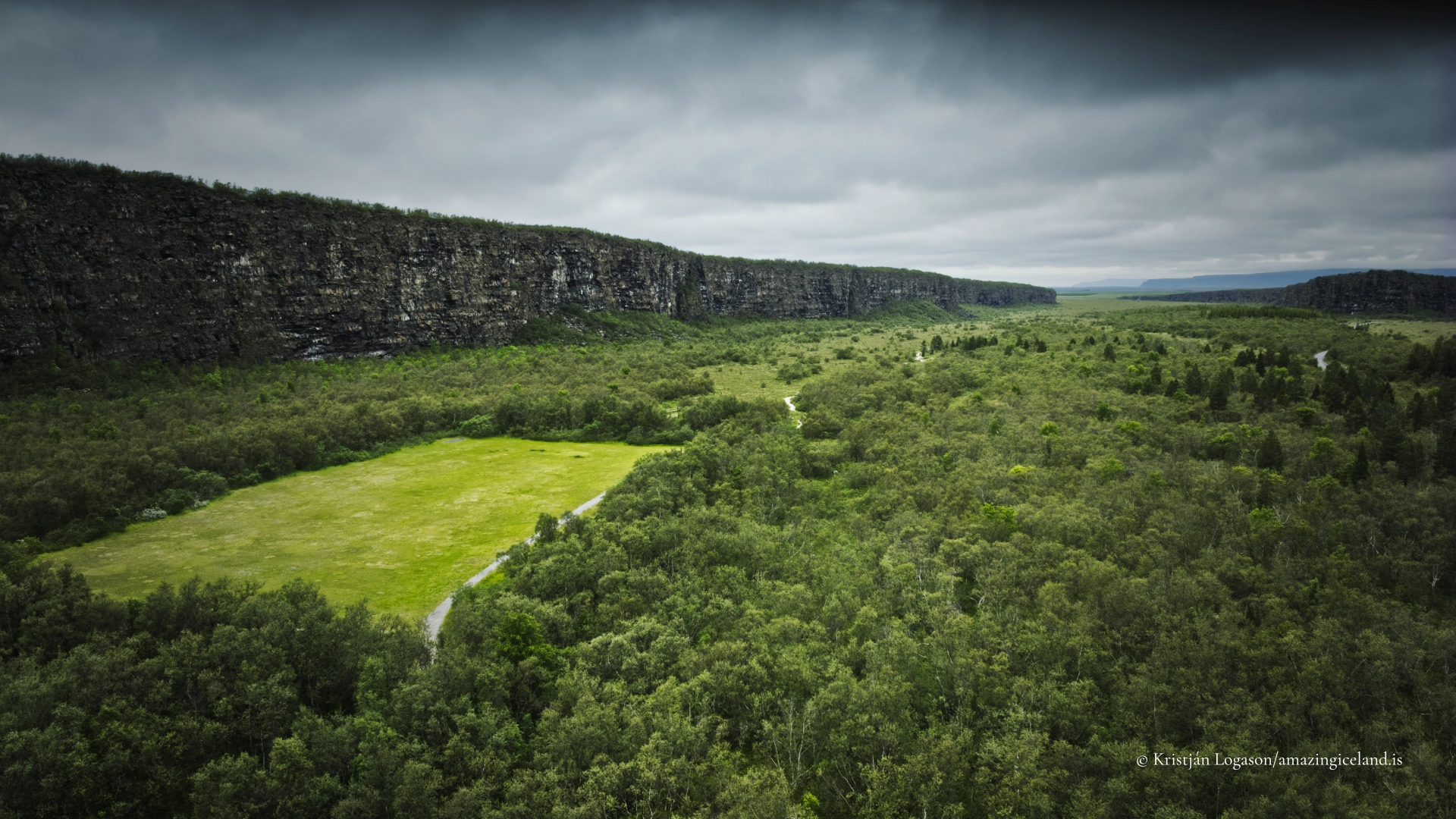
Ásbyrgi is a vast horseshoe-shaped depression in the northern part of Vatnajökull National Park. Sheer cliffs surround it on three sides, reaching roughly 100 metres at their highest, while a long rock formation known as Eyjan rises through the centre and divides the canyon into two arms.
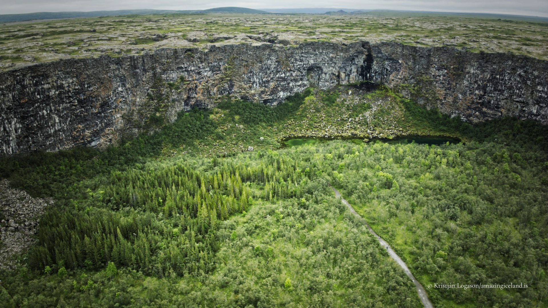
From above, its form is monumental. From within, Ásbyrgi feels unexpectedly sheltered. Birch woodland covers much of the canyon floor, paths run beneath the cliffs and the small pond Botnstjörn rests below the innermost wall. The scale of the surrounding rock remains visible, but the experience is quieter and more enclosed than the word canyon might suggest.
Ásbyrgi can be explored in several ways. Visitors can drive into the canyon almost as far as Botnstjörn, walk through the woodland, climb Eyjan for an elevated view or follow a longer trail towards Klappir on the upper eastern rim. Each reveals a different part of the same landscape.
The location of Ásbyrgi canyon
Latitude
66.0216
Longitude
-16.5053
Ásbyrgi canyon
Shaped by Catastrophic Floods
Ásbyrgi belongs to Jökulsárgljúfur, the great canyon system carved by Jökulsá á Fjöllum. The river now flows east of Ásbyrgi, but its abandoned course and the immense cliffs record an earlier and far more violent history.
According to the geological interpretation presented by Vatnajökull National Park, Ásbyrgi was probably shaped by at least two catastrophic glacial floods. The earlier may have occurred approximately 8,000–10,000 years ago, followed by another around 3,000 years ago. These dates are necessarily approximate, but the scale of the landforms shows that the floods were far greater than the ordinary flow of the modern river.
Enormous quantities of water, sediment and rock swept north through the area. The floods cut into the landscape, enlarged existing channels and left the horseshoe-shaped depression seen today. Jökulsá later shifted eastwards, abandoning Ásbyrgi and continuing through the canyon now associated with places such as Hljóðaklettar and Dettifoss.
Eyjan and Botnstjörn
Eyjan survived as a resistant central formation within the flood path. Its name means “the island”, an appropriate description of a long ridge that stands above the wooded floor and separates the two sides of Ásbyrgi.
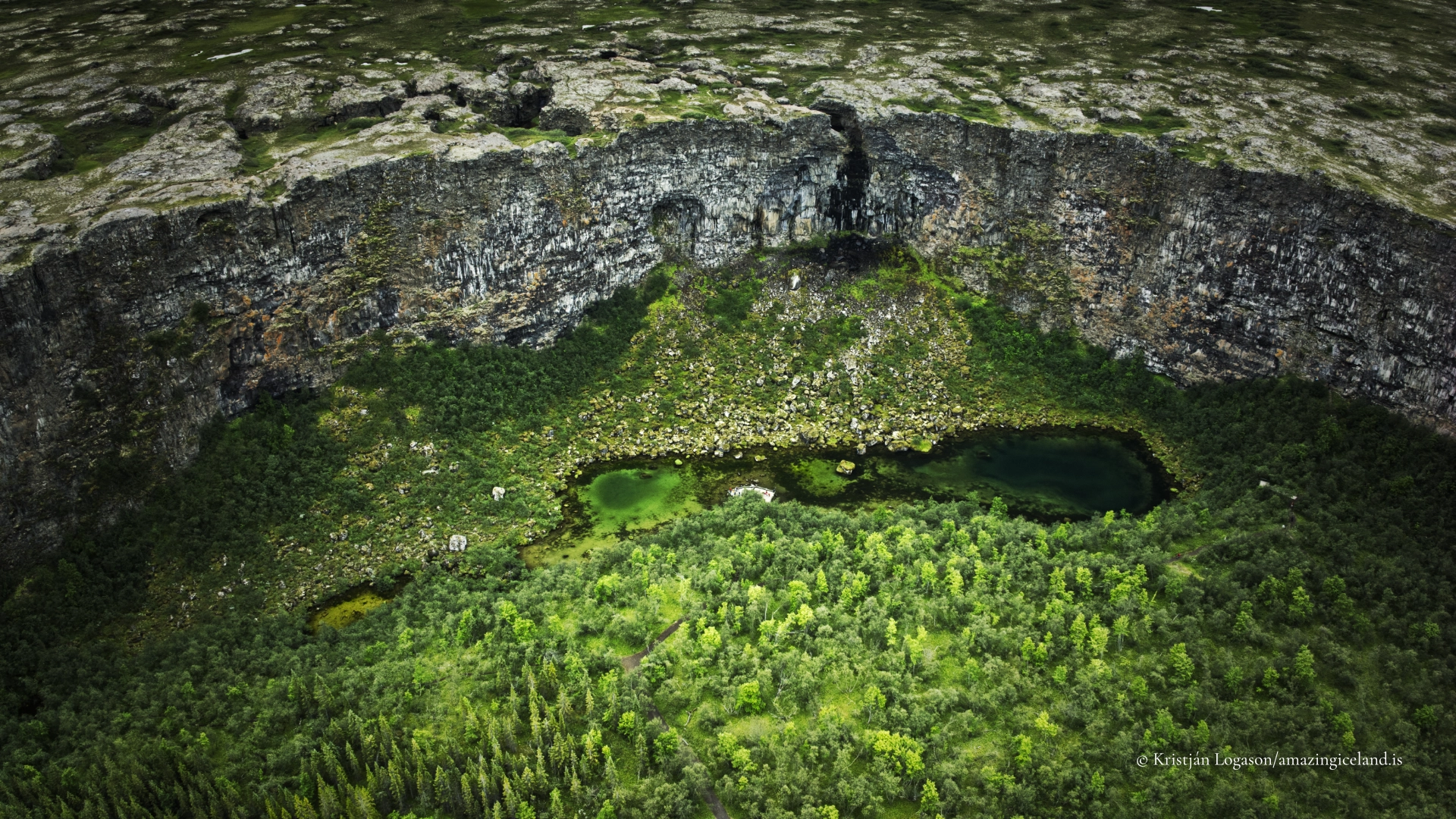
Botnstjörn provides a smaller and more comprehensible trace of the same events. The pond is considered an old plunge pool, formed where the force of the floodwater struck below the cliffs. Today it is still and sheltered, almost the opposite of the violence that created it.
The pond sits at the innermost end of Ásbyrgi and is reached by a short path from the parking area. Paths and viewing areas provide access without requiring a long hike, making this the part of the canyon most visitors can experience.

The Hoofprint of Sleipnir
Geology explains Ásbyrgi through catastrophic floods, but Icelandic folklore gives the canyon a very different origin.
The traditional story says that Ásbyrgi was formed when Sleipnir, the eight-legged horse of the god Óðinn, placed one hoof upon the earth. The horseshoe shape of the canyon made the association natural, and the story remains inseparable from the way Ásbyrgi has been imagined and described.
The resemblance is strongest when the canyon is seen from above or from one of the higher viewpoints. Eyjan occupies the centre like the frog of a hoof, while the cliffs curve around the woodland below.
Ásbyrgi also has traditions connected with elves or hidden people. They are particularly associated with the innermost part of the canyon around Botnstjörn and the surrounding cliffs. These traditions should be understood as folklore rather than documented history, but they express something recognisable about the place. The enclosed woodland, still water and high rock walls create an atmosphere quite different from the exposed landscapes outside the canyon.
The geological and folkloric explanations do not compete for the same purpose. One describes the physical forces that shaped Ásbyrgi; the other records how people interpreted its extraordinary form and atmosphere.
Woodland Beneath the Cliffs
Ásbyrgi contains one of the most extensive natural birch woodlands in this part of Iceland. Birch, willow and rowan grow across the canyon floor, accompanied by planted conifers in some areas. The vegetation softens the base of the cliffs and makes the interior feel markedly different from the open heathland surrounding it.
The woodland is essential to the experience of Ásbyrgi. In many Icelandic canyons, visitors remain exposed to wind and weather. Here, the cliffs and trees create shelter. Paths pass through vegetation before opening suddenly towards rock walls, clearings or views across the canyon.
Birdlife changes with the seasons, and nesting birds use the cliffs and vegetation around Botnstjörn. Temporary restrictions may apply to particular paths or areas during the nesting period. These are localised measures rather than a closure of Ásbyrgi as a whole, and visitors should follow the signs displayed on site.
Botnstjörn and Eyjan
The short walk to Botnstjörn is the simplest introduction to Ásbyrgi. The route is approximately one kilometre and takes around half an hour, although many visitors spend longer beside the pond or walking through the woodland. It offers the strongest sense of the shelter created by the cliffs but does not reveal the full horseshoe shape.
Eyjan gives a different perspective. A trail leads along the central rock formation for approximately 4.5 kilometres return, usually requiring between one and a half and two hours. From above the woodland, the relationship between Eyjan, the canyon walls and the open land to the north becomes much clearer.
Although Eyjan provides an elevated view, it is not the outer rim of Ásbyrgi.
The Walk to Klappir
Visitors wanting the broader view from the upper eastern cliffs can walk towards Klappir. This route is approximately nine kilometres return and normally takes two and a half to three hours. In addition to the view across Ásbyrgi, the area contains potholes and other features eroded into the bedrock by floodwater.
The Klappir walk is longer and more exposed than the paths around Botnstjörn. Weather can change the character of the route quickly, and the cliff edge requires ordinary care, particularly in wind, rain or poor visibility.
Several longer routes continue across Ásheiði and connect Ásbyrgi with other parts of Jökulsárgljúfur. Those walks require more planning than a normal visit to the canyon. Trail conditions, seasonal restrictions and current route information should be checked with the national park before departure.
Reaching Ásbyrgi
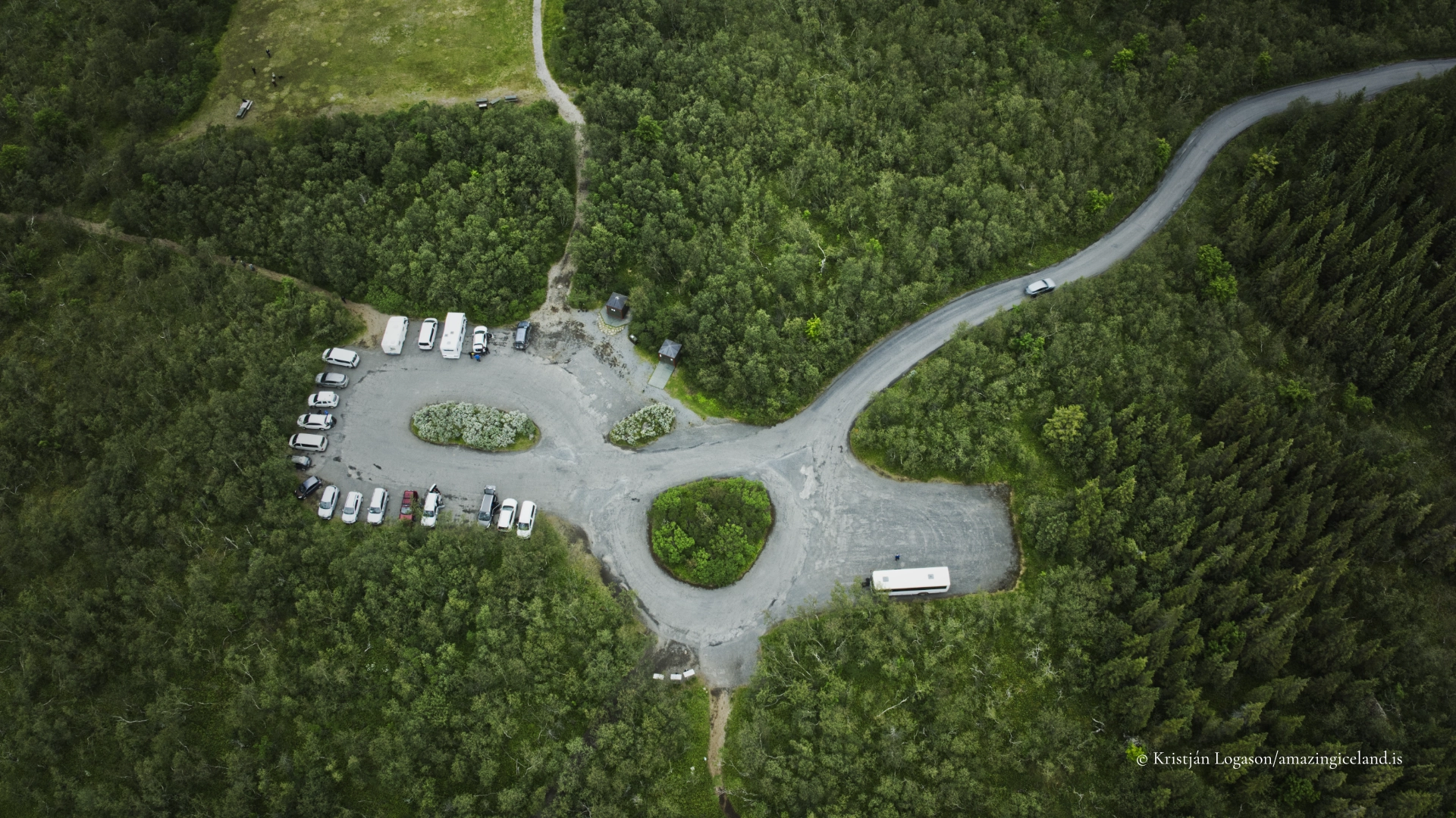
Ásbyrgi is reached from Route 85 in Northeast Iceland. A road leads into the canyon through the woodland to a parking area near Botnstjörn, allowing visitors to experience the innermost cliffs without completing a long approach on foot.
Gljúfrastofa, the national park visitor centre near the entrance to Ásbyrgi, provides information about the landscape, geology, walking routes and conditions within Jökulsárgljúfur. The visitor centre is open throughout the year, although opening times may vary by season. The campsite and some other visitor services are seasonal.
Summer access is generally straightforward, but winter requires a careful distinction between Ásbyrgi and the route through the national park farther south. Ásbyrgi can be approached from the north on Route 85 when weather and road conditions allow. However, snow may make internal roads, parking areas and walking paths difficult or temporarily inaccessible.
Road 862 south from Ásbyrgi through Jökulsárgljúfur has limited winter service and should not be assumed to provide a through-route towards Dettifoss. Current road conditions and closures should always be checked before travelling.
Ásbyrgi Within Jökulsárgljúfur
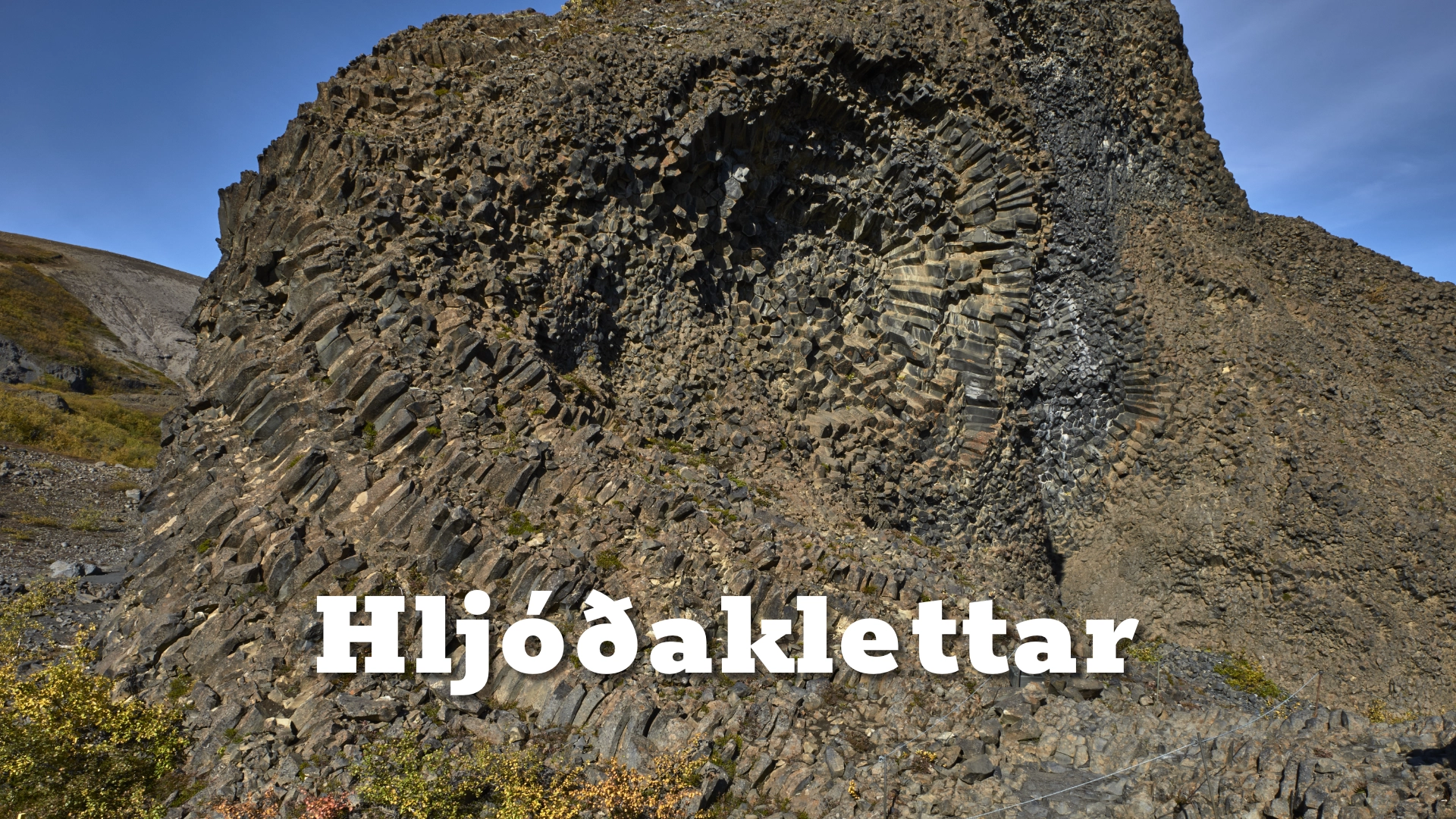
Ásbyrgi is often visited as part of a journey through Jökulsárgljúfur, but it deserves time as a destination in its own right. Dettifoss demonstrates the continuing power of Jökulsá á Fjöllum, while Hljóðaklettar exposes strange volcanic formations later cut and shaped by floodwater. Ásbyrgi shows what happened when the river occupied a course it has since abandoned.
The contrast is essential. Outside the canyon, the landscape is broad and exposed. Inside, woodland grows beneath curving cliffs and still water occupies an ancient plunge pool. A visitor standing beside Botnstjörn sees little of the horseshoe shape visible on a map, yet stands within a landform created by some of the most powerful floods known from Iceland’s postglacial history.
That combination of immense geological force and present-day shelter gives Ásbyrgi its character. It is both a remnant of catastrophe and one of the calmest landscapes in North Iceland.
Interesting facts:
-
- Ásbyrgi is approximately 3.5 kilometres long, more than one kilometre wide and surrounded by cliffs reaching about 100 metres.
- The central formation is called Eyjan, meaning “the island”, because it rises like a long island from the wooded canyon floor.
- Botnstjörn is considered an old plunge pool left by the catastrophic floods that shaped Ásbyrgi.
- According to tradition, the canyon is the hoofprint of Sleipnir, Óðinn’s eight-legged horse.
- Ásbyrgi contains extensive birch woodland, creating an unusually sheltered environment within the exposed landscape of Northeast Iceland.
Image Gallery
Photography tips:
- No single viewpoint explains all of Ásbyrgi. At Botnstjörn, the strongest photographs usually concentrate on the relationship between the pond, woodland and cliffs rather than attempting to show the complete canyon. Reflections can be effective in still weather, particularly when the rock face catches warm evening light.
- The paths through the birch woodland offer quieter images of trunks, foliage and sections of cliff appearing between the trees. Overcast conditions can work particularly well here by controlling contrast and bringing out colour in the vegetation.
- Eyjan provides more context and allows the scale of the woodland and canyon walls to become visible. Klappir offers the broadest impression of the horseshoe form, although the view depends heavily on weather and visibility.
- A wide-angle lens is useful below the cliffs, but it can make the scale difficult to judge. Including trees, people or the pond gives the rock walls a visual reference. From the higher viewpoints, a normal or short telephoto lens can help organise the canyon into stronger layers rather than reducing the entire landscape to a distant panorama.
- The light changes considerably through the day because of the height and curvature of the cliffs. Some areas remain in shadow while others receive direct light, creating strong contrasts. Early and late light is often the most expressive, but the most suitable time depends on the viewpoint and season.
- Ásbyrgi should not be photographed only as a horseshoe seen from above. Its real visual identity lies in the transition from the exposed landscape outside to the woodland, water and immense walls within.
Destinations nearby