Aldeyjarfoss basalt column waterfall
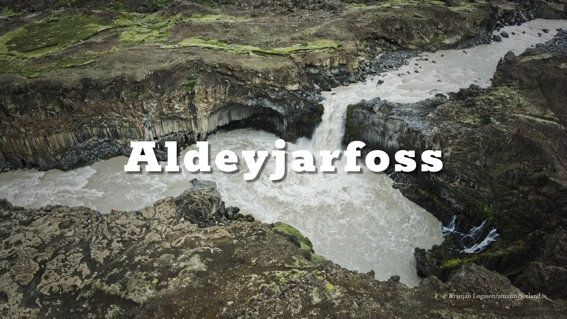
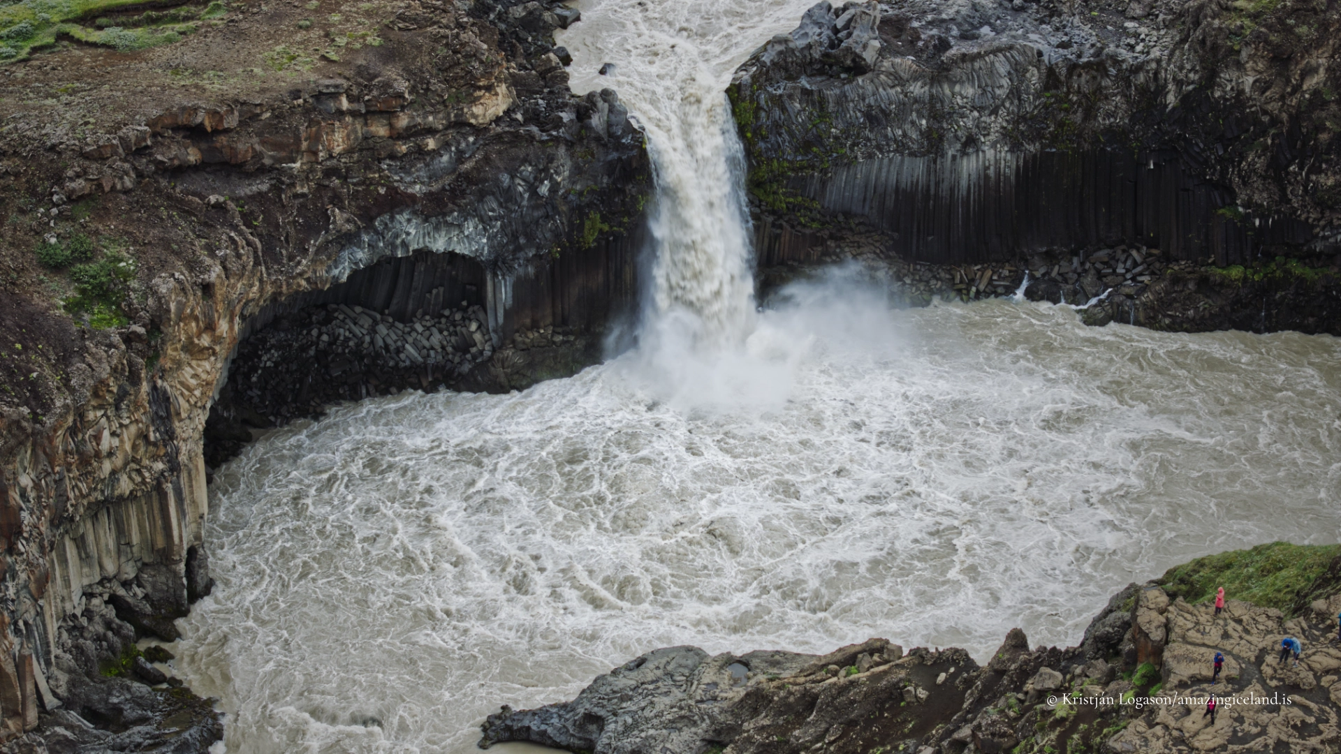
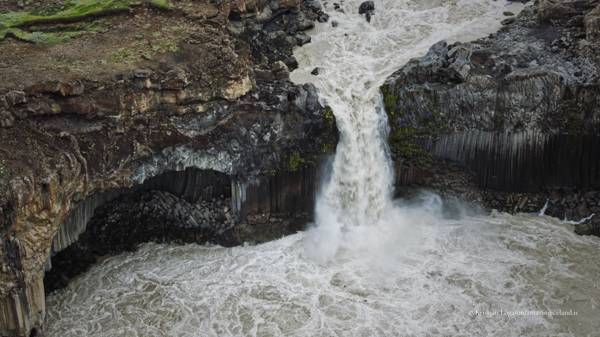
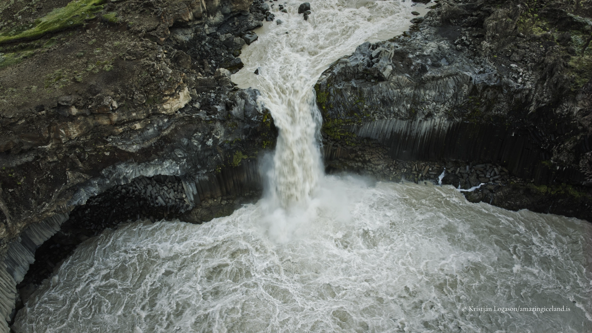
Aldeyjarfoss is not Iceland’s highest waterfall, nor does it carry the greatest volume of water. Its strength lies in the unusually clear relationship between river and rock. Skjálfandafljót is forced through a narrow opening before dropping into a basin enclosed by tall basalt columns. White, sediment-carrying water meets dark volcanic geometry, and the entire scene is concentrated within a comparatively small space.
The journey is part of understanding the place. Travelling south through Bárðardalur, farms become fewer and the valley gradually opens. The ordinary road ends, the Sprengisandur mountain road begins, and the character of the land changes. Aldeyjarfoss stands at that threshold: approached from North Iceland, but belonging naturally to the Highlands.
The location of Aldeyjarfoss basalt column waterfall
Latitude
65.3666
Longitude
-17.3370
Aldeyjarfoss basalt column waterfall
A waterfall formed within Suðurárhraun
The basalt surrounding Aldeyjarfoss belongs to Suðurárhraun, part of the much larger Frambruni lava field. The lava is generally dated to approximately 9,000–9,500 years ago, placing its formation relatively soon after the end of the last Ice Age in Iceland.
Columnar basalt develops when a thick body of basaltic lava cools and contracts. Cracks propagate through the cooling rock, commonly creating five- or six-sided columns. The fractures form roughly perpendicular to the surfaces from which the lava loses heat. What can look like deliberate stone architecture is therefore the visible record of cooling, contraction and time.
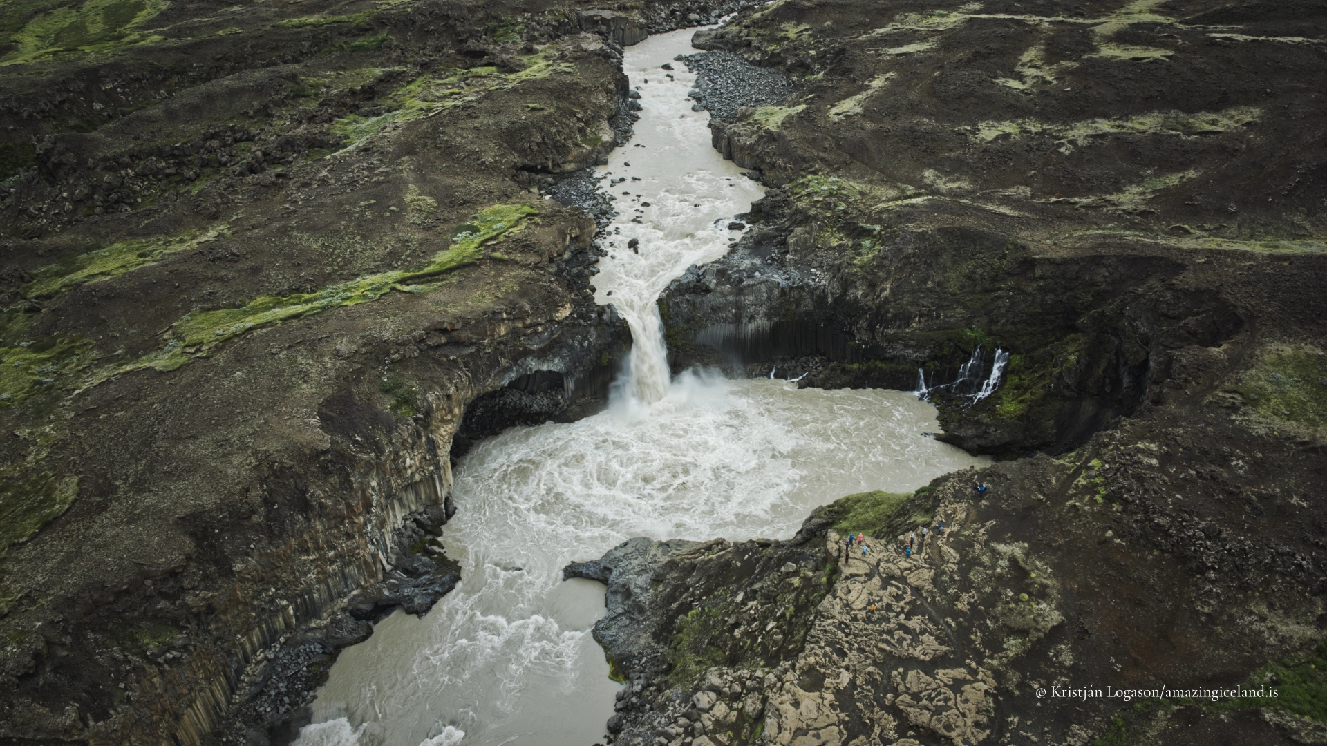
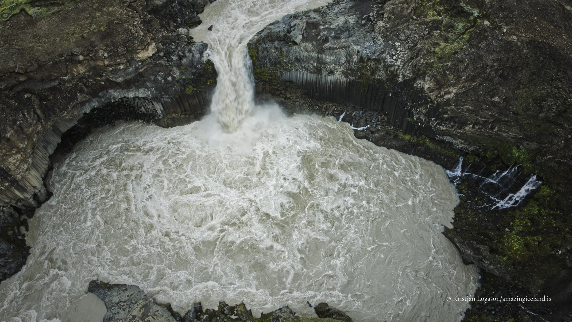
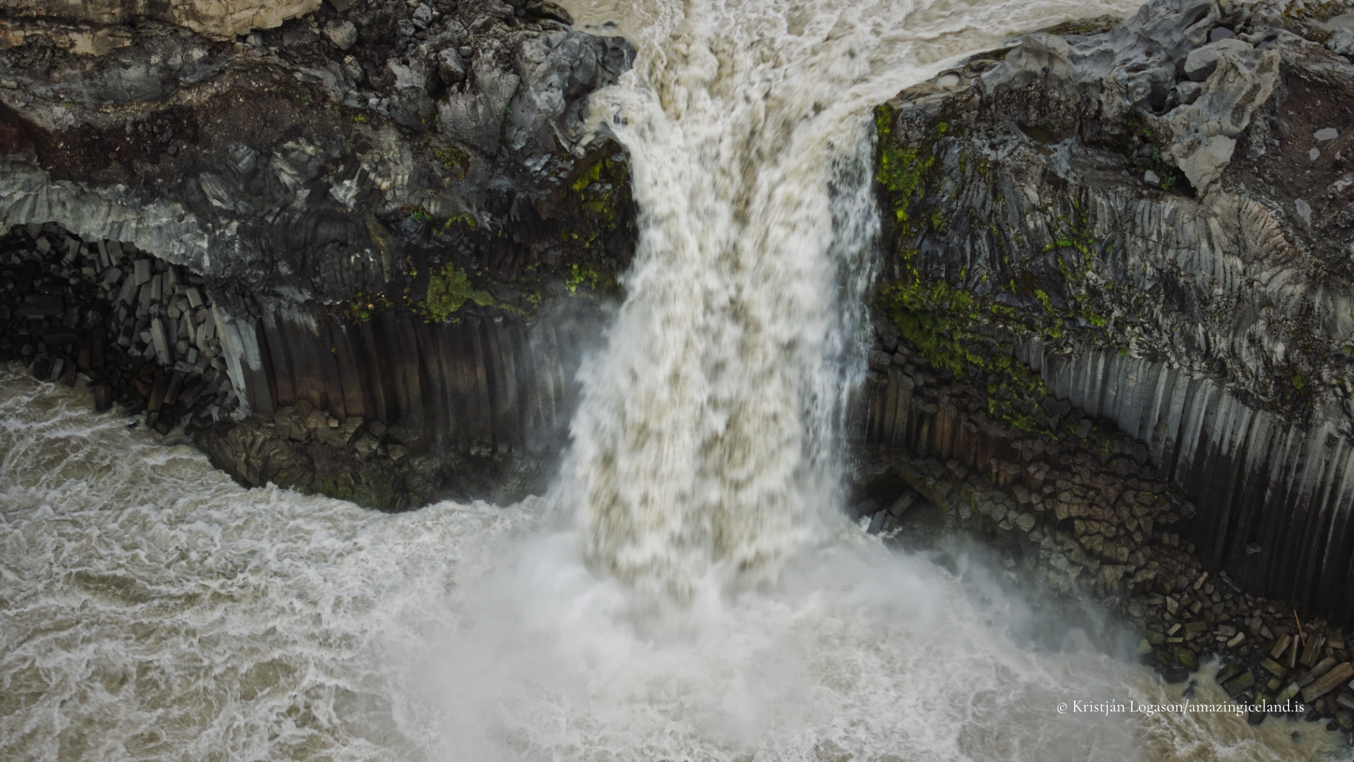
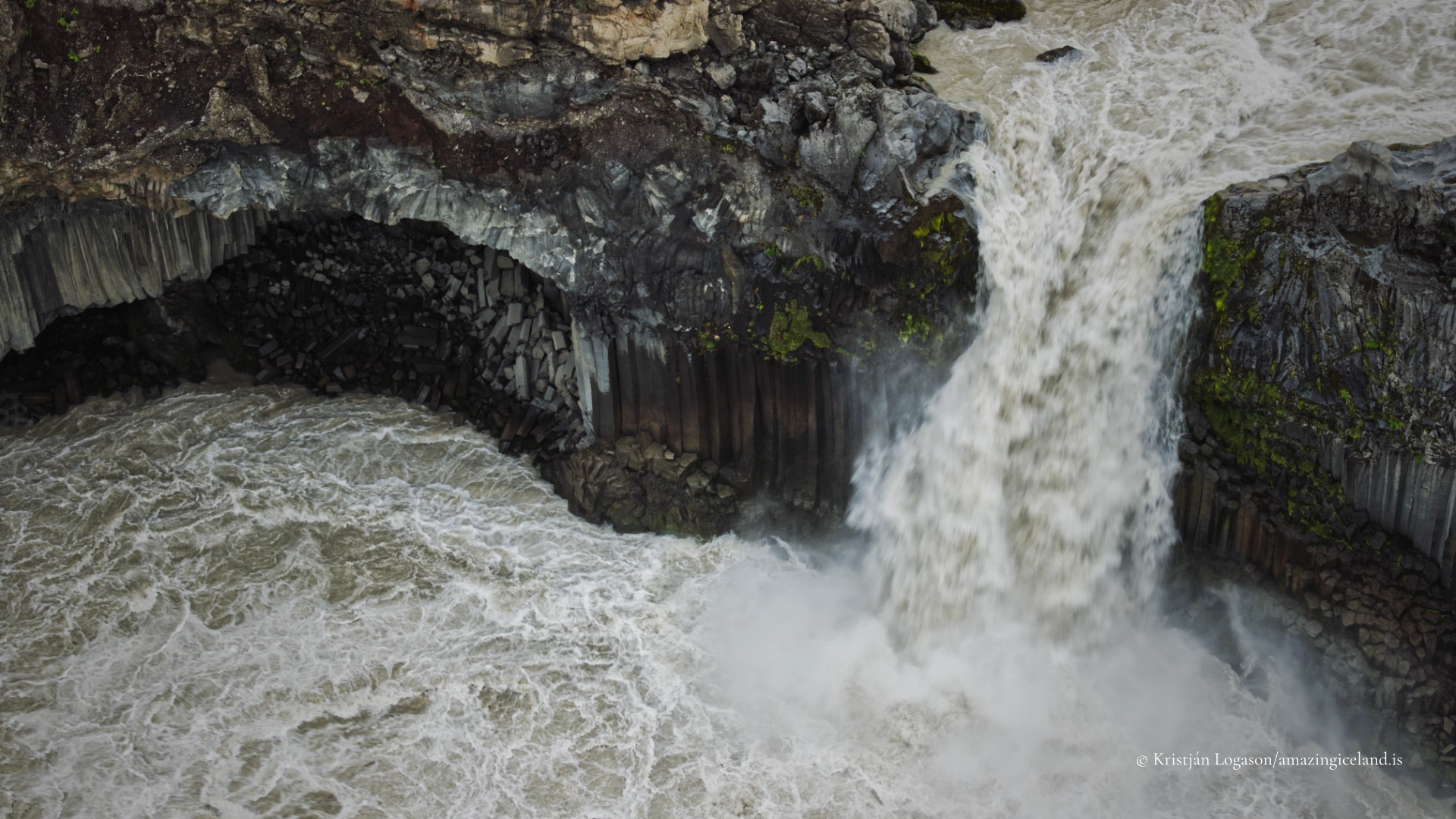
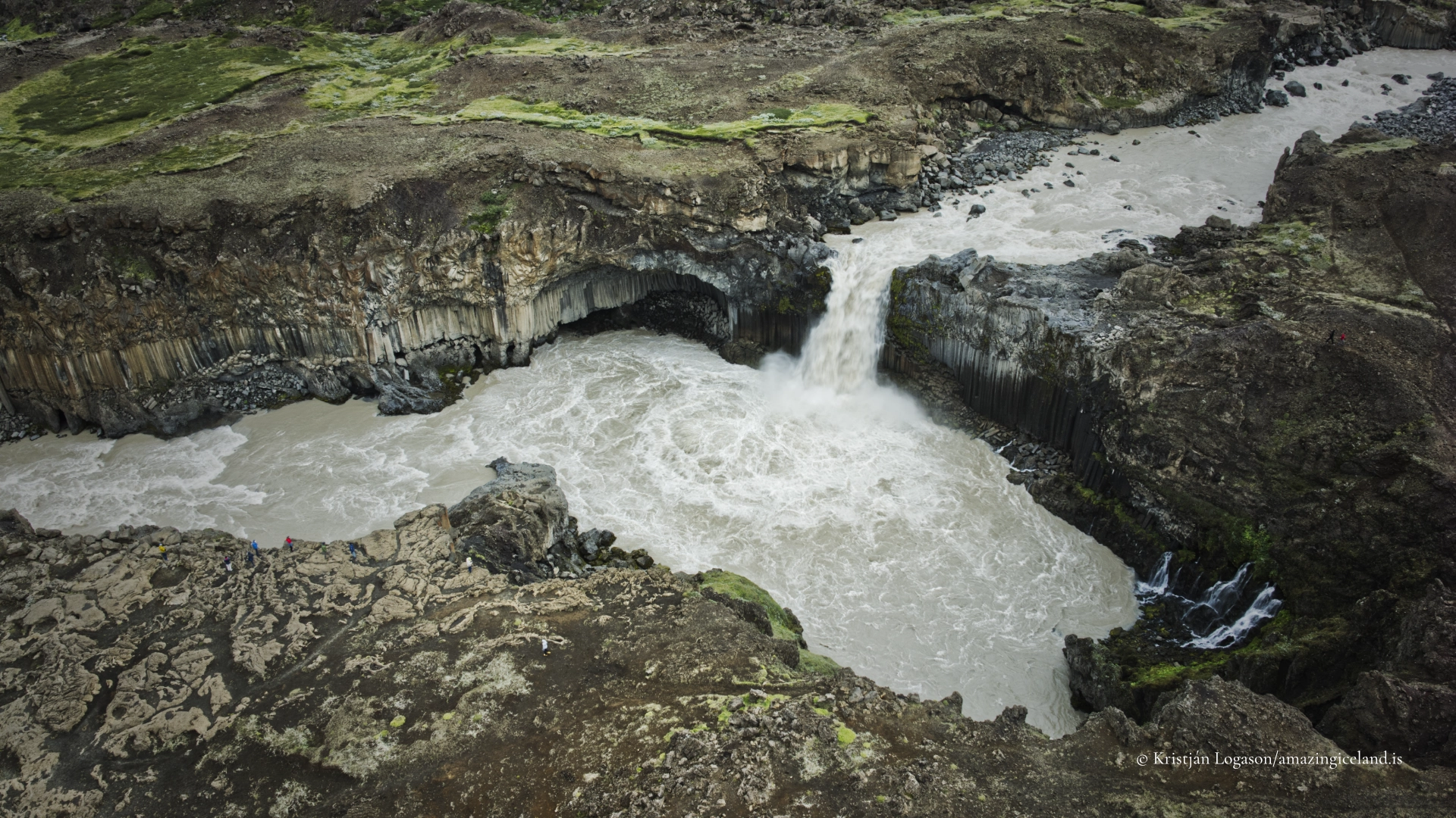
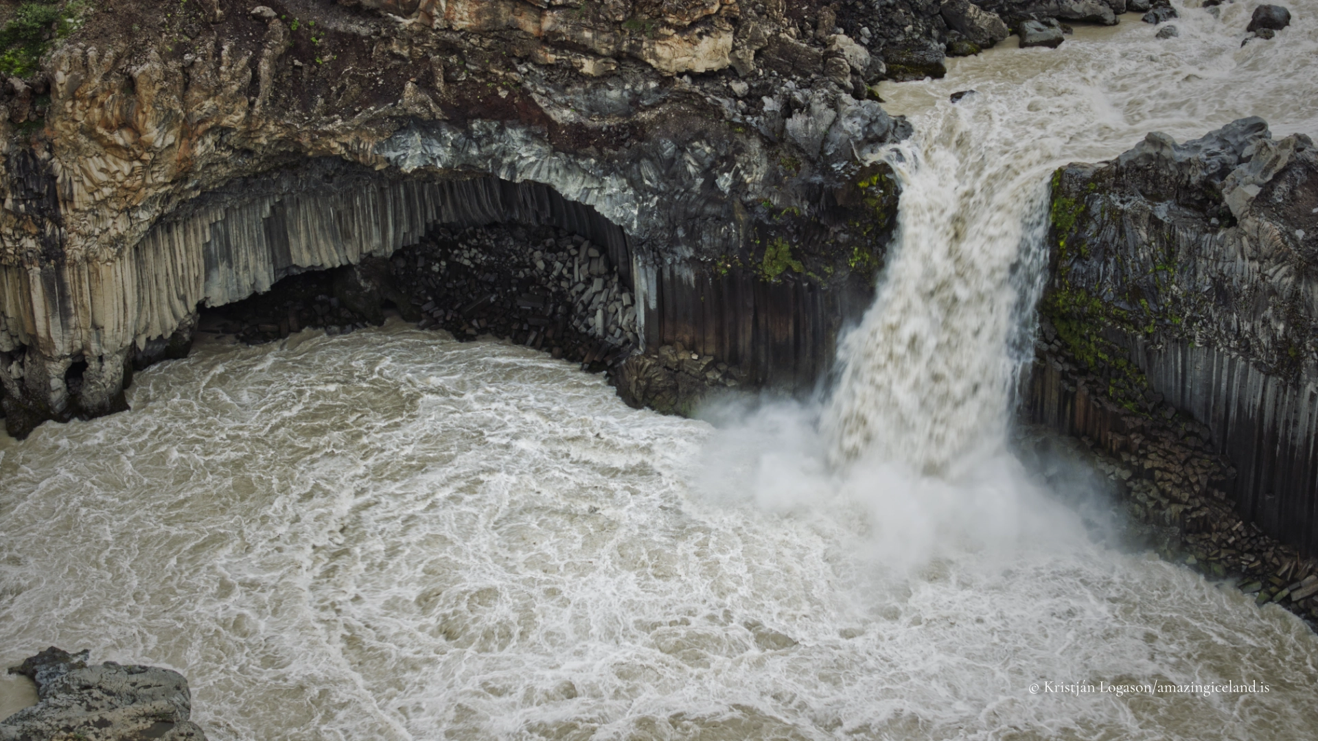
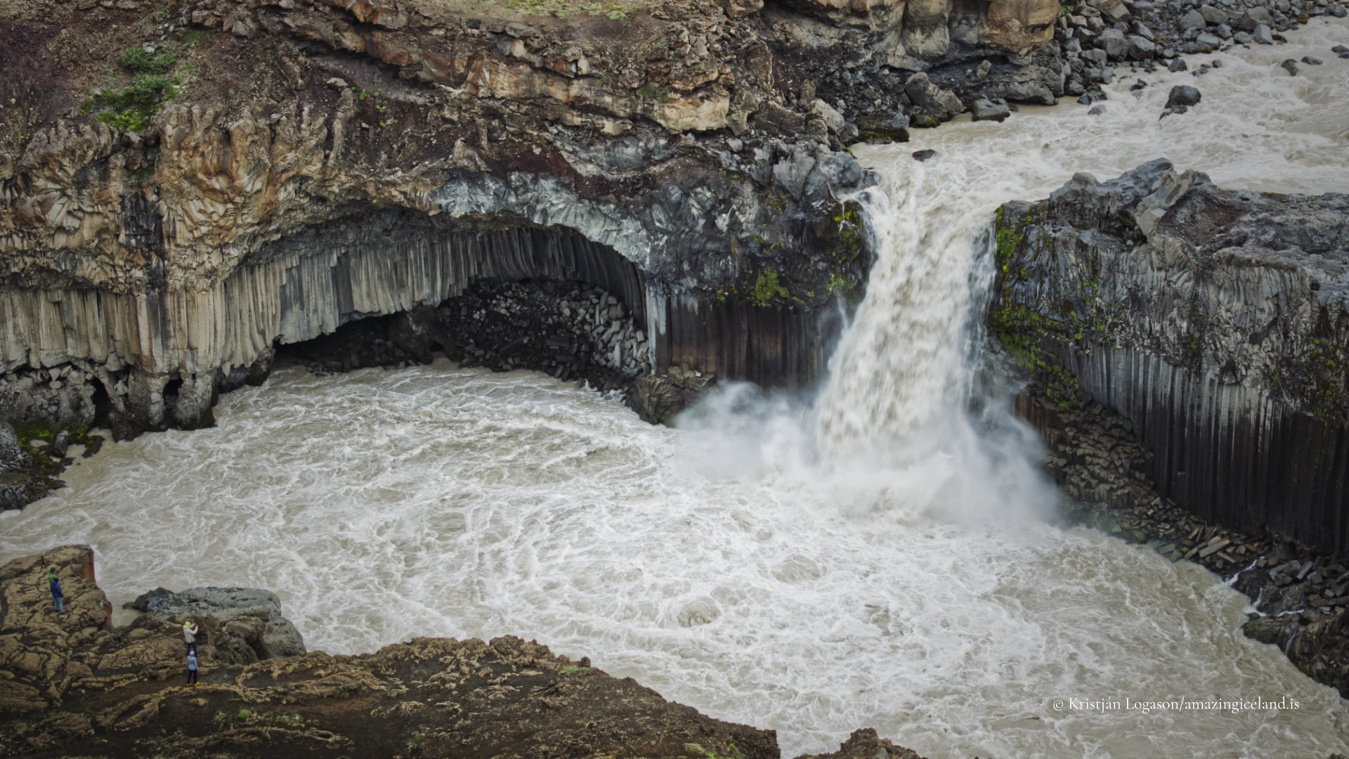
At Aldeyjarfoss, the columns do not appear merely as a wall beside the river. They curve around the basin and create a dark enclosure for the falling water. Some remain upright, while others have been broken, tilted or removed as the river exploited joints within the rock. The lava established the structure; Skjálfandafljót has continued to open and reshape it.
This interaction explains why the waterfall feels more powerful than its height alone suggests. The river and columns are not separate attractions. Each gives form to the other.
Skjálfandafljót and the 20-metre fall
Skjálfandafljót travels north from the central Highlands before reaching the sea at Skjálfandi bay. Its water comes from several sources, including glacial meltwater, precipitation and tributaries draining a large highland catchment. Flow, colour and sediment load can therefore change with temperature, rainfall and conditions far upstream.
Immediately above Aldeyjarfoss, the river narrows and accelerates before falling approximately 20 metres into the basalt-lined basin. Spray, turbulence and the confined setting amplify its sound and apparent force. In strong flow the water can appear heavy and grey-brown with sediment; under different conditions it may look lighter or clearer. Ice and snow can transform the surrounding rock in winter, although the road conditions that create those scenes can also make the site inaccessible.
The waterfall is also an ecological boundary. Migratory fish can travel roughly 73 kilometres inland through the Skjálfandafljót river system, but Aldeyjarfoss forms the upper limit of that journey. The waterfall is therefore more than a striking break in the landscape: it marks a real division within the life of the river.

From Bárðardalur onto F26
The normal approach begins near Goðafoss and follows Bárðardalsvegur vestri, Road 842, south through Bárðardalur. After approximately 37–38 kilometres, Road 842 ends and Sprengisandsleið, F26, begins. Aldeyjarfoss lies roughly four kilometres farther along the northernmost section of F26, with a short turn-off leading towards the parking area.
This distinction matters. Visitors approach through the settled valley, but the final section is a mountain road. A high-clearance four-wheel-drive vehicle is advisable. There are no river crossings on this northern approach to Aldeyjarfoss, but F26 continues south as a much longer and more demanding highland route. A visit to the waterfall should not be mistaken for evidence that the road across Sprengisandur is open or suitable for onward travel.
Road 842 may remain accessible longer than F26, but access to Aldeyjarfoss depends on the condition and official status of the final mountain-road section. Fixed seasonal dates are unreliable. Current road and weather conditions should always be checked before departure, and a closed road must never be entered.
Visitors pass through gates on the final approach. These belong to working land and must be closed again after passing through them.
The walk, viewpoints and facilities
There were no toilets or reliable visitor facilities at the parking area when last checked. Travellers should arrive prepared and take all waste away with them.
The walk from the parking area is short, but it includes a somewhat steep descent over rough and uneven ground. There is no constructed visitor route with boardwalks or railings at the waterfall. The accessible side offers several useful viewing positions rather than one fixed platform, but there is no practical visitor access to an equivalent viewpoint on the opposite bank.
The unfenced edge requires ordinary care. Loose gravel, wet rock, wind and the distraction of looking through a camera can all reduce awareness of footing. This is particularly relevant when moving backwards to adjust a composition or working with a tripod. Conditions at the site should determine how closely the edge is approached.
Aldeyjarfoss is not a place that needs a long list of facilities or activities. Its value lies in stopping at the boundary between valley and Highlands and observing how water has cut through one ancient body of lava.
Interesting facts:
-
- Aldeyjarfoss drops approximately 20 metres on the Skjálfandafljót river.
- Its columns formed within Suðurárhraun, part of the Frambruni lava field, around 9,000–9,500 years ago.
- The normal northern route follows Road 842 through Bárðardalur and then continues for roughly four kilometres on F26.
- No river crossings are required when approaching from the north.
- Aldeyjarfoss forms the upper limit for migratory fish within the Skjálfandafljót river system.
- The waterfall stands at a physical and visual transition between the inhabited valley and the Highlands.
Image Gallery
Photography tips:
- The classic view places the falling water inside the dark semicircle of basalt. A vertical composition can emphasise the height of the columns and the confinement of the river, while a wider frame can show Aldeyjarfoss as a break within the open landscape at the highland margin.
- Several positions on the accessible side allow the relationship between the waterfall and the columns to be adjusted. Lava in the foreground can create depth, but it should support rather than obscure the geometry of the basin. People, when naturally present, can provide scale.
- Shutter speed should be chosen according to the character of the water. A faster exposure preserves texture, sediment and weight when the river is powerful. A long exposure can simplify the composition and separate pale water from dark basalt, but smoothing the river automatically can remove much of what makes Aldeyjarfoss convincing.
- Overcast weather often works well because it retains detail in both the water and the dark columns. When low directional light reaches the basalt, it can reveal the three-dimensional form and separation of individual columns. Spray and wind may reach the lens, so a cloth and suitable protection are useful.
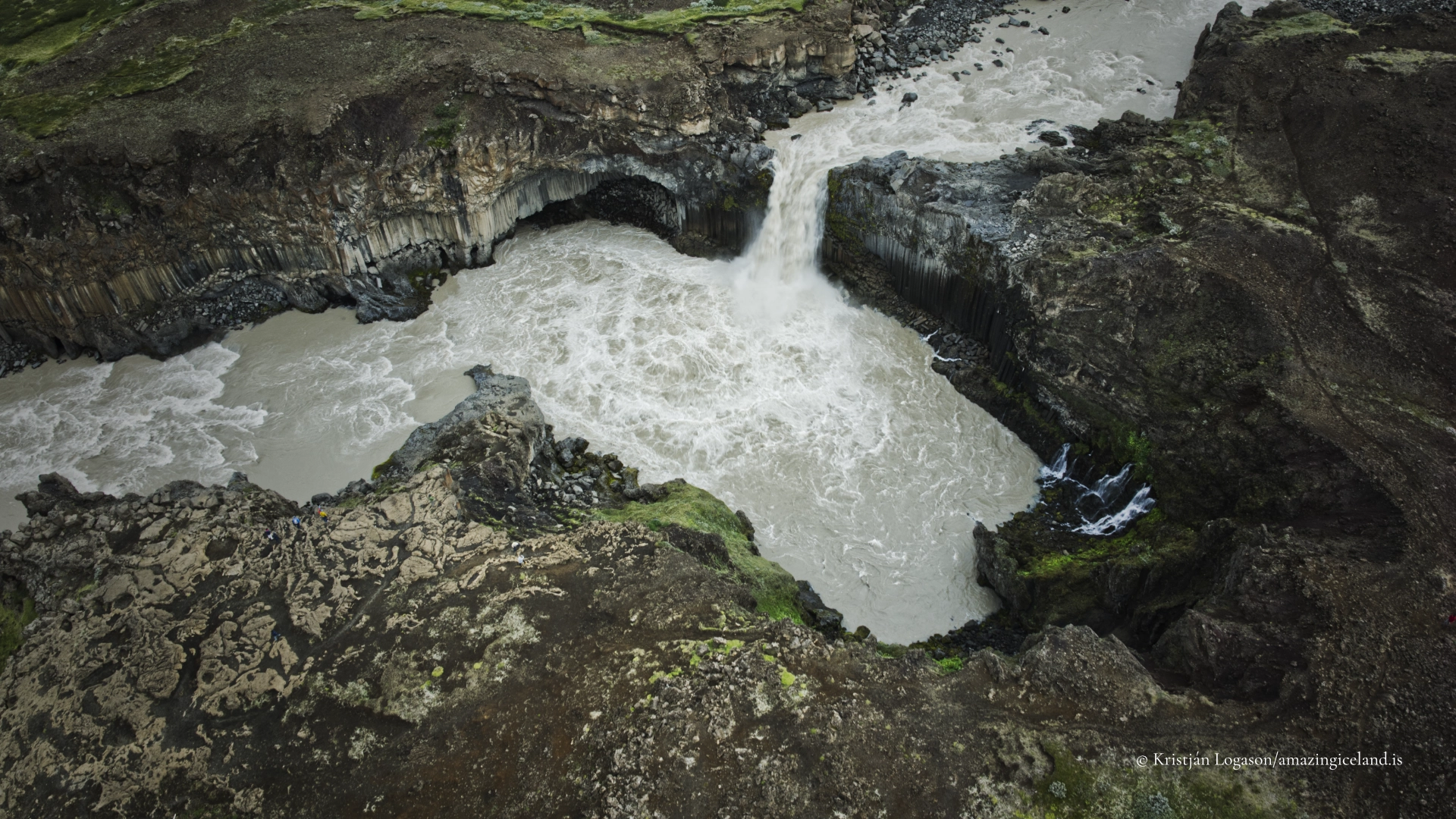
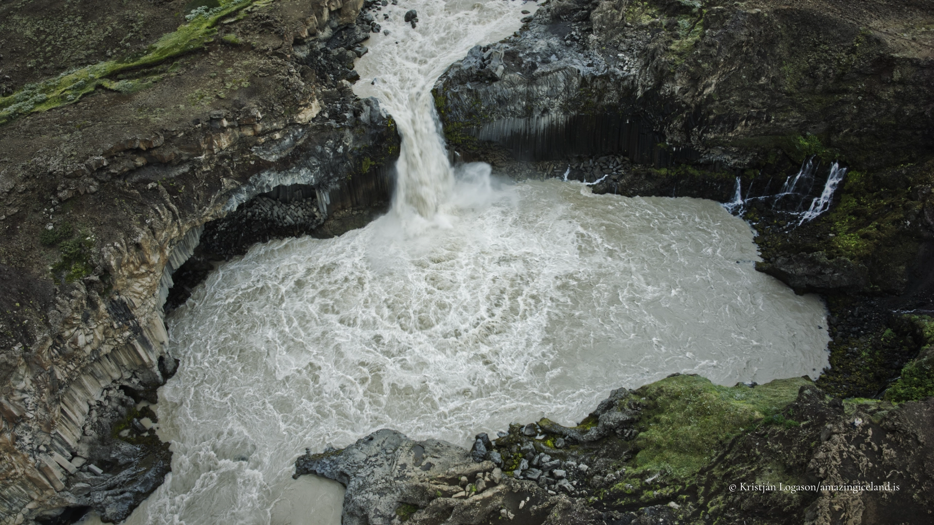
- From the air, the curve of the basin and the river channel above and below the fall become much clearer. Any drone flight must comply with current aviation and land-use rules and must not disturb people or wildlife.
- The edge is unfenced. Camera settings and compositions should be decided from stable ground, with particular care when stepping backwards or concentrating on a screen.
Destinations nearby