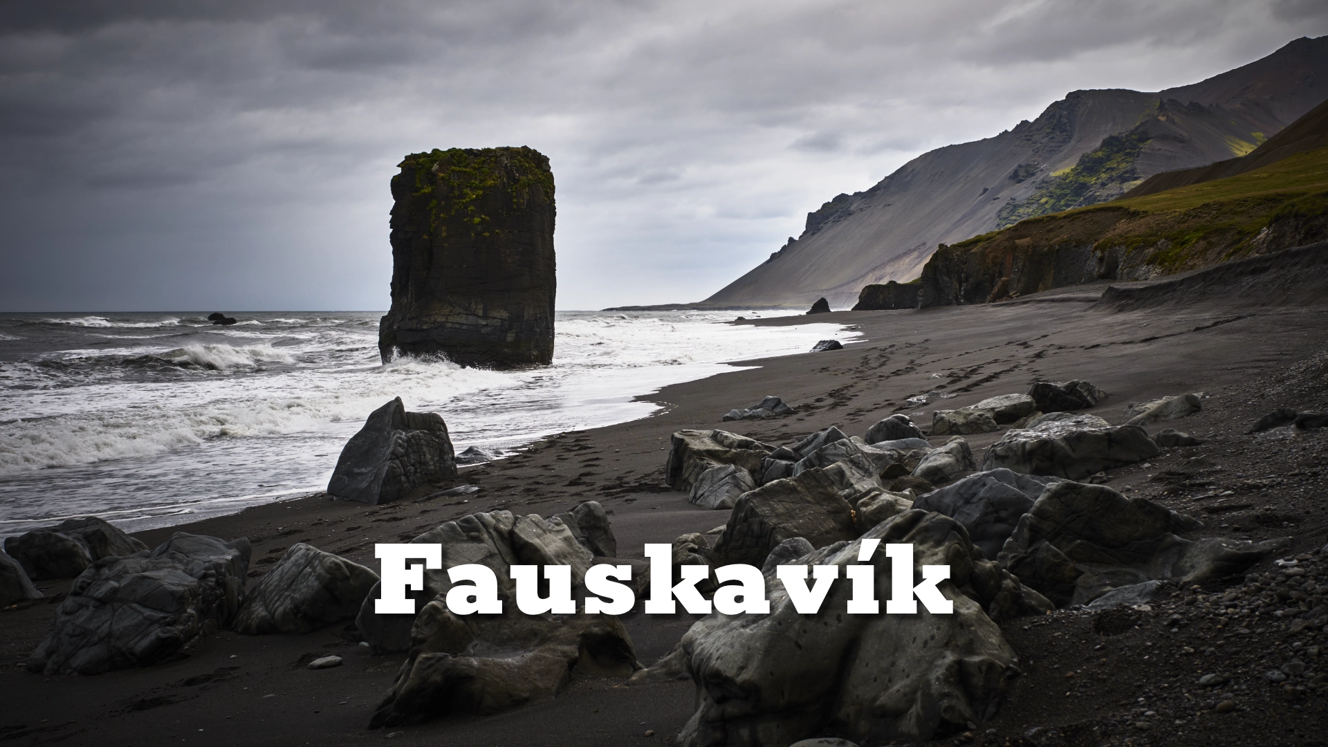
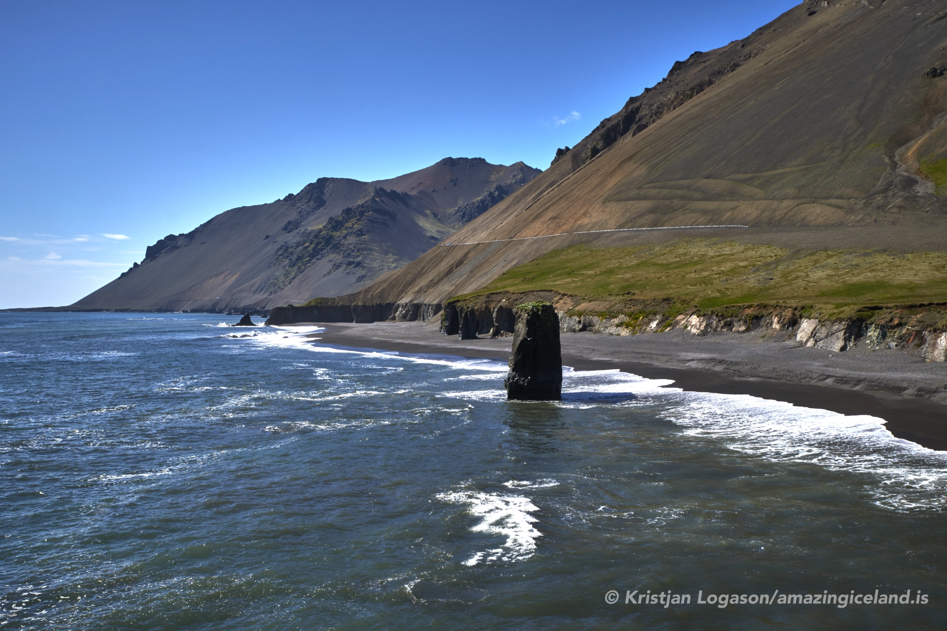
Along the rugged coastline of East Iceland, Fauskavík, also known as Stapavík, occupies a recessed stretch of coast shaped by volcanic bedrock and persistent wave energy. Isolated from settlements and infrastructure, the bay offers a direct reading of Iceland’s coastal geology—basalt cliffs, fractured stacks, and a shoreline defined more by process than by access.
The location of Fauskavík or stapavik bay
Latitude
65.2478
Longitude
-13.8406
Fauskavík or stapavik bay
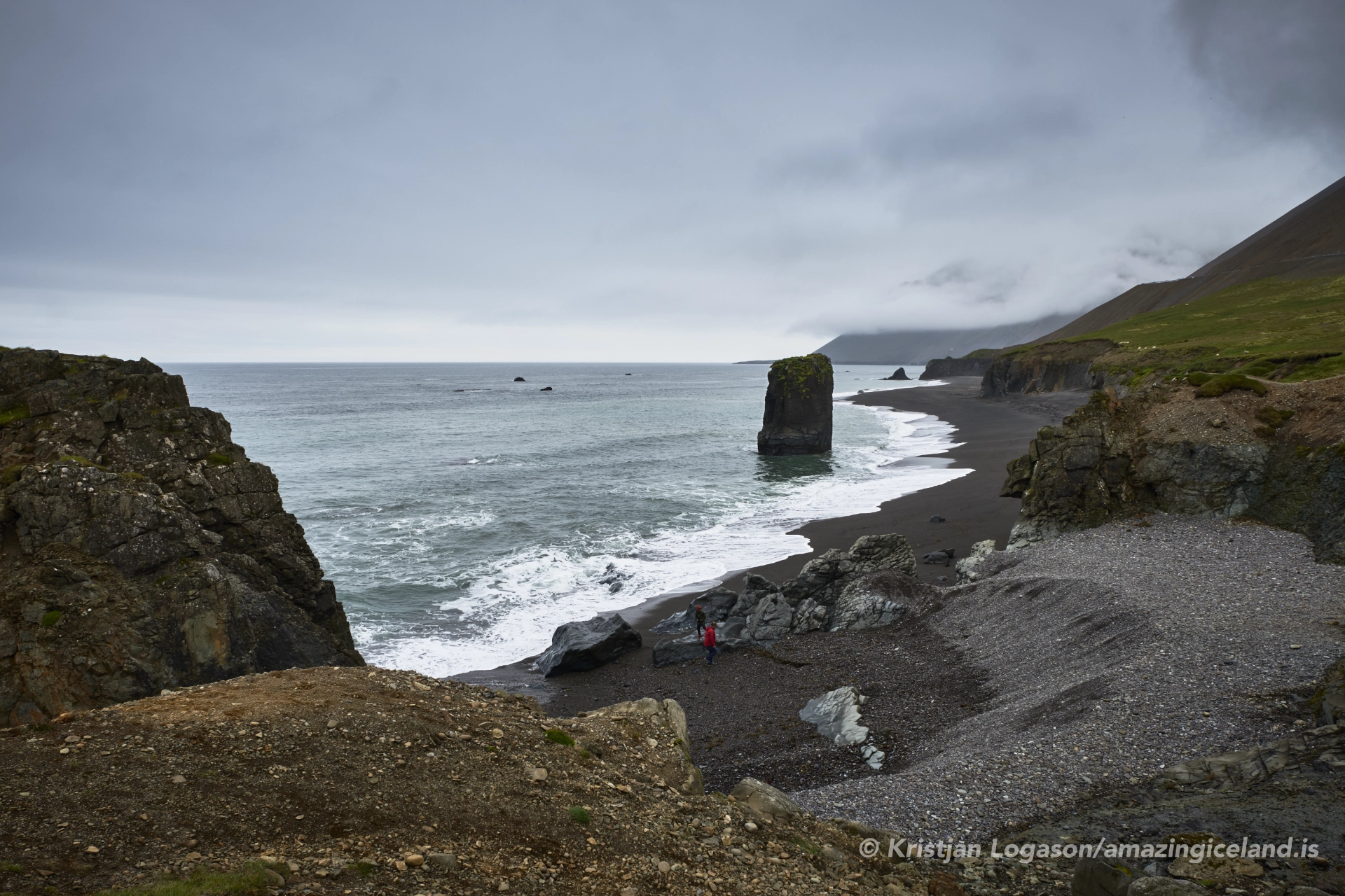
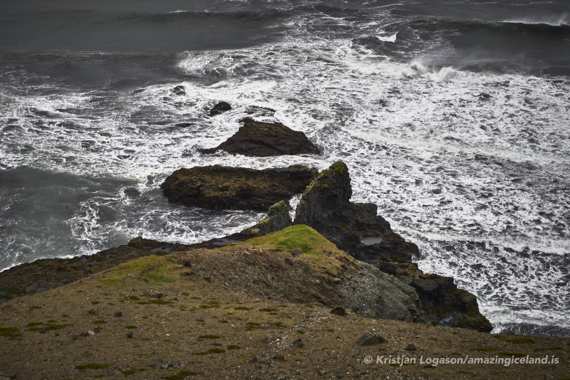
Fauskavík lies along the outer coast of East Iceland, facing the Norwegian Sea and exposed to long-fetch wave systems generated across the North Atlantic. Unlike the more sheltered fjords that define much of the region, this section of coastline is open and uncompromising. The bay itself is modest in scale, but its setting amplifies its impact: steep headlands, dark volcanic rock, and minimal lowland buffer between sea and cliff.
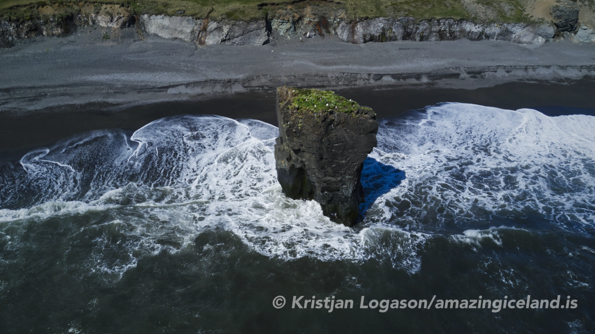
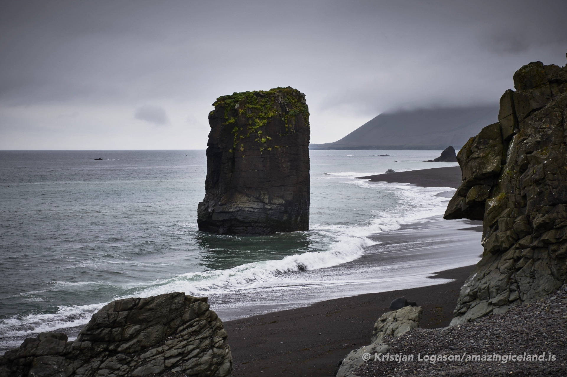
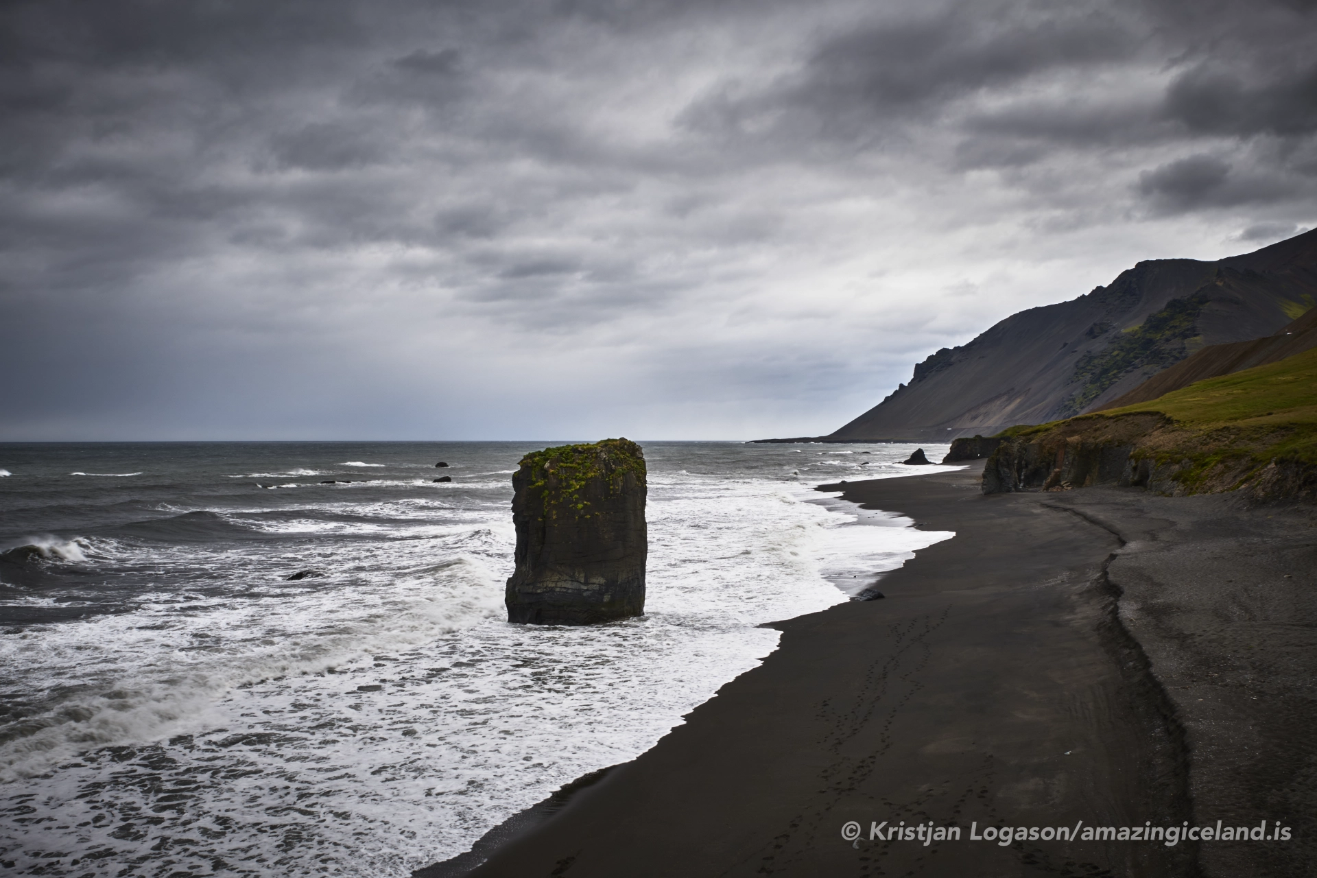
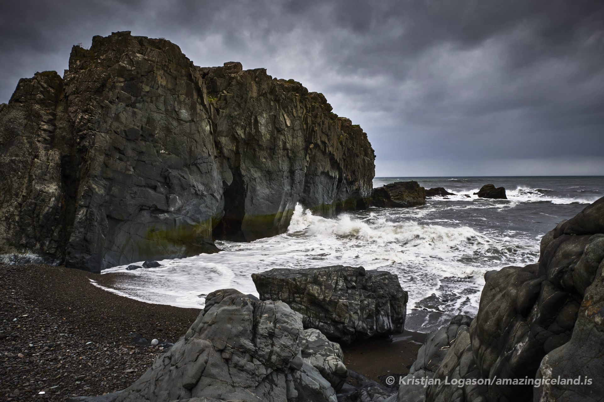
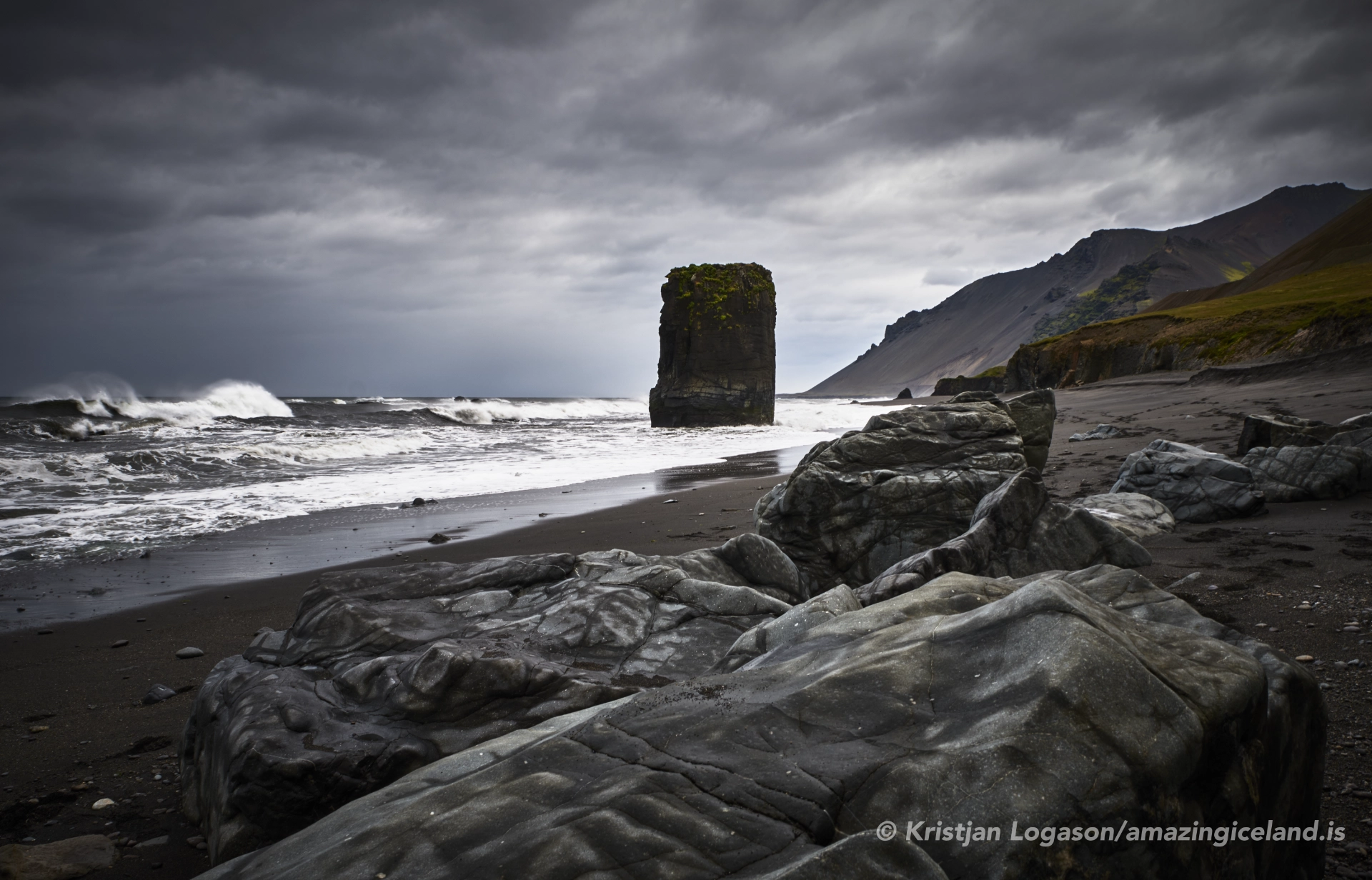
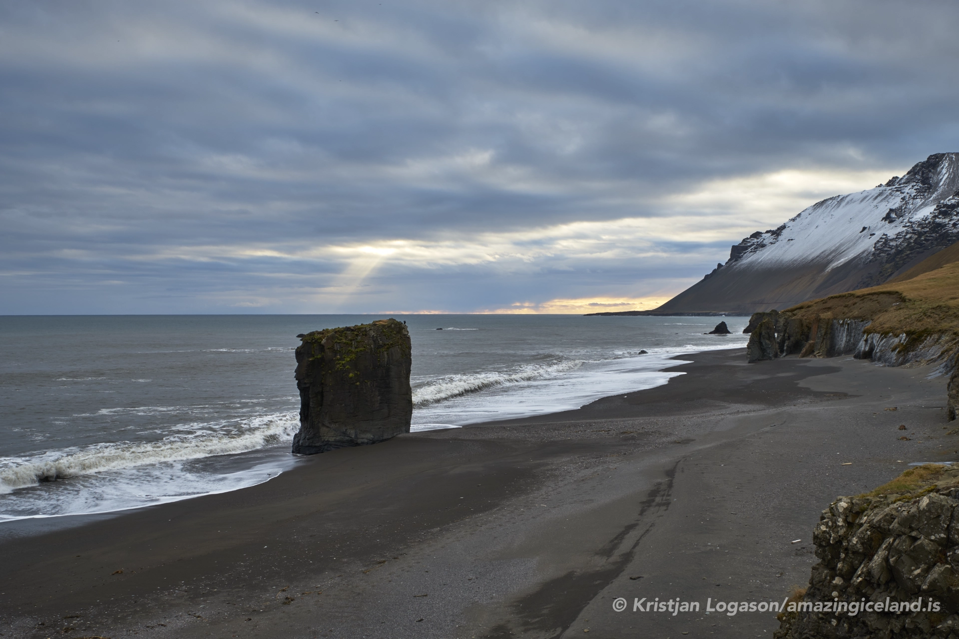
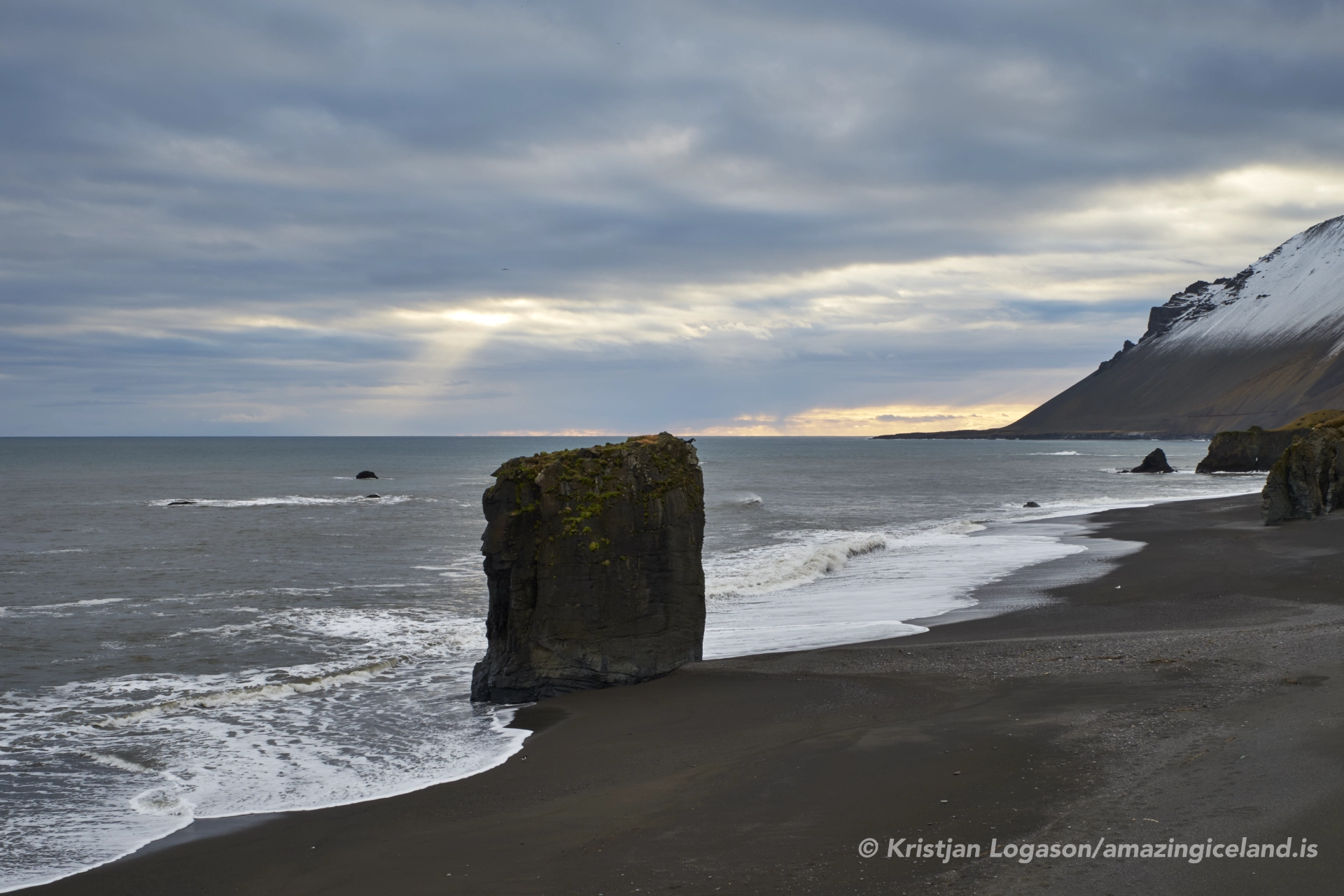
The bedrock here is predominantly basalt, formed through successive lava flows that cooled and fractured over time. In places, this cooling produced columnar basalt, visible in cliff faces and detached stacks along the shore. These columns create vertical articulation in the rock, guiding erosion and influencing how the coastline breaks apart under wave attack. Rather than smoothing the landscape, the sea exploits these fractures, accelerating collapse and retreat.
From a geomorphological perspective, Fauskavík is a high-energy coastal environment. There is little sediment accumulation, and beaches—where present—are narrow and transient. Material eroded from the cliffs is rapidly removed rather than deposited, reinforcing the sense of instability and exposure. The bay therefore reads not as a place of arrival, but as a place of passage—energy moving through rather than settling.
The dual naming of the bay—Fauskavík and Stapavík—reflects a common Icelandic pattern where local usage, historical references, and descriptive naming coexist. “Stapavík” is often associated with the rock stacks (stapar) that rise from the sea near the bay, sculpted remnants of cliff lines that once extended farther outward. These stacks function as visual markers of coastal retreat, recording former shoreline positions through absence rather than presence.
The isolation of the bay has limited direct human modification. There are no harbors, seawalls, or protective structures here. As a result, the coastline remains an active system, adjusting continuously to wave energy, frost action, and gravity-driven collapse. For academic observation, this lack of intervention is valuable—it allows coastal processes to be read without ambiguity.
Vegetation is sparse and largely confined to more stable slopes above the cliffs. Salt spray, wind exposure, and shallow soils restrict plant growth near the shore, reinforcing the dominance of rock and water in the visual field. This ecological restraint aligns with the bay’s broader character: minimal, exposed, and process-driven.
Access to Fauskavík is limited and informal. The bay is typically reached via rough coastal tracks branching from regional roads, and final approaches often require walking over uneven terrain. There is no designated infrastructure, and conditions vary significantly with weather and season. This lack of formal access reinforces the need for situational awareness and conservative decision-making.
From a safety perspective, the site demands respect. Cliff edges are unstable, rockfall is possible, and wave conditions can change rapidly. The absence of warning signs does not indicate safety; it indicates remoteness. Observation is best conducted from stable ground, with attention paid to wind direction and swell patterns.
Despite—or because of—these constraints, Fauskavík rewards careful observation. The soundscape is dominated by surf and wind rather than human activity. Visual attention is drawn to repetition: waves striking columnar faces, spray lifting and dissipating, and shadows moving across fractured rock surfaces.
Fauskavík is particularly instructive when viewed as part of the broader East Iceland coastal system. While fjords demonstrate glacial carving and sediment deposition, open bays like Fauskavík demonstrate what happens where that sediment supply is limited and wave energy dominates. The contrast clarifies how coastline type governs landform evolution.
In this context, the bay functions as a boundary condition—a place where volcanic structure sets the initial framework, but marine processes dictate long-term change. Over time, cliffs retreat inland, stacks collapse, and the coastline reorganizes. There is no equilibrium state here, only continuous adjustment.
Ultimately, Fauskavík (Stapavík) is defined by exposure. It is open to weather, to ocean, and to time in a way that inland or sheltered sites are not. The bay does not offer resolution or comfort; it offers clarity.
Within your broader destination framework, Fauskavík serves as a counterpoint to fjords, lagoons, and waterfalls. Where those concentrate water, this site disperses it. Where others emphasize accumulation, this one emphasizes loss. Together, they complete the picture of how Iceland’s landscapes are shaped—not only by ice and fire, but by persistent, patient wave energy.
Interesting facts:
- Fauskavík is also known as Stapavík, referencing nearby rock stacks.
- The bay is located on Iceland’s open east coast, not within a fjord system.
- Coastal cliffs are composed mainly of basalt lava flows, locally forming columnar structures.
- There is no built harbor or infrastructure at the site.
- The coastline is shaped by high-energy North Atlantic wave action.
Image Gallery

The Locomotive Elite
What do Donald Trump and Iceland’s Locomotive Elite have in common?
Far more than you think.
In The Locomotive Elite, you’ll uncover how a tiny clique in Iceland captured extensive control—of banks, courts, media, and even the central bank.
For decades they ruled, first democratically, then through corruption and in the end through crime, enriching themselves and their cronies while dismantling oversight.
The result?
One of the most spectacular financial collapses in modern history.
Photography tips:
- Work with repetition: Basalt columns, wave sets, and cliff faces reward rhythm-based compositions.
- Long exposures selectively: They can emphasize wave motion, but fast shutter speeds better convey force.
- Mind scale: Include cliff faces or distant stacks rather than foreground clutter to communicate size.
- Weather honesty: Overcast and wind suit the site; dramatic light is a bonus, not a requirement.
- Safety first: Avoid cliff edges and wave-cut platforms—distance strengthens both composition and survival.
Good cameras for Iceland
Sony A7R V

Sony A7s lll

Canon R6

Nikon Z6 lll

Destinations nearby


Good to have in Iceland


