Thingvellir national park
No place is more closely connected with the history of Iceland than Thingvellir. The Althing was established here around 930, laws were proclaimed and disputes settled, Christianity was adopted through an extraordinary act of political compromise, and centuries later Icelanders returned to Thingvellir to celebrate the foundation of their parliament and declare the modern republic.
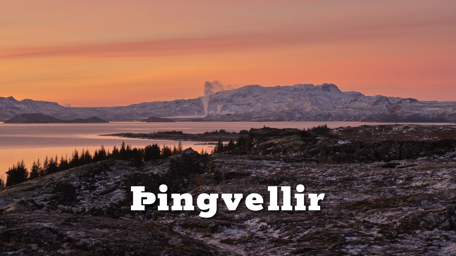
Thingvellir is also a place where the restless geology of Iceland is unusually visible. Almannagjá rises behind the old assembly grounds, fissures cross the lava and the clear waters of Silfra reveal part of the rift below the surface. History and landscape are not separate stories here. Together they have made Thingvellir both a national shrine and one of the most important cultural sites in Iceland.
The location of Thingvellir national park
Latitude
64.2558
Longitude
-21.1299
Thingvellir national park
The Althing and the making of Iceland
The settlers of Iceland had no king and no central executive government. Their society was governed through law, local chieftains and assemblies. Around 930, the Althing was established at Thingvellir as a general assembly for the whole country. It was both a legislative and judicial gathering, held for roughly two weeks at the beginning of summer.
People travelled to Thingvellir from across Iceland. Chieftains and their followers discussed laws and political matters, judges heard disputes, sentences were announced and alliances were formed. Merchants, craftspeople, farm workers, storytellers and those seeking work also gathered there. For the duration of the assembly, this otherwise quiet valley became the centre of Icelandic public life.
The lawspeaker stood at Lögberg, the Law Rock, and recited the laws aloud in a society without a written law book. He also announced decisions and addressed those assembled. Lögberg should not be understood as one securely identified rock that has survived unchanged from the tenth century. It was the place from which the lawspeaker could be seen and heard, and its precise location during the Commonwealth period remains uncertain. Changes caused by earthquakes and movement within the rift have also altered the landscape since the first assemblies.
The Commonwealth lasted until Iceland submitted to the Norwegian crown in 1262–1264. The Althing continued to meet at Thingvellir under foreign rule, although its authority changed. Its final session there was held in 1798. The institution was abolished in 1800 and restored as a consultative assembly in Reykjavík in 1844, meeting there for the first time the following year.
Þorgeir’s decision
One of the strongest stories associated with Thingvellir took place around the year 1000, when growing tension between pagan and Christian factions threatened to divide the country. Each side was prepared to live under its own law. Such a division could have fractured the young society and led to violence.
The decision was entrusted to the lawspeaker, Þorgeir Ljósvetningagoði, who was himself a pagan. According to Íslendingabók, he lay beneath his cloak for a day and a night while considering the matter. When he emerged, he called the people to Lögberg and ruled that Iceland should remain one country under one law and accept Christianity. Some pagan practices were initially allowed in private, giving society time to absorb the change.
The importance of the decision lies not only in Iceland’s conversion. Þorgeir placed the unity of the country above his own religious allegiance and found a settlement that opposing sides could accept. It remains an exceptional example of political leadership: not the victory of one faction over another, but a judgement intended to prevent a society from breaking apart.
Law, punishment and Drekkingarhylur
The history of Thingvellir was not always shaped by compromise. After Iceland came under Norwegian and later Danish rule, increasingly severe punishments were carried out at the assembly site. At Drekkingarhylur, a deep pool in the river Öxará, women condemned by the courts were drowned. Men were more commonly hanged or beheaded elsewhere at Thingvellir, while some people convicted of witchcraft were burned.
These executions belong to the legal and social history of the place and should not be hidden, but Drekkingarhylur needs no embellishment. It is neither a legend nor a theatrical horror story. It is evidence of a period when punishment was public, unequal and often brutal.

A national gathering place
During the nineteenth-century independence movement, Thingvellir acquired renewed meaning as a symbol of Iceland’s past and its claim to political freedom. The landscape, the old assembly and the idea of Icelanders gathering under their own law became inseparable in the national imagination.
In 1930, a vast national festival was held at Thingvellir to mark one thousand years since the founding of the Althing. That same year, Thingvellir became Iceland’s first national park. On 17 June 1944, another great gathering assembled here for the declaration of the Republic of Iceland. The choice of location connected the new republic directly with the assembly founded more than a thousand years earlier.
Thingvellir therefore became a national shrine through use, memory and repeated acts of national importance—not merely through official designation. A law passed in 1928 declared the protected site the property of the Icelandic nation and placed it under the preservation of the Althing.
This relationship between place and national memory also runs through Halldór Laxness’s novel Iceland’s Bell. Several of its central scenes are set at Thingvellir, where the old assembly grounds become part of a much larger story about poverty, injustice, lost independence and the endurance of Icelandic culture. Laxness did not use Thingvellir simply as scenery. He used it as a place where the country’s past continued to speak to its present.
UNESCO inscribed Thingvellir on the World Heritage List in 2004 for its cultural importance. The surrounding geology gives the historical site much of its extraordinary setting, but the UNESCO designation is cultural rather than a combined cultural and natural listing.
The rift valley and Thingvallavatn
Thingvellir lies within the active rift zone where the North American and Eurasian tectonic plates are gradually moving apart. This is often simplified into the claim that visitors can walk between two continents or stand with one foot on each plate. The reality is more interesting. The plate boundary is not a single narrow crack but a broad and geologically active zone of parallel fissures, faults and blocks of land that have subsided between them.
Almannagjá, the great fault and gorge above the historic assembly grounds, marks the western side of the rift valley. It is one part of that wider system, not a precise line separating two continents. On the opposite side of the valley, the faults around Hrafnagjá form another visible boundary. The land between them continues to widen and sink as the rift develops.
The river Öxará flows over the edge of Almannagjá at Öxarárfoss before crossing the old assembly grounds and entering Thingvallavatn. The lake is Iceland’s largest natural lake and has an ecosystem shaped by isolation, cold water and varied underwater habitats. Four different forms, or morphs, of Arctic charr live in the lake, each adapted to a different ecological niche. Thingvallavatn also supports brown trout known for their size and longevity.
Silfra
Silfra is a water-filled fissure near the northern shore of Thingvallavatn. Its cold water has filtered through porous lava before emerging in the fissure, producing exceptional clarity and underwater visibility. Visitors can walk to Silfra and see it from land. Entering the water to snorkel or dive, however, is a controlled activity conducted through authorised operators and must be arranged in advance.
Silfra is frequently promoted as a dive “between two continents.” As with Almannagjá, this is an attractive simplification rather than a literal geological description. Divers and snorkellers are entering a fissure within the broad Thingvellir rift zone—an experience that is remarkable without needing the myth.
Visiting Thingvellir
For a first visit, car park 1 at Hakið is the most useful starting point. The viewpoint gives an immediate sense of the rift valley, Thingvallavatn and the historic assembly grounds below. From there, a path descends through Almannagjá towards Lögberg and the lower part of the site.
The principal historic area is best explored on foot. Paths connect Almannagjá, Lögberg, Drekkingarhylur, the church and the assembly grounds. Öxarárfoss is reached by a short diversion within the gorge. Thingvellir Church stands near the river beside the park residence. The present church dates from the nineteenth century, but churches have stood at Thingvellir since the early Christian period.
Peningagjá is another water-filled fissure beside the main paths. Its name, meaning “Money Gorge,” comes from the custom of throwing coins into the clear water. Coins can still be seen on the bottom, but adding to them is not part of protecting the site.
The main paths require no specialist equipment under ordinary conditions. In winter, surfaces in Almannagjá can become slippery, although heavily used sections are sanded. Conditions can change rapidly, and visitors should still use footwear suited to ice, snow and uneven ground.
Thingvellir is a protected national park and a World Heritage Site. Visitors should remain on marked paths where required and avoid disturbing ruins, vegetation and fissures. Recreational drone flying is subject to special restrictions, including time limits in the main visitor area, while commercial and research flights require separate permission. As regulations can change, pilots should consult the national park’s current rules before bringing a drone.
Interesting facts:
- The Althing was founded at Thingvellir around 930 and met here until 1798.
- Around the year 1000, the pagan lawspeaker Þorgeir Ljósvetningagoði ruled that Iceland should accept Christianity while remaining one country under one law.
- Lögberg was the place from which the lawspeaker addressed the assembly; its exact Commonwealth-period location is uncertain.
- Thingvellir became Iceland’s first national park in 1930.
- The Republic of Iceland was declared at Thingvellir on 17 June 1944.
- UNESCO inscribed Thingvellir as a cultural World Heritage Site in 2004.
- Thingvallavatn contains four distinct morphs of Arctic charr adapted to different habitats within the lake.
- Almannagjá and Silfra are fissures within a broad rift zone, not a single line that divides two continents.
Image Gallery


Photography tips:
- Hakið is especially rewarding on an early winter morning, when low light reaches across the rift valley and Thingvallavatn. Frost, snow and long shadows can give the landscape a depth that is easily lost in stronger midday light.
- Thingvallavatn is a popular foreground for northern lights photography. The open view over the lake provides a broad northern sky, while calm water may reflect both the aurora and surrounding mountains.
- Öxarárfoss can be particularly dramatic beneath a textured or stormy sky. A wider composition can place the waterfall within Almannagjá rather than treating it only as an isolated cascade.
- Autumn colours at Thingvellir are often extraordinary. Low vegetation, birch and the dark lava create a rich mixture of red, gold, green and black across the valley.
- The landscape also rewards close observation. Lava, moss and other vegetation provide beautiful close-up subjects, particularly in soft or overcast light when their colour and texture become more visible.
- A frozen Thingvallavatn and its snow-covered surroundings can be beautiful around sunset, when the remaining colour in the sky is reflected in ice and open water. Photograph the lake from the shore and never assume that its ice is safe to walk on.
Destinations nearby