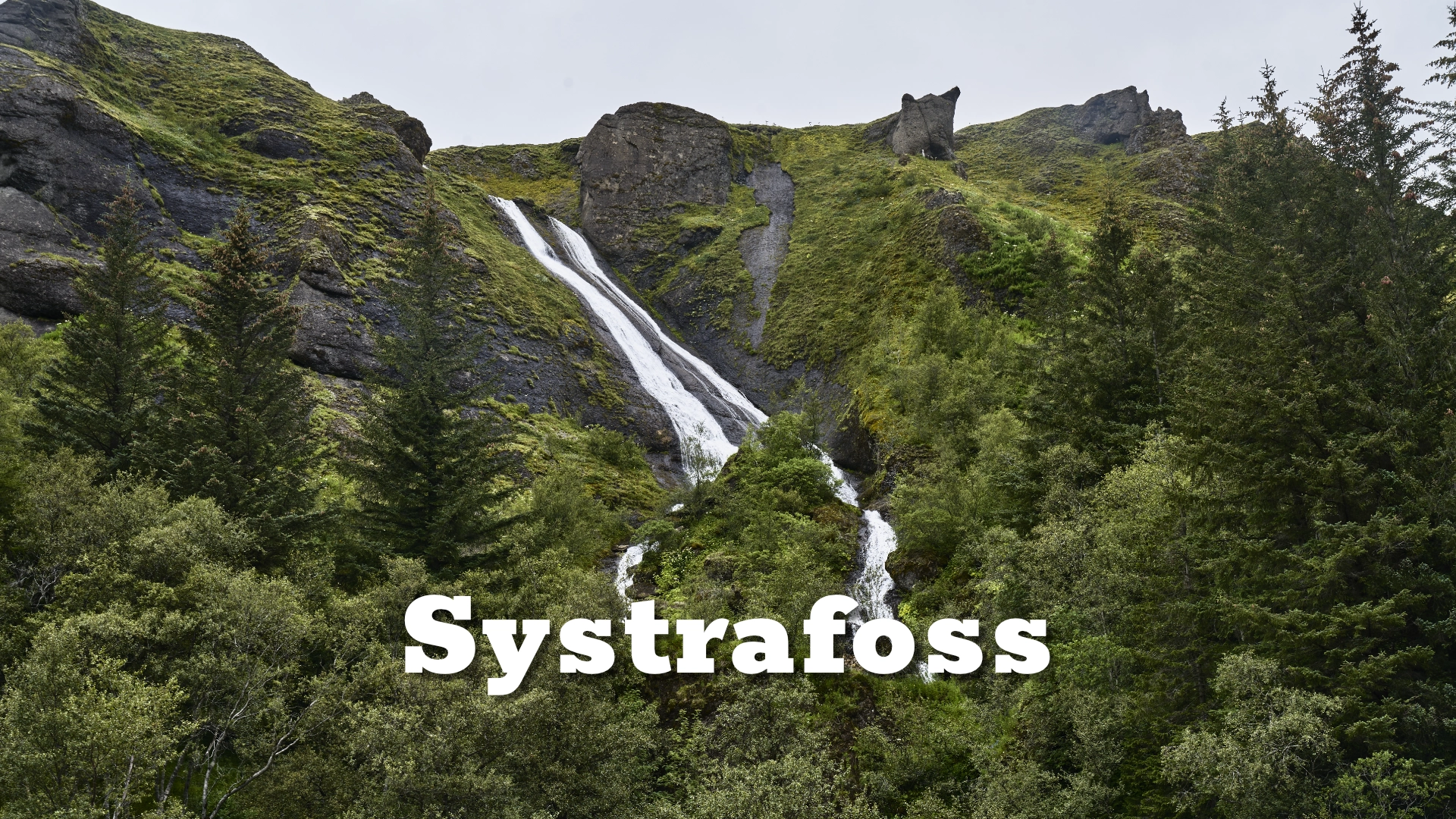
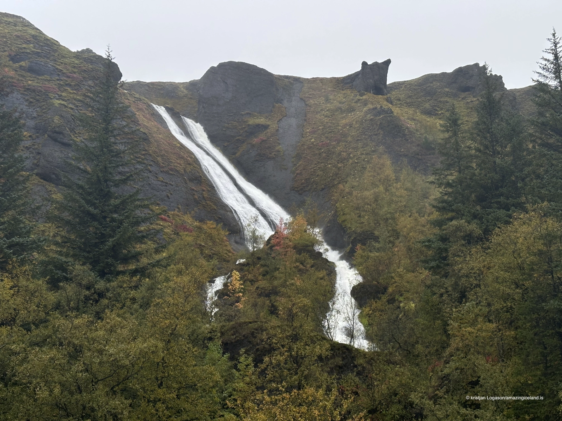
Overlooking the village of Kirkjubæjarklaustur, Systrafoss presents itself not as a single dramatic plunge, but as a structured system of waterfalls shaped by geology and time. The twin cascades—often referred to as Upper and Lower Systrafoss—form a visual and cultural landmark that connects Iceland’s volcanic terrain with centuries of settlement, belief, and landscape use.
The location of Systrafoss in Kirkjubæjarklaustur
63.7896
Latitude
Longitude
-18.0584
Systrafoss in Kirkjubæjarklaustur
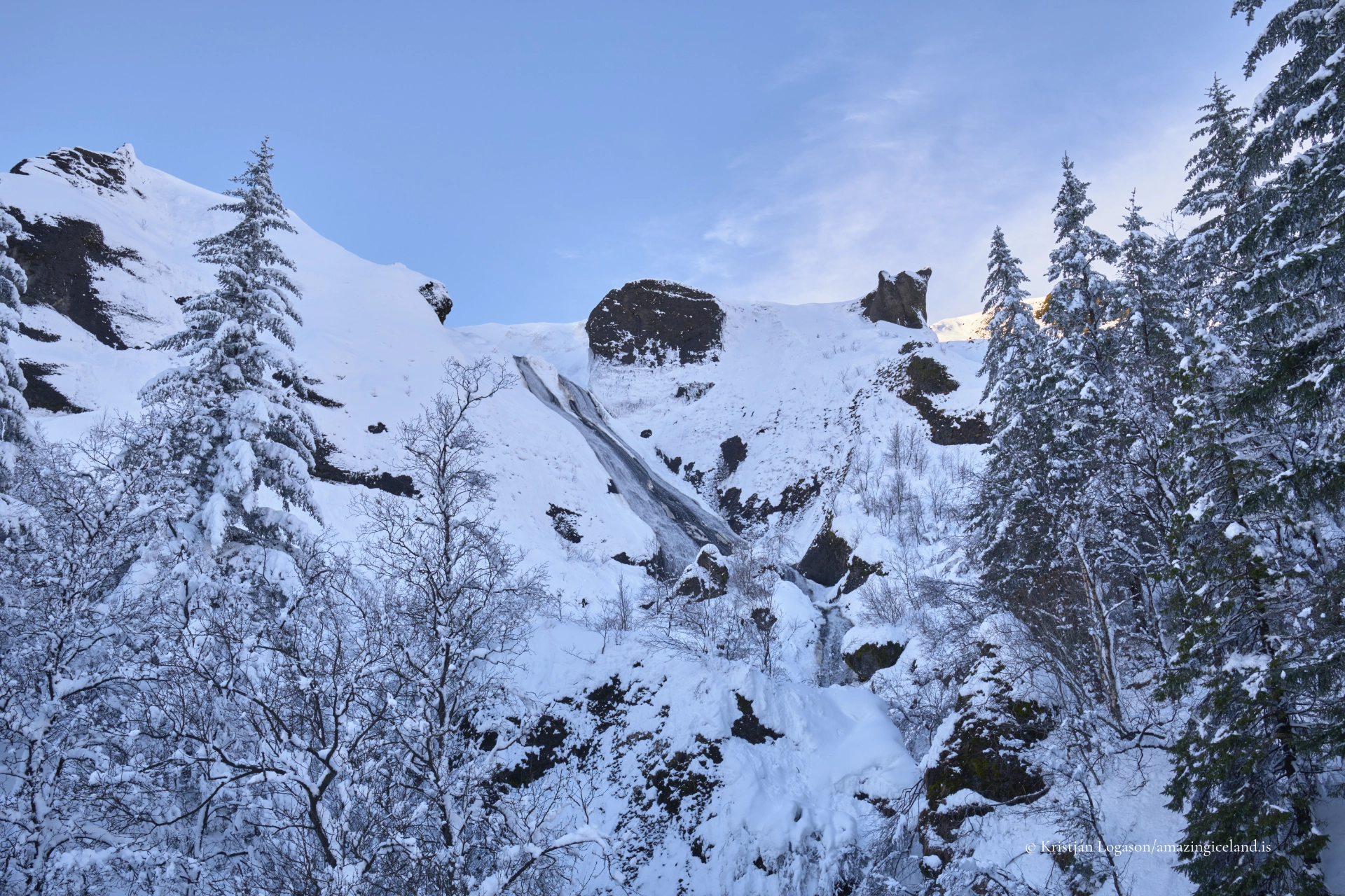
Systrafoss is located on the eastern edge of Kirkjubæjarklaustur, descending from the elevated basalt plateau that defines much of this region of South Iceland. Unlike Iceland’s large glacial waterfalls, Systrafoss is primarily a runoff-fed system, its flow responding directly to precipitation, snowmelt, and seasonal conditions rather than to a major river catchment. This hydrological dependency makes the waterfall dynamic rather than constant—sometimes restrained, sometimes assertive, but always legible in how it reflects recent weather patterns.
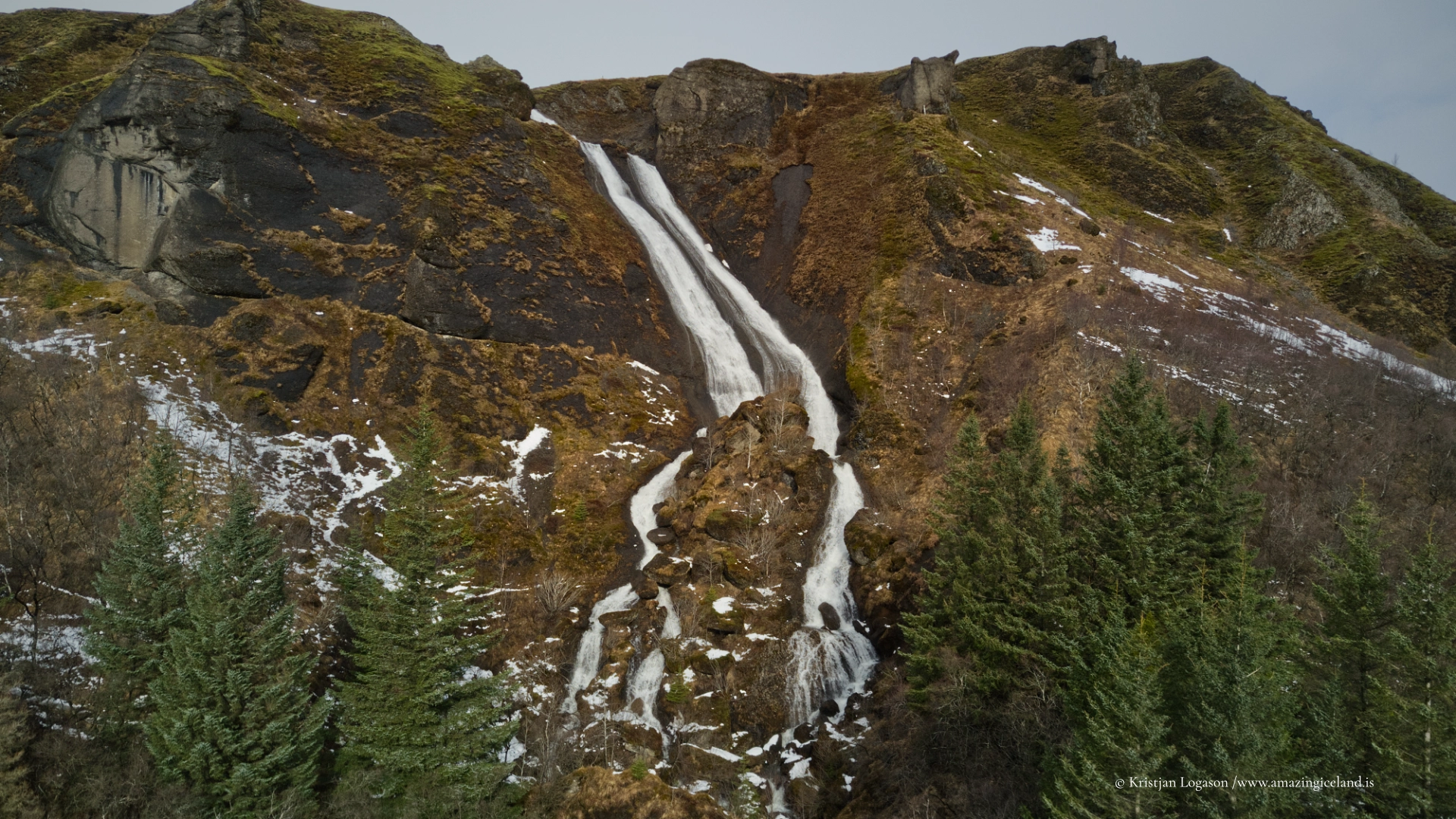
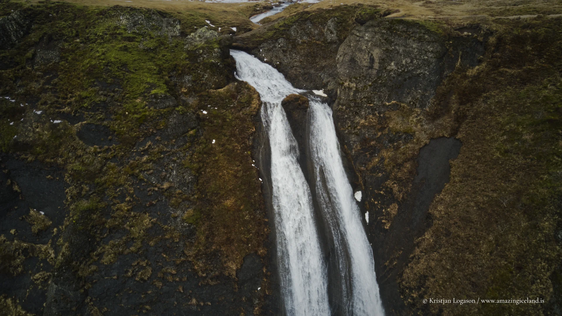
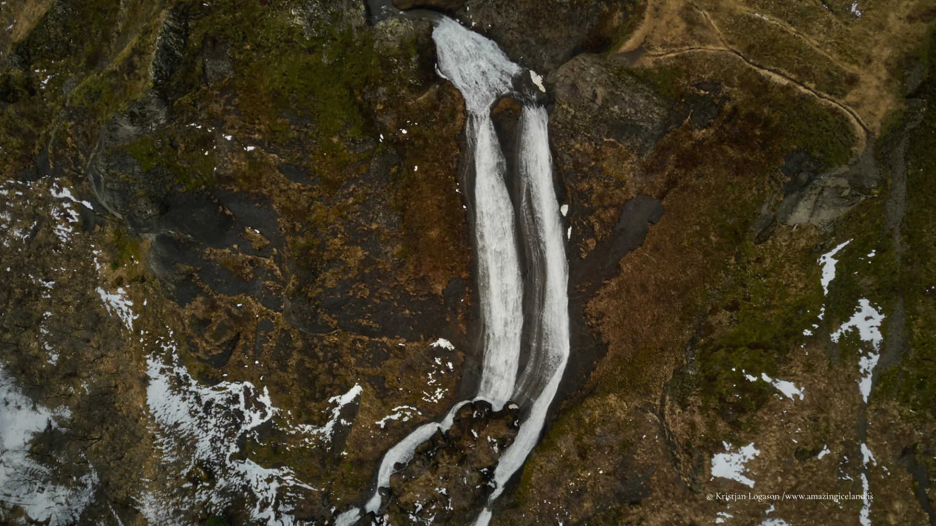
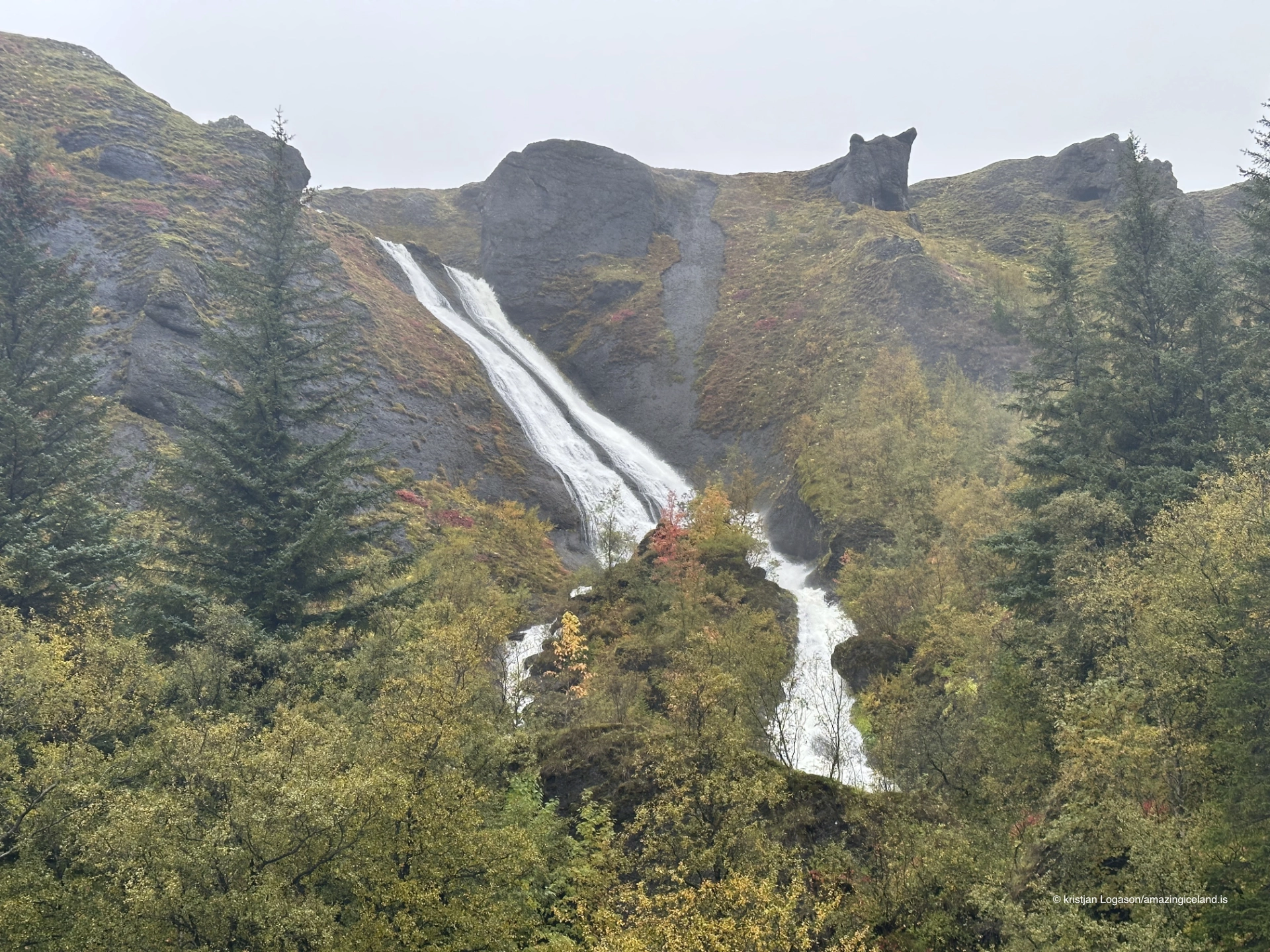
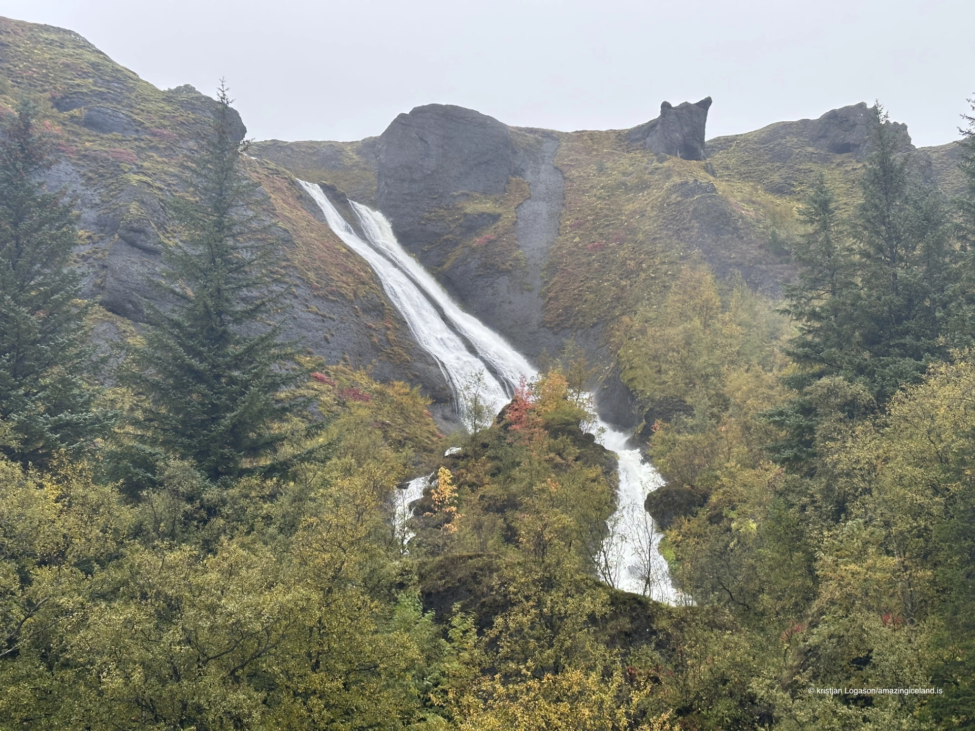
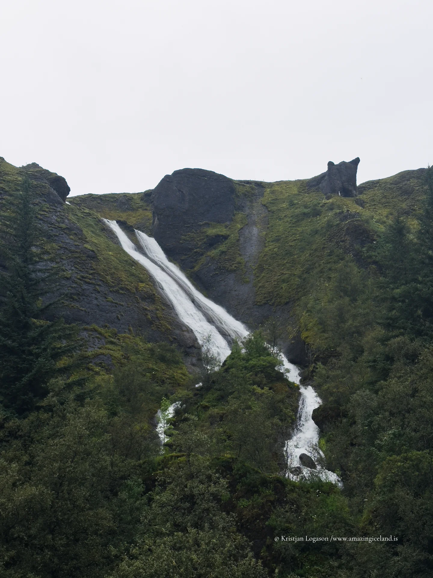
The waterfall system consists of two main sections. The lower cascade drops in a relatively narrow stream near the edge of the village, while the upper cascade spreads wider and higher across stepped basalt formations above. Together, they illustrate how columnar basalt and layered lava flows influence water behavior: the rock fractures guide the descent, creating sharp lines, angular ledges, and a distinctly vertical rhythm. This geological structure is typical of Icelandic volcanic landscapes, where repeated lava flows cool in successive layers, later exposed by erosion.
From an academic perspective, Systrafoss is a useful small-scale example of how volcanic stratigraphy and surface hydrology interact. The basalt here is dense but fractured, allowing limited infiltration while directing surface water along predictable channels. Over time, freeze–thaw cycles, chemical weathering, and mechanical erosion have widened these channels, refining the waterfall’s present form. The result is not a single dramatic event, but a readable system—water tracing the architecture of stone.
What sets Systrafoss apart from many other Icelandic waterfalls is its cultural anchoring. The name “Systrafoss” translates to “Sisters’ Waterfall,” a reference commonly associated with the Benedictine convent that once stood in Kirkjubæjarklaustur during the Middle Ages. While historical records and folklore do not always align cleanly, the persistence of the name reflects how natural features often become mnemonic anchors for human presence in the Icelandic landscape.
This relationship between place and narrative is reinforced by nearby landmarks such as Systravatn and Systrafjall, both of which are tied to local stories involving the nuns said to have lived here. From a scholarly viewpoint, these associations illustrate a broader Icelandic pattern: landscapes are not merely physical settings but repositories of memory, where geography and oral tradition co-evolve.
Visually, the waterfalls’ proximity to the village reinforces this connection. Systrafoss is not isolated in a remote valley; it is immediately present, rising behind houses and paths. This adjacency makes it a daily landmark rather than a distant spectacle. Historically, such proximity mattered. Waterfalls indicated reliable water sources, terrain stability, and natural boundaries—factors that influenced settlement decisions long before modern infrastructure.
Seasonally, Systrafoss undergoes marked transformation. In spring and early summer, snowmelt from the upper slopes increases flow, emphasizing the width and texture of the upper cascade. In drier periods, the waterfall becomes more linear and restrained, exposing the underlying basalt geometry. Winter introduces another layer altogether: partial freezing highlights edges and strata, temporarily turning flowing water into a sculptural form that reveals the waterfall’s internal structure.
From a landscape interpretation standpoint, Systrafoss functions as a vertical cross-section of the surrounding environment. Standing below the falls and looking upward, one can trace the transition from village-level sediment and vegetation to exposed lava flows and sparse highland ground cover. This verticality compresses ecological and geological zones into a short walking distance, making the site particularly valuable for observational learning.
The marked trail leading toward the upper falls and Systravatn allows visitors to experience this transition physically. As elevation increases, vegetation thins, rock exposure increases, and the soundscape shifts—from the ambient noise of the village to the focused acoustics of moving water and wind. This sensory progression reinforces the idea that Icelandic landscapes are not static backdrops but active systems shaped by energy, water, and time.
Despite its accessibility, Systrafoss rewards restraint. It is not a place that benefits from speed. The waterfall’s value lies in observation rather than immediacy—in noticing how flow patterns change across rock faces, how light interacts with spray and shadow, and how the falls relate spatially to the human settlement below. In this sense, Systrafoss aligns closely with your broader destination philosophy: places are understood best when read carefully, not consumed quickly.
Ultimately, Systrafoss is not defined by scale but by coherence. It brings together geology, hydrology, history, and lived landscape into a single, legible feature. It is a reminder that some of Iceland’s most instructive sites are not the largest or loudest, but the ones that reveal their structure openly to those willing to look.
Interesting facts:
- Systrafoss consists of two main waterfalls, often described as Upper and Lower Systrafoss.
- The waterfall is runoff-fed, making its flow highly seasonal and weather-dependent.
- The surrounding rock formations are primarily basalt lava layers, typical of volcanic plateaus in South Iceland.
- The name “Systrafoss” is linked to the historical Benedictine convent in Kirkjubæjarklaustur.
- The waterfall is directly visible from the village, making it an integrated part of the local landscape rather than a remote attraction.
Image Gallery

The Locomotive Elite
What do Donald Trump and Iceland’s Locomotive Elite have in common?
Far more than you think.
In The Locomotive Elite, you’ll uncover how a tiny clique in Iceland captured extensive control—of banks, courts, media, and even the central bank.
For decades they ruled, first democratically, then through corruption and in the end through crime, enriching themselves and their cronies while dismantling oversight.
The result?
One of the most spectacular financial collapses in modern history.
Photography tips:
- Work vertically: The waterfall’s structure benefits from vertical compositions that emphasize descent and layered rock.
- Include context: Frames that include parts of Kirkjubæjarklaustur help communicate scale and human–landscape relationship.
- Seasonal awareness: Spring provides volume; winter provides structure. Adjust expectations and exposure accordingly.
- Upper vs. lower falls: The upper cascade offers wider compositions and geological detail; the lower fall works well for tighter, more graphic framing.
- Light discipline: Overcast conditions are often ideal, reducing contrast on dark basalt and preserving water texture.
Good cameras for Iceland
Sony A7R V

Sony A7s lll

Canon R6

Nikon Z6 lll

Destinations nearby


Good to have in Iceland


