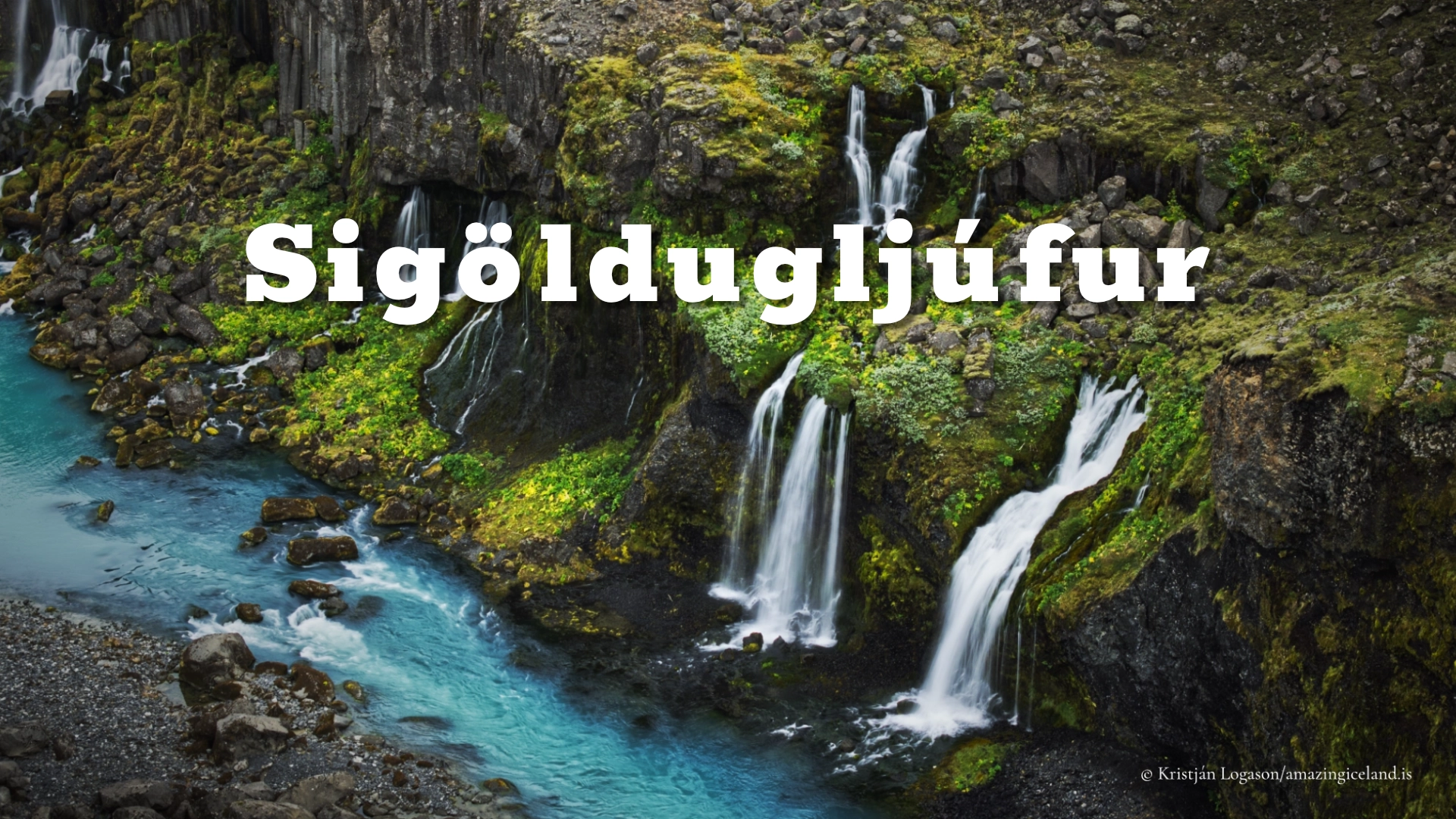
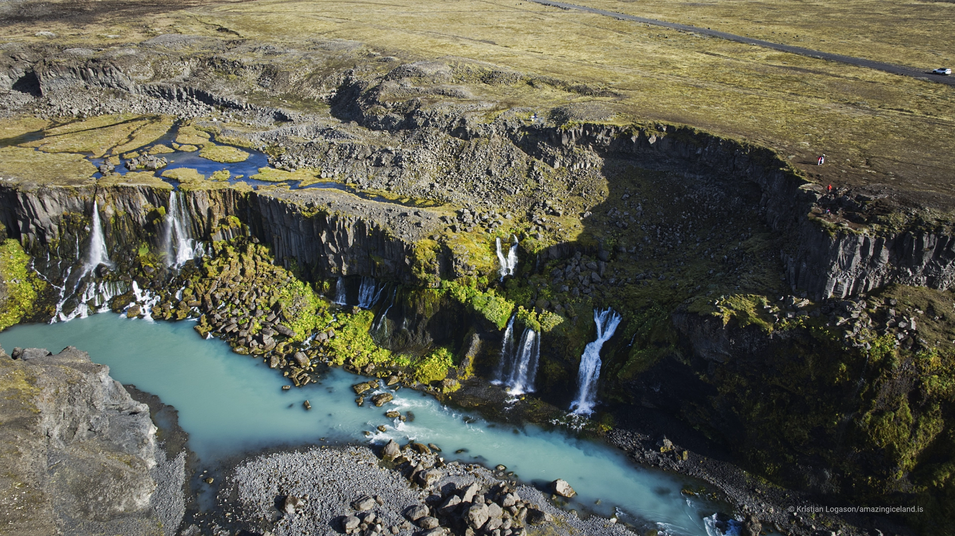
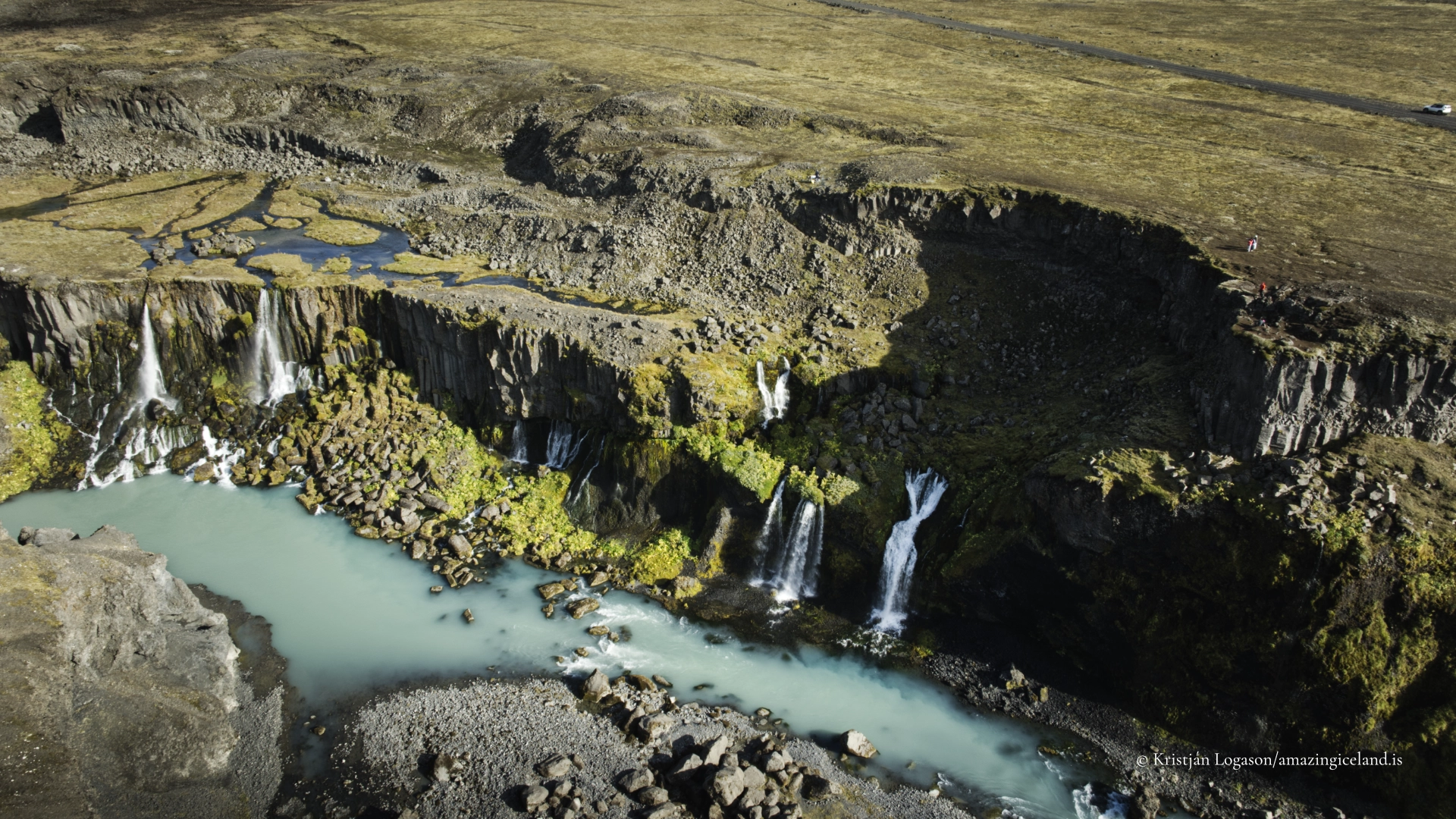
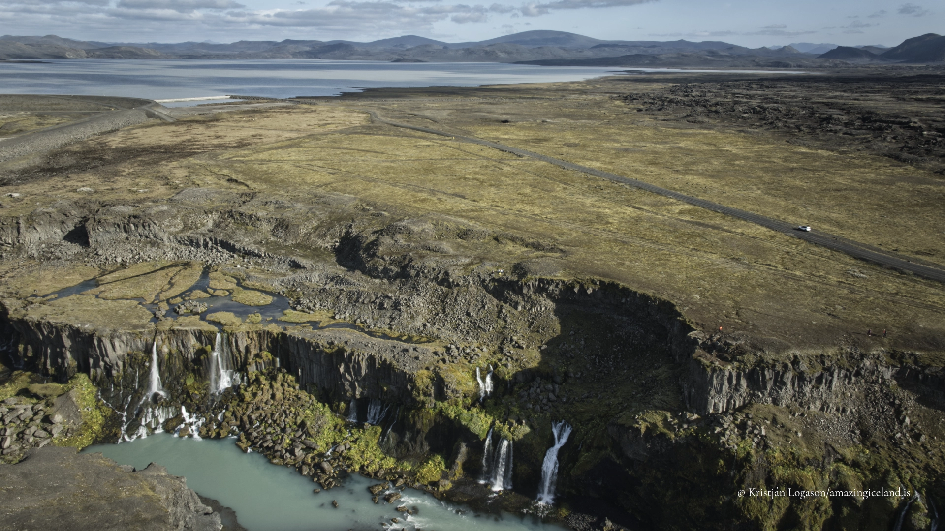
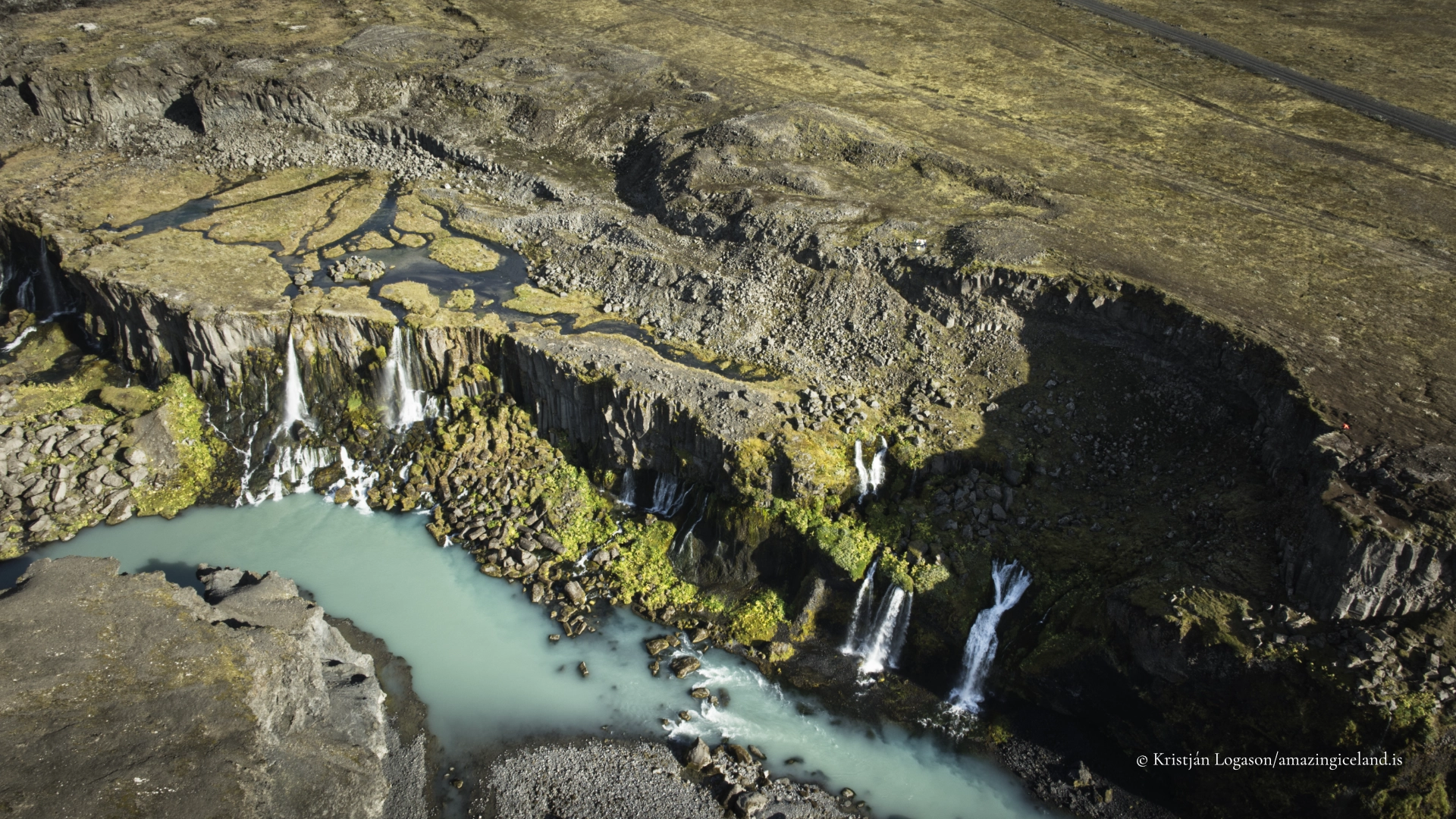
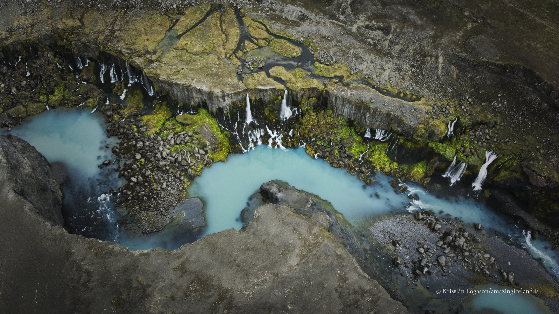
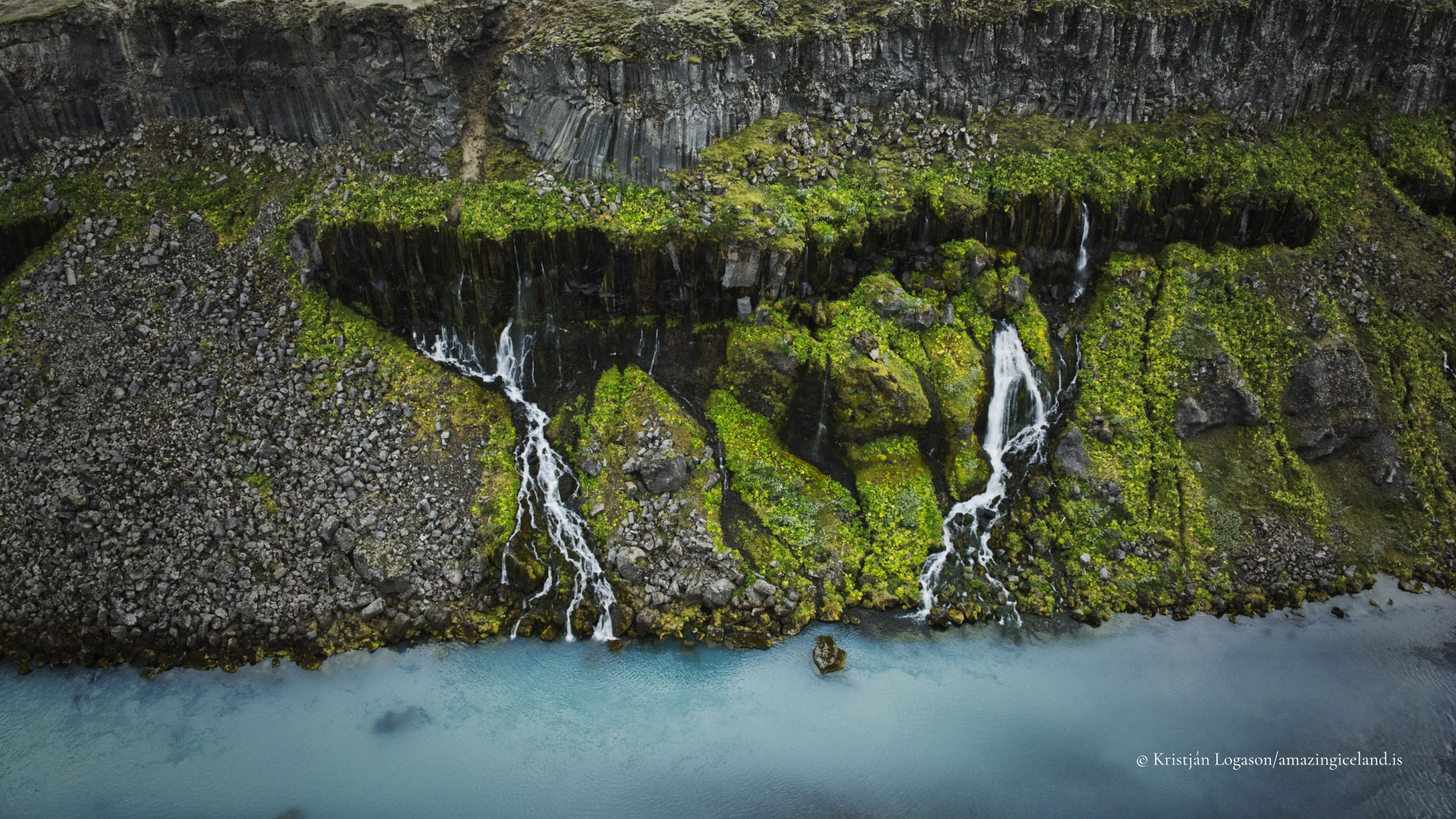
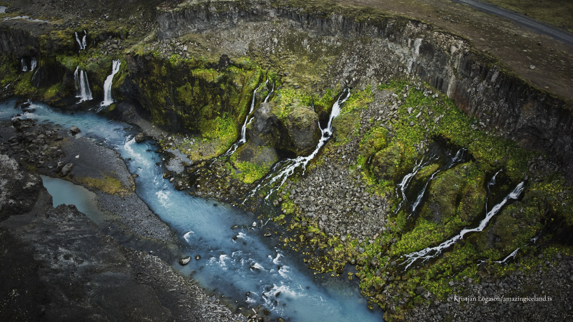
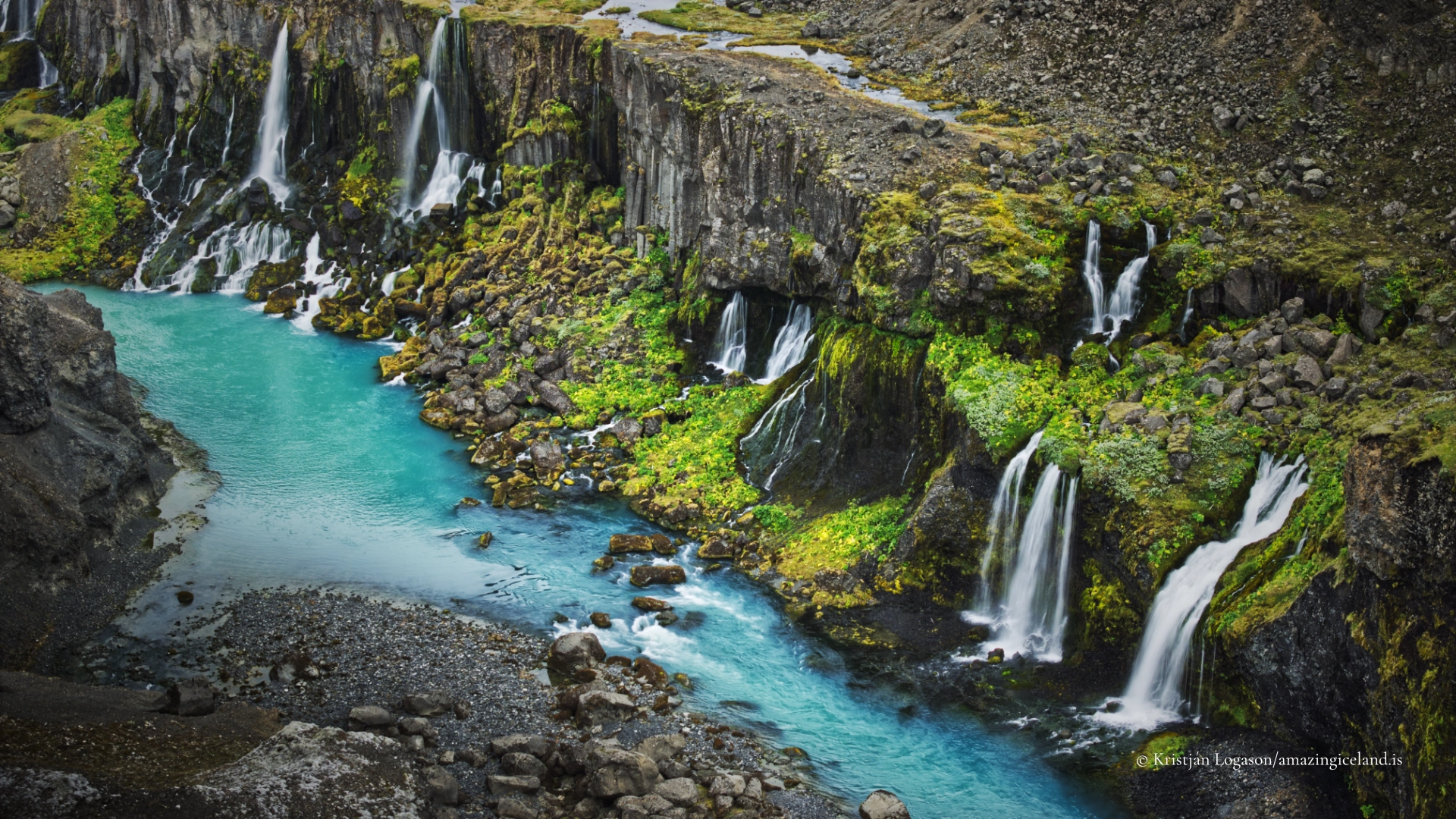
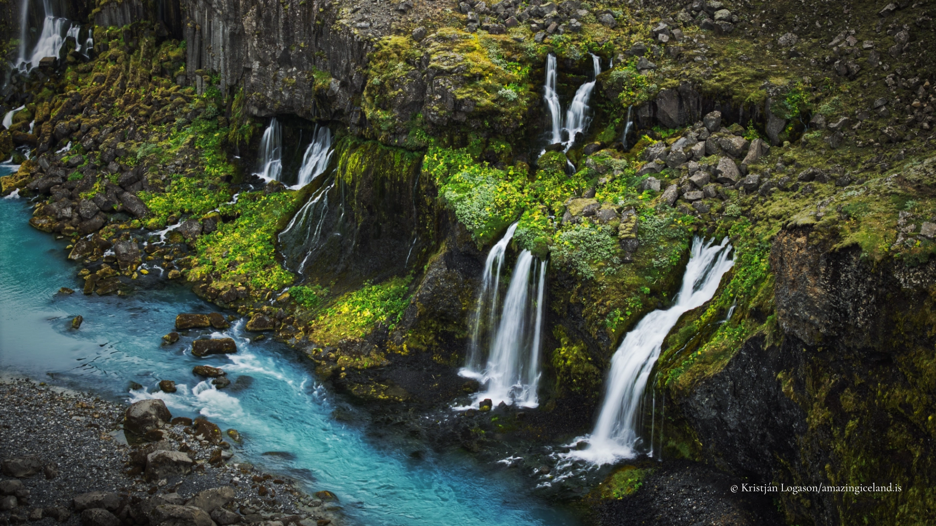
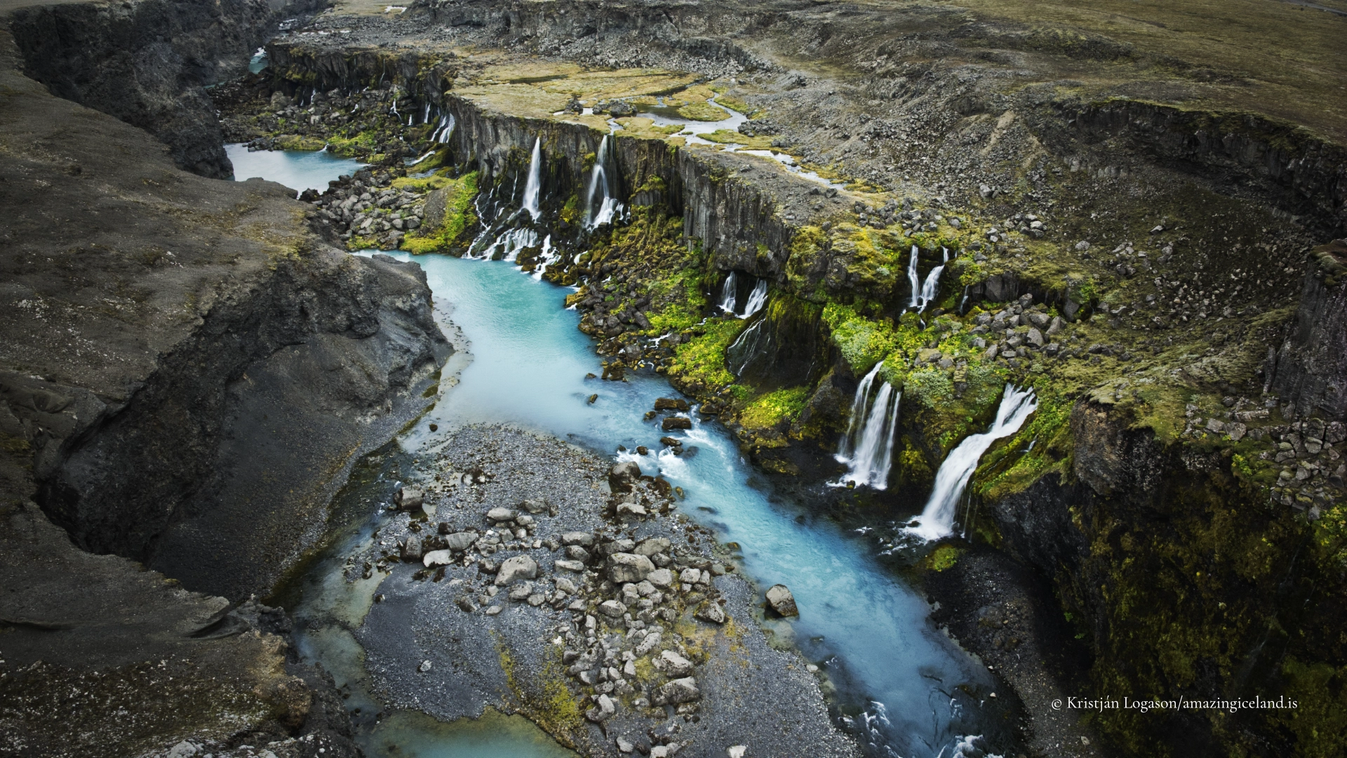
Sigöldugljúfur is a short but visually dense canyon in Iceland’s central highlands, located beside the mountain road F208 (Fjallabaksleið nyrðri) north of Landmannalaugar. Known for its striking blue-green water and a sequence of small, closely spaced waterfalls, the canyon is a clear example of how glacial rivers, volcanic bedrock, and sediment load interact to produce unusually vivid colour and form in a relatively confined space.
The location of Sigöldugljúfur canyon waterfalls by mountain road F208
Latitude
64.1596
Longitude
-18.9143
Sigöldugljúfur canyon waterfalls by mountain road F208
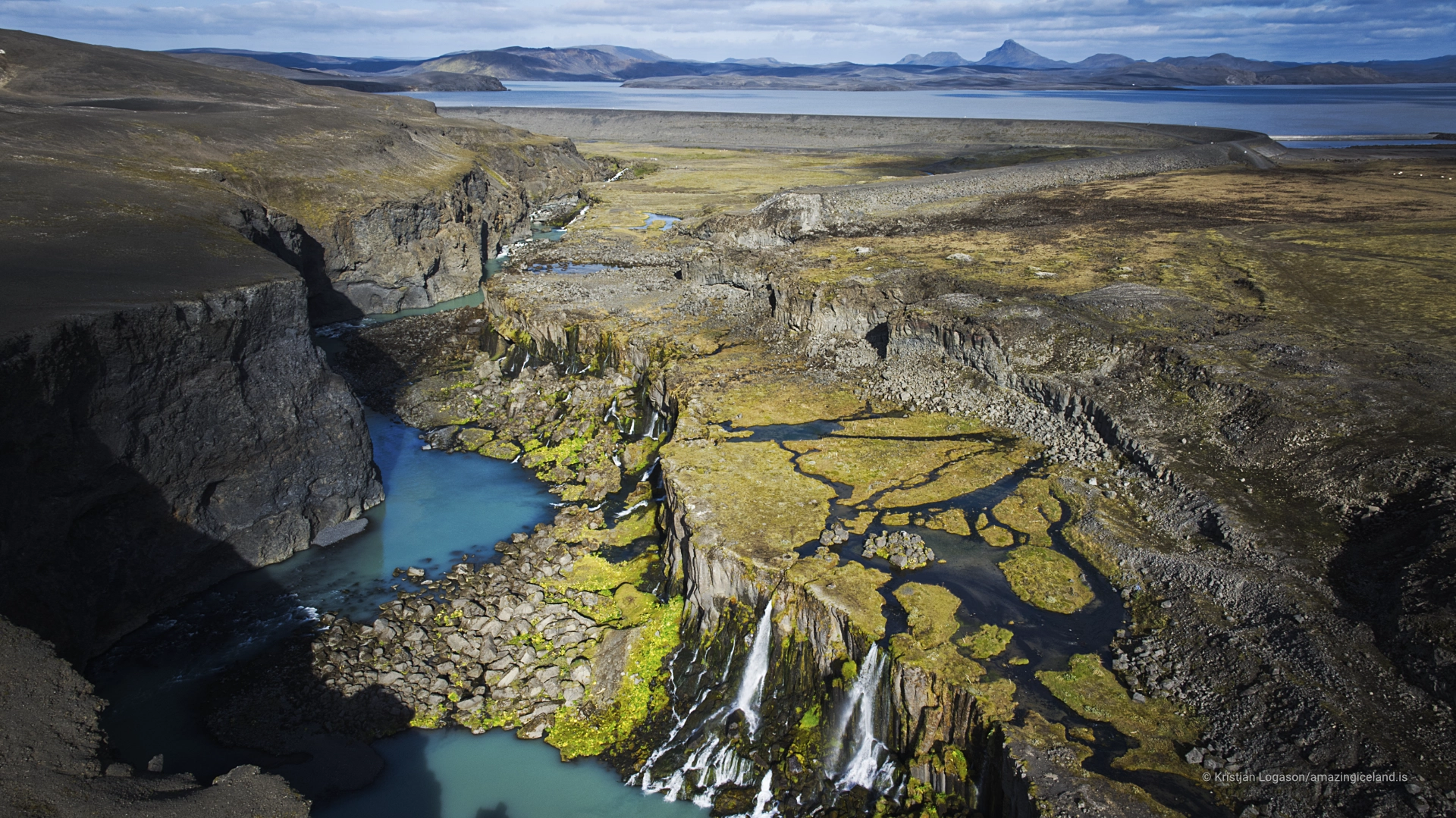
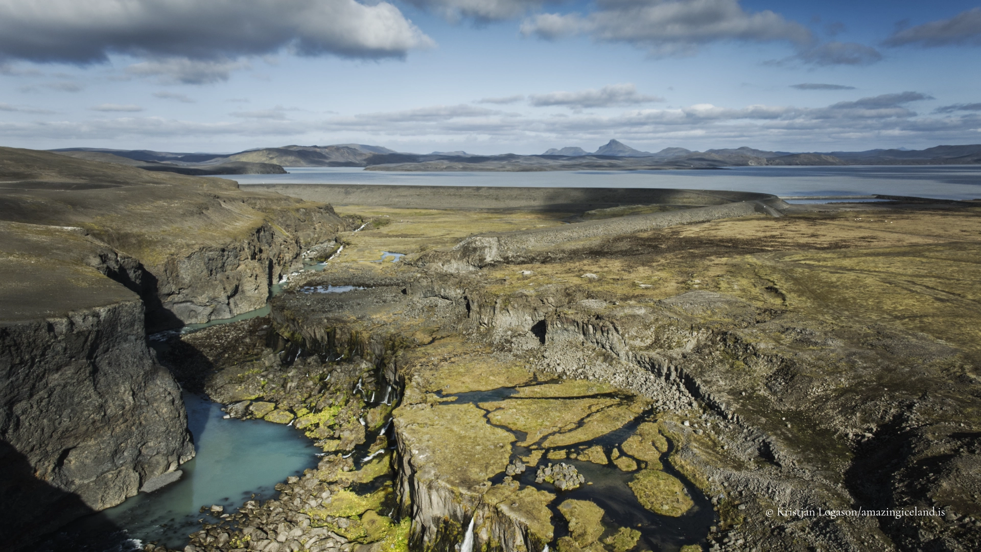
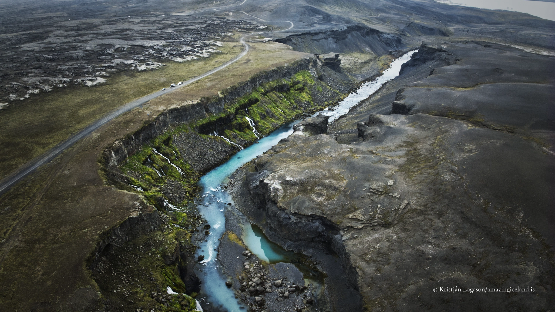
Sigöldugljúfur lies in the Tungnaá river system, in the interior highlands of South Iceland. The canyon sits just downstream of the Sigöldulón reservoir and near the Sigölduvirkjun hydropower area, although the canyon itself retains a natural appearance despite its proximity to energy infrastructure. Its accessibility from F208 makes it one of the more easily reached canyon features in the highlands, yet it remains less widely known than major destinations such as Landmannalaugar.
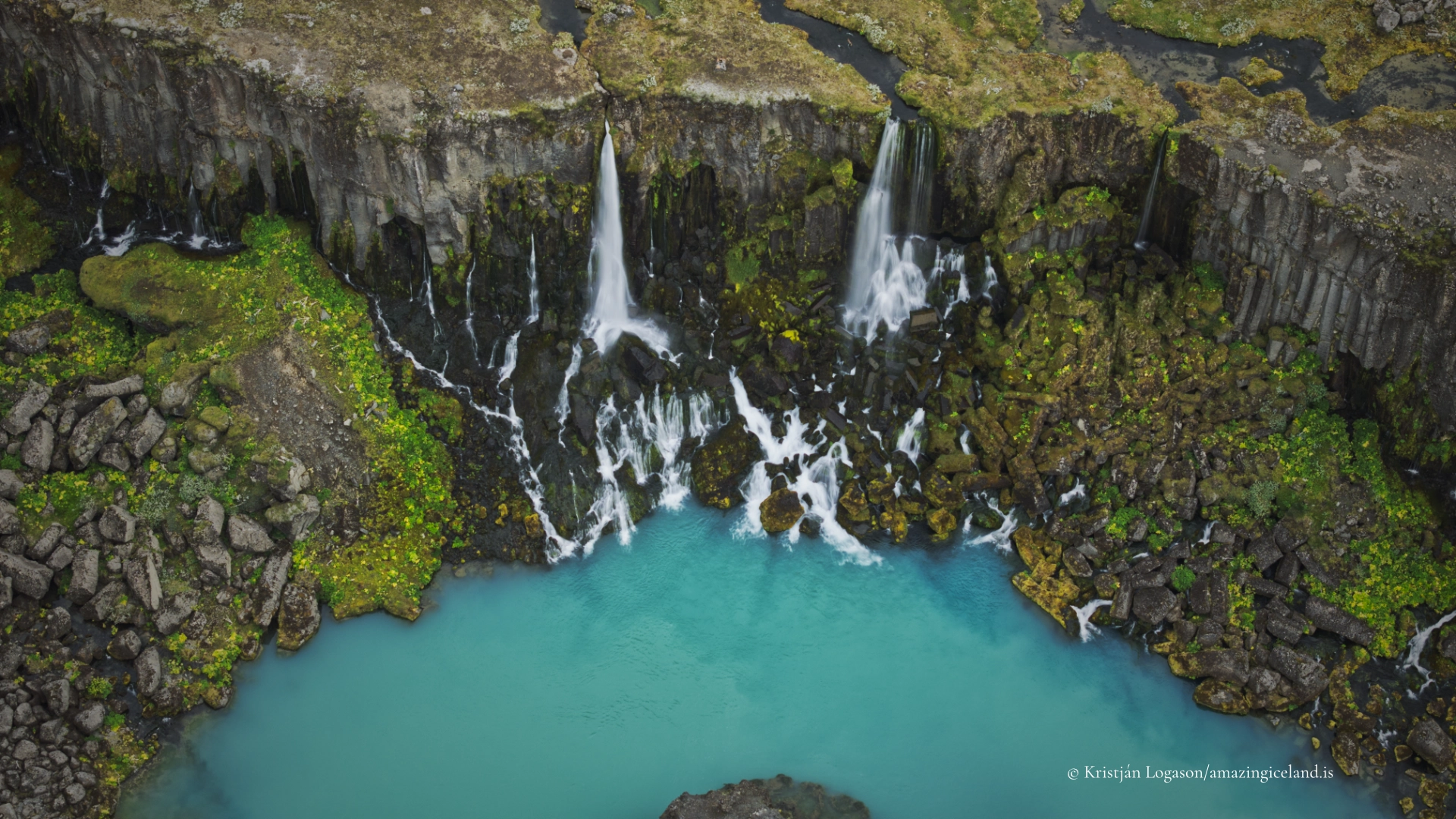
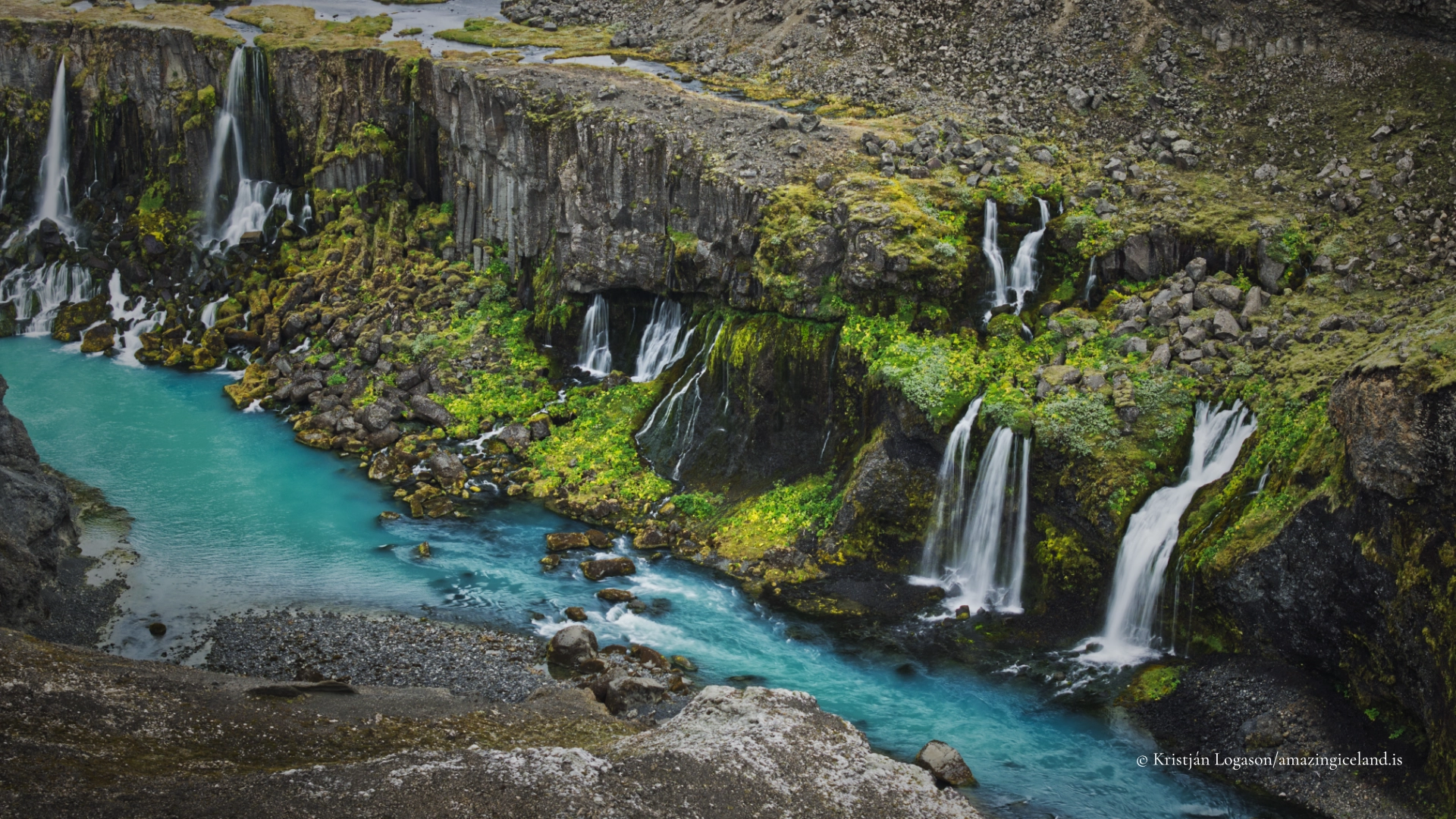
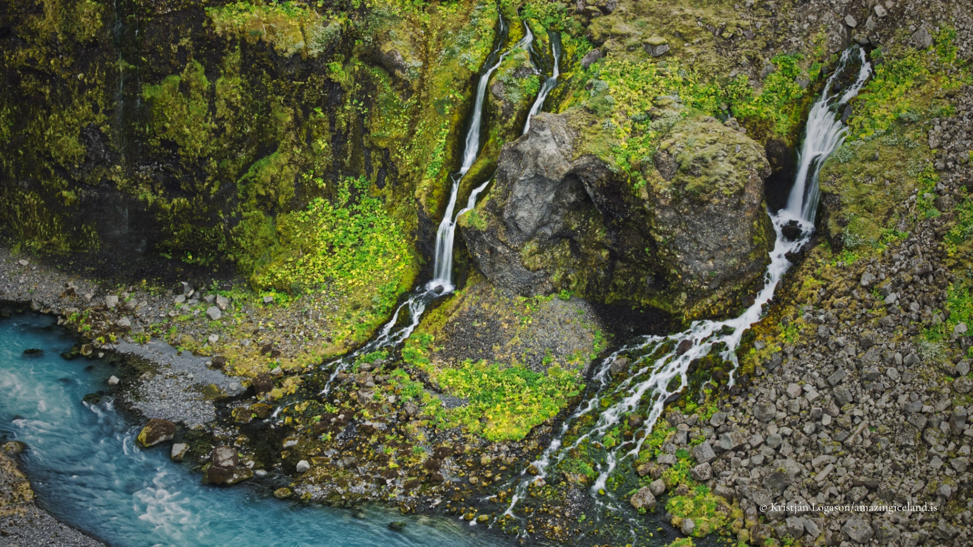
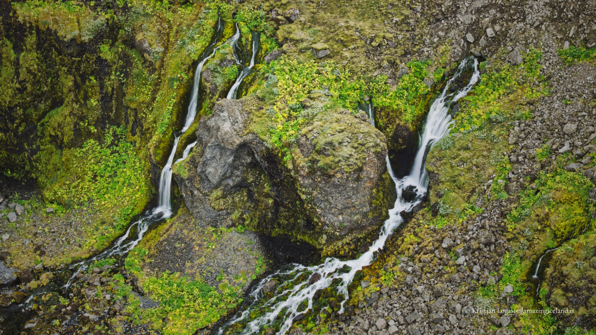
Geologically, Sigöldugljúfur is cut into volcanic bedrock shaped by repeated basaltic eruptions and subsequent fluvial erosion. The canyon is not deep or expansive by Icelandic standards; instead, its character comes from density rather than scale. Over a short distance, the river drops in multiple steps, creating a chain of narrow waterfalls separated by small ledges and pools. This stepwise profile reflects variations in rock resistance and erosion rates, where harder layers slow vertical incision while softer material erodes more quickly.
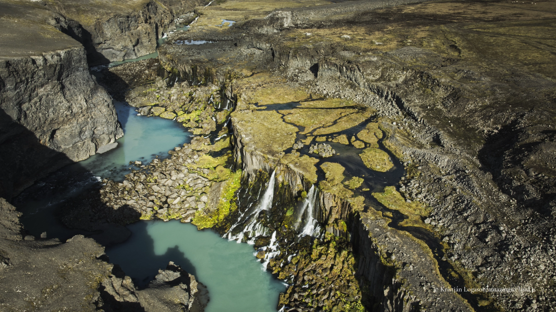
The most immediately striking feature of Sigöldugljúfur is the colour of the water. The river often appears an intense turquoise or milky blue-green, a result of suspended glacial sediment—commonly referred to as rock flour. These fine particles, produced by glacial grinding upstream, scatter light in a way that emphasizes blue and green wavelengths. The effect is strongest in stable flow conditions and good light, and it gives the canyon a visual identity that feels almost graphic against the dark volcanic rock.
Relationship to roads, hydropower, and landscape
From an academic and factual perspective, Sigöldugljúfur is inseparable from the broader land use context of the area. The nearby Sigölduvirkjun hydropower station and its reservoir have altered flow regimes in the Tungnaá system, particularly upstream. However, the canyon itself continues to function as a visible expression of river energy, sediment transport, and erosion. Seasonal and operational variations in water release can influence the volume and appearance of the waterfalls, meaning that the canyon may look subtly different from year to year—or even day to day.
Access is straightforward for a highland location but still subject to the usual constraints of interior travel. F208 is a mountain road, typically open only in summer, and conditions depend on weather, river levels, and maintenance. The canyon is visible from the road, and short walks allow visitors to approach the rim and view the waterfalls from above. Importantly, there are no formal barriers or developed viewpoints; this reinforces the need for caution near edges, where loose gravel and undercut banks are common.
Despite its proximity to infrastructure, Sigöldugljúfur feels visually coherent with the surrounding highland environment. Moss, low vegetation, and exposed lava surfaces frame the canyon without softening it. This balance—human modification nearby, raw geomorphology in the foreground—is characteristic of many Icelandic interior landscapes and is best understood as layered rather than contradictory.
Visual rhythm, scale, and why the canyon works so well
What makes Sigöldugljúfur particularly effective as a destination is not grandeur, but rhythm. The waterfalls repeat at short intervals, creating a visual sequence that draws the eye downstream. Each fall is modest on its own, yet together they form a coherent system that reads almost like a study in erosion stages.
Scale plays an important role here. Because the canyon is compact, visitors can see multiple waterfalls at once, allowing for comparative observation: differences in drop height, flow pattern, and rock texture become apparent when viewed side by side. This makes Sigöldugljúfur especially valuable for photographers and landscape observers interested in process rather than spectacle.
The canyon’s popularity increased significantly after aerial images circulated online, revealing patterns that are less obvious from ground level. From above, the turquoise water traces sharp bends and narrow channels, emphasizing contrast and repetition. While drones are often associated with this perspective, the underlying appeal is structural: Sigöldugljúfur is visually ordered, even though it is entirely the product of natural forces.
In the broader context of the Icelandic highlands, Sigöldugljúfur represents a class of landscape features that reward attentiveness. It does not dominate the horizon or announce itself from a distance. Instead, it invites close looking—at water colour, flow direction, and the way volcanic rock breaks and yields over time. This makes it a strong complement to larger, more famous sites along F208, offering depth rather than scale.
Interesting facts:
- Compact canyon: Sigöldugljúfur is short in length but contains multiple waterfalls in quick succession, giving it a high visual density.
- Glacial colour: The turquoise hue comes from suspended glacial sediment (rock flour) in the river water.
- Roadside highlands: The canyon is located directly beside F208, making it one of the more accessible canyon features in the central highlands.
- Hydropower context: It lies near the Sigölduvirkjun area, illustrating how natural landforms and energy infrastructure coexist in Iceland’s interior.
Image Gallery

The Locomotive Elite
What do Donald Trump and Iceland’s Locomotive Elite have in common?
Far more than you think.
In The Locomotive Elite, you’ll uncover how a tiny clique in Iceland captured extensive control—of banks, courts, media, and even the central bank.
For decades they ruled, first democratically, then through corruption and in the end through crime, enriching themselves and their cronies while dismantling oversight.
The result?
One of the most spectacular financial collapses in modern history.
Photography tips:
-
- Work in sequences: Instead of isolating one waterfall, compose frames that include two or more drops to show repetition and rhythm.
- Height matters: Elevated viewpoints reveal channel geometry and colour transitions; step back from the rim for safer, clearer angles.
- Mid-range shutter speeds: Around 1/4–1s preserves texture in the water without turning the canyon into a single blur.
- Colour discipline: Avoid oversaturating blues and greens in post-processing—the natural colour is already strong and easily exaggerated.
- Mind the edge: Canyon rims can be unstable; prioritize footing over framing.
Good cameras for Iceland
Sony A7R V

Sony A7s lll

Canon R6

Nikon Z6 lll

Destinations nearby


Good to have in Iceland


