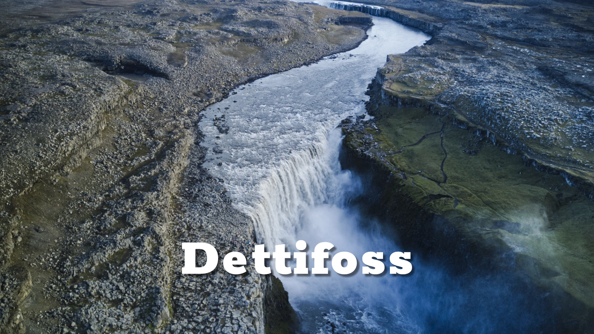
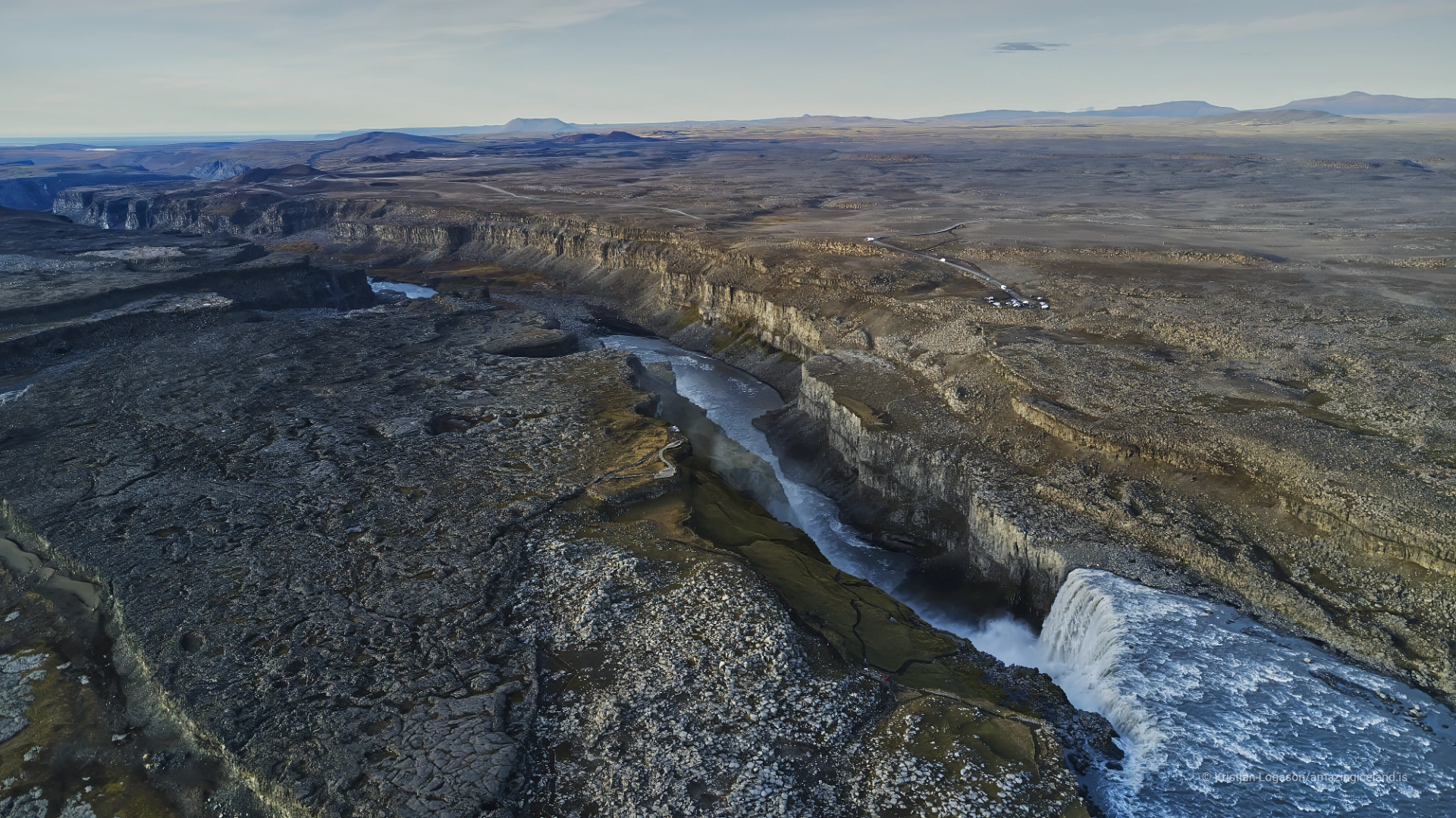
Located in Northeast Iceland within Vatnajökull National Park, Dettifoss lies on the Jökulsá á Fjöllum river, draining meltwater from Vatnajökull glacier. Unlike waterfalls shaped primarily by form or accessibility, Dettifoss is defined by magnitude—of water volume, erosive energy, and geological impact—making it one of the most uncompromising natural sites in Iceland.
The location of Dettifoss waterfall
Latitude
65.8147
Longitude
-16.3846
Dettifoss waterfall
Geological framework and canyon formation
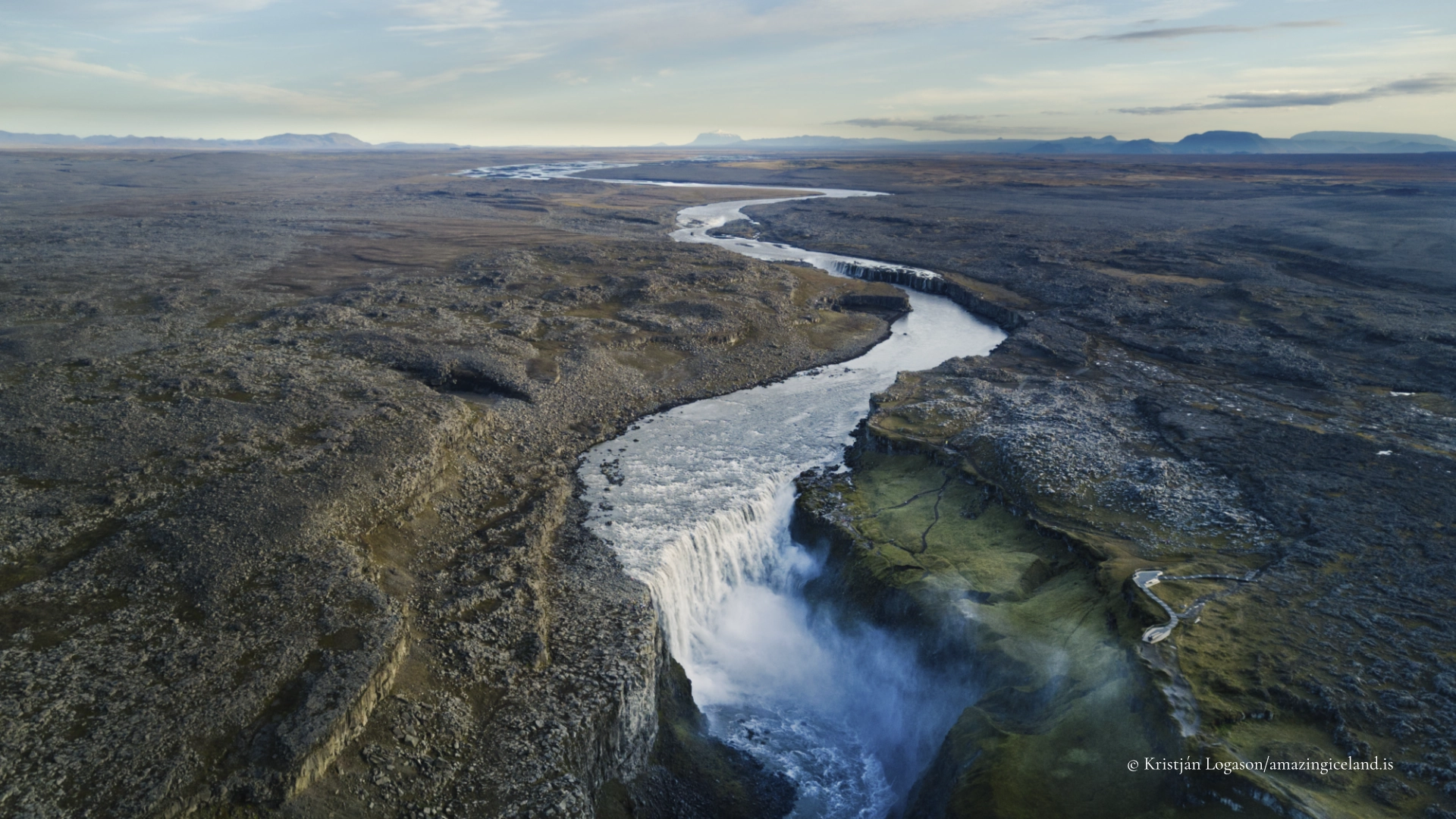
Dettifoss is situated along the Jökulsá á Fjöllum, one of Iceland’s most powerful glacial rivers. The river originates beneath Vatnajökull, Europe’s largest ice cap, and carries vast seasonal discharge shaped by meltwater dynamics, precipitation, and episodic glacial floods (jökulhlaups).
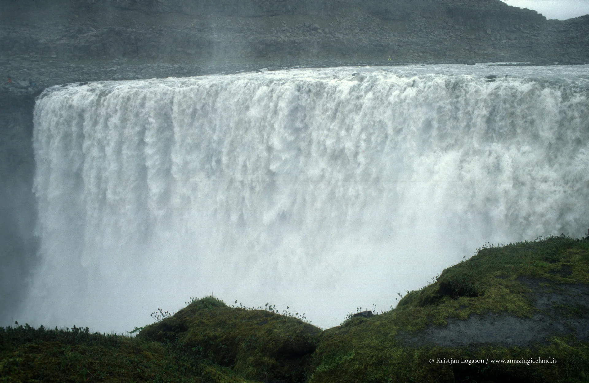
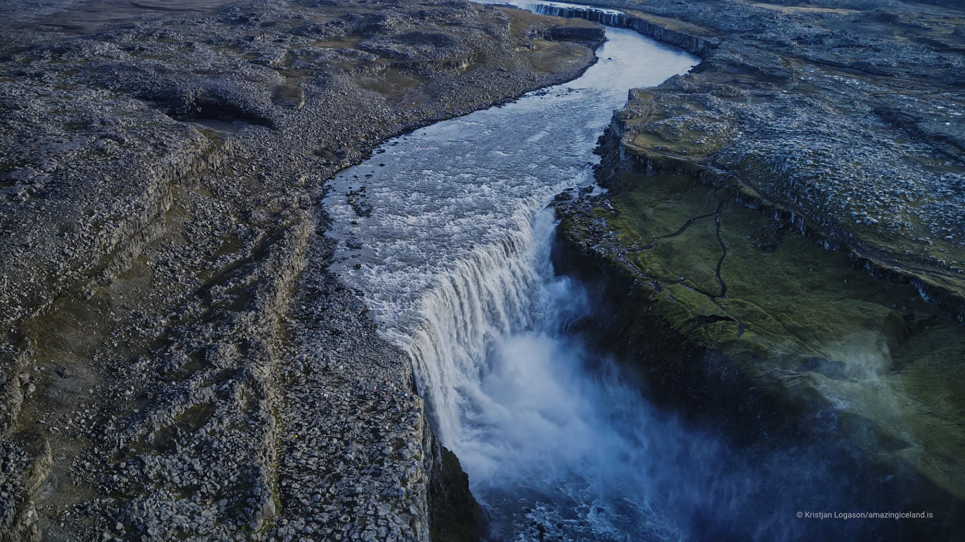
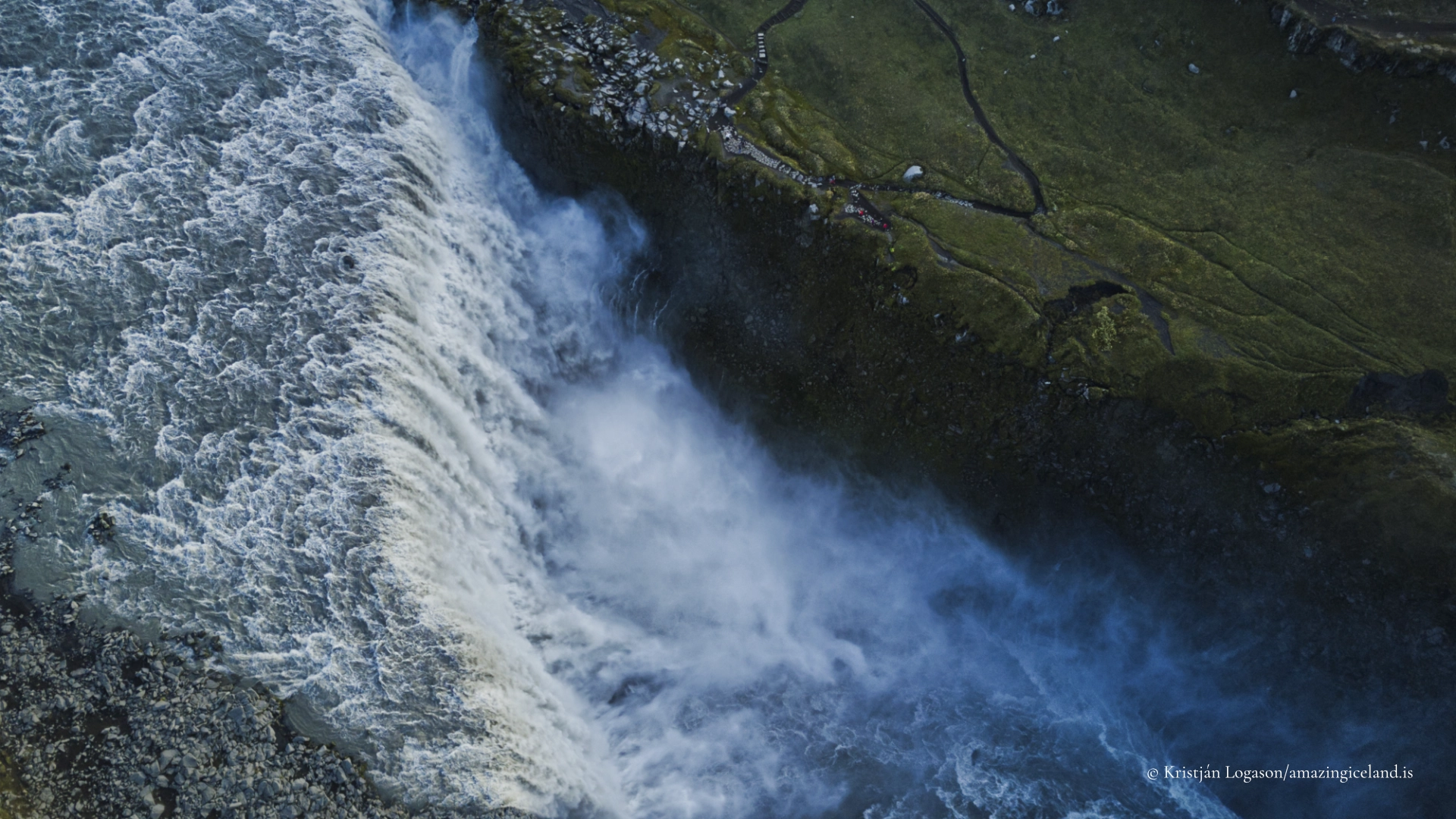
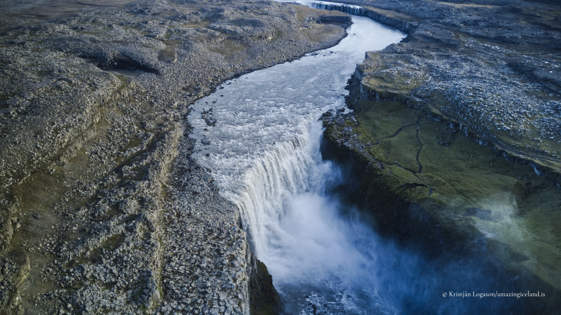
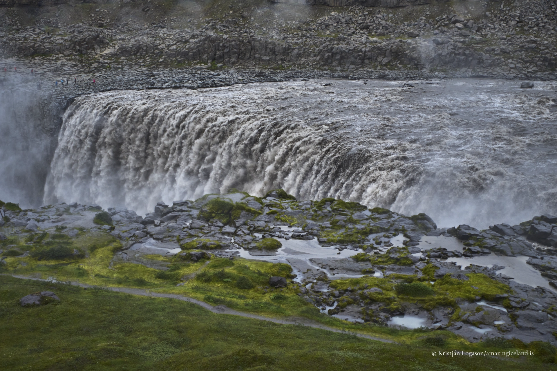
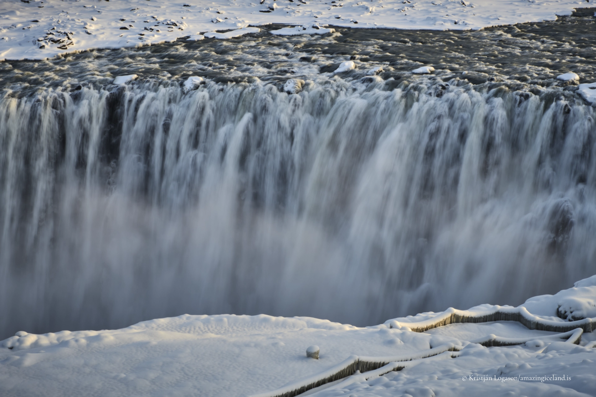
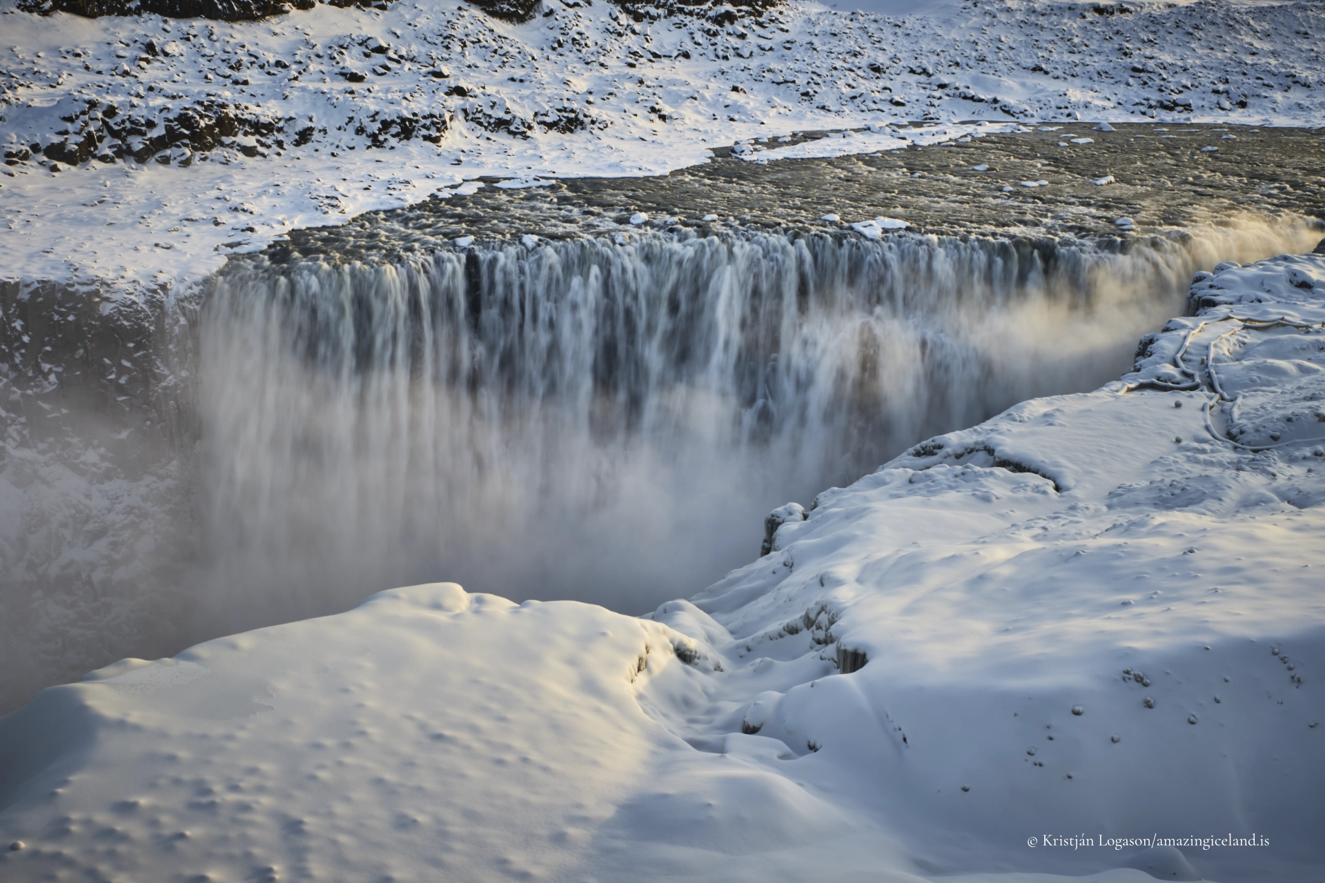
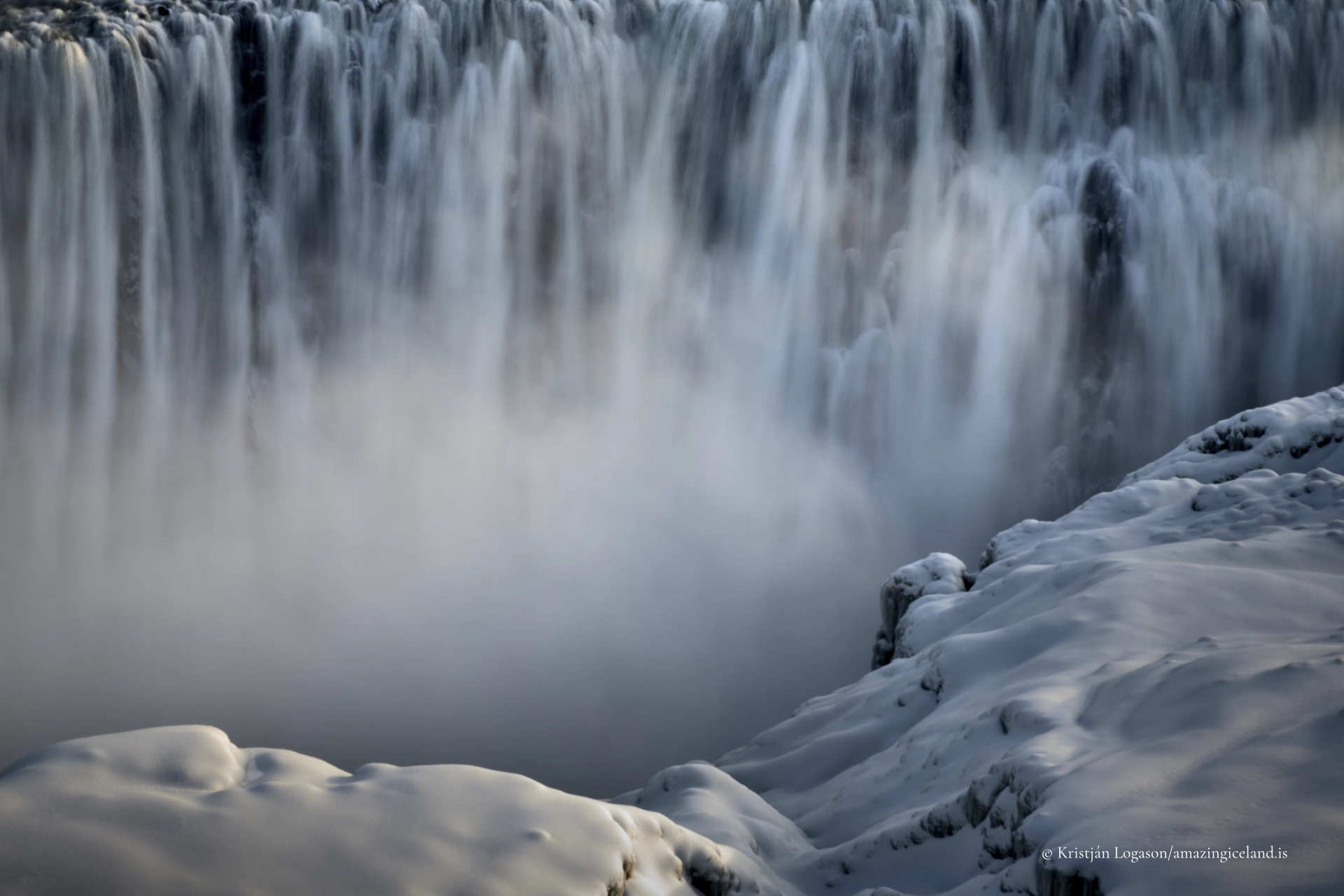
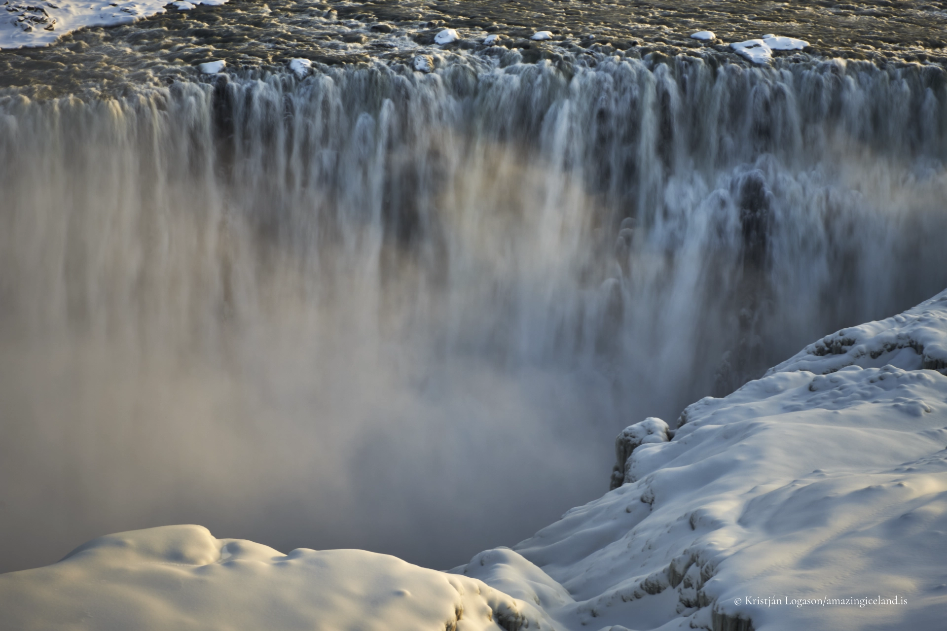
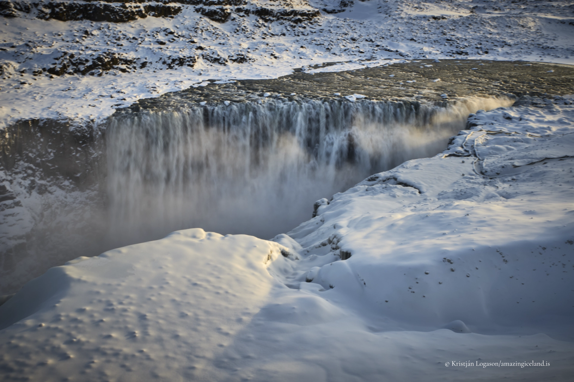
The waterfall drops approximately 44 metres across a width of about 100 metres, but its defining characteristic is not height or breadth—it is volume. Average discharge commonly exceeds 190 cubic metres per second, with peak flows far higher during summer melt and flood events. This sustained mass of water produces erosive forces that have carved the surrounding basalt into a deep, rectilinear canyon over relatively short geological time.
The bedrock here consists primarily of layered basalt flows associated with volcanic activity in the Northern Volcanic Zone. These flows cooled into jointed sheets rather than dense columnar arrays, allowing the river to exploit fractures and erode laterally as well as vertically. The result is a canyon defined by abrupt walls, sharp edges, and minimal vegetative cover—a landscape shaped faster than ecological systems can stabilize it.
From a geomorphological perspective, Dettifoss illustrates catastrophic fluvial erosion, amplified by glacial hydrology. It is not a static feature but part of an actively retreating knickpoint system, where upstream migration occurs incrementally as blocks fail and plunge into the gorge below.
Hydrology, sound, and sensory scale
Hydrologically, Dettifoss is extreme even by Icelandic standards. The Jökulsá á Fjöllum drains a vast catchment beneath Vatnajökull, and its discharge fluctuates dramatically with temperature and weather. Summer flows are typically highest, while winter reduces volume but enhances structural clarity as ice outlines canyon geometry.
The waterfall’s soundscape is inseparable from its identity. Low-frequency roar travels across the surrounding plateau long before the falls come into view, functioning as an acoustic signal of scale. Spray plumes rise continuously from the plunge pool, often generating localized weather effects, including mist clouds and transient rainbows under suitable light conditions.
Visually, Dettifoss resists containment within a single frame. The eye struggles to reconcile the width of the river, the vertical drop, and the depth of the canyon simultaneously. This perceptual overload is not incidental—it reflects the mismatch between human-scale perception and the physical processes on display.
Dettifoss is frequently cited as a benchmark for high-energy waterfall systems in basaltic terrain. Its behavior under variable discharge provides insight into erosion rates, block failure mechanics, and the interaction between glacial hydrology and volcanic bedrock.
Dettifoss within Vatnajökull National Park
Dettifoss forms part of a sequence of major waterfalls along the Jökulsá á Fjöllum, including Selfoss upstream and Hafragilsfoss downstream. Together, they illustrate different stages of river incision and energy dissipation within the same geological corridor.
This corridor lies within Vatnajökull National Park, a protected area encompassing glaciers, volcanic systems, and fluvial landscapes of global significance. Dettifoss’s inclusion within the park reflects not only its visual impact but its scientific value as an active geomorphic system.
The surrounding terrain is stark and sparsely vegetated, reinforcing the sense that geological processes here operate faster than biological recovery. This exposure allows the canyon walls, fracture patterns, and erosional scars to remain legible, turning the entire area into a large-scale field site.
Visiting Dettifoss—access, safety, and orientation
Dettifoss is accessible from both the east and west sides of the river via gravel roads branching from Route 1. Each side offers different perspectives: the east side provides closer proximity and frontal views, while the west side emphasizes context, scale, and downstream continuity.
Marked paths and viewing areas exist, but conditions can be deceptive. Loose gravel, strong winds, and persistent spray make footing unstable near the canyon edge. The waterfall’s power creates a psychological pull toward the brink, but safe viewing distances should be respected at all times.
Seasonality strongly affects access. Summer offers easier road conditions and maximum flow, while winter restricts access but transforms the site into an ice-framed study in structure and contrast. In all seasons, Dettifoss demands situational awareness rather than casual movement.
Unlike smaller waterfalls, Dettifoss does not reward proximity alone. Stepping back—both physically and conceptually—often yields a more accurate understanding of its scale and behavior.
Interpretation and meaning
Dettifoss occupies a particular position in Iceland’s landscape narrative. It is frequently described through superlatives, yet those descriptors risk flattening its complexity. The waterfall is not simply “the most powerful”; it is a visible endpoint of interacting systems—glacier, volcano, river, and gravity—operating in synchrony.
For visitors moving through North Iceland after sites such as Goðafoss or Mývatn, Dettifoss represents escalation rather than repetition. The river widens, the canyon deepens, and the tone shifts from balance to excess. This progression is instructive, illustrating how the same elemental forces produce radically different outcomes depending on scale and constraint.
Dettifoss ultimately resists domestication. Infrastructure remains minimal, interpretation is sparse, and the environment retains authority. The site communicates most effectively when allowed to do so directly—through sound, motion, and the visible consequences of sustained power.
Interesting facts:
- Dettifoss is widely regarded as Europe’s most powerful waterfall by average discharge.
- The waterfall is fed by glacial meltwater from Vatnajökull, Europe’s largest ice cap.
- Dettifoss appeared prominently in the opening sequence of the film Prometheus (2012), reinforcing its association with primordial landscapes.
- The surrounding canyon has been carved rapidly in basaltic lava flows from Iceland’s Northern Volcanic Zone.
- Dettifoss is part of a waterfall sequence including Selfoss and Hafragilsfoss along the same river.
Image Gallery

The Locomotive Elite
What do Donald Trump and Iceland’s Locomotive Elite have in common?
Far more than you think.
In The Locomotive Elite, you’ll uncover how a tiny clique in Iceland captured extensive control—of banks, courts, media, and even the central bank.
For decades they ruled, first democratically, then through corruption and in the end through crime, enriching themselves and their cronies while dismantling oversight.
The result?
One of the most spectacular financial collapses in modern history.
Photography tips:
- Expect spray: lens protection and frequent cleaning are essential.
- Use scale references: people or cliff edges help communicate magnitude.
- Avoid ultra-close framing: step back to include canyon depth.
- Midday light works: mist diffuses contrast and softens highlights.
- Winter reveals structure: ice outlines erosion patterns clearly.
Good cameras for Iceland
Sony A7R V

Sony A7s lll

Canon R6

Nikon Z6 lll

Destinations nearby


Good to have in Iceland


